Category:Dahlhausen (Attendorn)
Jump to navigation
Jump to search
| Object location | | View all coordinates using: OpenStreetMap |
|---|
human settlement in Germany  | |||||
| Upload media | |||||
| Instance of |
| ||||
|---|---|---|---|---|---|
| Location | Attendorn, Kreis Olpe, Arnsberg Government Region, North Rhine-Westphalia, Germany | ||||
 | |||||
Media in category "Dahlhausen (Attendorn)"
The following 6 files are in this category, out of 6 total.
-
 1836 Biekhofen.jpg 2,905 × 1,713; 2.68 MB
-
 1836 Lichtringhausen Windhausen.jpg 1,855 × 1,497; 1.71 MB
-
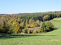 Dahlhausen bei Attendorn 1.JPG 4,000 × 3,000; 3.25 MB
-
 Dahlhausen bei Attendorn 2.JPG 3,896 × 2,923; 4.05 MB
-
 Dahlhausen, Gutsweg.JPG 4,000 × 3,000; 3.22 MB
-
 Gut Dahlhausen.jpg 3,910 × 2,933; 3.32 MB


