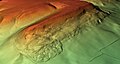
Category:DEM maps of Thuringia
Jump to navigation
Jump to search
Federal states of Germany:
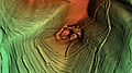
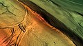
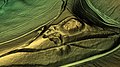
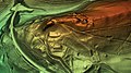
Deutsch: Das digitale Höhenmodell (DHM) (englisch digital elevation model (DEM)) bzw. digitale Geländemodell (DGM) (engl. digital terrain model (DTM)) basiert auf den numerischen Daten der Geländehöhen. Daraus lassen sich z. B. 3D-Ansichten erstellen.

Subcategories
This category has the following 4 subcategories, out of 4 total.
Media in category "DEM maps of Thuringia"
The following 42 files are in this category, out of 42 total.
-
 Alte Burg (Berka vor dem Hainich) Geländemodell.jpg 1,920 × 1,080; 1.49 MB
-
 Alter Ringelstein Geländemodell.jpg 1,920 × 1,080; 1.47 MB
-
 Baier (Rhön) Geländemodell.jpg 1,920 × 1,080; 1.53 MB
-
 Burg Frankenberg (Helmers) Geländemodell.jpg 1,920 × 1,080; 1.57 MB
-
 Burg Frankenstein (Bad Salzungen) Geländemodell.jpg 1,920 × 1,080; 1.43 MB
-
 Burg Hermannstein (Waltershausen) Geländemodell.jpg 1,920 × 1,080; 1.43 MB
-
 Burg Hornsberg (Seulingswald) Geländemodell.jpg 1,920 × 1,080; 1.24 MB
-
 Burg Stein (Thüringen) Geländemodell.jpg 1,920 × 1,080; 1.46 MB
-
 Burg Torstein Geländemodell.jpg 1,920 × 1,080; 1.63 MB
-
 Burg Walsburg Geländemodell.jpg 1,920 × 1,080; 1.6 MB
-
 Burgstelle Bocksberg Geländemodell.jpg 1,920 × 1,080; 1.5 MB
-
 Burgstelle Engenstein Geländemodell.jpg 1,920 × 1,080; 1.51 MB
-
 Burgstelle Grub Geländemodell.jpg 1,920 × 1,080; 1.29 MB
-
 Burgstelle Schlösschen (Ohrdruf) Geländemodell.jpg 1,920 × 1,080; 1.18 MB
-
 Burgstelle Schlösschen (Tiefenort) Geländemodell.jpg 1,920 × 1,080; 1.29 MB
-
 Burgstelle Schlösschen (Unterrohn) Geländemodell.jpg 1,920 × 1,080; 1.2 MB
-
 Burgstelle Tafelberg Geländemodell.jpg 1,920 × 1,080; 1.27 MB
-
 Das Wahl Geländemodell.jpg 1,920 × 1,080; 1.42 MB
-
 DEM Alteburg-Arnstadt.jpg 1,414 × 1,825; 890 KB
-
 Eisenacher Burg Geländemodell.jpg 1,920 × 1,080; 1.41 MB
-
 Habichtsburg Geländemodell.jpg 1,920 × 1,080; 1.35 MB
-
 Hopperode Wüstung.jpg 1,920 × 1,017; 598 KB
-
 Hüneburg (Schnellmannshausen) Geländemodell.jpg 1,920 × 1,080; 1.21 MB
-
 Hünenburg (Flarchheim) Geländemodell.jpg 1,920 × 1,080; 1.5 MB
-
 Johannisberg (Jena-Lobeda) Geländemodell.jpg 1,920 × 1,080; 1.75 MB
-
 Käfernburg (Burg) Geländemodell.jpg 1,920 × 1,080; 1.41 MB
-
 Malittenburg Geländemodell.jpg 1,920 × 1,080; 1.49 MB
-
 Metilstein Geländemodell.jpg 1,920 × 1,080; 1.3 MB
-
 Monraburg Geländemodell.jpg 1,920 × 1,080; 1.48 MB
-
 Neuer Ringelstein Geländemodell.jpg 1,920 × 1,080; 1.41 MB
-
 Raspenburg Geländemodell.jpg 1,920 × 1,080; 1.42 MB
-
 Raubschloss (Gräfenroda) Geländemodell.jpg 1,920 × 1,080; 1.39 MB
-
 Reinhardsberg.jpg 1,920 × 1,017; 1.2 MB
-
 Reinsburg Geländemodell.jpg 1,920 × 1,080; 1.74 MB
-
 Ringwallanlage Brunfthof Geländemodell.jpg 1,920 × 1,080; 1.6 MB
-
 Ruine Burg Stein Geländemodell.jpg 1,920 × 1,080; 1.49 MB
-
 Sargberg an der Hainleite.jpg 1,920 × 1,017; 1.24 MB
-
 Schöneburg (Oechsen) Geländemodell.jpg 1,920 × 1,080; 1.2 MB
-
 Tannenburg (Schönau vor dem Walde) Geländemodell.jpg 1,920 × 1,080; 1.55 MB
-
 Wallanlage Kirchberg in Möbisburg Geländemodell.jpg 1,920 × 1,080; 1.52 MB
-
 Wallanlage Sargberg Nahaufnahme.jpg 1,920 × 1,017; 905 KB
-
 Wendenburg Geländemodell.jpg 1,920 × 1,080; 1.52 MB
_Gel%C3%A4ndemodell.jpg)

_Gel%C3%A4ndemodell.jpg)
_Gel%C3%A4ndemodell.jpg)
_Gel%C3%A4ndemodell.jpg)
_Gel%C3%A4ndemodell.jpg)
_Gel%C3%A4ndemodell.jpg)
_Gel%C3%A4ndemodell.jpg)


_Gel%C3%A4ndemodell.jpg)
_Gel%C3%A4ndemodell.jpg)
_Gel%C3%A4ndemodell.jpg)


_Gel%C3%A4ndemodell.jpg)
_Gel%C3%A4ndemodell.jpg)
_Gel%C3%A4ndemodell.jpg)
_Gel%C3%A4ndemodell.jpg)


_Gel%C3%A4ndemodell.jpg)


_Gel%C3%A4ndemodell.jpg)
_Gel%C3%A4ndemodell.jpg)


