Category:Crieff (civil parish)
Jump to navigation
Jump to search
Scottish parish in Perth and Kinross, Scotland, UK | |||||
| Upload media | |||||
| Instance of | |||||
|---|---|---|---|---|---|
| Part of |
| ||||
| Named after | |||||
| Location |
| ||||
| Population |
| ||||
| Area |
| ||||
 | |||||
Subcategories
This category has the following 3 subcategories, out of 3 total.
Media in category "Crieff (civil parish)"
The following 200 files are in this category, out of 936 total.
(previous page) (next page)-
 'After Hurricane Bawbag' - geograph.org.uk - 5343809.jpg 2,223 × 2,966; 1.89 MB
-
 'Boy on a hill' - geograph.org.uk - 5343737.jpg 2,197 × 1,653; 1.29 MB
-
 'Light fills the space where trees once stood' - geograph.org.uk - 5343805.jpg 2,053 × 2,729; 3.19 MB
-
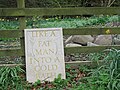 'LIKE A FAT MAN INTO A COLD BATH' - geograph.org.uk - 5343845.jpg 3,264 × 2,448; 4.82 MB
-
 'Somewhere between a blink and a breath' - geograph.org.uk - 5343733.jpg 1,934 × 3,060; 2.78 MB
-
 45 bus in Hollybush Drive - geograph.org.uk - 4125099.jpg 640 × 480; 65 KB
-

-
 A frosty field, Barvick - geograph.org.uk - 6336495.jpg 1,024 × 769; 307 KB
-

-
 A greener section of Sauchie Road - geograph.org.uk - 4138316.jpg 480 × 640; 82 KB
-

-

-

-

-
-
-

-

-

-

-

-

-

-

-

-

-

-

-

-
-

-
-

-

-

-

-
-
 A small woodland - geograph.org.uk - 3432807.jpg 640 × 480; 375 KB
-
 A ^ A Stores, King Street - geograph.org.uk - 4135851.jpg 640 × 480; 95 KB
-
 A85 (Perth Road) Entering Crieff - geograph.org.uk - 2673223.jpg 640 × 480; 237 KB
-
 A85 Between Gilmerton and Crieff - geograph.org.uk - 2673216.jpg 640 × 480; 179 KB
-
 Academy Road, Crieff - geograph.org.uk - 3250297.jpg 611 × 750; 193 KB
-
 Access road to Crieff High School - geograph.org.uk - 4131090.jpg 640 × 480; 58 KB
-
 Activity course at Crieff - geograph.org.uk - 5345285.jpg 3,264 × 2,448; 5.67 MB
-
 Aiton Fine Arts, King Street - geograph.org.uk - 4135843.jpg 480 × 640; 82 KB
-
 Alligan Crescent, August 2014 - geograph.org.uk - 4131031.jpg 640 × 480; 57 KB
-
 Alligan Road housing - geograph.org.uk - 4131042.jpg 640 × 480; 62 KB
-
 Allt Garbh dropping down to Shaggie Burn - geograph.org.uk - 6540436.jpg 1,600 × 1,162; 488 KB
-
 Ancaster Road, Crieff - geograph.org.uk - 4124819.jpg 640 × 480; 124 KB
-
 Ancient ash trees at Brae of Monzie - geograph.org.uk - 6540404.jpg 1,600 × 1,200; 679 KB
-

-

-
 Approaching Crieff - geograph.org.uk - 3505521.jpg 640 × 480; 332 KB
-
-
 Approaching Crieff Leisure Centre - geograph.org.uk - 4131227.jpg 640 × 480; 77 KB
-

-

-

-

-

-
-

-
-

-

-

-

-
-

-

-

-

-

-

-
-

-

-

-

-
-

-

-

-

-

-

-
-

-

-

-
 Arable land, Dornock - geograph.org.uk - 3432824.jpg 640 × 480; 246 KB
-
 Arable land, Dornock - geograph.org.uk - 4593525.jpg 800 × 450; 339 KB
-
 Arable land, Innerpeffray - geograph.org.uk - 3434214.jpg 640 × 480; 295 KB
-
 Arable land, Pittachar - geograph.org.uk - 3505528.jpg 640 × 480; 317 KB
-
 Arable with a touch of railway - geograph.org.uk - 3505539.jpg 640 × 480; 274 KB
-
 Autumn in Macrosty Park - geograph.org.uk - 4220494.jpg 480 × 640; 119 KB
-
 B8062 - geograph.org.uk - 3432795.jpg 640 × 480; 302 KB
-
 B8062 at Dornock - geograph.org.uk - 3200892.jpg 1,200 × 797; 625 KB
-
 B8062 from Crieff to Kinkell Bridge - geograph.org.uk - 3200871.jpg 1,200 × 797; 493 KB
-
 B8062 from Kinkell Bridge to Crieff - geograph.org.uk - 3200860.jpg 1,200 × 797; 475 KB
-
 B8062 from Kinkell Bridge to Crieff - geograph.org.uk - 3200868.jpg 1,200 × 797; 515 KB
-
 B8062 near Crieff - geograph.org.uk - 3200910.jpg 1,200 × 797; 474 KB
-
 B8062 near Woodburn road end - geograph.org.uk - 4415887.jpg 1,600 × 1,067; 648 KB
-
 B8062, Dornock - geograph.org.uk - 3432816.jpg 640 × 480; 352 KB
-
 Bakery in King Street - geograph.org.uk - 4135827.jpg 480 × 640; 82 KB
-
 Bam, Broich Road - geograph.org.uk - 4132811.jpg 640 × 480; 59 KB
-
 Bandstand - MacRosty Park - geograph.org.uk - 2429105.jpg 1,600 × 1,067; 668 KB
-
 Bandstand, Mcrostie Park, Crieff - geograph.org.uk - 1246132.jpg 640 × 460; 112 KB
-
 Barbers in the High Street - geograph.org.uk - 4132666.jpg 480 × 640; 81 KB
-
 Barley - geograph.org.uk - 4593536.jpg 800 × 450; 368 KB
-
 Barvick Burn - geograph.org.uk - 2834510.jpg 480 × 640; 73 KB
-
 Barvick Burn - geograph.org.uk - 2834643.jpg 480 × 640; 90 KB
-
 Barvick Burn - geograph.org.uk - 3374989.jpg 640 × 480; 327 KB
-
 Barvick Burn - geograph.org.uk - 5672292.jpg 1,024 × 769; 331 KB
-
 Barvick Burn - geograph.org.uk - 5672298.jpg 1,024 × 769; 291 KB
-
 Battery hen pens - geograph.org.uk - 1184983.jpg 640 × 480; 48 KB
-
 Beauly Denny power line - geograph.org.uk - 3432789.jpg 640 × 480; 262 KB
-
 Ben Vorlich viewed from Crieff - geograph.org.uk - 3257994.jpg 1,000 × 735; 178 KB
-
 Bench Mark, Crieff - geograph.org.uk - 1851454.jpg 480 × 640; 103 KB
-
 Bend coming off Crieff Bridge - geograph.org.uk - 4132736.jpg 640 × 480; 64 KB
-
 Bend in Alligan Crescent - geograph.org.uk - 4131034.jpg 640 × 480; 61 KB
-
 Bend in Kincardine Road - geograph.org.uk - 4130618.jpg 640 × 480; 72 KB
-
 Bend in Skye Gardens - geograph.org.uk - 4131114.jpg 640 × 480; 75 KB
-
 Bend in Turleum Road - geograph.org.uk - 4130473.jpg 640 × 480; 58 KB
-
 Bin day in Commissioner Street - geograph.org.uk - 4135692.jpg 640 × 480; 61 KB
-
 Bin day in Knock Road - geograph.org.uk - 4129946.jpg 640 × 480; 78 KB
-
 Bin day in Milnab Street - geograph.org.uk - 4139209.jpg 640 × 480; 60 KB
-
 Bin day in North Bridge Street - geograph.org.uk - 4132443.jpg 640 × 480; 77 KB
-
 Bin day in Pittenzie Street - geograph.org.uk - 4131283.jpg 640 × 480; 76 KB
-
 Bin day in Sauchie Place - geograph.org.uk - 4135982.jpg 640 × 480; 57 KB
-
 Bin in Pittenzie Road - geograph.org.uk - 4131259.jpg 480 × 640; 74 KB
-
 Bin in Rathearn Terrace - geograph.org.uk - 4129970.jpg 640 × 480; 88 KB
-
 Blue Craigs - geograph.org.uk - 5672378.jpg 1,024 × 683; 244 KB
-
 Bog at the edge of the wood - geograph.org.uk - 966809.jpg 640 × 480; 148 KB
-
 Bog, Stonefield Hill - geograph.org.uk - 5673246.jpg 1,024 × 683; 329 KB
-
 Boggy moorland, Stonefield Hill - geograph.org.uk - 5672361.jpg 1,024 × 769; 180 KB
-
 Bogs, Stonefield Hill - geograph.org.uk - 5672386.jpg 1,024 × 683; 247 KB
-
 Boltachan Burn at Crieff - geograph.org.uk - 3575972.jpg 640 × 480; 135 KB
-
 Boots, High Street - geograph.org.uk - 4132640.jpg 480 × 640; 61 KB
-
 Bottom end of Hebridean Gardens - geograph.org.uk - 4131138.jpg 640 × 480; 65 KB
-
 Bottom end of Turleum Road - geograph.org.uk - 4130480.jpg 640 × 480; 76 KB
-
 Bottom of Church Street - geograph.org.uk - 4131922.jpg 640 × 480; 71 KB
-
 Bottom of Sauchie Road - geograph.org.uk - 4135935.jpg 640 × 480; 76 KB
-

-
 Bridge in Sauchie Road - geograph.org.uk - 4137785.jpg 640 × 480; 100 KB
-
 Bridge Over The Old Railway - geograph.org.uk - 2425872.jpg 1,600 × 1,067; 1.02 MB
-
 Bridge Over The Turret Burn - geograph.org.uk - 2429100.jpg 1,600 × 1,067; 982 KB
-
 Bridgend Garden - geograph.org.uk - 3575622.jpg 3,872 × 2,592; 4.87 MB
-
 Brogan Fuels Depot, Crieff - geograph.org.uk - 3250068.jpg 1,000 × 707; 187 KB
-
 Broich Road reaches Burrell Street - geograph.org.uk - 4132399.jpg 640 × 480; 69 KB
-
 Broich Road, looking north-west - geograph.org.uk - 4132808.jpg 640 × 480; 72 KB
-
 Building site, just off Broich Road - geograph.org.uk - 4132809.jpg 640 × 480; 66 KB
-
 Buildings in Milnab Street - geograph.org.uk - 4139214.jpg 640 × 480; 75 KB
-
 Bungalow in Sauchie Road - geograph.org.uk - 4138323.jpg 640 × 480; 74 KB
-
 Bungalows in Broich Road - geograph.org.uk - 4132336.jpg 640 × 480; 52 KB
-
 Bungalows in Cameron Place - geograph.org.uk - 4130495.jpg 640 × 480; 52 KB
-
 Bungalows in Hollybush Crescent - geograph.org.uk - 4130452.jpg 640 × 480; 71 KB
-
 Bungalows in Kincardine Road - geograph.org.uk - 4130589.jpg 640 × 480; 75 KB
-
 Bungalows in McOwan Avenue - geograph.org.uk - 4130513.jpg 640 × 480; 55 KB
-

-
 Bus in North Bridge Street - geograph.org.uk - 4132445.jpg 640 × 480; 59 KB
-
 Bus in Strathearn Terrace - geograph.org.uk - 4129980.jpg 640 × 480; 90 KB
-

-
 Bus stop in Burrell Street - geograph.org.uk - 4135923.jpg 640 × 480; 74 KB
-
 Bus stop in King Street - geograph.org.uk - 4135886.jpg 640 × 480; 61 KB
-
 Bus stop in Pittenzie Road - geograph.org.uk - 4131235.jpg 640 × 480; 59 KB
-
 Bus stop in South Bridgend - geograph.org.uk - 4132764.jpg 640 × 480; 60 KB
-
 Butchers in King Street - geograph.org.uk - 4135848.jpg 480 × 640; 81 KB
-
 Cafe Rhubarb, Crieff - geograph.org.uk - 5117763.jpg 640 × 427; 87 KB
-
 Café in East High Street - geograph.org.uk - 4132695.jpg 480 × 640; 76 KB
-
 Café, West High Street - geograph.org.uk - 4132547.jpg 480 × 640; 69 KB
-
 Cairn, Stonefield Hill - geograph.org.uk - 5672388.jpg 1,024 × 683; 205 KB
-
 Campbell Construction, Strowan Road - geograph.org.uk - 4132755.jpg 640 × 480; 92 KB
-
 Cancer Research, High Street - geograph.org.uk - 4132661.jpg 480 × 640; 77 KB
-
 Capability Scotland, High Street - geograph.org.uk - 4132646.jpg 480 × 640; 82 KB
-

-
 Car park, Crieff Leisure Centre - geograph.org.uk - 4131224.jpg 640 × 480; 69 KB
-

-

-
-
-
 Cars in King Street - geograph.org.uk - 4135865.jpg 640 × 480; 62 KB
-
 Chapel at Innerpeffray - geograph.org.uk - 5564922.jpg 4,000 × 3,000; 3.62 MB
-

-

-
 Child after Child, High Street - geograph.org.uk - 4132638.jpg 640 × 480; 91 KB
-

-
 Church of Scotland, Crieff (spire) - geograph.org.uk - 4129966.jpg 480 × 640; 95 KB
-
 Church of Scotland, Crieff (tower) - geograph.org.uk - 4129972.jpg 466 × 640; 56 KB
-
 Church spire in Crieff - geograph.org.uk - 5483869.jpg 5,184 × 3,888; 4.65 MB
-
 Civil Engineers in King Street - geograph.org.uk - 4135830.jpg 480 × 640; 71 KB
-
 Clan Dragon, West High Street - geograph.org.uk - 4132546.jpg 480 × 640; 76 KB
-
 Clearfelled section - geograph.org.uk - 1184949.jpg 640 × 480; 98 KB
-
 Clydesdale Bank, West High Street - geograph.org.uk - 4132505.jpg 640 × 470; 65 KB
-
 Coat of Arms at Crieff Museum - geograph.org.uk - 4132664.jpg 480 × 640; 80 KB
-

-
 Coldwells Road in Crieff - geograph.org.uk - 5564931.jpg 4,000 × 3,000; 3.28 MB
-
 Colony Farm - geograph.org.uk - 6678762.jpg 5,184 × 3,888; 586 KB
-
 Colony Farmhouse - geograph.org.uk - 6678756.jpg 5,184 × 3,888; 950 KB
-


_-_geograph.org.uk_-_4125133.jpg)
_-_geograph.org.uk_-_4125139.jpg)
_-_geograph.org.uk_-_4125140.jpg)
_-_geograph.org.uk_-_4125142.jpg)
_-_geograph.org.uk_-_4125151.jpg)
_-_geograph.org.uk_-_4125143.jpg)
_-_geograph.org.uk_-_4125146.jpg)
_-_geograph.org.uk_-_4125147.jpg)
_-_geograph.org.uk_-_4125149.jpg)
_-_geograph.org.uk_-_4125153.jpg)
_-_geograph.org.uk_-_4125155.jpg)
_-_geograph.org.uk_-_4125156.jpg)
_-_geograph.org.uk_-_4125157.jpg)
_-_geograph.org.uk_-_4125160.jpg)
_-_geograph.org.uk_-_4125168.jpg)
_-_geograph.org.uk_-_4125161.jpg)
_-_geograph.org.uk_-_4125162.jpg)
_-_geograph.org.uk_-_4125165.jpg)
_-_geograph.org.uk_-_4125167.jpg)
_-_geograph.org.uk_-_4125169.jpg)
_-_geograph.org.uk_-_4125170.jpg)
_-_geograph.org.uk_-_4125172.jpg)
_-_geograph.org.uk_-_4125173.jpg)
_-_geograph.org.uk_-_4125175.jpg)
_-_geograph.org.uk_-_4125177.jpg)
_-_geograph.org.uk_-_4125178.jpg)
_-_geograph.org.uk_-_4125180.jpg)


_Entering_Crieff_-_geograph.org.uk_-_2673223.jpg)


_-_geograph.org.uk_-_4129966.jpg)
_-_geograph.org.uk_-_4129972.jpg)


&filefrom=Coming+towards+the+junction+of+Alligan+Crescent+and+Alligan+Road+-+geograph.org.uk+-+4131036.jpg#mw-category-media)