Category:Crailing (civil parish)
Jump to navigation
Jump to search
Scottish parish in Scottish Borders, Scotland, UK | |||||
| Upload media | |||||
| Instance of | |||||
|---|---|---|---|---|---|
| Part of |
| ||||
| Named after | |||||
| Location |
| ||||
| Population |
| ||||
| Area |
| ||||
 | |||||
Subcategories
This category has the following 4 subcategories, out of 4 total.
Media in category "Crailing (civil parish)"
The following 200 files are in this category, out of 352 total.
(previous page) (next page)-
 A 'horse stile' on St Cuthbert's Way - geograph.org.uk - 2211136.jpg 2,592 × 1,944; 2.14 MB
-

-
 A cave high above the Oxnam Water - geograph.org.uk - 5675219.jpg 1,151 × 1,600; 877 KB
-
 A cave in sandstone - geograph.org.uk - 5675226.jpg 1,226 × 1,600; 781 KB
-
 A common toad at Crailing - geograph.org.uk - 5739931.jpg 1,024 × 683; 654 KB
-
 A Crailing cave interior - geograph.org.uk - 5675238.jpg 1,196 × 1,600; 318 KB
-

-
 A Fine Set of Teeth - geograph.org.uk - 4645978.jpg 463 × 640; 144 KB
-
 A fir sapling growing on a mature oak - geograph.org.uk - 3362480.jpg 456 × 640; 220 KB
-
 A gate blocks the way - geograph.org.uk - 1916370.jpg 640 × 543; 81 KB
-
 A hedge-lined minor road near Brownrigg - geograph.org.uk - 5999734.jpg 4,000 × 3,000; 3.06 MB
-
 A junction of minor roads at Brownrigg - geograph.org.uk - 5999730.jpg 4,000 × 3,000; 2.96 MB
-
 A misty Borders landscape - geograph.org.uk - 5268586.jpg 640 × 432; 194 KB
-
 A molecatcher has been here - geograph.org.uk - 5726201.jpg 1,280 × 844; 544 KB
-
 A muddy path, Monteviot - geograph.org.uk - 3091832.jpg 640 × 480; 376 KB
-
 A path in Natives Wood - geograph.org.uk - 2756055.jpg 427 × 640; 196 KB
-
 A road passes Ploughlands Pond - geograph.org.uk - 2817303.jpg 640 × 360; 269 KB
-
 A standing stone at Woodside - geograph.org.uk - 3362485.jpg 640 × 468; 200 KB
-
 A strip wood at Woodside - geograph.org.uk - 3362475.jpg 640 × 480; 232 KB
-
-
 A view across the Oxnam Water floodplain - geograph.org.uk - 5675249.jpg 1,206 × 1,600; 421 KB
-
 A wall detail at Monteviot House Gardens - geograph.org.uk - 3554460.jpg 640 × 480; 203 KB
-
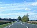
 A698 at Crailing - geograph.org.uk - 5843420.jpg 1,024 × 780; 169 KB
-
 A698 near Crailing - geograph.org.uk - 3165416.jpg 640 × 442; 36 KB
-
 A698 near Shortacres - geograph.org.uk - 5843427.jpg 1,024 × 746; 147 KB
-
 A698 nears Crailing Tofts Farm - geograph.org.uk - 5848682.jpg 1,024 × 759; 104 KB
-
 A698 towards Jedburgh - geograph.org.uk - 6355353.jpg 1,024 × 684; 286 KB
-
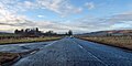 A698 towards Jedburgh - geograph.org.uk - 6355364.jpg 1,024 × 512; 154 KB
-
 A698 towards Jedburgh - geograph.org.uk - 6355378.jpg 1,024 × 512; 143 KB
-
 Access drive to Monteviot House - geograph.org.uk - 6270347.jpg 4,608 × 3,456; 4.12 MB
-

-
 An arable field at Crailing - geograph.org.uk - 5739928.jpg 1,024 × 683; 873 KB
-
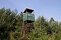 An observation tower at Pond Wood - geograph.org.uk - 2893018.jpg 640 × 427; 213 KB
-
 An overgrown pond at The Moor - geograph.org.uk - 2893046.jpg 427 × 640; 218 KB
-
 An overgrown pond at The Moor - geograph.org.uk - 2893048.jpg 640 × 427; 236 KB
-
 Ancient Fort and View of Teviotdale - geograph.org.uk - 5910469.jpg 5,184 × 3,888; 468 KB
-
 Anyone for a swim^ - geograph.org.uk - 4084040.jpg 640 × 480; 415 KB
-
 Approaching Ploughlands - geograph.org.uk - 6224325.jpg 1,600 × 1,060; 477 KB
-
 Approaching the old railway route, Ploughlands - geograph.org.uk - 6224346.jpg 1,600 × 1,060; 574 KB
-
 Arable land near Brownrig - geograph.org.uk - 3622320.jpg 640 × 480; 290 KB
-
 B.A.Way on River Teviot bank - geograph.org.uk - 6425557.jpg 4,608 × 3,456; 4.27 MB
-
 B6400 at Nisbet heading west - geograph.org.uk - 4778677.jpg 1,024 × 683; 248 KB
-
 B6400 heading away from A698 - geograph.org.uk - 5793573.jpg 1,500 × 1,044; 1.41 MB
-
 B6400 over Nisbet Bridge - geograph.org.uk - 6425504.jpg 4,608 × 3,456; 3.31 MB
-
 Baittens farm - geograph.org.uk - 4140013.jpg 1,024 × 678; 175 KB
-
 Bale store, Nisbet Hillhead - geograph.org.uk - 5217278.jpg 1,024 × 683; 259 KB
-
 Barley above Crailing - geograph.org.uk - 3629232.jpg 640 × 480; 254 KB
-
 Barley field near Crailing - geograph.org.uk - 3066120.jpg 640 × 480; 79 KB
-
 Barley fields at Brownrigg - geograph.org.uk - 4143006.jpg 1,024 × 678; 231 KB
-
 Barley, Crailing Tofts - geograph.org.uk - 3632345.jpg 640 × 480; 228 KB
-
 Barley, Monteviot - geograph.org.uk - 3091839.jpg 640 × 480; 275 KB
-
 Barley, Monteviot - geograph.org.uk - 3293072.jpg 640 × 480; 300 KB
-

-
 Bell tower at Monteviot House Garden - geograph.org.uk - 6448411.jpg 1,600 × 1,200; 621 KB
-
 Birnyedge Plantation - geograph.org.uk - 3346419.jpg 640 × 480; 350 KB
-
 Birnyedge Plantation - geograph.org.uk - 3351393.jpg 640 × 480; 359 KB
-
 Blacksmiths at Crailing - geograph.org.uk - 4645974.jpg 480 × 640; 149 KB
-
 Blindwells Plantation - geograph.org.uk - 3622316.jpg 640 × 480; 347 KB
-
 Borders Abbeys Way near Nisbet - geograph.org.uk - 4083556.jpg 640 × 480; 538 KB
-
 Borders Abbeys Way near Ploughlands Farm - geograph.org.uk - 4084074.jpg 640 × 480; 595 KB
-
 Borders Abbeys Way near Ploughlands Farm - geograph.org.uk - 4084079.jpg 640 × 480; 462 KB
-
 Borders Abbeys Way west of Nisbet - geograph.org.uk - 4084035.jpg 640 × 480; 487 KB
-
 Bridge over River Teviot - geograph.org.uk - 5793242.jpg 1,500 × 1,125; 1.56 MB
-
 Bridge over the Teviot at Nisbet (2) - geograph.org.uk - 3076394.jpg 800 × 530; 129 KB
-
 Bridge over the Teviot at Nisbet (3) - geograph.org.uk - 3076397.jpg 800 × 530; 122 KB
-
 Bridge over the Teviot at Nisbet - geograph.org.uk - 3075943.jpg 800 × 530; 135 KB
-
 Bridges - old and new at Crailing - geograph.org.uk - 4776519.jpg 1,024 × 672; 191 KB
-
 Bullocks at Eat Nesbit - geograph.org.uk - 3066115.jpg 640 × 480; 68 KB
-
 Cherry tree blossom at Crailing - geograph.org.uk - 2894470.jpg 604 × 426; 309 KB
-
 Cherry tree blossom at Crailing - geograph.org.uk - 2894475.jpg 640 × 535; 236 KB
-
 Crailing Bridge over Oxnam Water - geograph.org.uk - 3070761.jpg 4,000 × 3,000; 4.88 MB
-
 Crailing countryside - geograph.org.uk - 5675156.jpg 1,239 × 1,600; 675 KB
-
 Crailing Kirk ( Ale ^ Teviot United Church) - geograph.org.uk - 4100801.jpg 4,608 × 3,456; 3.05 MB
-
 Crailing Kirk - geograph.org.uk - 1916376.jpg 640 × 480; 93 KB
-
 Crailing Kirk. - geograph.org.uk - 980013.jpg 640 × 480; 95 KB
-
 Crailing Old Parish Churchyard - geograph.org.uk - 2908213.jpg 640 × 480; 201 KB
-
 Crailing Old Parish Churchyard - geograph.org.uk - 5726222.jpg 1,280 × 853; 1.12 MB
-
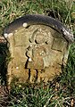
 Crailing Parish War Memorial - geograph.org.uk - 3099776.jpg 640 × 480; 137 KB
-
 Crailing Tofts - geograph.org.uk - 4110176.jpg 640 × 480; 71 KB
-
 Deer seat, Nisbet Muir - geograph.org.uk - 5217292.jpg 1,024 × 683; 275 KB
-
 Dere Street - geograph.org.uk - 3346414.jpg 640 × 480; 296 KB
-
 Dere Street toward Roman Camp (site off) - geograph.org.uk - 6278787.jpg 4,608 × 3,456; 4.4 MB
-
 Descending to Littledeanlees - geograph.org.uk - 5866320.jpg 1,600 × 1,060; 483 KB
-
 Descent to the Oxnam Water - geograph.org.uk - 5866326.jpg 1,600 × 1,060; 607 KB
-
 Ditch near Kirkmains - geograph.org.uk - 3065695.jpg 640 × 480; 123 KB
-
 Drive exit, Monteviot House - geograph.org.uk - 3091836.jpg 640 × 480; 293 KB
-
 Dry stone wall on Peniel Heugh - geograph.org.uk - 2140898.jpg 2,000 × 1,500; 2.14 MB
-
 Early Julyan in Crailing orchard 2022.jpg 6,000 × 8,000; 21.23 MB
-
 East Nisbet farm - geograph.org.uk - 5867045.jpg 1,600 × 1,060; 404 KB
-
 Entrance and drive, Monteviot House - geograph.org.uk - 1870239.jpg 800 × 530; 209 KB
-
 Entrance road to Ploughlands Farm - geograph.org.uk - 1316399.jpg 640 × 538; 63 KB
-
 Entrance road to private house - geograph.org.uk - 1170578.jpg 640 × 480; 121 KB
-
 Entrance to Crailing - geograph.org.uk - 2684982.jpg 640 × 480; 63 KB
-
 Entrance to Native Woods - geograph.org.uk - 3930813.jpg 640 × 480; 114 KB
-
 Farm buildings at Ploughlands - geograph.org.uk - 6224332.jpg 1,600 × 1,059; 414 KB
-
 Farm cottages on the Kelso road. - geograph.org.uk - 980012.jpg 640 × 480; 97 KB
-
 Farm road - geograph.org.uk - 2809894.jpg 640 × 480; 310 KB
-
 Farm road - Jedburgh Railway trackbed - geograph.org.uk - 2768164.jpg 640 × 480; 350 KB
-
 Farm road, Nisbet Moor - geograph.org.uk - 5217281.jpg 1,024 × 683; 400 KB
-
 Farm track to Ploughlands Farm - geograph.org.uk - 4084084.jpg 640 × 480; 459 KB
-
 Farmland at Crailing - geograph.org.uk - 2893053.jpg 640 × 401; 238 KB
-
 Farmland by Natives Wood - geograph.org.uk - 2756049.jpg 427 × 640; 179 KB
-
 Farmland Near Folly Loch - geograph.org.uk - 1635010.jpg 640 × 480; 58 KB
-
 Farmland Near Natives Wood - geograph.org.uk - 5910449.jpg 5,184 × 3,888; 787 KB
-

-
 Field above Monteviot House - geograph.org.uk - 2211059.jpg 2,592 × 1,944; 1.2 MB
-
 Field access through Boggyhall Wood - geograph.org.uk - 4778680.jpg 1,024 × 683; 249 KB
-
 Field below Monument Wood, Peniel Heugh - geograph.org.uk - 6000469.jpg 1,600 × 1,060; 311 KB
-
 Field corner, Blackrig Plantation - geograph.org.uk - 6223939.jpg 1,600 × 1,060; 607 KB
-
 Field edge fencing toward Peniel Heugh - geograph.org.uk - 6270379.jpg 3,456 × 4,608; 3.18 MB
-

-

-

-
 Field track near Nisbet - geograph.org.uk - 6223936.jpg 1,600 × 1,060; 486 KB
-
 Field with Pond - geograph.org.uk - 1834889.jpg 1,600 × 1,200; 540 KB
-
 Field, Upper Nisbet - geograph.org.uk - 6224321.jpg 1,600 × 1,060; 515 KB
-
 Fields above Baittens - geograph.org.uk - 2211123.jpg 2,592 × 1,944; 1.86 MB
-

-
 Fields below Natives Wood - geograph.org.uk - 1871502.jpg 800 × 530; 186 KB
-
 Fields near Brownrigg Farm - geograph.org.uk - 2211156.jpg 2,592 × 1,944; 1.73 MB
-
 Fields near Ploughlands - geograph.org.uk - 3075912.jpg 800 × 530; 147 KB
-

-
 Fieldside path to Peniel Heugh - geograph.org.uk - 5999751.jpg 1,600 × 1,060; 676 KB
-
 Firebreak in Stubcross Plantation - geograph.org.uk - 6278706.jpg 4,608 × 3,456; 5.25 MB
-
 Floodplain of the River Teviot - geograph.org.uk - 3066127.jpg 640 × 480; 82 KB
-
 Footbridge at Harestanes - geograph.org.uk - 1870471.jpg 800 × 530; 301 KB
-
 Footbridge in Divet Ha' Wood - geograph.org.uk - 3901472.jpg 1,024 × 678; 353 KB
-
 Footbridge over Oxnam Water - geograph.org.uk - 3085016.jpg 4,000 × 3,000; 4.72 MB
-
 Footbridge over the Oxnam Water - geograph.org.uk - 4140007.jpg 1,024 × 678; 265 KB
-
 Footpath into Roman Wood from Dere Street - geograph.org.uk - 6278781.jpg 4,608 × 3,456; 3.45 MB
-
 Footpath through Blindwells Plantation - geograph.org.uk - 5999722.jpg 4,000 × 3,000; 4.36 MB
-
 Footpath to Waterloo Monument Penial Heugh - geograph.org.uk - 6270392.jpg 2,212 × 3,002; 2.73 MB
-
 Forest road rising towards Peniel Heugh - geograph.org.uk - 2140870.jpg 2,000 × 1,123; 2.92 MB
-
 Former railway line by Dub Plantation - geograph.org.uk - 3075930.jpg 800 × 530; 145 KB
-
 Fort on Peniel Heugh - geograph.org.uk - 1057831.jpg 640 × 480; 80 KB
-
 Gate to Blackrig Plantation - geograph.org.uk - 6223950.jpg 1,600 × 1,092; 616 KB
-
 Gates to fields below Penial Heugh - geograph.org.uk - 6270373.jpg 3,456 × 4,608; 3.08 MB
-
 Gateway to Wellingtonia avenue, Monteviot Estate - geograph.org.uk - 3901496.jpg 1,024 × 678; 288 KB
-
 Grassland near Brownrigg - geograph.org.uk - 3629236.jpg 640 × 480; 264 KB
-
 Grassy lane from Ploughlands - geograph.org.uk - 6224342.jpg 1,600 × 1,060; 739 KB
-
 Graveyard at Nisbet - geograph.org.uk - 3066113.jpg 640 × 480; 114 KB
-
 Grazing land near Baittens - geograph.org.uk - 1916366.jpg 640 × 480; 56 KB
-
 Green lane near Crailing - geograph.org.uk - 3346388.jpg 640 × 480; 287 KB
-
 Harvest, Crailing - geograph.org.uk - 3632341.jpg 640 × 480; 228 KB
-
 Harvested fields below Victoria Clump (wood) - geograph.org.uk - 6271268.jpg 4,608 × 3,456; 3.08 MB
-
 Hill fort, Peniel Heugh - geograph.org.uk - 5217270.jpg 1,024 × 683; 270 KB
-

-
 Houses at Crailing Tofts on the A698 - geograph.org.uk - 4776515.jpg 1,024 × 624; 101 KB
-
 Houses on North Street Belhaven - geograph.org.uk - 5824608.jpg 2,048 × 1,536; 1.23 MB
-
 In Natives Wood - geograph.org.uk - 4551003.jpg 3,439 × 4,575; 6.15 MB
-
 Irrigation pipeline at Dub Plantation - geograph.org.uk - 4084067.jpg 640 × 480; 505 KB
-

-
 Jedburgh Railway trackbed - geograph.org.uk - 2768193.jpg 640 × 480; 368 KB
-
 Jedburgh Railway trackbed - geograph.org.uk - 2809891.jpg 640 × 480; 352 KB
-

-
 Lane from Maxton dropping towards Teviotdale - geograph.org.uk - 5113194.jpg 899 × 1,600; 405 KB
-
 Line of trees at top of field - geograph.org.uk - 5793234.jpg 1,500 × 1,125; 1.7 MB
-
 Location plaque on Waterloo Monument, Peniel Heugh - geograph.org.uk - 6000014.jpg 1,600 × 1,060; 640 KB
-
 Logos, Crailing Tofts - geograph.org.uk - 4110179.jpg 640 × 480; 263 KB
-
 Main Drive and Estate Buildings for Monteviot House - geograph.org.uk - 5909282.jpg 5,184 × 3,888; 730 KB
-
 Marshes at Shortacres - geograph.org.uk - 1455280.jpg 640 × 480; 40 KB
-
 Mid-winter Sun Over The Teviot - geograph.org.uk - 1635002.jpg 640 × 480; 112 KB
-
 Minor road at East Nisbet - geograph.org.uk - 4778673.jpg 1,600 × 1,067; 536 KB
-
 Minor road beside Pond Wood - geograph.org.uk - 5996820.jpg 4,000 × 3,000; 4.36 MB
-
 Minor road leading to Maxton - geograph.org.uk - 4778683.jpg 1,024 × 683; 231 KB
-
 Minor road near Brownrigg - geograph.org.uk - 4140786.jpg 1,024 × 678; 270 KB
-
 Minor road near Brownrigg Farm - geograph.org.uk - 2211168.jpg 2,592 × 1,944; 1.41 MB
-
 Minor road passing through woodland - geograph.org.uk - 6270366.jpg 4,608 × 3,456; 5.77 MB
-

-
 Minor road to Muirhouselaw - geograph.org.uk - 6000471.jpg 1,600 × 1,060; 595 KB
-
 Minor road, Nisbet - geograph.org.uk - 2768225.jpg 640 × 360; 273 KB
-
 Monteviot bridge - geograph.org.uk - 3070731.jpg 4,000 × 3,000; 4.56 MB
-
 Monteviot House - geograph.org.uk - 3554471.jpg 640 × 450; 197 KB
-
 Monteviot House Gardens - geograph.org.uk - 3554453.jpg 640 × 480; 188 KB
-
 Monteviot House Gardens - geograph.org.uk - 3554464.jpg 640 × 463; 223 KB
-
 Muck and stubble, Nisbet - geograph.org.uk - 2768196.jpg 640 × 480; 314 KB
-
 Muck and stubble, Nisbet - geograph.org.uk - 2768205.jpg 640 × 480; 321 KB
-
 Natives Wood - geograph.org.uk - 1056878.jpg 640 × 359; 133 KB
-
 Natives Wood - geograph.org.uk - 2756042.jpg 427 × 640; 208 KB
-
 New route waymark near Peniel Heugh - geograph.org.uk - 6223869.jpg 1,600 × 1,060; 305 KB
-
 Newly planted crops - geograph.org.uk - 1048995.jpg 640 × 480; 109 KB
-
 Nisbet - geograph.org.uk - 2768210.jpg 640 × 360; 248 KB
-
 Nisbet Bridge - geograph.org.uk - 4084050.jpg 640 × 480; 556 KB
-
 Nisbet Moor - geograph.org.uk - 4790872.jpg 1,024 × 683; 269 KB
-
 Nisbet phone box - geograph.org.uk - 5866580.jpg 1,600 × 1,060; 488 KB
-
 Nisbet Waste Water Treatment Works - geograph.org.uk - 6224350.jpg 1,600 × 1,060; 465 KB
-
 Nisbetmill Cauld, River Teviot - geograph.org.uk - 6224414.jpg 1,600 × 1,060; 564 KB
-
 Non compliant sign, Monument Wood - geograph.org.uk - 5217238.jpg 1,024 × 683; 436 KB
-
 Non natives in Natives Wood - geograph.org.uk - 1056873.jpg 640 × 359; 122 KB
-
 North bank approach to the Monteviot Bridge - geograph.org.uk - 3070682.jpg 4,000 × 3,000; 4.54 MB
-

-
 Northwest from Peniel Heugh - geograph.org.uk - 6000460.jpg 1,600 × 1,060; 349 KB
-
 O-S Bench Mark on Trig Point. Peniel Heugh - geograph.org.uk - 6270403.jpg 3,402 × 4,568; 7.28 MB
-
 Oilseed rape, Crailing Tofts - geograph.org.uk - 1049047.jpg 640 × 359; 92 KB
-
 Old mill lade near Nisbet - geograph.org.uk - 6224355.jpg 1,600 × 1,060; 642 KB
-
 Old quarry in Natives Wood - geograph.org.uk - 1870452.jpg 800 × 530; 313 KB
-
 On Coldhaugh Bank looking into the valley of Oxnam Water - geograph.org.uk - 3085028.jpg 4,000 × 3,000; 4.57 MB
-

-
 Orchard, Crailing - geograph.org.uk - 1049022.jpg 640 × 480; 93 KB
-
 Ordnance Survey Cut Mark - geograph.org.uk - 4710462.jpg 640 × 480; 112 KB


_-_geograph.org.uk_-_3076394.jpg)
_-_geograph.org.uk_-_3076397.jpg)


_-_geograph.org.uk_-_4100801.jpg)


_-_geograph.org.uk_-_6278787.jpg)


_-_geograph.org.uk_-_6271268.jpg)


&filefrom=Ordnance+Survey+Flush+Bracket+1513+-+geograph.org.uk+-+4769987.jpg#mw-category-media)