
Category:Cortachy and Clova
Scottish parish in Angus, Scotland, UK | |||||
| Upload media | |||||
| Instance of | |||||
|---|---|---|---|---|---|
| Named after | |||||
| Location |
| ||||
| Population |
| ||||
| Area |
| ||||
 | |||||
The parish of Cortachy and Clova (Angus, Scotland) includes Clova, Cortachy and Glenprosen.
Subcategories
This category has the following 6 subcategories, out of 6 total.
C
G
L
S
Media in category "Cortachy and Clova"
The following 200 files are in this category, out of 1,320 total.
(previous page) (next page)-

-
 A big meander on the River South Esk - geograph.org.uk - 2893849.jpg 640 × 480; 82 KB
-
 A cairn below Cathelle Houses - geograph.org.uk - 2886101.jpg 1,142 × 857; 576 KB
-
 A chasm opening on The Snub - geograph.org.uk - 2886039.jpg 857 × 1,142; 684 KB
-
 A firebreak in the forest - geograph.org.uk - 2886218.jpg 857 × 1,142; 667 KB
-
 A great day on the summit of Mayar - geograph.org.uk - 2879162.jpg 1,142 × 857; 628 KB
-
 A hairpin on the forest track - geograph.org.uk - 2886591.jpg 1,142 × 857; 601 KB
-

-
 A new estate road above Wheen - geograph.org.uk - 2882406.jpg 1,142 × 857; 562 KB
-
 A rock exposure on the forest track - geograph.org.uk - 2886596.jpg 1,142 × 857; 609 KB
-
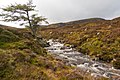
 A small burn flowing down the hill - geograph.org.uk - 2886587.jpg 857 × 1,142; 651 KB
-
 A small cairn on the summit area of White Hill - geograph.org.uk - 2883612.jpg 1,142 × 857; 581 KB
-
 A small peaty pool on Hunt Hill - geograph.org.uk - 2874204.jpg 857 × 1,142; 573 KB
-
 A small pool in the moraines in Corrie Fee - geograph.org.uk - 2881946.jpg 1,142 × 857; 578 KB
-

-

-
 A wider part of the chasm on The Snub - geograph.org.uk - 2886045.jpg 857 × 1,142; 663 KB
-
 Above Bachnagairn - geograph.org.uk - 2654803.jpg 1,000 × 1,532; 242 KB
-
 Above Corrie Kilbo - geograph.org.uk - 1880063.jpg 640 × 480; 74 KB
-
 Above Corrie Kilbo - geograph.org.uk - 1880080.jpg 640 × 480; 87 KB
-
 Above Corrie Sharroch - geograph.org.uk - 1880133.jpg 640 × 480; 76 KB
-
 Above Kirkton of Clova on the path to Loch Brandy - geograph.org.uk - 5876461.jpg 1,600 × 1,131; 420 KB
-
 Above Snow Burn - geograph.org.uk - 1880197.jpg 640 × 480; 81 KB
-

-
 Above the East Burn of Glenmoye - geograph.org.uk - 3647397.jpg 640 × 480; 468 KB
-
 Acharn - geograph.org.uk - 1878310.jpg 640 × 480; 50 KB
-
 Across the bealach towards Green Hill - geograph.org.uk - 2885358.jpg 1,142 × 857; 594 KB
-

-
 Across the top of Corrie Sharroch - geograph.org.uk - 2875975.jpg 1,142 × 857; 595 KB
-
 Across the upper slopes of Cairn Derg - geograph.org.uk - 2886199.jpg 1,142 × 857; 579 KB
-
 Adielinn Cottage - geograph.org.uk - 2894354.jpg 640 × 480; 107 KB
-
 Aerial, Sandy Hillock - geograph.org.uk - 3255917.jpg 640 × 360; 192 KB
-
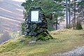
 Airlie Memorial Tower - geograph.org.uk - 3249123.jpg 574 × 640; 47 KB
-
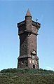 Airlie Memorial Tower - geograph.org.uk - 3314093.jpg 750 × 1,169; 100 KB
-
 Airlie Memorial Tower - geograph.org.uk - 5196692.jpg 5,184 × 3,888; 4.2 MB
-
 Airlie Memorial Tower - geograph.org.uk - 6028605.jpg 1,600 × 1,200; 258 KB
-

-
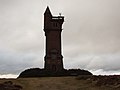 Airlie Monument - geograph.org.uk - 2242492.jpg 1,600 × 1,200; 159 KB
-
 Airlie Monument - geograph.org.uk - 4075467.jpg 634 × 1,024; 520 KB
-
 Airlie Monument - geograph.org.uk - 6366212.jpg 1,024 × 683; 97 KB
-
 Airlie monument from the north - geograph.org.uk - 6827028.jpg 1,600 × 1,200; 338 KB
-

-

-
 Along the western flank of Little Driesh - geograph.org.uk - 2875922.jpg 1,142 × 857; 618 KB
-

-
 Angular rocks on Cairn Bannoch - geograph.org.uk - 6811302.jpg 2,000 × 1,333; 2.37 MB
-
 Approaching Broad Cairn - geograph.org.uk - 5836418.jpg 640 × 360; 65 KB
-
 Approaching Cairn Bannoch from the west - geograph.org.uk - 3748298.jpg 1,024 × 768; 147 KB
-
 Approaching Dykehead - geograph.org.uk - 4901277.jpg 1,600 × 1,168; 521 KB
-
 Approaching Moulzie - geograph.org.uk - 5051079.jpg 1,024 × 704; 184 KB
-
 Approaching Stony Loch - geograph.org.uk - 2940740.jpg 4,608 × 3,456; 5.6 MB
-
 Approaching summit of Driesh - geograph.org.uk - 7242293.jpg 1,024 × 473; 74 KB
-

-
 Approaching The Goet - geograph.org.uk - 2942640.jpg 3,072 × 2,304; 922 KB
-
 Approaching the rocky summit of Tolmount - geograph.org.uk - 4491971.jpg 1,024 × 768; 188 KB
-
 Arched gateway to Cortachy Castle - geograph.org.uk - 4692691.jpg 4,608 × 3,456; 2.98 MB
-
 Ascending Mayar - geograph.org.uk - 1880198.jpg 640 × 480; 88 KB
-
 At the summit cairn on Tom Buidhe - geograph.org.uk - 4493885.jpg 1,024 × 768; 162 KB
-
 At the summit of Driesh - geograph.org.uk - 2874114.jpg 1,142 × 857; 609 KB
-
 At the summit of Hunt Hill - geograph.org.uk - 2874194.jpg 1,142 × 857; 579 KB
-
 Atton below Cairn Inks - geograph.org.uk - 4899107.jpg 900 × 1,200; 244 KB
-
 Atton in Glen Clova - geograph.org.uk - 2002479.jpg 848 × 600; 112 KB
-
 Atton, Glen Clova - geograph.org.uk - 2893505.jpg 640 × 480; 87 KB
-
 Auchnadoes plantation and cemetery - geograph.org.uk - 6827087.jpg 1,600 × 1,200; 652 KB
-
 B Gully, Corrie of Fee - geograph.org.uk - 5516998.jpg 800 × 1,200; 199 KB
-
 B Gully, Corrie of Fee - geograph.org.uk - 5517009.jpg 800 × 1,200; 129 KB
-
 B955 below the Craigs of Inchdowrie - geograph.org.uk - 2893803.jpg 640 × 480; 87 KB
-
 B955 heading for Clova - geograph.org.uk - 5738463.jpg 5,184 × 3,888; 7.36 MB
-
 B955 in lower Glen Clova - geograph.org.uk - 6520703.jpg 5,184 × 3,888; 6.96 MB
-
 Bachnagairn - geograph.org.uk - 3256051.jpg 480 × 640; 100 KB
-

-
 Balnaboth Craig - geograph.org.uk - 1190799.jpg 640 × 383; 62 KB
-
 Barns at Rottal - geograph.org.uk - 2894643.jpg 640 × 480; 95 KB
-
 Barns in Glen Prosen - geograph.org.uk - 2865189.jpg 640 × 480; 88 KB
-
 Bathing pool in the young River Esk - geograph.org.uk - 6330756.jpg 1,600 × 900; 633 KB
-
 Bealach between Little Driesh and Hunt Hill - geograph.org.uk - 2874188.jpg 1,142 × 857; 549 KB
-
 Bedroom at Sheriffbank Cottage - geograph.org.uk - 2243339.jpg 480 × 640; 240 KB
-
 Beehives in Glen Uig - geograph.org.uk - 2865174.jpg 640 × 480; 150 KB
-

-
 Bell heather - geograph.org.uk - 2530987.jpg 2,000 × 2,667; 1.41 MB
-
 Belmonies - geograph.org.uk - 2865168.jpg 640 × 480; 101 KB
-
 Below Ben Tirran towards Rottal Lodge - geograph.org.uk - 2882466.jpg 1,142 × 857; 650 KB
-
 Below Glenclova Forest - geograph.org.uk - 3073774.jpg 2,592 × 1,944; 1.34 MB
-
 Ben Reid from Boustie Ley - geograph.org.uk - 2886089.jpg 1,142 × 857; 589 KB
-
 Ben Tirran (trig point) - geograph.org.uk - 5226129.jpg 2,048 × 1,536; 536 KB
-
 Ben Tirran - SW top - geograph.org.uk - 2375701.jpg 640 × 480; 54 KB
-
 Bends on the River South Esk - geograph.org.uk - 5738450.jpg 5,184 × 3,888; 6.42 MB
-

-
 Biological weathering in Corrie Fee - geograph.org.uk - 2671203.jpg 640 × 480; 101 KB
-
 Birch trees, Glen Cally - geograph.org.uk - 1779825.jpg 600 × 450; 170 KB
-
 Black Skellies - geograph.org.uk - 2875937.jpg 1,142 × 857; 626 KB
-
 Blackpot Burn - geograph.org.uk - 2645901.jpg 640 × 480; 302 KB
-
 Blizzard on its way in Glen Clova - geograph.org.uk - 5530701.jpg 640 × 480; 54 KB
-
 Boggy ground above Loch Brandy - geograph.org.uk - 2885446.jpg 1,142 × 857; 572 KB
-
 Boggy ground and a shallow lochan - geograph.org.uk - 2885365.jpg 1,142 × 857; 582 KB
-
 Boggy peat - geograph.org.uk - 6811422.jpg 5,184 × 3,888; 4.71 MB
-
 Boggy pool between White Hill and Cairn Trench - geograph.org.uk - 2883659.jpg 1,142 × 857; 611 KB
-
 Boggy pool on the western side of White Hill - geograph.org.uk - 2883602.jpg 1,142 × 857; 612 KB
-
 Bogs on Dog Hillock - geograph.org.uk - 3255190.jpg 640 × 360; 246 KB
-
 Bogs on the Altentersie Burn - geograph.org.uk - 942828.jpg 640 × 480; 84 KB
-
 Bontyre - geograph.org.uk - 2893495.jpg 640 × 480; 79 KB
-
 Boulder Field - geograph.org.uk - 2934109.jpg 630 × 473; 153 KB
-
 Boulders above Glen Doll - geograph.org.uk - 6566250.jpg 1,024 × 768; 737 KB
-
 Boulders and stone shelter on Cat Law - geograph.org.uk - 6265875.jpg 5,152 × 3,864; 6.21 MB
-
 Boulders on the Shank of Drumwhallo - geograph.org.uk - 6190306.jpg 5,184 × 3,888; 5.49 MB
-
 Boundary fence on the northwest side of The Goet - geograph.org.uk - 2885265.jpg 1,142 × 857; 549 KB
-

-
 Boundary old ^ new - geograph.org.uk - 2414665.jpg 473 × 630; 145 KB
-
 Boundary wall - geograph.org.uk - 6545627.jpg 768 × 1,024; 201 KB
-
 Braedownie Farm in Glen Clova - geograph.org.uk - 1997200.jpg 640 × 506; 119 KB
-
 Braedownie Quarry - geograph.org.uk - 2893411.jpg 640 × 480; 92 KB
-
 Braedownie, Glen Doll - geograph.org.uk - 2125861.jpg 3,648 × 2,736; 2.42 MB
-
 Braeminzion - geograph.org.uk - 4899897.jpg 1,600 × 1,251; 345 KB
-
 Braeminzion Farm - geograph.org.uk - 2894360.jpg 640 × 480; 84 KB
-
 Braeminzion Plantation - geograph.org.uk - 5738436.jpg 5,184 × 3,888; 5.54 MB
-
 Brick structure at Brocklas - geograph.org.uk - 1865786.jpg 2,112 × 2,816; 3 MB
-
 Bridge at Glencally - geograph.org.uk - 5557261.jpg 5,184 × 3,888; 5.56 MB
-
 Bridge over Burn of Glencally - geograph.org.uk - 5054951.jpg 4,313 × 3,235; 3.87 MB
-
 Bridge over the Cald Burn - geograph.org.uk - 6008224.jpg 1,600 × 1,010; 289 KB
-
 Bridge over the Prosen Water - geograph.org.uk - 6190397.jpg 5,184 × 3,888; 3.74 MB
-
 Bridge over the South Esk - geograph.org.uk - 4692683.jpg 3,987 × 2,849; 2.08 MB
-
 Bridge over White Water - geograph.org.uk - 3062457.jpg 640 × 480; 129 KB
-
 Bridge over White Water, Glen Doll - geograph.org.uk - 3402154.jpg 640 × 427; 70 KB
-
 Bridge to Kinrive Farm - geograph.org.uk - 2644404.jpg 640 × 480; 292 KB
-
 Bridge to Kinrive Farm in Glenmoy - geograph.org.uk - 1865756.jpg 2,816 × 2,112; 2.97 MB
-
 Bridge to Whitehaugh - geograph.org.uk - 905098.jpg 640 × 480; 73 KB
-
 Bridge, Glen Moy - geograph.org.uk - 2639886.jpg 640 × 480; 253 KB
-
 Broad Cairn - geograph.org.uk - 5836421.jpg 640 × 360; 60 KB
-
 Broad Cairn mountain tracks - geograph.org.uk - 2414646.jpg 630 × 473; 147 KB
-
 Brocklas - geograph.org.uk - 2766712.jpg 640 × 300; 139 KB
-
 Brocklas - geograph.org.uk - 4900311.jpg 900 × 1,200; 190 KB
-
 Brocklas cottage - geograph.org.uk - 1865779.jpg 2,816 × 2,112; 2.99 MB
-
 Brocklas cottage - geograph.org.uk - 3636674.jpg 1,600 × 1,200; 524 KB
-
 Brocklas Cottage - geograph.org.uk - 4607270.jpg 640 × 478; 86 KB
-

-
 Brocklas from the Clova road - geograph.org.uk - 4618575.jpg 480 × 640; 55 KB
-
 Brocklas from the north - geograph.org.uk - 2496023.jpg 640 × 480; 179 KB
-
 Brocklas sheepfold - geograph.org.uk - 6028603.jpg 1,600 × 1,200; 744 KB
-
 Broken fence on Craigthran - geograph.org.uk - 1005321.jpg 640 × 480; 100 KB
-
 Broom Hill - geograph.org.uk - 3255889.jpg 640 × 360; 260 KB
-
 Brushwood Bales - geograph.org.uk - 1881658.jpg 640 × 480; 83 KB
-
 Buckhood - geograph.org.uk - 2865716.jpg 640 × 480; 94 KB
-
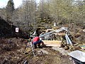 Building a bridge - geograph.org.uk - 3466741.jpg 2,048 × 1,536; 1.55 MB
-
 Buildings in Glen Prosen village - geograph.org.uk - 2517645.jpg 2,000 × 1,500; 927 KB
-
 Bulldozed track above Glen Prosen - geograph.org.uk - 6190233.jpg 5,184 × 3,888; 5.16 MB
-
 Burn at Rottal - geograph.org.uk - 2390146.jpg 1,500 × 1,125; 806 KB
-
 Burn by the trees - geograph.org.uk - 3466536.jpg 2,048 × 1,536; 1.16 MB
-
 Burn in Glencuilt - geograph.org.uk - 5755952.jpg 5,184 × 3,888; 4.92 MB
-
 Burn of Bonhard - geograph.org.uk - 2395066.jpg 1,125 × 1,500; 853 KB
-
 Burn of Bonhard - geograph.org.uk - 2893497.jpg 640 × 480; 106 KB
-
 Burn of Cally - geograph.org.uk - 1778912.jpg 800 × 534; 270 KB
-
 Burn of Cormandie - geograph.org.uk - 2389446.jpg 1,500 × 1,125; 807 KB
-
 Burn of Cormandie - geograph.org.uk - 2390224.jpg 1,500 × 1,125; 964 KB
-
 Burn of Fafernie - geograph.org.uk - 4088189.jpg 640 × 480; 96 KB
-
 Burn of Farchal - geograph.org.uk - 1191152.jpg 480 × 640; 144 KB
-
 Burn of Glenarm - geograph.org.uk - 4900315.jpg 1,600 × 1,200; 444 KB
-
 Burn of Gowal - geograph.org.uk - 2075786.jpg 1,600 × 1,068; 512 KB
-
 Burn of Gowall, Glen Doll - geograph.org.uk - 2125850.jpg 3,648 × 2,736; 2.34 MB
-
 Burn of Inchmill glen - geograph.org.uk - 2517714.jpg 2,000 × 1,500; 722 KB
-
 Burn of Kilbo - geograph.org.uk - 1878650.jpg 480 × 640; 118 KB
-
 Burn of Kilbo - geograph.org.uk - 2530928.jpg 2,000 × 1,500; 980 KB
-
 Burn of Kilbo - geograph.org.uk - 5608521.jpg 640 × 425; 98 KB
-
 Burn of Lednathie - geograph.org.uk - 2865185.jpg 640 × 480; 113 KB
-
 Burn of Louie - geograph.org.uk - 6190357.jpg 5,184 × 3,888; 3.77 MB
-
 Burn of North Inchdowrie - geograph.org.uk - 2893870.jpg 640 × 480; 117 KB
-
 Burning debris after clear felling - geograph.org.uk - 2395090.jpg 1,500 × 1,125; 682 KB
-

-

-
 Burnside Lodge - geograph.org.uk - 2894461.jpg 640 × 480; 126 KB
-
 Burnside Lodge - geograph.org.uk - 2894463.jpg 640 × 480; 155 KB
-
 Burnt heather, Glen Logie - geograph.org.uk - 1572966.jpg 640 × 480; 111 KB
-
 Butt on the moor - geograph.org.uk - 2517804.jpg 2,000 × 1,500; 872 KB
-
 Butt, Finbracks - geograph.org.uk - 2645872.jpg 640 × 480; 322 KB
-
 Butts, Finbracks - geograph.org.uk - 2645881.jpg 640 × 480; 335 KB
-
 Caddam Farm - geograph.org.uk - 2893824.jpg 640 × 480; 65 KB
-
 Cairn above Wester Lednathie - geograph.org.uk - 3234254.jpg 640 × 297; 62 KB
-
 Cairn atop Mayar - geograph.org.uk - 7041804.jpg 1,600 × 1,200; 325 KB
-
 Cairn Bannoch - geograph.org.uk - 5836408.jpg 640 × 360; 74 KB
-
 Cairn beside the Craig Burn - geograph.org.uk - 2882488.jpg 857 × 1,142; 633 KB
-
 Cairn Broadlands - geograph.org.uk - 3253583.jpg 640 × 360; 253 KB
-
 Cairn Broadlands - geograph.org.uk - 3255185.jpg 480 × 640; 327 KB
-
 Cairn near Glenprosen Lodge - geograph.org.uk - 1115965.jpg 640 × 426; 78 KB
-
 Cairn of Gowal - geograph.org.uk - 5836413.jpg 640 × 360; 53 KB
-
 Cairn on Cairn Leith - geograph.org.uk - 1651232.jpg 640 × 422; 75 KB
-
 Cairn on Corwharn - geograph.org.uk - 3234244.jpg 640 × 425; 91 KB
-
 Cairn on Craigthran - geograph.org.uk - 2644664.jpg 640 × 480; 250 KB
-
 Cairn on Green Hill - geograph.org.uk - 2940669.jpg 4,608 × 3,456; 6.06 MB
-
 Cairn on White Bents - geograph.org.uk - 2886116.jpg 1,142 × 857; 563 KB
-
 Cairn Trench - summit area - geograph.org.uk - 2883676.jpg 1,142 × 857; 600 KB
-
 Cairn, east of Finbracks - geograph.org.uk - 5755912.jpg 5,184 × 3,888; 6.36 MB
-
 Cairn, The Goet - geograph.org.uk - 5515511.jpg 800 × 533; 49 KB
-
 Cald Burn - geograph.org.uk - 3025835.jpg 640 × 480; 116 KB
-
 Capel Burn - geograph.org.uk - 3025829.jpg 640 × 480; 101 KB
-
 Capel Mounth - geograph.org.uk - 1005264.jpg 640 × 480; 103 KB
-
 Capel Mounth - geograph.org.uk - 2923369.jpg 437 × 640; 67 KB
-
 Capel Mounth track - geograph.org.uk - 1005234.jpg 640 × 480; 99 KB
-
 Car park at Cortachy - geograph.org.uk - 2868874.jpg 640 × 480; 129 KB
-
 Car park or disused quarry - geograph.org.uk - 6827033.jpg 1,600 × 1,200; 519 KB
-
 Carn Dearg Mountaineering Club hut - geograph.org.uk - 3250561.jpg 640 × 360; 240 KB
-
 Cart shed at Kinrive - geograph.org.uk - 5215145.jpg 640 × 360; 73 KB


_-_geograph.org.uk_-_5226129.jpg)


