Category:Comrie (civil parish)
Jump to navigation
Jump to search
Scottish parish | |||||
| Upload media | |||||
| Instance of | |||||
|---|---|---|---|---|---|
| Part of |
| ||||
| Named after | |||||
| Location |
| ||||
| Population |
| ||||
| Area |
| ||||
 | |||||
Subcategories
This category has the following 2 subcategories, out of 2 total.
P
S
Media in category "Comrie (civil parish)"
The following 200 files are in this category, out of 1,801 total.
(previous page) (next page)-

-
 "Ws" - geograph.org.uk - 4710261.jpg 5,932 × 3,955; 5.78 MB
-
 'Allt na Gallanaich' descending Achraw Hill - geograph.org.uk - 2426753.jpg 4,000 × 3,000; 6.31 MB
-
 'Allt na Gallanaich' near the top of Achraw Hill - geograph.org.uk - 2427138.jpg 3,736 × 2,802; 5.47 MB
-
 'Rob Roy Homes' at Dalchonzie - geograph.org.uk - 2421514.jpg 3,913 × 2,742; 3.57 MB
-
 'The Girron' looms over St Fillans at Little Port - geograph.org.uk - 2424951.jpg 3,869 × 2,902; 2.8 MB
-
 'The Shielings' - St Fillan's Park, Perthshire - geograph.org.uk - 2423804.jpg 4,000 × 3,000; 5.7 MB
-
 717m top on Meall Fearna - geograph.org.uk - 6703175.jpg 1,024 × 683; 492 KB
-
 A bog between Glen Beich and Glen Tarken - geograph.org.uk - 6681895.jpg 1,024 × 683; 236 KB
-
 A boggy col - geograph.org.uk - 6847583.jpg 1,024 × 768; 319 KB
-
 A burn draining Cnoc nan Oighreag - geograph.org.uk - 5863514.jpg 1,600 × 1,067; 589 KB
-
 A confluence of paths - geograph.org.uk - 2432757.jpg 4,000 × 3,000; 3.03 MB
-
 A confluence of streams - geograph.org.uk - 4220836.jpg 6,000 × 4,000; 5.84 MB
-
 A foggy day in Glen Artney - geograph.org.uk - 3240536.jpg 3,897 × 2,923; 3.24 MB
-
 A helping hand - geograph.org.uk - 4727690.jpg 4,542 × 3,080; 6.32 MB
-
 A house on the A85 near Loch Earn - geograph.org.uk - 2669697.jpg 800 × 600; 354 KB
-
 A junction of paths on Dun More - geograph.org.uk - 2432329.jpg 4,000 × 3,000; 3.95 MB
-
 A junction of tracks - geograph.org.uk - 4727713.jpg 6,000 × 4,000; 6.87 MB
-
 A long way from home - geograph.org.uk - 4732177.jpg 6,000 × 4,000; 7.31 MB
-
 A minor tributary of the Invergeldie Burn - geograph.org.uk - 4964026.jpg 2,592 × 1,944; 1.4 MB
-
 A private road to Ardvorlich House - geograph.org.uk - 2669442.jpg 800 × 600; 287 KB
-
 A profusion of bracken - geograph.org.uk - 5150959.jpg 6,000 × 4,000; 5.93 MB
-
 A profusion of Rowan Berries - geograph.org.uk - 4710256.jpg 6,000 × 4,000; 6 MB
-
 A rear view of the Earthquake House Observatory, The Ross, Comrie, Perthshire.jpg 4,896 × 3,672; 6.93 MB
-
 A road in Srath a' Ghlinne - geograph.org.uk - 5962369.jpg 1,024 × 1,024; 666 KB
-
 A Sense of Symmetry - geograph.org.uk - 6756526.jpg 680 × 1,024; 209 KB
-
 A small tributary of the Lednock - geograph.org.uk - 6223643.jpg 1,600 × 1,067; 578 KB
-
 A view down the glen - geograph.org.uk - 1879614.jpg 800 × 530; 230 KB
-
 A view of Loch Earn near St. Fillans - geograph.org.uk - 3152372.jpg 640 × 480; 56 KB
-
 A view of Stùc a' Chroin and Ben Vorlich - geograph.org.uk - 5963196.jpg 1,024 × 683; 343 KB
-
 A walk through the treetops in Laggan Wood - geograph.org.uk - 2432865.jpg 3,855 × 2,891; 5.83 MB
-

-
 A85 at Sawmill Wood, Dalchonzie - geograph.org.uk - 2660263.jpg 783 × 800; 152 KB
-
 A85 at Tynreoch - geograph.org.uk - 3200326.jpg 1,200 × 797; 796 KB
-
 A85 at Woodend Cottage - geograph.org.uk - 3200318.jpg 1,200 × 797; 724 KB
-
 A85 east of Lochearnhead - geograph.org.uk - 3200314.jpg 1,200 × 797; 636 KB
-
 A85 east of Lochearnhead - geograph.org.uk - 3200322.jpg 1,200 × 797; 825 KB
-
 A85 in upper Strathearn - geograph.org.uk - 3284274.jpg 1,600 × 1,200; 473 KB
-
 A85 near Dunira - geograph.org.uk - 3200331.jpg 1,200 × 797; 589 KB
-
 A85 near Dunira - geograph.org.uk - 3200334.jpg 1,200 × 797; 599 KB
-
 A85 near Dunira - geograph.org.uk - 3200342.jpg 1,200 × 797; 596 KB
-
 A85 west of Comrie - geograph.org.uk - 4559914.jpg 3,350 × 2,124; 2.87 MB
-
 A85, St Fillans - geograph.org.uk - 4987463.jpg 1,024 × 683; 403 KB
-
 Aberuchill Castle and grounds - geograph.org.uk - 3280903.jpg 3,071 × 2,461; 1.17 MB
-
 Above Ardvorlich - geograph.org.uk - 6703379.jpg 1,024 × 683; 488 KB
-
 Above the Beich Burn - geograph.org.uk - 4221558.jpg 6,000 × 4,000; 7.08 MB
-
 Above the Beich Burn - geograph.org.uk - 5151462.jpg 6,000 × 4,000; 6.35 MB
-
 Access gates to Power Station surge shaft, St Fillans - geograph.org.uk - 2424569.jpg 3,911 × 2,933; 5.04 MB
-
 Access to the grouse moors above Glentarken Wood - geograph.org.uk - 2425644.jpg 3,911 × 2,933; 5.34 MB
-
 Achraw Hill - geograph.org.uk - 6314866.jpg 1,024 × 683; 218 KB
-
 Across Loch Earn, a church in St Fillans - geograph.org.uk - 4401481.jpg 583 × 800; 141 KB
-
 Across the Coire Bhuidhe to Ben Our - geograph.org.uk - 1873623.jpg 640 × 480; 88 KB
-
 Agricultural Anderson Shelter - geograph.org.uk - 4741449.jpg 3,744 × 2,808; 4.71 MB
-
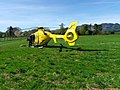 Air Ambulance, West Cowden - geograph.org.uk - 2462032.jpg 640 × 481; 85 KB
-
 Airigh a' Chinn Chreagaich - geograph.org.uk - 6682809.jpg 1,024 × 683; 266 KB
-
 All terrain vehicle track, Creag Each - geograph.org.uk - 6681917.jpg 1,024 × 683; 269 KB
-
 Allt a' Bhealach Gliogarsnaiche - geograph.org.uk - 6703190.jpg 1,024 × 683; 456 KB
-
 Allt a' Bhealaich Gliogarsnaiche - geograph.org.uk - 6703349.jpg 683 × 1,024; 131 KB
-
 Allt a' Choire Bhuidhe - geograph.org.uk - 1873615.jpg 640 × 480; 160 KB
-
 Allt a' Coire Buidhe - geograph.org.uk - 2393117.jpg 1,024 × 768; 346 KB
-
 Allt an Dubh Choirein - geograph.org.uk - 4469265.jpg 800 × 450; 202 KB
-
 Allt an Dubh Choirein - geograph.org.uk - 4469278.jpg 800 × 450; 87 KB
-
 Allt an Dubh Choirein - geograph.org.uk - 4471268.jpg 800 × 533; 286 KB
-
 Allt an Dubh Choirein - geograph.org.uk - 4472564.jpg 800 × 533; 189 KB
-
 Allt an Dubh Choirein - geograph.org.uk - 5656113.jpg 1,280 × 853; 585 KB
-
 Allt an Fhionn - geograph.org.uk - 6682939.jpg 1,024 × 576; 223 KB
-
 Allt an Fhionn - geograph.org.uk - 6682941.jpg 1,024 × 576; 237 KB
-
 Allt an Fhionn - southward - geograph.org.uk - 2428612.jpg 4,000 × 3,000; 4.73 MB
-
 Allt an Fhionn flowing towards Loch Earn - geograph.org.uk - 3240143.jpg 3,869 × 2,902; 4.42 MB
-
 Allt an Fhionn, Glen Tarken Wood - geograph.org.uk - 6683565.jpg 1,024 × 1,024; 788 KB
-
 Allt Bealach Gliogarsnaiche - geograph.org.uk - 1879573.jpg 800 × 530; 245 KB
-
 Allt Ceilidh and Stùc Gharbh - geograph.org.uk - 5958270.jpg 1,024 × 1,024; 544 KB
-
 Allt Coire nan Daimh - geograph.org.uk - 5197288.jpg 1,024 × 576; 224 KB
-
 Allt Coire Tubhaidh - geograph.org.uk - 1879498.jpg 530 × 800; 269 KB
-
 Allt Eas Domhain, below the intake - geograph.org.uk - 6682840.jpg 683 × 1,024; 284 KB
-
 Allt Garbh - geograph.org.uk - 5962726.jpg 1,024 × 1,024; 711 KB
-
 Allt Ghoinean - geograph.org.uk - 3712183.jpg 4,000 × 3,000; 4.72 MB
-
 Allt Glas below Dalclathick - geograph.org.uk - 5477343.jpg 1,024 × 704; 157 KB
-
 Allt Innein - geograph.org.uk - 5958281.jpg 1,024 × 1,024; 609 KB
-
 Allt Mathaig at Glenmaik - geograph.org.uk - 4710729.jpg 629 × 800; 162 KB
-
 Allt Mòr rushes down to fill Loch Lednock - geograph.org.uk - 3847925.jpg 751 × 1,024; 196 KB
-
 Allt na Creige Ruaidhe running into Glen Tarken - geograph.org.uk - 2428781.jpg 3,639 × 2,729; 4.22 MB
-
 Allt na Tamhaisg - geograph.org.uk - 2159419.jpg 2,000 × 1,500; 2.7 MB
-
 Allt Ollach - geograph.org.uk - 4775958.jpg 4,896 × 3,672; 6.95 MB
-
 Allt Sgairnich Mhoir - geograph.org.uk - 2439731.jpg 427 × 640; 320 KB
-
 Allt Shuas with boulders - geograph.org.uk - 3237774.jpg 4,000 × 3,000; 5.5 MB
-
 Allt Srath a' Ghlinne - geograph.org.uk - 5958252.jpg 1,024 × 683; 320 KB
-
 Allt Tobar Sneachda - geograph.org.uk - 5962816.jpg 1,024 × 683; 434 KB
-
 Almost twin tops of Ben Vorlich - geograph.org.uk - 2747072.jpg 640 × 480; 64 KB
-
 Along the burn - geograph.org.uk - 4220840.jpg 6,000 × 4,000; 6.5 MB
-
 Alongside the River Lednock - geograph.org.uk - 2432738.jpg 640 × 480; 167 KB
-

-
 Am Beannan cliffs and wild flowers - geograph.org.uk - 6224224.jpg 1,024 × 768; 344 KB
-
 Am Bioran - geograph.org.uk - 5945971.jpg 3,967 × 2,933; 4.67 MB
-
 Am Bioran - geograph.org.uk - 6847555.jpg 1,024 × 768; 230 KB
-
 Am Bioran - geograph.org.uk - 6847562.jpg 1,024 × 768; 296 KB
-
 Am Bioran - geograph.org.uk - 6847570.jpg 1,024 × 768; 268 KB
-
 Am Bioran and Beinn Fuath - geograph.org.uk - 6847587.jpg 1,024 × 768; 229 KB
-
 Am Bioran and Loch Earn - geograph.org.uk - 3281021.jpg 4,608 × 3,456; 5.92 MB
-
 An Dunan from Eildreach - geograph.org.uk - 4708448.jpg 6,000 × 4,000; 5.58 MB
-
 An equal opportunities flock in Glen Beich - geograph.org.uk - 3239248.jpg 2,870 × 2,285; 2.71 MB
-
 An intrusion at Easter Dundurn - geograph.org.uk - 3712225.jpg 4,000 × 3,000; 4.66 MB
-
 Ancient Alder - geograph.org.uk - 4221455.jpg 6,000 × 4,000; 6.04 MB
-
 Ancient Alder - geograph.org.uk - 5150945.jpg 6,000 × 4,000; 6.47 MB
-
 Ancient ash tree in St Fillans village - geograph.org.uk - 3241731.jpg 3,848 × 2,772; 4.88 MB
-
 Approach Drive, Glenbeich - geograph.org.uk - 5946349.jpg 4,896 × 3,264; 6.32 MB
-
 Approaching Allt an Fhionn in Glentarken Wood - geograph.org.uk - 3240139.jpg 3,883 × 2,912; 5.85 MB
-
 Approaching Ben Chonzie summit - geograph.org.uk - 2372935.jpg 640 × 463; 66 KB
-
 Approaching Dalrannoch from the west - geograph.org.uk - 5477326.jpg 1,024 × 716; 169 KB
-
 Approaching Dalrannoch Hill from the west - geograph.org.uk - 3240522.jpg 3,762 × 2,821; 3.16 MB
-
 Approaching high ground - geograph.org.uk - 4220843.jpg 6,000 × 4,000; 6.39 MB
-
 Approaching Lochearnhead - geograph.org.uk - 2683022.jpg 2,560 × 1,920; 2.41 MB
-
 Approaching new vistas - geograph.org.uk - 4220849.jpg 5,725 × 3,817; 6.12 MB
-
 Approaching St Fillans - geograph.org.uk - 5942106.jpg 4,896 × 3,264; 5.74 MB
-
 Approaching the Beich Burn - geograph.org.uk - 4221419.jpg 6,000 × 4,000; 6.58 MB
-
 Approaching the lochside from Fin Glen - geograph.org.uk - 3235058.jpg 4,000 × 3,000; 6.9 MB
-
 Approaching the summit of Ben Vorlich - geograph.org.uk - 3812037.jpg 4,144 × 2,762; 3.55 MB
-
 Approaching the summit of Creag Each - geograph.org.uk - 3233033.jpg 3,635 × 2,707; 3.76 MB
-
 Approaching the woodland surrounding Melville's Monument - geograph.org.uk - 2432293.jpg 3,828 × 2,871; 3.99 MB
-
 Arboreal Twins - geograph.org.uk - 5160179.jpg 6,000 × 4,000; 6.98 MB
-
 Arches of disused railway, St Fillans - geograph.org.uk - 3239959.jpg 4,000 × 3,000; 5.34 MB
-
 Ardveich farmhouse - geograph.org.uk - 4219624.jpg 5,856 × 3,904; 5.78 MB
-
 Ardveich Wood from Eildreach - geograph.org.uk - 4708492.jpg 6,000 × 4,000; 6.03 MB
-
 Ardvorlich - geograph.org.uk - 6757729.jpg 2,000 × 1,333; 2.7 MB
-
 Ardvorlich Burn - geograph.org.uk - 1880153.jpg 1,024 × 679; 327 KB
-
 Ardvorlich Burn - geograph.org.uk - 5171441.jpg 4,998 × 3,419; 3.4 MB
-
 Ardvorlich Burn - geograph.org.uk - 6702290.jpg 1,024 × 684; 477 KB
-
 Ardvorlich Cottage - geograph.org.uk - 3284428.jpg 1,600 × 1,200; 593 KB
-
 Ardvorlich Estate from the track to Ben Vorlich - geograph.org.uk - 2276563.jpg 1,000 × 668; 567 KB
-
 Ardvorlich House - geograph.org.uk - 2393084.jpg 1,024 × 768; 261 KB
-
 Ardvorlich House - geograph.org.uk - 4660436.jpg 640 × 425; 100 KB
-
 Ardvorlich House - geograph.org.uk - 4710293.jpg 5,891 × 3,928; 7.13 MB
-
 Ardvorlich House - geograph.org.uk - 5171439.jpg 5,147 × 3,653; 6.95 MB
-
 Ardvorlich House - geograph.org.uk - 6151132.jpg 1,024 × 575; 190 KB
-
 Ardvorlich Hydro Scheme Dam - geograph.org.uk - 1984917.jpg 1,483 × 1,009; 842 KB
-
 Ardvorlich Hydro-scheme dam - geograph.org.uk - 3115513.jpg 480 × 640; 105 KB
-
 Ardvorlich Hydroelectric Dam - geograph.org.uk - 4660475.jpg 640 × 425; 100 KB
-

-
 Ascending Am Beannan - geograph.org.uk - 4776032.jpg 4,896 × 3,672; 6.32 MB
-
 Ascending the Maam Road towards Dun More - geograph.org.uk - 2431743.jpg 4,000 × 3,000; 5.64 MB
-
 Ascending the Track - geograph.org.uk - 4707724.jpg 6,000 × 4,000; 6.73 MB
-
 Ascending to open ground - geograph.org.uk - 4221579.jpg 5,656 × 3,771; 5.32 MB
-
 Aspens in Glen Beich - geograph.org.uk - 6682802.jpg 1,024 × 683; 237 KB
-
 Assaulting the hillside - geograph.org.uk - 4221589.jpg 4,687 × 3,125; 6.04 MB
-
 At Jerusalem, Loch Earn - geograph.org.uk - 3240313.jpg 4,000 × 3,000; 3.82 MB
-
 At St Fillans 1 - geograph.org.uk - 4223664.jpg 5,243 × 3,469; 6.64 MB
-
 At St Fillans 10 - geograph.org.uk - 4225827.jpg 5,506 × 3,632; 5.28 MB
-
 At St Fillans 11 - geograph.org.uk - 4226581.jpg 6,000 × 4,000; 7.07 MB
-
 At St Fillans 12 - geograph.org.uk - 4226599.jpg 5,886 × 3,924; 6.58 MB
-
 At St Fillans 13 - geograph.org.uk - 4226612.jpg 6,000 × 4,000; 6.03 MB
-
 At St Fillans 14 - geograph.org.uk - 4226625.jpg 5,896 × 3,931; 5.35 MB
-
 At St Fillans 15 - geograph.org.uk - 4226640.jpg 4,995 × 3,506; 6.3 MB
-
 At St Fillans 2 - geograph.org.uk - 4223667.jpg 5,937 × 3,958; 6.73 MB
-
 At St Fillans 3 - geograph.org.uk - 4223668.jpg 5,853 × 3,952; 6.03 MB
-
 At St Fillans 4 - geograph.org.uk - 4223669.jpg 5,659 × 3,836; 7.05 MB
-
 At St Fillans 5 - geograph.org.uk - 4223670.jpg 5,890 × 3,927; 6.83 MB
-
 At St Fillans 9 - geograph.org.uk - 4225826.jpg 5,117 × 3,417; 5.21 MB
-
 At the hairpin - geograph.org.uk - 4707757.jpg 6,000 × 4,000; 5.91 MB
-
 At the summit of An Dunan - 489m - geograph.org.uk - 4708433.jpg 6,000 × 4,000; 5.52 MB
-
 At the summit of Ben Chonzie - geograph.org.uk - 4617033.jpg 640 × 480; 55 KB
-
 At the top of Am Bioran - geograph.org.uk - 3712052.jpg 4,000 × 3,000; 5.37 MB
-
 Attractive stone house at the foot of Glen Tarken - geograph.org.uk - 2430885.jpg 3,897 × 2,923; 5.12 MB
-
 Attribution at the Diel's Caldron - geograph.org.uk - 2432854.jpg 4,000 × 3,000; 3.68 MB
-
 Auchinner and Sròn na Maoile - geograph.org.uk - 4471160.jpg 800 × 533; 189 KB
-

-
 Autumn grass, Auchinner - geograph.org.uk - 5956862.jpg 1,024 × 683; 301 KB
-
 Avoiding electrocution - geograph.org.uk - 5151877.jpg 5,778 × 3,852; 4.96 MB
-
 B827, Comrie - geograph.org.uk - 2461847.jpg 640 × 480; 66 KB
-
 Back o'Toon Lane, Comrie - geograph.org.uk - 1961321.jpg 1,536 × 2,048; 1.06 MB
-
 Ballindalloch roadend - geograph.org.uk - 6572421.jpg 1,024 × 575; 223 KB
-
 Balnacoul Castle - geograph.org.uk - 4987377.jpg 1,024 × 683; 269 KB
-
 Beach, Loch Earn - geograph.org.uk - 4987481.jpg 1,024 × 683; 440 KB
-
 Bealach Gliogarsnaich - geograph.org.uk - 1879555.jpg 800 × 530; 178 KB
-
 Bealach Gliogarsnaich - geograph.org.uk - 3264768.jpg 800 × 600; 130 KB
-
 Bealach Gliogarsnaich - geograph.org.uk - 6703369.jpg 1,024 × 683; 511 KB
-
 Bealach Gliogarsnaich below Ben Vorlich - geograph.org.uk - 6702860.jpg 1,024 × 576; 378 KB
-
 Bealach Gliogarsnaich below Ben Vorlich - geograph.org.uk - 6703195.jpg 1,024 × 683; 454 KB
-
 Bealach Gliogarsnaich from below - geograph.org.uk - 1879599.jpg 800 × 530; 244 KB
-
 Bealach na h-Iolaire - geograph.org.uk - 5962764.jpg 1,024 × 683; 325 KB
-

-

-
 Beginning of track up Fin Glen - geograph.org.uk - 3234393.jpg 4,000 × 3,000; 5.4 MB
-
 Beich Burn upstream of the hydroelectric intake - geograph.org.uk - 6682813.jpg 1,024 × 683; 220 KB
-
 Beinn Bhan from the north east - geograph.org.uk - 3235146.jpg 4,000 × 3,000; 4.08 MB
-
 Beinn Dearg, Sròn na Broigleag - geograph.org.uk - 5963364.jpg 683 × 1,024; 300 KB
-
 Beinn Domhnuill - geograph.org.uk - 3264761.jpg 800 × 600; 138 KB
-
 Beinn Domhnuill - geograph.org.uk - 6703164.jpg 1,024 × 683; 532 KB
-
 Beinn Domhnuill from the south - geograph.org.uk - 1879207.jpg 800 × 530; 207 KB
-
 Below Carn Labhruinn - geograph.org.uk - 5958183.jpg 1,024 × 683; 410 KB
-

-
 Ben Chonzie - Summit View - geograph.org.uk - 3044072.jpg 640 × 480; 62 KB
-
 Ben Chonzie from Glen Lednock - geograph.org.uk - 4709047.jpg 6,000 × 4,000; 5.64 MB
-
 Ben Chonzie hill path - geograph.org.uk - 3077113.jpg 1,024 × 768; 133 KB
-
 Ben Chonzie Summit Plateau - geograph.org.uk - 3043835.jpg 640 × 480; 87 KB
-
 Ben Our - geograph.org.uk - 2133789.jpg 640 × 480; 122 KB
-
 Ben Our - geograph.org.uk - 2277707.jpg 640 × 480; 117 KB
-
 Ben Our - geograph.org.uk - 6702856.jpg 1,024 × 576; 408 KB
-
 Ben Our from Dalveich - geograph.org.uk - 3239304.jpg 3,744 × 2,791; 3.6 MB
-
 Ben Vorlich - geograph.org.uk - 2133344.jpg 640 × 480; 105 KB
-
 Ben Vorlich - geograph.org.uk - 2133786.jpg 640 × 480; 123 KB


&filefrom=Ben+Vorlich+-+geograph.org.uk+-+2393182.jpg#mw-category-media)