Category:Company Land
Jump to navigation
Jump to search
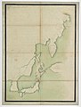
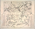
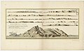
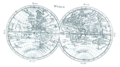
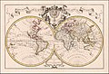
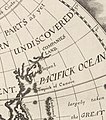
Company Land (Dutch: Companies Landt; French: Terre de la Compagnie) was a phantom island or extension of the North American continent that appeared on maps throughout the 17th and 18th centuries, even long after Vitus Bering's lieutenant Martin Spanberg disproved its existence as then understood. It is possible it was a misrepresentation or misunderstanding of one of the Kurils, often identified with Urup.
a phantom island or continental extension appearing on 17th & 18th century European maps  | |||||
| Upload media | |||||
| Instance of | |||||
|---|---|---|---|---|---|
| Named after | |||||
| Located in or next to body of water | |||||
| Said to be the same as | Urup | ||||
| |||||
Subcategories
This category has the following 5 subcategories, out of 5 total.
Media in category "Company Land"
The following 62 files are in this category, out of 62 total.
-

-

-

-

-
 AMH-5177-NA Map of Japan, Korea and west America.jpg 2,400 × 1,693; 455 KB
-
 L'Asie divisée en ses principales régions... - par le Sr Sanson... - btv1b55000424t.jpg 11,419 × 7,126; 11.62 MB
-

-
 Cowley's Circumnavigation 1699.jpg 6,387 × 3,699; 5.24 MB
-
 Delisle - L'Asie (Ausschnitt Jesso Japan Compagnie).jpg 1,020 × 836; 685 KB
-
 Delisle - L'Asie.jpg 3,672 × 2,872; 9.08 MB
-

-

-
 Map of Asia in 1700 by Guillaume de L'Isle.jpg 7,647 × 5,826; 13.98 MB
-
 1700 Orbis Terrarum Visscher mr.jpg 2,250 × 1,918; 4.58 MB
-
 Carte des Indes et de la Chine par Guillaume de l'Isle - 1705.png 1,086 × 1,021; 2 MB
-

-
-
 Delisle - Carte d'Asie (Compagnieland).jpg 783 × 799; 576 KB
-

-
-
 Carte des Indes et de la Chine.png 4,790 × 4,623; 31.33 MB
-
 Map - Special Collections University of Amsterdam - OTM- HB-KZL 31-02-47.tif 7,503 × 6,259; 134.36 MB
-

-

-
 Anville Nouvel atlas de la Chine - Page56 Tartarie.jpg 2,500 × 1,610; 2.86 MB
-
-
 Map - Special Collections University of Amsterdam - OTM- HB-KZL 31-02-43.tif 7,303 × 6,277; 131.15 MB
-
 Map - Special Collections University of Amsterdam - OTM- HB-KZL 31-02-44.tif 7,320 × 6,659; 139.46 MB
-
 Map - Special Collections University of Amsterdam - OTM- HB-KZL 31-02-45.tif 7,730 × 6,687; 147.89 MB
-
 Map - Special Collections University of Amsterdam - OTM- HB-KZL 31-02-46.tif 7,653 × 6,633; 145.23 MB
-
 Map - Special Collections University of Amsterdam - OTM- HB-KZL 31-02-48.tif 7,779 × 6,621; 147.36 MB
-

-
 1749 map Chinese Tartary by Tobias Mayer.jpg 19,690 × 12,721; 45.11 MB
-
-

-
-
 Carte-des-isles-du-japon-terre-de-jesso-et-pays-voisoins-d-bellin.jpg 1,799 × 1,300; 2.61 MB
-
 Mappemonde ou Description du globe terrestre (4072626326).jpg 2,000 × 1,419; 2.95 MB
-
 Kaart van Azië, objectnr A 16217.jpg 7,397 × 5,936; 36.35 MB
-
 Kitchen-22-Asia-Amur-Basin-2854.jpg 2,560 × 1,920; 2.05 MB
-

-

-

-

-

-

-

-
 Admiralty Chart No 2459 North west Pacific Ocean, Published 1877.jpg 10,538 × 8,307; 8.76 MB
-
 Admiralty Chart No 2683 Pacific Ocean, Published 1859.jpg 11,866 × 7,934; 34.89 MB
-
 AMH-8631-NA Map of the Pacific Ocean.jpg 2,400 × 2,223; 551 KB
-
-
 Dury Atlas Map 4 Asia.jpg 2,996 × 2,625; 1.84 MB
-
 EB1 Plate LXXXVII Fig. 2 World.png 2,768 × 1,550; 3.34 MB
-

-
 Jan Janssonius - Japan.jpg 6,726 × 5,561; 8.04 MB
-
 Mallet-TerredeGesso.png 555 × 749; 731 KB
-
 Map of Oceania and Pacific Ocean. Wellcome M0005004.jpg 3,708 × 2,839; 2.8 MB
-
-

-
 Companies Land.jpeg 770 × 873; 732 KB
-
-
 Staten Island (Jan Janssonius 1652).jpeg 2,765 × 2,719; 1.5 MB
.jpg)

,_NG-501-86.jpg)
,_Japan_and_Others_by_Dutch_%E8%8D%B7%E8%98%AD%E4%BA%BA%E6%89%80%E7%B9%AA%E7%A6%8F%E7%88%BE%E6%91%A9%E6%B2%99%E8%87%BA%E7%81%A3%E8%88%87%E6%97%A5%E6%9C%AC.jpg)


.jpg)


.jpg)


.jpg)
.jpg)


.jpg)

.jpg)


_ou_du_nouveau_(-de_l%27ancien)_monde_-_publi%C3%A9_par_le_Sr_d%27Anville..._-_btv1b53006855m_(2_of_2).jpg)


.jpg)
_(14786489953).jpg)


.jpg)


.jpg)


.jpg)
.jpg)
.jpeg)