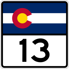
Category:Colorado State Highway 13
Jump to navigation
Jump to search
 | number: | (thirteen) |
|---|---|---|
| State highways in Colorado: | 1 · 2 · 3 · 5 · 7 · 8 · 9 · 10 · 11 · 12 · 13 · 14 · 15 · 16 · 17 · 21 · 22 · 23 · 26 · 30 · 33 |
state highway in Garfield, Rio Blanco, and Moffat counties in Colorado, United States | |||||
| Upload media | |||||
| Instance of | |||||
|---|---|---|---|---|---|
| Location |
| ||||
| Located in or next to body of water | |||||
| Transport network | |||||
| Connects with |
| ||||
| Owned by | |||||
| Maintained by | |||||
| Length |
| ||||
| Terminus | |||||
| Partially coincident with | |||||
| |||||
English: Media related to Colorado State Highway 13, a 128.00-mile (206.00 km) state highway in Garfield, Rio Blanco, and Moffat counties in Colorado, United States, that connects a roundabout with Airport Road, Taughenbaugh Boulevard, and South 7th Street in Rifle with Wyoming Highway 789 in Wyoming (south of Baggs).
Subcategories
This category has only the following subcategory.
Media in category "Colorado State Highway 13"
The following 4 files are in this category, out of 4 total.
-
Colorado 13.svg 601 × 601; 5 KB
-
Colorado State Highway 13 Map.svg 1,028 × 609; 829 KB
-
CraigColorado.jpg 5,184 × 3,456; 5.24 MB
-
Rio Blanco County, Colorado.JPG 4,980 × 3,178; 12.08 MB


