Category:Collessie (civil parish)
Jump to navigation
Jump to search
Scottish parish in Fife, Scotland, UK | |||||
| Upload media | |||||
| Instance of | |||||
|---|---|---|---|---|---|
| Part of |
| ||||
| Named after | |||||
| Location |
| ||||
| Population |
| ||||
| Area |
| ||||
 | |||||
Subcategories
This category has the following 2 subcategories, out of 2 total.
C
W
Media in category "Collessie (civil parish)"
The following 200 files are in this category, out of 268 total.
(previous page) (next page)-
 A gated entrance to three private properties - geograph.org.uk - 3987893.jpg 1,884 × 1,443; 812 KB
-
 A Giffordtown house - geograph.org.uk - 3985899.jpg 1,523 × 1,383; 342 KB
-
 A house in Charlottetown - geograph.org.uk - 3985935.jpg 2,091 × 1,555; 800 KB
-
 A pair of semi-detached cottages by B937 - geograph.org.uk - 3985989.jpg 4,608 × 3,456; 3.11 MB
-
 A91 at Rosslem Cottages - geograph.org.uk - 5869905.jpg 5,184 × 3,888; 5.5 MB
-
 A91 east of Auchtermuchty - geograph.org.uk - 5013173.jpg 640 × 480; 45 KB
-
 A91 milestone - geograph.org.uk - 5869918.jpg 5,184 × 3,888; 5.18 MB
-
 A91 near Collessie - geograph.org.uk - 3663695.jpg 640 × 480; 272 KB
-
 A91 near Rosslem Cottages - geograph.org.uk - 4562292.jpg 640 × 481; 71 KB
-
 A91 north of Drumley Farm - geograph.org.uk - 4562291.jpg 640 × 479; 62 KB
-
 Access road to Backhouse, Rossie Estate, Fife - geograph.org.uk - 5744118.jpg 5,857 × 3,305; 3.18 MB
-
 Access road to Backhouse, Rossie Estate, Fife - geograph.org.uk - 5744122.jpg 5,657 × 3,375; 4.12 MB
-
 Angle Park Pond - geograph.org.uk - 4412716.jpg 1,066 × 800; 215 KB
-
 Arable Land at Heatherhall Woods - geograph.org.uk - 3774138.jpg 4,752 × 3,168; 3.45 MB
-
 B937 to Newburgh - geograph.org.uk - 4412655.jpg 1,066 × 800; 153 KB
-
 Bale store near Rankeilour House - geograph.org.uk - 3673068.jpg 640 × 480; 347 KB
-
 Ballomill Farm - geograph.org.uk - 6620028.jpg 5,605 × 3,262; 3.03 MB
-
 Ballomill Farm - geograph.org.uk - 6620055.jpg 5,033 × 2,971; 3.42 MB
-
 Barley, Bowhouse Farm - geograph.org.uk - 3559593.jpg 640 × 480; 290 KB
-
 Barley, Bowhouse Farm - geograph.org.uk - 3559600.jpg 640 × 480; 290 KB
-
 Barley, Bowhouse Farm - geograph.org.uk - 3567614.jpg 640 × 480; 296 KB
-
 Benchmark on Collessie Parish Church - geograph.org.uk - 6096761.jpg 640 × 480; 114 KB
-
 Bend in the forestry road - geograph.org.uk - 2383914.jpg 2,560 × 1,920; 1.44 MB
-
 Birnie Loch - geograph.org.uk - 4676127.jpg 1,200 × 1,600; 393 KB
-
 Birnie Loch Nature Reserve - geograph.org.uk - 4412592.jpg 1,066 × 800; 282 KB
-
 Bracken forest edge - geograph.org.uk - 4131330.jpg 2,048 × 1,536; 1.52 MB
-
 Bridge over river - geograph.org.uk - 6620103.jpg 5,482 × 3,624; 5.74 MB
-
 Brooding clouds over a grassy slope - geograph.org.uk - 2454093.jpg 640 × 467; 44 KB
-
 Building, Ladybank Golf Course - geograph.org.uk - 5319893.jpg 640 × 429; 83 KB
-
 Bus, Howe of Fife - geograph.org.uk - 3567598.jpg 640 × 372; 193 KB
-
 Cattle near Easter Kilwhiss - geograph.org.uk - 3663664.jpg 640 × 480; 251 KB
-
 Cattle near Easter Kilwhiss - geograph.org.uk - 3668088.jpg 640 × 480; 244 KB
-
 Cattle, Rossie - geograph.org.uk - 3663690.jpg 640 × 480; 258 KB
-
 Charlottetown, Howe of Fife - geograph.org.uk - 3985695.jpg 2,236 × 1,427; 718 KB
-
 Charolais bulls - geograph.org.uk - 3663656.jpg 640 × 480; 303 KB
-
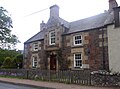
 Church Street Ladybank - geograph.org.uk - 3773770.jpg 640 × 427; 77 KB
-
 Collessie - geograph.org.uk - 3663701.jpg 640 × 480; 279 KB
-
 Collessie - geograph.org.uk - 4412708.jpg 1,066 × 800; 246 KB
-
 Collessie Den and Den Burn - geograph.org.uk - 2054940.jpg 640 × 480; 103 KB
-
 Collessie Den in early spring - geograph.org.uk - 6096782.jpg 640 × 427; 126 KB
-
 Collessie Kirk - geograph.org.uk - 3941044.jpg 1,600 × 1,200; 694 KB
-
 Collessie Kirk, Howe of Fife Parish - geograph.org.uk - 4436088.jpg 640 × 480; 77 KB
-
 Collessie Main street - geograph.org.uk - 2054918.jpg 640 × 480; 68 KB
-
 Collessie Parish Church - geograph.org.uk - 6096762.jpg 640 × 480; 61 KB
-
 Collessie Quarry Entrance - geograph.org.uk - 4240158.jpg 2,048 × 1,536; 919 KB
-
 Commercial Crescent, Ladybank - geograph.org.uk - 3559576.jpg 640 × 480; 275 KB
-
 Commercial Road, Ladybank - geograph.org.uk - 5170791.jpg 800 × 534; 145 KB
-
 Cottages near Collessie - geograph.org.uk - 4412652.jpg 1,066 × 800; 210 KB
-
 Cottages on Collessie main street - geograph.org.uk - 2054973.jpg 640 × 480; 64 KB
-
 Council Waste ground - geograph.org.uk - 4243105.jpg 2,048 × 1,536; 855 KB
-
 Driveway to Halhill Farm - geograph.org.uk - 2055042.jpg 640 × 480; 75 KB
-
 Dry-stane dyke - geograph.org.uk - 2383944.jpg 2,560 × 1,920; 1,022 KB
-
 Dunshalt road - geograph.org.uk - 2002296.jpg 1,280 × 960; 275 KB
-
 Easter Kilwhiss Farm - geograph.org.uk - 2055122.jpg 640 × 480; 57 KB
-
 Electrical boxes - geograph.org.uk - 6620009.jpg 4,583 × 2,806; 2.66 MB
-
 Fairways through the forest - geograph.org.uk - 1892888.jpg 1,600 × 1,200; 507 KB
-
 Farm land at Halhill. - geograph.org.uk - 2569254.jpg 4,752 × 3,168; 5.48 MB
-
 Farm road, Annsmuir - geograph.org.uk - 3673086.jpg 640 × 480; 286 KB
-
 Farm track - geograph.org.uk - 4241713.jpg 2,048 × 1,536; 882 KB
-
 Farmer checking his field - geograph.org.uk - 2750887.jpg 640 × 480; 55 KB
-
 Farmland at Easter Kilwhiss - geograph.org.uk - 2752415.jpg 640 × 439; 125 KB
-
 Farmland at Newton - geograph.org.uk - 2054910.jpg 640 × 480; 50 KB
-
 Farmland at Rossie - geograph.org.uk - 4146503.jpg 640 × 480; 94 KB
-
 Farmland near Charlottetown - geograph.org.uk - 2752379.jpg 640 × 457; 128 KB
-
 Farmland near Collessie - geograph.org.uk - 4930517.jpg 1,500 × 1,000; 1.64 MB
-
 Farmland near Easter Kilwhiss - geograph.org.uk - 2752425.jpg 480 × 640; 94 KB
-
 Farmland near Lumquhat - geograph.org.uk - 3048125.jpg 640 × 435; 283 KB
-
 Farmland near Peterhead - geograph.org.uk - 3089508.jpg 640 × 480; 343 KB
-
 Farmland on the Howe of Fife - geograph.org.uk - 4155099.jpg 480 × 640; 422 KB
-
 Farmland on the Howe of Fife - geograph.org.uk - 4155110.jpg 640 × 480; 312 KB
-
 Feeding the swans - geograph.org.uk - 5744096.jpg 5,623 × 3,634; 5.45 MB
-
 Field belt - geograph.org.uk - 4231083.jpg 2,048 × 1,536; 785 KB
-
 Field boundary - geograph.org.uk - 2752369.jpg 480 × 640; 120 KB
-
 Field boundary near Ladybank - geograph.org.uk - 3089551.jpg 640 × 480; 295 KB
-
 Fields at Ballantagar, near Monimail - geograph.org.uk - 4450383.jpg 640 × 480; 40 KB
-
 Fife Animal Park (recently closed) - geograph.org.uk - 3985848.jpg 4,608 × 3,456; 3.19 MB
-
 Flood under Railway Bridge - geograph.org.uk - 4412715.jpg 1,066 × 800; 212 KB
-
 Flood water loch - geograph.org.uk - 4241703.jpg 2,048 × 1,536; 623 KB
-
 Flooded gravel pit - geograph.org.uk - 3089389.jpg 640 × 457; 342 KB
-
 Flooded gravel pit - geograph.org.uk - 3517925.jpg 640 × 480; 247 KB
-
 Floodlit dressage - geograph.org.uk - 2165816.jpg 640 × 487; 129 KB
-
 Forest clearing - geograph.org.uk - 2383955.jpg 2,560 × 1,920; 1.73 MB
-
 Forest clearing - geograph.org.uk - 4131344.jpg 2,048 × 1,536; 1.66 MB
-
 Forest edge - geograph.org.uk - 4131310.jpg 2,048 × 1,536; 1.52 MB
-
 Former gravel pit, Ladybank - geograph.org.uk - 3786530.jpg 640 × 480; 240 KB
-
 Gaddon Loch - geograph.org.uk - 6502075.jpg 5,962 × 3,592; 3.3 MB
-
 Giffordtown Hall - geograph.org.uk - 2055113.jpg 640 × 480; 66 KB
-
 Giffordtown Hall - geograph.org.uk - 4412713.jpg 1,066 × 800; 190 KB
-
 Grange Hill Trig Point - geograph.org.uk - 4600655.jpg 2,560 × 1,920; 2.92 MB
-
 Grange Hill trigpoint - geograph.org.uk - 6066716.jpg 640 × 427; 71 KB
-
 Grass field, Ladybank - geograph.org.uk - 3519759.jpg 640 × 480; 265 KB
-
 Grass field, Newton - geograph.org.uk - 4096598.jpg 640 × 360; 203 KB
-
 Halhill - geograph.org.uk - 2055035.jpg 640 × 480; 72 KB
-
 Harvested timber - geograph.org.uk - 2383904.jpg 2,560 × 1,920; 1.62 MB
-
 Harvesting at Collessie - geograph.org.uk - 2054913.jpg 640 × 480; 56 KB
-
 Harvesting at Collessie - geograph.org.uk - 2054915.jpg 640 × 480; 76 KB
-
 Heatherhall Wood - geograph.org.uk - 3089490.jpg 640 × 480; 603 KB
-
 Heatherhall Wood - geograph.org.uk - 3663648.jpg 640 × 480; 362 KB
-
 Heatherhall Wood - geograph.org.uk - 3663654.jpg 640 × 480; 337 KB
-
 Heatherhall Wood - geograph.org.uk - 3668077.jpg 640 × 480; 357 KB
-
 Heatherhall Wood - geograph.org.uk - 3668081.jpg 640 × 480; 359 KB
-
 Heatherhall Wood - geograph.org.uk - 3676765.jpg 640 × 480; 327 KB
-
 Heatherhall Wood - geograph.org.uk - 3712216.jpg 640 × 480; 389 KB
-
 Heatherhall Wood - geograph.org.uk - 4307420.jpg 3,672 × 4,896; 5.88 MB
-
 Heatherhall Woods Ladybank - geograph.org.uk - 3774097.jpg 4,752 × 3,168; 5.3 MB
-
 Heatherhall Woods Ladybank - geograph.org.uk - 3774156.jpg 4,752 × 3,168; 5.47 MB
-
 Heggie's Muir Wood - geograph.org.uk - 3517898.jpg 640 × 480; 354 KB
-
 Heggie's Muir Wood - geograph.org.uk - 3519753.jpg 640 × 480; 353 KB
-
 Heggie's Muir Wood - geograph.org.uk - 6097482.jpg 640 × 480; 102 KB
-
 House on a Hill, Cornhill - geograph.org.uk - 4412649.jpg 1,066 × 800; 284 KB
-
 Houses and church, Collessie - geograph.org.uk - 2054961.jpg 640 × 480; 78 KB
-
 Howe of Fife - geograph.org.uk - 3559583.jpg 640 × 480; 294 KB
-
 Howe of Fife arable - geograph.org.uk - 3957810.jpg 640 × 360; 170 KB
-
 Irrigation, Howe of Fife - geograph.org.uk - 3559580.jpg 640 × 480; 288 KB
-
 Irrigation, Howe of Fife - geograph.org.uk - 3567606.jpg 640 × 480; 266 KB
-
 Ladybank Golf Course - geograph.org.uk - 3673102.jpg 640 × 480; 252 KB
-
 Ladybank Masonic hall - geograph.org.uk - 2002329.jpg 960 × 1,280; 269 KB
-
 Ladybank Post Office - geograph.org.uk - 5170794.jpg 800 × 534; 194 KB
-
 Ladybank Railway Station - geograph.org.uk - 3773760.jpg 4,752 × 3,168; 3.61 MB
-
 Ladybank railway station - geograph.org.uk - 3789053.jpg 640 × 480; 283 KB
-
 Ladybank railway station - geograph.org.uk - 3789058.jpg 640 × 480; 274 KB
-
 Ladybank Railway Station - geograph.org.uk - 4556991.jpg 4,608 × 3,456; 3.05 MB
-
 Ladybank Railway Station - geograph.org.uk - 5319895.jpg 640 × 426; 84 KB
-
 Ladybank railway station, Fife - geograph.org.uk - 3943382.jpg 1,024 × 768; 213 KB
-
 Large field at Melville House - geograph.org.uk - 4450397.jpg 640 × 480; 59 KB
-
 Level crossing near Jennystown - geograph.org.uk - 6118541.jpg 5,184 × 3,888; 5.79 MB
-
 Level Crossing near Jennystown - geograph.org.uk - 6347913.jpg 640 × 427; 91 KB
-
 Level Crossing near Jennystown - geograph.org.uk - 6585306.jpg 5,689 × 3,654; 3.93 MB
-
 Level Crossing near Jennystown - geograph.org.uk - 6585308.jpg 3,706 × 3,366; 1.9 MB
-
 Level Crossing near Jennystown - geograph.org.uk - 6585312.jpg 5,698 × 3,362; 3.31 MB
-
 Lindores road - geograph.org.uk - 3663700.jpg 2,048 × 1,536; 730 KB
-
 Lining the drive - geograph.org.uk - 3524018.jpg 2,048 × 1,536; 1.5 MB
-

-
 Loch Edensmuir - geograph.org.uk - 4473592.jpg 640 × 480; 79 KB
-
 Loch Edensmuir by A92 - geograph.org.uk - 6079795.jpg 5,184 × 2,695; 1.43 MB
-
 Loch Edensmuir, Ballantager - geograph.org.uk - 6097485.jpg 640 × 480; 83 KB
-
 Lomond hills - geograph.org.uk - 4229443.jpg 2,048 × 1,536; 956 KB
-
 Low bridge and deep water - geograph.org.uk - 3524158.jpg 2,048 × 1,536; 1.02 MB
-
 Lower Melville Wood Landfill Site - geograph.org.uk - 3053146.jpg 800 × 523; 101 KB
-
 Lower Melville Wood Landfill Site - geograph.org.uk - 3053147.jpg 800 × 532; 106 KB
-
 Lower Melville Wood Landfill Site - geograph.org.uk - 4231299.jpg 2,048 × 1,536; 678 KB
-
 Masonic Lodge, Ladybank, Fife - geograph.org.uk - 3006325.jpg 3,008 × 2,000; 2.58 MB
-
 Melville doocot - geograph.org.uk - 2551699.jpg 1,500 × 2,000; 762 KB
-
 Melville Home Farm - geograph.org.uk - 3669229.jpg 640 × 480; 239 KB
-
 Melville Home Farm - geograph.org.uk - 6097096.jpg 1,024 × 768; 204 KB
-
 Minor road B937 - geograph.org.uk - 4210577.jpg 768 × 1,024; 204 KB
-
 More quarried out farmland - geograph.org.uk - 4244284.jpg 2,048 × 1,536; 783 KB
-
 Newton of Collessie - geograph.org.uk - 3381955.jpg 640 × 480; 57 KB
-
 Notice in field - geograph.org.uk - 6620183.jpg 4,214 × 2,587; 2.17 MB
-
 Octagonal barn - geograph.org.uk - 3524074.jpg 2,048 × 1,536; 870 KB
-
 Old alignment, A91 - geograph.org.uk - 3668095.jpg 640 × 480; 283 KB
-

-
 Old outhouse in Collessie - geograph.org.uk - 2054976.jpg 640 × 480; 129 KB
-
 One missing "P" and two missing "Ts" - geograph.org.uk - 2752395.jpg 640 × 460; 37 KB
-
 Parkview fishery - geograph.org.uk - 4244280.jpg 2,048 × 1,536; 877 KB
-
 Path, Heatherhall Wood - geograph.org.uk - 3668082.jpg 640 × 480; 344 KB
-
 Path, Heatherhall Wood - geograph.org.uk - 3668085.jpg 640 × 480; 354 KB
-
 Peterhead farm buildings - geograph.org.uk - 6620168.jpg 5,374 × 3,477; 4.27 MB
-
 Pig accommodation, Angle Park - geograph.org.uk - 3676755.jpg 640 × 480; 268 KB
-
 Pig sty at Angle Park pond - geograph.org.uk - 6096740.jpg 640 × 480; 40 KB
-
 Pitcairlie Burn - geograph.org.uk - 3567659.jpg 640 × 480; 373 KB
-
 Planting a vegetable crop, Howe of Fife - geograph.org.uk - 3843644.jpg 640 × 480; 281 KB
-
 Plaque on railway bridge - geograph.org.uk - 6620126.jpg 3,359 × 2,591; 1.47 MB
-
 Pointed pillars - geograph.org.uk - 2002321.jpg 1,280 × 960; 248 KB
-
 Pond, Rossie - geograph.org.uk - 3957819.jpg 640 × 480; 312 KB
-
 Public path - geograph.org.uk - 6619989.jpg 5,972 × 3,698; 3.81 MB
-
 Public path - geograph.org.uk - 6620024.jpg 5,581 × 3,781; 3.21 MB
-
 Public path - geograph.org.uk - 6620034.jpg 5,810 × 3,671; 4.06 MB
-
 Public path - geograph.org.uk - 6620043.jpg 5,691 × 3,603; 5.24 MB
-
 Public path - geograph.org.uk - 6620047.jpg 5,548 × 3,581; 5.36 MB
-
 Public path - geograph.org.uk - 6620061.jpg 5,676 × 3,530; 4.75 MB
-
 Quarry haul road - geograph.org.uk - 4243095.jpg 2,048 × 1,536; 922 KB
-
 Railway bridge - geograph.org.uk - 4240425.jpg 2,048 × 1,536; 645 KB
-
 Railway Bridge - geograph.org.uk - 4243109.jpg 2,048 × 1,536; 1.25 MB
-
 Railway bridge - geograph.org.uk - 6620116.jpg 5,064 × 3,529; 3.98 MB
-
 Railway bridge near Giffordtown - geograph.org.uk - 3676752.jpg 640 × 480; 303 KB
-
 Railway bridge over the river Eden - geograph.org.uk - 2002218.jpg 1,280 × 960; 294 KB
-
 Railway Bridge, Collessie - geograph.org.uk - 4412710.jpg 1,066 × 800; 351 KB
-
 Railway buildings, Ladybank - geograph.org.uk - 3519766.jpg 640 × 346; 160 KB
-
 Railway milepost - geograph.org.uk - 3673036.jpg 640 × 480; 276 KB
-
 Railway, Ballomill - geograph.org.uk - 3673062.jpg 640 × 480; 261 KB
-
 Ramornie Bridge - geograph.org.uk - 3517884.jpg 640 × 480; 286 KB
-
 Ramornie Bridge, Pitlessie - geograph.org.uk - 6347916.jpg 640 × 427; 64 KB
-
 Red Myre - geograph.org.uk - 5869862.jpg 5,184 × 3,888; 3.36 MB
-
 Reflected cloudscape - geograph.org.uk - 6114138.jpg 640 × 480; 286 KB
-
 Restored land, Melville - geograph.org.uk - 6705280.jpg 1,024 × 683; 209 KB
-
 River Eden - geograph.org.uk - 2002220.jpg 1,280 × 960; 298 KB
-
 River Eden - geograph.org.uk - 2002287.jpg 960 × 1,280; 350 KB
-
 River Eden - geograph.org.uk - 2002742.jpg 1,280 × 960; 337 KB
-
 River Eden at Kingskettle - geograph.org.uk - 2917627.jpg 2,520 × 1,680; 343 KB
-
 River Eden at Pitlessie - geograph.org.uk - 6118543.jpg 5,184 × 3,888; 6.8 MB
-
 River Eden from Ramornie Bridge - geograph.org.uk - 3089404.jpg 640 × 480; 378 KB
-

-
 Road and Road Sign to Collessie - geograph.org.uk - 4412644.jpg 1,066 × 800; 251 KB
-
 Road into Innerleith - geograph.org.uk - 3524097.jpg 2,048 × 1,536; 857 KB
-
 Road Junction near Freuchie - geograph.org.uk - 4619169.jpg 4,608 × 3,456; 3.61 MB
-
 Road through the trees - geograph.org.uk - 3524053.jpg 2,048 × 1,536; 1.47 MB
-
 Road to Ramornie Mains - geograph.org.uk - 2002747.jpg 1,280 × 960; 200 KB
-
 Road, Collessie - geograph.org.uk - 3663696.jpg 640 × 480; 268 KB
-
 Road, Pitlessie Common - geograph.org.uk - 3517905.jpg 640 × 480; 264 KB


_-_geograph.org.uk_-_3985848.jpg)


&filefrom=Rolling+fields+-+geograph.org.uk+-+4241709.jpg#mw-category-media)