Category:Clun (civil parish)
Jump to navigation
Jump to search

civil parish in Shropshire, England | |||||
| Upload media | |||||
| Instance of | |||||
|---|---|---|---|---|---|
| Location | Shropshire, West Midlands, England | ||||
| Population |
| ||||
 | |||||
Subcategories
This category has the following 6 subcategories, out of 6 total.
Media in category "Clun (civil parish)"
The following 200 files are in this category, out of 939 total.
(previous page) (next page)-
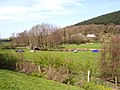
 'The Jack Mytton Way' near Llwyn - geograph.org.uk - 1247389.jpg 600 × 450; 233 KB
-
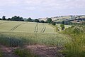 A Clun Forest wheat field - geograph.org.uk - 5956585.jpg 1,024 × 684; 341 KB
-
 A gate on Stow Hill - geograph.org.uk - 5495454.jpg 1,024 × 683; 359 KB
-
 A lane west of Clun in May - geograph.org.uk - 6487385.jpg 640 × 480; 68 KB
-
 A narrow road - geograph.org.uk - 5954291.jpg 1,024 × 684; 424 KB
-
 A488 acute junction at Penargoed - geograph.org.uk - 3727558.jpg 3,585 × 2,485; 1.5 MB
-

-
 A488 at Lower Rockhill - geograph.org.uk - 5898279.jpg 1,024 × 768; 163 KB
-
 A488 at New Invention village boundary - geograph.org.uk - 5898272.jpg 1,024 × 737; 184 KB
-
 A488 at Penargoed - geograph.org.uk - 5898286.jpg 1,024 × 792; 147 KB
-
 A488 at Tindings - geograph.org.uk - 5898275.jpg 1,024 × 783; 180 KB
-
 A488 descends Cockford Bank - geograph.org.uk - 3728331.jpg 4,000 × 3,000; 2 MB
-
 A488 east of Bicton - geograph.org.uk - 5898289.jpg 1,024 × 732; 158 KB
-
 A488 entering Clun - geograph.org.uk - 3134710.jpg 640 × 446; 85 KB
-
 A488 entering Clun - geograph.org.uk - 5898282.jpg 1,024 × 768; 174 KB
-
 A488 heads down Colstrey Bank - geograph.org.uk - 5898293.jpg 1,024 × 795; 151 KB
-
 A488 junction at New Invention - geograph.org.uk - 6485645.jpg 4,032 × 3,024; 4.24 MB
-
 A488 junction for Bucknell - geograph.org.uk - 6485673.jpg 4,032 × 2,144; 4.91 MB
-
 A488 Knighton to Clun road - geograph.org.uk - 4448170.jpg 2,700 × 2,030; 1.86 MB
-
 A488 near Green Shutters - geograph.org.uk - 5898269.jpg 1,024 × 791; 210 KB
-
 A488 north near Blackwell Cottage - geograph.org.uk - 2703763.jpg 640 × 452; 53 KB
-
 A488 north of Colstey Wood - geograph.org.uk - 3727405.jpg 3,140 × 2,383; 1.46 MB
-
 A488 north of Harp House - geograph.org.uk - 5898290.jpg 1,024 × 811; 171 KB
-
 A488 north of New Invention - geograph.org.uk - 5898277.jpg 1,024 × 768; 154 KB
-
 A488 north of Tindings - geograph.org.uk - 3728763.jpg 3,584 × 2,489; 1.14 MB
-
 A488 northeast of Five Turnings - geograph.org.uk - 3728935.jpg 3,913 × 2,638; 1.26 MB
-
 A488 northwest of Colstey - geograph.org.uk - 3727505.jpg 3,233 × 2,394; 1.28 MB
-
 A488 on Colstrey Bank near Wernacton - geograph.org.uk - 2703810.jpg 640 × 448; 67 KB
-
 A488 passes junction with un-named lane to Bryn - geograph.org.uk - 3727521.jpg 3,217 × 2,343; 1.91 MB
-
 A488 passes Rockhill Farm - geograph.org.uk - 3728343.jpg 3,461 × 2,503; 1.59 MB
-
 A488 passes through New Invention - geograph.org.uk - 3728920.jpg 4,000 × 3,000; 1.99 MB
-
 A488 road between Knighton and Clun - geograph.org.uk - 6485652.jpg 4,032 × 3,024; 4.75 MB
-
 A488 running into New Invention - geograph.org.uk - 3134474.jpg 640 × 441; 105 KB
-
 A488 south of Blackwell Cottage - geograph.org.uk - 3727533.jpg 2,937 × 2,264; 1.16 MB
-
 A488 south of Tindings - geograph.org.uk - 3728753.jpg 3,619 × 2,759; 1.53 MB
-
 A488 southeast of Oak Farm - geograph.org.uk - 3728356.jpg 3,530 × 2,711; 1.55 MB
-
 A488, Rockhill - geograph.org.uk - 4161302.jpg 800 × 600; 391 KB
-
 A488, Rockhill - geograph.org.uk - 5641976.jpg 1,024 × 683; 370 KB
-

-
 About to climb - geograph.org.uk - 5956577.jpg 1,024 × 684; 492 KB
-
 An Englishman's house... - geograph.org.uk - 2890621.jpg 640 × 480; 84 KB
-
 An old road - geograph.org.uk - 5954289.jpg 1,024 × 684; 420 KB
-
 Ancient farmhouse at Bryndrinog near Newcastle, Clun Valley - geograph.org.uk - 5608511.jpg 5,184 × 2,920; 6.32 MB
-
 Ancient hedgerow beside the byway - geograph.org.uk - 6105904.jpg 640 × 480; 125 KB
-
 Apex of the wood - geograph.org.uk - 2553770.jpg 1,024 × 768; 156 KB
-
 Approach to the ford and footbridge over the River Clun - geograph.org.uk - 4256656.jpg 4,048 × 2,321; 4.74 MB
-

-

-

-

-
 Approaching Stepple Farm - geograph.org.uk - 1242297.jpg 600 × 450; 377 KB
-
 Approaching the mast on Black Hill - geograph.org.uk - 6158916.jpg 640 × 480; 81 KB
-
 Ash near Hobarris - geograph.org.uk - 1110215.jpg 480 × 640; 40 KB
-
 At the Clun Green Man 2018 - geograph.org.uk - 5768031.jpg 640 × 480; 102 KB
-
 At the mast on Black Hill - geograph.org.uk - 6158923.jpg 640 × 480; 59 KB
-
 Autumn ploughsoil near Clun - geograph.org.uk - 2085575.jpg 640 × 480; 126 KB
-
-
 Back lane to Menutton farm, South of Clun - geograph.org.uk - 4256692.jpg 4,048 × 3,040; 6.55 MB
-
 Badger paw print in the muddy field - geograph.org.uk - 6101700.jpg 640 × 480; 140 KB
-
 Baled hay, Purlogue - geograph.org.uk - 5954299.jpg 1,024 × 684; 356 KB
-
 Barn at Bicton - geograph.org.uk - 1922277.jpg 640 × 480; 93 KB
-
 Barn at Whitcott Keysett - geograph.org.uk - 1922251.jpg 640 × 480; 63 KB
-
 Barn on the road to Bicton - geograph.org.uk - 1922290.jpg 640 × 480; 64 KB
-
 Barns at Guilden Down - geograph.org.uk - 6130559.jpg 800 × 600; 87 KB
-
 Base of Sowdley Wood - geograph.org.uk - 4683485.jpg 800 × 600; 534 KB
-

-
 Behind Caradoc - geograph.org.uk - 5495459.jpg 1,024 × 683; 351 KB
-

-
 Belt of conifers - geograph.org.uk - 6487428.jpg 640 × 480; 71 KB
-
 Bench on the lane above Clun - geograph.org.uk - 2890649.jpg 640 × 480; 147 KB
-

-
 Bend on a narrow bridge - geograph.org.uk - 1247367.jpg 600 × 450; 316 KB
-
 Beside the River Unk - geograph.org.uk - 6114172.jpg 640 × 480; 122 KB
-
 Bicton Ford - geograph.org.uk - 4598175.jpg 1,084 × 725; 487 KB
-
 Bicton Road - geograph.org.uk - 394950.jpg 450 × 600; 48 KB
-
 Birches Mill on the River Unk - geograph.org.uk - 2964142.jpg 640 × 480; 112 KB
-
 Birches Mill on the River Unk in May - geograph.org.uk - 6156201.jpg 640 × 480; 92 KB
-

-

-
 Black barn at "Three Gates" - geograph.org.uk - 2117053.jpg 2,616 × 2,304; 2.12 MB
-
 Blackthorn blossom in March in the Cefns - geograph.org.uk - 6105079.jpg 640 × 480; 146 KB
-
 Blackwell Cottage - geograph.org.uk - 1922303.jpg 640 × 480; 61 KB
-
-
 Bracken-filled hedge near The Quern - geograph.org.uk - 2554153.jpg 1,024 × 768; 179 KB
-
 Branching ramparts - geograph.org.uk - 6132118.jpg 800 × 600; 107 KB
-
 Bridge over dingle - geograph.org.uk - 5711018.jpg 480 × 640; 127 KB
-
 Bridleway to Bergam 1 - geograph.org.uk - 5484254.jpg 640 × 480; 80 KB
-
 Bridleway to Bergam 2 - geograph.org.uk - 5484255.jpg 640 × 480; 86 KB
-
 Bridleway to Sowdley Wood, near Clun - geograph.org.uk - 163365.jpg 640 × 426; 114 KB
-
 Bright Flowers (Clun) - geograph.org.uk - 6071282.jpg 3,648 × 2,736; 4.72 MB
-
 Brook House - geograph.org.uk - 2379159.jpg 640 × 480; 94 KB
-
 Bryn Hill - geograph.org.uk - 3303850.jpg 1,600 × 1,200; 1.39 MB
-
 Bryn Hill - geograph.org.uk - 5209392.jpg 800 × 600; 235 KB
-
 Bryn House at Bryn - geograph.org.uk - 6113325.jpg 640 × 480; 74 KB
-
 Bryn road junction - geograph.org.uk - 3728805.jpg 800 × 451; 195 KB
-

-
 Bryndrinog - geograph.org.uk - 6236419.jpg 1,024 × 768; 959 KB
-

-
 Buffalo Lane (Clun) - geograph.org.uk - 6818562.jpg 4,032 × 2,268; 3.94 MB
-
 Bull in the field - geograph.org.uk - 2964185.jpg 640 × 480; 82 KB
-
 Burfield - geograph.org.uk - 6488396.jpg 640 × 480; 83 KB
-
 Burfield farm house - geograph.org.uk - 6488381.jpg 640 × 480; 74 KB
-
 Burfield farm on 'The Jack Mytton Way' - geograph.org.uk - 1247355.jpg 600 × 450; 240 KB
-
 Burlow Farm - geograph.org.uk - 3728809.jpg 800 × 451; 190 KB
-
 Burlow Lane - geograph.org.uk - 3728814.jpg 800 × 451; 188 KB
-

-
 Byway in the Cefns - geograph.org.uk - 6105103.jpg 640 × 480; 121 KB
-
 Byway in the Cefns - geograph.org.uk - 6105109.jpg 640 × 480; 131 KB
-
 Byway in the Cefns - geograph.org.uk - 6156058.jpg 640 × 480; 138 KB
-

-
 Caer Caradoc - geograph.org.uk - 4958414.jpg 1,024 × 768; 227 KB
-
 Cairn on Pen-y-wern Hill - geograph.org.uk - 449027.jpg 640 × 443; 68 KB
-
 Cairn on Pen-y-wern Hill near Clun - geograph.org.uk - 2890456.jpg 640 × 480; 74 KB
-
 Cairn on Pen-y-wern Hill near Clun - geograph.org.uk - 2890463.jpg 640 × 480; 73 KB
-
 Cairn on Pen-y-wern Hill near Clun - geograph.org.uk - 2890585.jpg 640 × 480; 119 KB
-
 Camping at Hurst Mill Farm - geograph.org.uk - 398385.jpg 600 × 450; 67 KB
-
 Camping field at Springhill Farm - geograph.org.uk - 1922162.jpg 640 × 480; 91 KB
-
 Caradoc, Clun - geograph.org.uk - 6054525.jpg 497 × 640; 209 KB
-
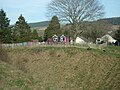
 Castle Moat (Clun) - geograph.org.uk - 6822021.jpg 4,032 × 3,024; 7.02 MB
-
 Cat on the footbridge - geograph.org.uk - 2644978.jpg 640 × 480; 85 KB
-
 Cattle grazing above Clun. - geograph.org.uk - 4448198.jpg 1,802 × 1,354; 1.35 MB
-

-
 Cattle in a meadow in May - geograph.org.uk - 6488265.jpg 640 × 480; 66 KB
-
 Ceiling at St. George's Church (Nave ^ Clun) - geograph.org.uk - 6073104.jpg 3,648 × 2,056; 1.4 MB
-
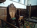 Chair inside St. George's Church (Chancel ^ Clun) - geograph.org.uk - 6073222.jpg 3,648 × 2,736; 2.34 MB
-
 Chapel Farm 1 - geograph.org.uk - 5482278.jpg 640 × 480; 84 KB
-
 Chapel Farm 2 - geograph.org.uk - 5482286.jpg 640 × 480; 74 KB
-
 Chapel Lawn, South Shropshire - geograph.org.uk - 6492263.jpg 4,032 × 1,585; 3.34 MB
-
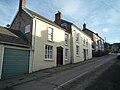 Church Street (Clun) - geograph.org.uk - 6071736.jpg 3,648 × 2,736; 3.61 MB
-
 Church Street, Clun - geograph.org.uk - 5832867.jpg 1,280 × 850; 777 KB
-
 Churchyard at St. George's Church (Clun) - geograph.org.uk - 6073258.jpg 3,648 × 2,736; 4.75 MB
-
 Cleared forest - geograph.org.uk - 5969192.jpg 800 × 600; 124 KB
-
 Climbing Clun Hill - geograph.org.uk - 1111444.jpg 640 × 480; 110 KB
-
 Clock on St. George's Church (Bell Tower ^ Clun) - geograph.org.uk - 6073255.jpg 4,096 × 3,072; 5.49 MB
-
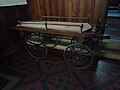 Clun Bier - geograph.org.uk - 6073180.jpg 3,648 × 2,736; 2.12 MB
-
 Clun Bowling Club - geograph.org.uk - 6068501.jpg 3,648 × 2,056; 3.39 MB
-
 Clun Bowling Club - geograph.org.uk - 6069901.jpg 3,648 × 2,736; 4.66 MB
-
 Clun Bowling Club - geograph.org.uk - 6069932.jpg 2,736 × 3,648; 4.6 MB
-
 Clun Bowling Club - geograph.org.uk - 6071228.jpg 3,648 × 2,056; 3.7 MB
-
 Clun Bowling Club - geograph.org.uk - 6818527.jpg 4,032 × 2,268; 4.19 MB
-
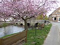
 Clun Bridge - geograph.org.uk - 6071280.jpg 3,648 × 2,736; 4.99 MB
-
 Clun Bridge - geograph.org.uk - 6818558.jpg 4,032 × 3,024; 5.22 MB
-
-
 Clun Bridge in late May - geograph.org.uk - 6484804.jpg 640 × 480; 152 KB
-
 Clun Bridge on May Bank Holiday Monday - geograph.org.uk - 5765708.jpg 640 × 480; 109 KB
-
 Clun Castle (Bailey) - geograph.org.uk - 6071231.jpg 3,648 × 2,056; 3.52 MB
-
 Clun Castle (Bailey) - geograph.org.uk - 6071262.jpg 3,648 × 2,056; 3.56 MB
-
 Clun Castle (Bailey) - geograph.org.uk - 6071273.jpg 3,648 × 2,056; 3.64 MB
-
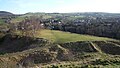
 Clun Castle (Earthworks) - geograph.org.uk - 6818518.jpg 4,032 × 3,024; 5.72 MB
-
 Clun Castle (Fish pond) - geograph.org.uk - 6818505.jpg 4,032 × 2,268; 4.68 MB
-
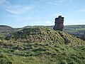
 Clun Castle (Keep) - geograph.org.uk - 6067599.jpg 3,648 × 2,736; 4.76 MB
-
 Clun Castle (Keep) - geograph.org.uk - 6068077.jpg 2,736 × 3,648; 3.79 MB
-
 Clun Castle (Keep) - geograph.org.uk - 6069879.jpg 2,736 × 3,648; 4.14 MB
-
 Clun Castle (Keep) - geograph.org.uk - 6069885.jpg 2,736 × 3,648; 3.55 MB
-
 Clun Castle (Keep) - geograph.org.uk - 6069942.jpg 3,648 × 2,736; 4.72 MB
-
 Clun Castle (Keep) - geograph.org.uk - 6069944.jpg 2,736 × 3,648; 4.91 MB
-
 Clun Castle (Keep) - geograph.org.uk - 6071248.jpg 3,648 × 2,056; 3.52 MB
-
 Clun Castle (Keep) - geograph.org.uk - 6368242.jpg 960 × 720; 212 KB
-
 Clun Castle (Keep) - geograph.org.uk - 6818510.jpg 4,032 × 3,024; 6.5 MB
-
 Clun Castle (Keep) - geograph.org.uk - 6818512.jpg 3,024 × 4,032; 5.68 MB
-
 Clun Castle (Keep) - geograph.org.uk - 6818519.jpg 4,032 × 3,024; 4.73 MB
-
 Clun Castle (Keep) - geograph.org.uk - 6818521.jpg 4,032 × 3,024; 5.76 MB
-
 Clun Castle (Keep) - geograph.org.uk - 6818543.jpg 4,032 × 3,024; 5.51 MB
-
 Clun Castle (Keep) - geograph.org.uk - 6818551.jpg 4,032 × 3,024; 6.13 MB
-
 Clun Castle (Keep) - geograph.org.uk - 6818552.jpg 4,032 × 3,024; 5.37 MB
-
 Clun Castle (Keep) - geograph.org.uk - 6822029.jpg 4,032 × 3,024; 4.7 MB
-
 Clun Castle (Moat) - geograph.org.uk - 6069891.jpg 3,648 × 2,736; 4.8 MB
-
 Clun Castle (Moat) - geograph.org.uk - 6069893.jpg 3,648 × 2,736; 4.75 MB
-
 Clun Castle (Moat) - geograph.org.uk - 6071271.jpg 3,648 × 2,056; 3.67 MB
-
 Clun Castle (Motte) - geograph.org.uk - 6068165.jpg 3,648 × 2,736; 4.1 MB
-
 Clun Castle (Motte) - geograph.org.uk - 6071249.jpg 3,648 × 2,056; 3.58 MB
-
 Clun Castle (Unearthed Remains) - geograph.org.uk - 6069882.jpg 3,648 × 2,736; 3.35 MB
-
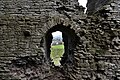
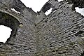
 Clun Castle (Wall ^1) - geograph.org.uk - 6069896.jpg 3,648 × 2,736; 4.67 MB
-
 Clun Castle (Wall ^1) - geograph.org.uk - 6069902.jpg 3,648 × 2,736; 4.76 MB
-
 Clun Castle (Wall ^1) - geograph.org.uk - 6069937.jpg 3,648 × 2,736; 4.68 MB
-
 Clun Castle (Wall ^2) - geograph.org.uk - 6069912.jpg 3,648 × 2,736; 4.75 MB
-
 Clun Castle (Wall ^2) - geograph.org.uk - 6071246.jpg 3,648 × 2,056; 3.53 MB
-
 Clun Castle (Wall) - geograph.org.uk - 6818536.jpg 4,032 × 3,024; 5.07 MB
-
 Clun Castle (Wall) - geograph.org.uk - 6818554.jpg 4,032 × 3,024; 4.87 MB
-
 Clun Castle - geograph.org.uk - 6066306.jpg 3,648 × 2,056; 2.43 MB
-
 Clun Castle - geograph.org.uk - 6066765.jpg 3,648 × 2,056; 3.59 MB
-
 Clun Castle - geograph.org.uk - 6069904.jpg 3,648 × 2,736; 4.68 MB
-
 Clun Castle - geograph.org.uk - 6071251.jpg 3,648 × 2,056; 3.52 MB
-
 Clun Castle - geograph.org.uk - 6071253.jpg 3,648 × 2,056; 3.45 MB
-
 Clun Castle - geograph.org.uk - 6071268.jpg 3,648 × 2,736; 4.74 MB
-
 Clun Castle - geograph.org.uk - 6368232.jpg 960 × 720; 262 KB
-
 Clun Castle - geograph.org.uk - 6669211.jpg 1,600 × 1,060; 342 KB
-
 Clun Castle - geograph.org.uk - 6816479.jpg 4,032 × 2,268; 2.85 MB
-
 Clun Castle - geograph.org.uk - 6816488.jpg 4,032 × 3,024; 6.5 MB
-
 Clun Castle - geograph.org.uk - 6818544.jpg 2,980 × 1,659; 4.12 MB
-
 Clun Castle - geograph.org.uk - 6822026.jpg 4,032 × 3,024; 5.93 MB
-
 Clun Castle and the River Clun - geograph.org.uk - 6816485.jpg 4,032 × 2,268; 5.51 MB
-
 Clun Castle Keep and ditch - geograph.org.uk - 6005650.jpg 1,600 × 1,060; 402 KB
-
 Clun Castle remains - geograph.org.uk - 5761949.jpg 5,567 × 3,715; 4.04 MB
-
 Clun Castle remains - geograph.org.uk - 5761952.jpg 5,860 × 3,911; 5.38 MB
-
 Clun Castle remains - geograph.org.uk - 5764460.jpg 3,766 × 5,643; 3.43 MB
-
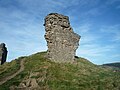
 Clun Castle remains, Great Tower detail 1 - geograph.org.uk - 5764445.jpg 6,220 × 4,152; 6.94 MB
-
 Clun Castle remains, Great Tower detail 2 - geograph.org.uk - 5764449.jpg 6,031 × 4,025; 7.16 MB
-
 Clun Castle remains, Great Tower detail 3 - geograph.org.uk - 5764454.jpg 6,480 × 4,326; 7.78 MB
-
 Clun Castle remains, Great Tower detail 4 - geograph.org.uk - 5764458.jpg 7,360 × 4,912; 7.08 MB


_-_geograph.org.uk_-_6071282.jpg)


_-_geograph.org.uk_-_6818562.jpg)


_-_geograph.org.uk_-_6822021.jpg)


_-_geograph.org.uk_-_6073104.jpg)
_-_geograph.org.uk_-_6073222.jpg)


_-_geograph.org.uk_-_6071736.jpg)

_-_geograph.org.uk_-_6073258.jpg)

_-_geograph.org.uk_-_6073255.jpg)


_-_geograph.org.uk_-_6071231.jpg)
_-_geograph.org.uk_-_6071262.jpg)
_-_geograph.org.uk_-_6071273.jpg)
_-_geograph.org.uk_-_6818518.jpg)
_-_geograph.org.uk_-_6818505.jpg)
_-_geograph.org.uk_-_6067599.jpg)
_-_geograph.org.uk_-_6068077.jpg)
_-_geograph.org.uk_-_6069879.jpg)
_-_geograph.org.uk_-_6069885.jpg)
_-_geograph.org.uk_-_6069942.jpg)
_-_geograph.org.uk_-_6069944.jpg)
_-_geograph.org.uk_-_6071248.jpg)
_-_geograph.org.uk_-_6368242.jpg)
_-_geograph.org.uk_-_6818510.jpg)
_-_geograph.org.uk_-_6818512.jpg)
_-_geograph.org.uk_-_6818519.jpg)
_-_geograph.org.uk_-_6818521.jpg)
_-_geograph.org.uk_-_6818543.jpg)
_-_geograph.org.uk_-_6818551.jpg)
_-_geograph.org.uk_-_6818552.jpg)
_-_geograph.org.uk_-_6822029.jpg)
_-_geograph.org.uk_-_6069891.jpg)
_-_geograph.org.uk_-_6069893.jpg)
_-_geograph.org.uk_-_6071271.jpg)
_-_geograph.org.uk_-_6068165.jpg)
_-_geograph.org.uk_-_6071249.jpg)
_-_geograph.org.uk_-_6069882.jpg)
_-_geograph.org.uk_-_6069896.jpg)
_-_geograph.org.uk_-_6069902.jpg)
_-_geograph.org.uk_-_6069937.jpg)
_-_geograph.org.uk_-_6069912.jpg)
_-_geograph.org.uk_-_6071246.jpg)
_-_geograph.org.uk_-_6818536.jpg)
_-_geograph.org.uk_-_6818554.jpg)


&filefrom=Clun+Castle+ruins+viewed+from+the+nearby+Jack+Mytton+Way+-+geograph.org.uk+-+6487017.jpg#mw-category-media)