Category:Chapel Lawn
Jump to navigation
Jump to search
English: Chapel Lawn is a village in the Redlake Valley, three miles south of Clun, Shropshire, England
village in Shropshire, United Kingdom  | |||||
| Upload media | |||||
| Instance of | |||||
|---|---|---|---|---|---|
| Location | Clun, Shropshire, West Midlands, England | ||||
 | |||||
Subcategories
This category has the following 2 subcategories, out of 2 total.
C
- Caer Caradoc (Chapel Lawn) (26 F)
Media in category "Chapel Lawn"
The following 53 files are in this category, out of 53 total.
-
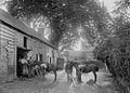
 "The smithy" Chapel Lawn (1294231).jpg 1,000 × 710; 138 KB
-
 -The smithy, Chapel Lawn (1293738).jpg 1,000 × 713; 148 KB
-
 Barn and cowhouse at Squire Farm, Chapel Lawn.jpg 1,800 × 1,350; 485 KB
-
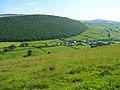
 Chapel Lawn & Brineddin wood - Flickr - S. rae.jpg 3,264 × 2,448; 2.53 MB
-
 Chapel Lawn (1294043).jpg 1,000 × 710; 97 KB
-
 Chapel Lawn - geograph.org.uk - 2554026.jpg 1,024 × 768; 133 KB
-
 Chapel Lawn - geograph.org.uk - 2554039.jpg 1,024 × 768; 126 KB
-
 Chapel Lawn - geograph.org.uk - 5495117.jpg 1,024 × 683; 355 KB
-
 Chapel Lawn - geograph.org.uk - 5495738.jpg 1,024 × 683; 295 KB
-
 Chapel Lawn Farm - geograph.org.uk - 2554057.jpg 1,024 × 768; 108 KB
-
-
 Chapel Lawn village - geograph.org.uk - 654703.jpg 640 × 480; 75 KB
-
 Chapel Lawn.jpg 1,024 × 768; 164 KB
-
 Crush and pens - geograph.org.uk - 640224.jpg 480 × 640; 62 KB
-
 Entering Chapel Lawn - geograph.org.uk - 654676.jpg 640 × 462; 67 KB
-
 Horses and rainbow near Bryncalled - geograph.org.uk - 655011.jpg 640 × 480; 61 KB
-
 Horses near Bryncalled - geograph.org.uk - 655012.jpg 640 × 480; 93 KB
-
 Lane to Bucknell - geograph.org.uk - 655099.jpg 640 × 480; 96 KB
-
 Listed building at Squire Farmhouse, near Chapel Lawn.jpg 4,000 × 3,000; 4.81 MB
-
 The Quern, Chapel Lawn 01.jpg 4,000 × 3,000; 4.48 MB
-
 The Quern, Chapel Lawn 02.jpg 4,000 × 3,000; 4.81 MB
-
 The Quern, Chapel Lawn 03.jpg 4,000 × 3,000; 4.75 MB
-
 The Quern, Chapel Lawn 04.jpg 4,000 × 3,000; 1.85 MB
-
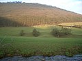
 The Redlake Valley - geograph.org.uk - 654980.jpg 640 × 481; 95 KB
-
 Variety of hedges in Nettledale - geograph.org.uk - 450384.jpg 640 × 481; 96 KB
-
 Brineddin Wood - geograph.org.uk - 298212.jpg 640 × 480; 89 KB
-
 Crossroads at Lye - geograph.org.uk - 654999.jpg 640 × 480; 89 KB
-
 Damp meadows in the Redlake valley. - geograph.org.uk - 655077.jpg 640 × 480; 95 KB
-
 Darky Dale Lane - 1 - geograph.org.uk - 655128.jpg 640 × 478; 70 KB
-
 Darky Dale Lane - 2 - geograph.org.uk - 655130.jpg 640 × 468; 80 KB
-
 Entrance to Meeroak Farm - geograph.org.uk - 655124.jpg 640 × 480; 126 KB
-
 Entrance to Roseheart Kingdom - geograph.org.uk - 654993.jpg 640 × 480; 71 KB
-
 Farmland at Pentre Hodre - geograph.org.uk - 654187.jpg 640 × 480; 86 KB
-
 Footpath at Honeyhole - geograph.org.uk - 655044.jpg 640 × 480; 115 KB
-
 Footpath at Pentre Hodre - geograph.org.uk - 654182.jpg 640 × 480; 87 KB
-
 Footpath sign on Black Hill - geograph.org.uk - 654316.jpg 640 × 480; 97 KB
-
 Forest path near Meeroak Farm - geograph.org.uk - 655125.jpg 640 × 480; 113 KB
-
 Forest track at Black Hill - geograph.org.uk - 654310.jpg 640 × 472; 62 KB
-
 Forest track near Meeroak Farm - geograph.org.uk - 655121.jpg 640 × 480; 119 KB
-
 Horse near Bryncalled - geograph.org.uk - 655017.jpg 640 × 480; 79 KB
-
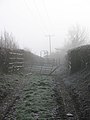
 Lane east of Chapel Lawn - geograph.org.uk - 654716.jpg 640 × 475; 57 KB
-
 Lane from Pentre Hodre to Obley - geograph.org.uk - 654185.jpg 640 × 480; 65 KB
-
 Lane in the Redlake valley - geograph.org.uk - 655075.jpg 640 × 480; 76 KB
-
 Lane junction at Obley - geograph.org.uk - 654177.jpg 640 × 480; 84 KB
-
 Lane near The Quern - geograph.org.uk - 654719.jpg 640 × 460; 60 KB
-
 Lane on Hodre Hill - geograph.org.uk - 654271.jpg 640 × 480; 96 KB
-
 Lay-by on the Redlake valley lane - geograph.org.uk - 655081.jpg 640 × 480; 57 KB
-
 Meadows in the Redlake valley - geograph.org.uk - 655089.jpg 640 × 480; 81 KB
-
 Mountain biking on Black Hill. - geograph.org.uk - 585275.jpg 640 × 480; 101 KB
-
 Narrow lane to Pentre Hodre - geograph.org.uk - 655002.jpg 640 × 480; 107 KB
-

-
 The Redlake Valley - geograph.org.uk - 655020.jpg 640 × 480; 73 KB
-
 The Redlake Valley - geograph.org.uk - 655023.jpg 640 × 480; 104 KB
.jpg)
.jpg)


.jpg)


