Category:Clackmannan (civil parish)
Jump to navigation
Jump to search
Scottish parish in Clackmannanshire, Scotland, UK | |||||
| Upload media | |||||
| Instance of | |||||
|---|---|---|---|---|---|
| Part of |
| ||||
| Named after | |||||
| Location |
| ||||
| Population |
| ||||
| Area |
| ||||
 | |||||
Subcategories
This category has the following 2 subcategories, out of 2 total.
K
- Kennet, Clackmannanshire (4 F)
S
- Slack, Clackmannanshire (5 F)
Media in category "Clackmannan (civil parish)"
The following 200 files are in this category, out of 211 total.
(previous page) (next page)-
 17th century tombstone - geograph.org.uk - 3535324.jpg 640 × 480; 109 KB
-
 17th century tombstone - geograph.org.uk - 3535347.jpg 640 × 480; 118 KB
-
 18th century tombstone - geograph.org.uk - 3535340.jpg 480 × 640; 99 KB
-
 18th century tombstone - geograph.org.uk - 3535344.jpg 480 × 640; 95 KB
-
 18th century tombstone - geograph.org.uk - 3535353.jpg 480 × 640; 116 KB
-
 A ploughed field by Gartarry Wood - geograph.org.uk - 3004466.jpg 640 × 360; 194 KB
-
 A small wood, Woodside - geograph.org.uk - 2722621.jpg 640 × 360; 299 KB
-
 A876 nears Kilbagie Roundabout - geograph.org.uk - 4549835.jpg 640 × 481; 38 KB
-
 A876 north of Kilbagie - geograph.org.uk - 4549834.jpg 640 × 482; 46 KB
-

-
 A907 by-passes Clackmannan - geograph.org.uk - 4569846.jpg 640 × 480; 52 KB
-
 A907 north of Kennet Cottages - geograph.org.uk - 4569848.jpg 640 × 481; 45 KB
-
 Aberdeen Wood - geograph.org.uk - 3088505.jpg 640 × 360; 250 KB
-

-
 Aberdona Road at Gartreilly Burn Bridge - geograph.org.uk - 3958008.jpg 5,184 × 3,456; 7.5 MB
-
 Aberdona Wood - geograph.org.uk - 4140715.jpg 800 × 450; 418 KB
-
 Alexander Park - geograph.org.uk - 3322361.jpg 640 × 360; 180 KB
-
 Alloa Furniture Restoration, Clackmannan - geograph.org.uk - 4236663.jpg 1,600 × 1,106; 542 KB
-
 Alloa Road from Meadow Grove - geograph.org.uk - 4236711.jpg 1,600 × 1,062; 1.1 MB
-
 An abandoned building site - geograph.org.uk - 2722633.jpg 640 × 360; 224 KB
-
 An abandoned building site - geograph.org.uk - 2724831.jpg 640 × 360; 224 KB
-
 B910 and former railway bridge near Clackmannan - geograph.org.uk - 3958092.jpg 1,600 × 1,067; 616 KB
-
 B910 near Linn Mill - geograph.org.uk - 6595905.jpg 1,024 × 768; 205 KB
-

-
 B913 - geograph.org.uk - 5895951.jpg 1,024 × 683; 363 KB
-
 Balhearty Wood - geograph.org.uk - 4140702.jpg 800 × 450; 396 KB
-
 Bank of Rosebay Willowherb at Kilbagie - geograph.org.uk - 5934553.jpg 1,024 × 768; 149 KB
-

-
 Between the roundabouts - geograph.org.uk - 4484406.jpg 800 × 450; 302 KB
-
 Birkhill Plantation - geograph.org.uk - 6167110.jpg 1,024 × 768; 324 KB
-
 Birkhill Plantation - geograph.org.uk - 6167112.jpg 1,024 × 768; 263 KB
-
 Black Devon - geograph.org.uk - 4484583.jpg 800 × 450; 429 KB
-
 Board, Clackmannan Parish Church - geograph.org.uk - 5185288.jpg 640 × 427; 65 KB
-
 Bridge at Gartmorn Dam - geograph.org.uk - 4021245.jpg 428 × 640; 98 KB
-
 Broadcarse - geograph.org.uk - 3106261.jpg 640 × 360; 210 KB
-
 Buildings at Arns, Lookaboutye Brae - geograph.org.uk - 4236789.jpg 1,600 × 1,062; 613 KB
-
 Bulls, Aberdona - geograph.org.uk - 4140711.jpg 800 × 450; 310 KB
-
 Bungalow on Lookaboutye Brae - geograph.org.uk - 4236793.jpg 1,600 × 1,188; 487 KB
-
 Burnbrae Wood - geograph.org.uk - 3203076.jpg 640 × 480; 328 KB
-
 Cadger Burn - geograph.org.uk - 2724839.jpg 640 × 360; 291 KB
-
 Canal Burn - geograph.org.uk - 2594514.jpg 640 × 480; 275 KB
-
 Carse, Craighton - geograph.org.uk - 2873750.jpg 640 × 360; 219 KB
-
 Castlebridge Colliery - geograph.org.uk - 5050935.jpg 5,160 × 3,404; 7.4 MB
-
 Cattle, Gartfinnan - geograph.org.uk - 4486447.jpg 800 × 450; 308 KB
-
 Cherryton brickworks - geograph.org.uk - 2854546.jpg 4,320 × 3,240; 2.84 MB
-
 Cherryton Brickworks site - geograph.org.uk - 4485676.jpg 800 × 450; 382 KB
-
 Cherryton Brickworks site - geograph.org.uk - 4485678.jpg 800 × 450; 429 KB
-
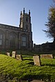
 Clackmannan Church - geograph.org.uk - 3298121.jpg 534 × 800; 310 KB
-
 Clackmannan Churchyard - geograph.org.uk - 3298129.jpg 800 × 534; 331 KB
-
 Clackmannan Masonic Lodge, ^1303 - geograph.org.uk - 4236694.jpg 1,600 × 1,062; 508 KB
-
 Clackmannan mercat cross - geograph.org.uk - 3535268.jpg 479 × 640; 66 KB
-
 Clackmannan Parish Church - geograph.org.uk - 2499379.jpg 4,320 × 3,240; 1.96 MB
-
 Clackmannan Parish Church - geograph.org.uk - 5185290.jpg 683 × 1,024; 310 KB
-
 Clackmannan Tower - geograph.org.uk - 2499355.jpg 4,320 × 3,240; 2.6 MB
-
 Clackmannan Tower - geograph.org.uk - 2499368.jpg 4,320 × 3,240; 2.7 MB
-
 Clackmannan Tower - geograph.org.uk - 3681958.jpg 640 × 478; 55 KB
-
 Clackmannan Tower - geograph.org.uk - 3681961.jpg 480 × 640; 66 KB
-
 Clackmannan Tower - geograph.org.uk - 5559493.jpg 640 × 480; 60 KB
-
 Clackmannan Tower - geograph.org.uk - 5871885.jpg 2,496 × 856; 253 KB
-
 Clackmannan Tower - geograph.org.uk - 6575158.jpg 1,024 × 768; 262 KB
-
 Clackmannan Tower, Clackmannan - geograph.org.uk - 4236733.jpg 1,600 × 1,062; 640 KB
-
 Clackmannan War Memorial - geograph.org.uk - 3958118.jpg 800 × 1,200; 501 KB
-
 Clackmannan War Memorial - geograph.org.uk - 4236699.jpg 1,062 × 1,600; 817 KB
-
 Clackmannanshire sunset - geograph.org.uk - 2764883.jpg 640 × 480; 179 KB
-
 Clackmannanshire-Fife boundary - geograph.org.uk - 5745307.jpg 3,968 × 2,976; 2.37 MB
-
 Confluence of the Black Devon and Forth - geograph.org.uk - 3624528.jpg 640 × 480; 225 KB
-
 Craigmad Wood - geograph.org.uk - 3203070.jpg 640 × 480; 314 KB
-
 Craigmad Wood - geograph.org.uk - 4490575.jpg 800 × 450; 300 KB
-
 Cycle route ^76 towards Craighton - geograph.org.uk - 4236805.jpg 1,600 × 1,062; 728 KB
-
 Devonway, Clackmannan - geograph.org.uk - 4236634.jpg 1,600 × 1,060; 576 KB
-
 Door, Clackmannan Tower - geograph.org.uk - 6575160.jpg 1,024 × 768; 389 KB
-
 Drain, Kennet Pans - geograph.org.uk - 2873756.jpg 640 × 360; 234 KB
-
 Edge of Lower Saline Wood - geograph.org.uk - 3330472.jpg 640 × 480; 246 KB
-

-
 Evening barley, Gartarry - geograph.org.uk - 6595135.jpg 1,024 × 768; 164 KB
-
 Fallen thorn tree, Aberdeen Wood - geograph.org.uk - 2857635.jpg 640 × 360; 211 KB
-
 Farm buildings at Craighton - geograph.org.uk - 4236820.jpg 1,600 × 1,062; 636 KB
-
 Farm track, Aberdona - geograph.org.uk - 4140707.jpg 640 × 360; 245 KB
-
 Farmland near Aberdona Mains - geograph.org.uk - 2776492.jpg 640 × 427; 315 KB
-
 Farmland near Clackmannan - geograph.org.uk - 3624633.jpg 640 × 480; 373 KB
-
 Farmland near Craigton - geograph.org.uk - 3628235.jpg 640 × 480; 320 KB
-
 Farmland near Gartlove - geograph.org.uk - 4827251.jpg 1,500 × 863; 1.46 MB
-
 Farmland near Grassmainston - geograph.org.uk - 2764849.jpg 640 × 434; 252 KB
-
 Farmland near Grassmainston - geograph.org.uk - 2765819.jpg 640 × 480; 451 KB
-
 Farmland near Loanside - geograph.org.uk - 3627905.jpg 640 × 480; 452 KB
-
 Fearns Wood - geograph.org.uk - 2722274.jpg 640 × 360; 276 KB
-
 Fearns Wood - geograph.org.uk - 5739222.jpg 1,024 × 683; 512 KB
-
 Fiddle Wood - geograph.org.uk - 2776567.jpg 640 × 427; 286 KB
-
 Field boundary - geograph.org.uk - 3628223.jpg 640 × 480; 376 KB
-
 Field boundary near Gartgreenie - geograph.org.uk - 2789101.jpg 640 × 450; 341 KB
-
 Field, Aberdona - geograph.org.uk - 3330470.jpg 640 × 480; 337 KB
-
 Field, Hazleyshaw - geograph.org.uk - 2722298.jpg 640 × 360; 241 KB
-
 Fields - Gartmorn Dam - geograph.org.uk - 4021710.jpg 640 × 428; 77 KB
-
 Forestry plantation near Gartlove - geograph.org.uk - 2789104.jpg 630 × 420; 279 KB
-
 Former boundary, Gartgreenie - geograph.org.uk - 5739220.jpg 1,024 × 683; 355 KB
-
 Forth estuary - geograph.org.uk - 3627888.jpg 640 × 480; 347 KB
-
 Gartarry Wood - geograph.org.uk - 2843313.jpg 640 × 360; 231 KB
-
 Gartarry Wood - geograph.org.uk - 4484399.jpg 800 × 450; 414 KB
-
 Gartfinnan - geograph.org.uk - 3958046.jpg 5,184 × 3,456; 6.75 MB
-
 Gartfinnan - geograph.org.uk - 6595964.jpg 1,024 × 768; 320 KB
-
 Gartgreenie Wood - geograph.org.uk - 4202530.jpg 800 × 450; 357 KB
-
 Gartgreenie Wood - geograph.org.uk - 4210005.jpg 800 × 450; 396 KB
-
 Gartgreenie Wood - geograph.org.uk - 4490584.jpg 800 × 450; 341 KB
-
 Gartgreenie Wood - geograph.org.uk - 5739218.jpg 1,024 × 683; 465 KB
-
 Gartlove Plantation - geograph.org.uk - 2769594.jpg 640 × 480; 521 KB
-
 Gartlove Plantation - geograph.org.uk - 4486445.jpg 800 × 450; 416 KB
-
 Gartmorn Dam - geograph.org.uk - 2987109.jpg 640 × 480; 240 KB
-
 Gartmorn Dam - geograph.org.uk - 4021255.jpg 640 × 428; 49 KB
-
 Gartmorn Dam - geograph.org.uk - 4021713.jpg 640 × 428; 30 KB
-
 Gartmorn Dam - geograph.org.uk - 4021714.jpg 640 × 428; 75 KB
-
 Gartmorn Dam - geograph.org.uk - 4360655.jpg 640 × 480; 111 KB
-
 Gartmorn Dam in winter - geograph.org.uk - 2764899.jpg 640 × 480; 334 KB
-
 Gartmorn reflections - geograph.org.uk - 2764912.jpg 640 × 409; 223 KB
-
 Gartreilly Burn - geograph.org.uk - 5080674.jpg 800 × 534; 128 KB
-
 Gate at the end of the High Street - geograph.org.uk - 3681968.jpg 640 × 480; 95 KB
-
 Gateside Cottage ^ B910 - geograph.org.uk - 3958071.jpg 5,184 × 3,456; 7.39 MB
-
 Grazing sheep - geograph.org.uk - 2150861.jpg 2,560 × 1,920; 1.21 MB
-
 Hazleyshaw farm sign - geograph.org.uk - 2722294.jpg 640 × 480; 332 KB
-
 Health and Sa - geograph.org.uk - 2724825.jpg 640 × 360; 261 KB
-
 High Street, Clackmannan - geograph.org.uk - 4236746.jpg 1,600 × 1,062; 521 KB
-
 High Street, Clackmannan - geograph.org.uk - 5185295.jpg 1,024 × 683; 248 KB
-
 Houses on Devonway, Clackmannan - geograph.org.uk - 4236484.jpg 1,600 × 1,127; 609 KB
-
 Houses on High Street, Clackmannan - geograph.org.uk - 4236749.jpg 1,600 × 1,062; 539 KB
-
 Kilbagie Roundabout - geograph.org.uk - 4718467.jpg 640 × 480; 75 KB
-
 Kincardine Railway - geograph.org.uk - 4484413.jpg 800 × 450; 401 KB
-
 Lodge Clackmannan No 1303 - geograph.org.uk - 3958112.jpg 5,184 × 3,456; 7.5 MB
-
 Lookaboutye Brae a cycle friendly road - geograph.org.uk - 4236773.jpg 1,600 × 1,109; 501 KB
-
 Lookaboutye on Lookaboutye Brae - geograph.org.uk - 4236779.jpg 1,600 × 1,124; 747 KB
-
 Lookaboutye on Lookaboutye Brae - geograph.org.uk - 4236781.jpg 1,600 × 1,062; 644 KB
-
 Lower Saline Wood - geograph.org.uk - 2776499.jpg 640 × 427; 536 KB
-
 Main Street, Clackmannan - geograph.org.uk - 3958107.jpg 5,184 × 3,456; 6.45 MB
-
 Main Street, Clackmannan - geograph.org.uk - 4484397.jpg 800 × 450; 331 KB
-
 Manure heap - geograph.org.uk - 2594528.jpg 640 × 480; 259 KB
-
 Minor road by Gartgreenie Wood - geograph.org.uk - 3958032.jpg 1,600 × 1,067; 602 KB
-
 Minor road SE of Forestmill - geograph.org.uk - 3958021.jpg 1,600 × 1,067; 771 KB
-
 Modern Art - Gartmorn Dam - geograph.org.uk - 4360645.jpg 480 × 640; 122 KB
-

-
 National Cycle Network Route 764 at bridge over Black Devon - geograph.org.uk - 3958057.jpg 5,184 × 3,456; 7.72 MB
-
 National Cycle Network Route 764 near Clackmannan - geograph.org.uk - 3958080.jpg 5,184 × 3,456; 6.8 MB
-
 National Cycle Network Route 764 near Clackmannan - geograph.org.uk - 3958088.jpg 1,600 × 1,067; 991 KB
-
 National Cycle Route 76, near Lookaboutye - geograph.org.uk - 5745296.jpg 3,968 × 2,976; 2.7 MB
-
 Near Gartgreenie - geograph.org.uk - 2722285.jpg 640 × 360; 229 KB
-
 New hardcore, Cow Wood - geograph.org.uk - 5080668.jpg 800 × 534; 200 KB
-
 North Plantation, The Forest - geograph.org.uk - 2724823.jpg 640 × 360; 292 KB
-
 Oilseed rape, Gartarry - geograph.org.uk - 4484402.jpg 800 × 450; 349 KB
-
 Old tombstone - geograph.org.uk - 3535330.jpg 640 × 480; 125 KB
-
 Old tombstone - geograph.org.uk - 3535336.jpg 480 × 640; 117 KB
-
 Opencast workings - geograph.org.uk - 3343520.jpg 640 × 427; 391 KB
-
 Opencast workings - geograph.org.uk - 3343526.jpg 640 × 480; 368 KB
-
 Opencast workings - geograph.org.uk - 3343537.jpg 640 × 427; 358 KB
-
 Parish Church, Clackmannan - geograph.org.uk - 4236748.jpg 1,600 × 1,062; 553 KB
-
 Parklands Muir - geograph.org.uk - 2724199.jpg 640 × 360; 224 KB
-
 Path along the edge of Lower Saline Wood - geograph.org.uk - 1897150.jpg 800 × 531; 271 KB
-

-
 Path leading to Lady's Brae - geograph.org.uk - 4236785.jpg 1,600 × 1,067; 1.16 MB
-
 Path, Clackmannan - geograph.org.uk - 4484572.jpg 800 × 450; 398 KB
-
 Pheasant rearing pens - geograph.org.uk - 3322369.jpg 640 × 360; 208 KB
-
 Pond, Brucefield - geograph.org.uk - 3203074.jpg 640 × 480; 399 KB
-
 Power line, Gartgreenie - geograph.org.uk - 2724217.jpg 640 × 480; 241 KB
-
 Powerline, Solsgirth - geograph.org.uk - 5895956.jpg 1,024 × 683; 346 KB
-
 Powerlines out of Longannet - geograph.org.uk - 5747529.jpg 1,024 × 683; 307 KB
-
 Railway to Alloa at Kilbagie - geograph.org.uk - 5879131.jpg 1,024 × 768; 275 KB
-
 Railway to Dunfermline at Kilbagie - geograph.org.uk - 5934485.jpg 1,024 × 768; 248 KB
-
 Road from Forest Mill to Aberdona - geograph.org.uk - 1897163.jpg 800 × 531; 134 KB
-
 Road junction near Aberdona House - geograph.org.uk - 1897161.jpg 800 × 531; 227 KB
-
 Road leading to Inch of Ferryton - geograph.org.uk - 4236798.jpg 1,600 × 1,062; 476 KB
-
 Road leading to Loanside - geograph.org.uk - 4236802.jpg 1,600 × 1,080; 842 KB
-
 Road through Aberdona Wood - geograph.org.uk - 1897141.jpg 800 × 531; 266 KB
-
 Robin on fence - geograph.org.uk - 4021261.jpg 640 × 428; 27 KB
-
 School Wood - geograph.org.uk - 2722302.jpg 640 × 360; 232 KB
-
 School Wood - geograph.org.uk - 3203062.jpg 640 × 480; 350 KB
-
 School Wood - geograph.org.uk - 4491906.jpg 800 × 450; 379 KB
-
 Sculpture near Clackmannan - geograph.org.uk - 4236478.jpg 1,032 × 836; 190 KB
-
 Sheep, Allaleckie - geograph.org.uk - 2722594.jpg 640 × 360; 228 KB
-
 Sheriffyards Colliery - geograph.org.uk - 4021227.jpg 640 × 428; 107 KB
-
 Sheriffyards Colliery - geograph.org.uk - 4021236.jpg 428 × 640; 105 KB
-
 Side road to Coalsnaughton - geograph.org.uk - 4601392.jpg 640 × 430; 57 KB
-
 Slack Wood - geograph.org.uk - 4490549.jpg 800 × 450; 357 KB
-
 South Plantation, The Forest - geograph.org.uk - 2722306.jpg 640 × 360; 253 KB
-
 South Plantation, The Forest - geograph.org.uk - 4491917.jpg 800 × 450; 320 KB
-
 Stirling and Dunfermline Railway - geograph.org.uk - 4485655.jpg 800 × 664; 525 KB
-
 Stirling and Dunfermline Railway - geograph.org.uk - 4485662.jpg 800 × 450; 350 KB
-
 Stirling and Dunfermline Railway - geograph.org.uk - 4486438.jpg 800 × 450; 335 KB
-
 Stirling and Dunfermline Railway - geograph.org.uk - 4486441.jpg 800 × 450; 411 KB
-
 Stirling and Dunfermline Railway - geograph.org.uk - 4486451.jpg 800 × 450; 369 KB
-
 Stirling and Dunfermline Railway - geograph.org.uk - 4490560.jpg 800 × 450; 375 KB
-
 Stirling and Dunfermline Railway - geograph.org.uk - 4490567.jpg 800 × 450; 374 KB
-
 Stirling and Dunfermline Railway - geograph.org.uk - 6595957.jpg 1,024 × 768; 336 KB
-
 Stone of Mannan - geograph.org.uk - 3535295.jpg 471 × 640; 75 KB
-
 Straw bales, Craigrie - geograph.org.uk - 2594535.jpg 640 × 359; 213 KB
-
 Stripwood, Kennet - geograph.org.uk - 4484415.jpg 800 × 450; 433 KB
-
 Stripwood, Kennet - geograph.org.uk - 4484417.jpg 800 × 450; 441 KB
-
 Stubble and round bale, Gartlove - geograph.org.uk - 4140725.jpg 640 × 360; 229 KB
-
 Stubble, Kennet Pans - geograph.org.uk - 3106268.jpg 640 × 360; 219 KB
-
 Summit, King's Seat Hill - geograph.org.uk - 6576254.jpg 1,024 × 768; 255 KB
-

-

-

-
 The Black Devon - geograph.org.uk - 3624862.jpg 640 × 480; 325 KB
-
 The County Barr on Main Street, Clackmannan - geograph.org.uk - 4236719.jpg 1,600 × 1,062; 693 KB


&filefrom=The+Horseshoe+Bar+on+Main+Street%2C+Clackmannan+-+geograph.org.uk+-+4236724.jpg#mw-category-media)