Category:Church signs in Lancashire
Jump to navigation
Jump to search
Ceremonial counties of England: Bedfordshire · Berkshire · Buckinghamshire · Cambridgeshire · Cheshire · Cornwall · Cumbria · Derbyshire · Devon · Dorset · Durham · East Riding of Yorkshire · East Sussex · Essex · Gloucestershire · Greater London · Greater Manchester · Hampshire · Herefordshire · Hertfordshire · Isle of Wight · Kent · Lancashire · Leicestershire · Lincolnshire · Merseyside · Norfolk · North Yorkshire · Northamptonshire · Northumberland · Nottinghamshire · Oxfordshire · Shropshire · Somerset · South Yorkshire · Staffordshire · Suffolk · Surrey · Tyne and Wear · Warwickshire · West Midlands · West Sussex · West Yorkshire · Wiltshire · Worcestershire
City-counties: Bristol ·
Former historic counties:
Other former counties:
City-counties: Bristol ·
Former historic counties:
Other former counties:
Subcategories
This category has only the following subcategory.
Media in category "Church signs in Lancashire"
The following 75 files are in this category, out of 75 total.
-
 St Anne's Catholic Church, Accrington - geograph.org.uk - 701819.jpg 618 × 462; 174 KB
-
 The Parish Church of St Ann - geograph.org.uk - 124244.jpg 640 × 480; 81 KB
-

-
 Church Sign, Burnley Road - geograph.org.uk - 916978.jpg 640 × 480; 113 KB
-

-
 St Peters Parish Church, Belmont, Sign - geograph.org.uk - 707896.jpg 640 × 480; 218 KB
-
 St Mary's Church Borwick, Sign - geograph.org.uk - 1306341.jpg 640 × 480; 87 KB
-
 St Paul's Church - geograph.org.uk - 85834.jpg 480 × 640; 94 KB
-
 St Mary's Catholic Church, Chipping, Sign - geograph.org.uk - 752386.jpg 480 × 640; 203 KB
-

-
 Parish Church of St Peter, Chorley, Sign - geograph.org.uk - 664472.jpg 640 × 480; 198 KB
-
 Christ Church, Charnock Richard, Sign - geograph.org.uk - 611169.jpg 640 × 480; 143 KB
-
 Christ Church, Glasson, Sign - geograph.org.uk - 615343.jpg 640 × 480; 170 KB
-

-
 Churchtown lancashire - panoramio (1).jpg 990 × 743; 258 KB
-
 Coppull Parish Church, Sign - geograph.org.uk - 1103316.jpg 640 × 480; 96 KB
-
 Dolphinholme Methodist Church, Sign - geograph.org.uk - 580294.jpg 640 × 480; 222 KB
-
 St Patricks RC Church, Earby - geograph.org.uk - 623688.jpg 480 × 640; 116 KB
-

-

-
 Forton United Reformed Church, Sign - geograph.org.uk - 1412695.jpg 640 × 480; 71 KB
-
 Holy Trinity Church, Freckleton.jpg 640 × 480; 194 KB
-

-
 Holy Trinity Parish Church, Hoghton, Sign - geograph.org.uk - 619236.jpg 640 × 426; 116 KB
-
-
 St Mary's Catholic Church, Hornby, Sign - geograph.org.uk - 611877.jpg 640 × 480; 184 KB
-
 Inskip Baptist Church - geograph.org.uk - 1778033.jpg 640 × 426; 260 KB
-
-
 Longton, St. Andrew - geograph.org.uk - 158056.jpg 640 × 480; 87 KB
-
 Lumb Baptist Church, Sign - geograph.org.uk - 682383.jpg 452 × 640; 71 KB
-
 St Cuthbert's Church, Lytham.jpeg 640 × 427; 89 KB
-
 Church, Lytham - DSC07150.JPG 3,648 × 2,736; 3.6 MB
-
-
 Mellor Methodist Church, Sign - geograph.org.uk - 1074426.jpg 640 × 480; 78 KB
-
 Middleton Methodist Church, Sign - geograph.org.uk - 1548741.jpg 640 × 480; 93 KB
-
 Holy Family Catholic Church, Sign - geograph.org.uk - 1595788.jpg 480 × 640; 76 KB
-

-
 All Saints, New Longton - geograph.org.uk - 158032.jpg 640 × 480; 75 KB
-
 New Row Methodist Church, Sign - geograph.org.uk - 990738.jpg 480 × 640; 188 KB
-
 Christ Church, Newburgh, Sign - geograph.org.uk - 702578.jpg 640 × 480; 164 KB
-
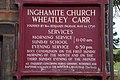 Notice board Inghamite Church - geograph.org.uk - 104363.jpg 640 × 426; 152 KB
-

-

-

-

-

-
 St Annes Parish Church, Sign - geograph.org.uk - 632168.jpg 640 × 480; 170 KB
-

-
 Scorton Methodist Church, Sign - geograph.org.uk - 951480.jpg 640 × 480; 189 KB
-
 Sign at St John the Baptist Church, Burscough (1).JPG 4,320 × 3,240; 2.53 MB
-
 St Hilda's Church, Bilsborrow, Sign - geograph.org.uk - 619480.jpg 640 × 426; 81 KB
-
 St James Parish Church - geograph.org.uk - 1144924.jpg 640 × 371; 63 KB
-
 St James' Church, Shireshead, Sign - geograph.org.uk - 615356.jpg 640 × 480; 186 KB
-
 St John the Baptist, Bretherton, Sign - geograph.org.uk - 1374254.jpg 640 × 480; 102 KB
-
 St John the Evangelist Church - geograph.org.uk - 1291391.jpg 640 × 426; 140 KB
-

-
 St Mark's Church, Scarisbrick (4).JPG 3,456 × 4,608; 3.38 MB
-
 St Mary's Church, Oswaldtwistle, Sign - geograph.org.uk - 717400.jpg 640 × 480; 203 KB
-
 St Stephen's Church, Tockholes, Sign - geograph.org.uk - 990695.jpg 640 × 480; 150 KB
-
 St Wilfrid's Church, Melling, Sign - geograph.org.uk - 612084.jpg 640 × 480; 189 KB
-

-
 St. Mary's Fernyhalgh notice board - geograph.org.uk - 151785.jpg 640 × 480; 112 KB
-

-
 Sunderland Point Mission Church, front.jpg 3,176 × 1,624; 2.28 MB
-
 Tewitfield Methodist Church, Sign - geograph.org.uk - 1300631.jpg 480 × 640; 116 KB
-

-

-

-

-
 Tockholes United Reformed Church, Sign - geograph.org.uk - 990719.jpg 480 × 640; 186 KB
-
 Tunstead Church, Stacksteads. - geograph.org.uk - 504657.jpg 640 × 576; 96 KB
-
 Mount Zion Church, Walk Mill - geograph.org.uk - 542676.jpg 640 × 426; 154 KB
-
 The Parish Church of St Nicholas, Wrea Green, Lancashire - geograph.org.uk - 1738485.jpg 1,632 × 1,224; 902 KB
-
 St Johns Church, Yealand, Doorway - geograph.org.uk - 1308606.jpg 480 × 640; 100 KB
-
 St Johns Church, Yealand, Sign - geograph.org.uk - 1308588.jpg 480 × 640; 82 KB


.jpg)


,_Longridge,_Sign_-_geograph.org.uk_-_1371259.jpg)


_East_Beach,_Lytham_St._Annes,_FY8_5EX_-_geograph.org.uk_-_1738699.jpg)


.JPG)


.JPG)


