Category:Church signs in Hampshire
Jump to navigation
Jump to search
Ceremonial counties of England: Bedfordshire · Berkshire · Buckinghamshire · Cambridgeshire · Cheshire · Cornwall · Cumbria · Derbyshire · Devon · Dorset · Durham · East Riding of Yorkshire · East Sussex · Essex · Gloucestershire · Greater London · Greater Manchester · Hampshire · Herefordshire · Hertfordshire · Isle of Wight · Kent · Lancashire · Leicestershire · Lincolnshire · Merseyside · Norfolk · North Yorkshire · Northamptonshire · Northumberland · Nottinghamshire · Oxfordshire · Shropshire · Somerset · South Yorkshire · Staffordshire · Suffolk · Surrey · Tyne and Wear · Warwickshire · West Midlands · West Sussex · West Yorkshire · Wiltshire · Worcestershire
City-counties: Bristol ·
Former historic counties:
Other former counties:
City-counties: Bristol ·
Former historic counties:
Other former counties:
Media in category "Church signs in Hampshire"
The following 147 files are in this category, out of 147 total.
-
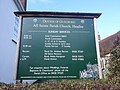
 All Saints Church, Burley Road, Thorney Hill (NHLE Code 1302198) (June 2022) (Signboard).JPG 1,600 × 2,600; 1.51 MB
-
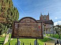
 All Saints Church, Catherington Lane, Catherington (May 2019) (Signboard).JPG 2,800 × 2,000; 2.48 MB
-
 All Saints Church, Church Lane, Braishfield (NHLE Code 1339105) (May 2021) (Signboard).jpg 2,800 × 2,000; 2.28 MB
-
 All Saints Church, Church Lane, East Meon (NHLE Code 1351116) (July 2019) (Signboard).JPG 2,200 × 2,000; 2.07 MB
-
 All Saints Church, Forge Road, Kingsley (NHLE Code 1094004) (May 2021) (Signboard).JPG 2,200 × 2,000; 1.91 MB
-
 All Saints Church, Headley, Hampshire 08.jpg 4,128 × 3,096; 4.93 MB
-
 All Saints Church, High Street, Headley (NHLE Code 1094029) (May 2021) (Signboard).JPG 2,000 × 1,600; 1.26 MB
-
 All Saints Church, Hordle Lane, Hordle (NHLE Code 1221328) (July 2021) (Signboard).JPG 2,400 × 1,800; 1.66 MB
-
 All Saints Church, Odiham 66.jpg 4,000 × 3,000; 4.22 MB
-
 All Saints' Church, East Stratton 11.jpg 3,000 × 4,000; 4.1 MB
-
 All Saints' Church, Farringdon, Hampshire 01.jpg 4,128 × 3,096; 5.83 MB
-
 All Saints' churchyard, Barton Stacey 01.jpg 3,000 × 4,000; 4.51 MB
-
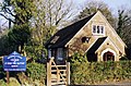
 Allbrook Evangelical Free Church, Allbrook Hill, Allbrook (June 2019) (Signboard).jpg 2,400 × 1,800; 1.91 MB
-
 Entrance to St Mary, Amport-geograph-2547925.jpg 640 × 480; 141 KB
-
 Anchor Community Church, Quob Lane, West End (May 2019) (Signboard).JPG 3,000 × 2,000; 2.73 MB
-
 St John the Baptist, Bashley - geograph.org.uk - 1508205.jpg 640 × 423; 156 KB
-
 Bench in the wall - geograph.org.uk - 806709.jpg 640 × 480; 113 KB
-
 St Mary's Church, Bentley, Hampshire 01.JPG 4,000 × 3,000; 3.15 MB
-

-

-
 St. Nicholas' Church, Bishops Sutton 03.JPG 2,816 × 2,112; 1.47 MB
-

-

-

-
 Brethren Meeting Room, off West Hill Road North, South Wonston (May 2021) (Signboard).JPG 3,408 × 2,000; 1.38 MB
-
 Cadnam Methodist Church, Old Romsey Road, Cadnam (July 2021) (Signboard).JPG 1,800 × 2,600; 1.49 MB
-
 Canada Common Methodist Church, Canada Common, near West Wellow (July 2021) (Signboard).jpg 1,400 × 2,600; 1.57 MB
-

-

-
 Christ Church, Hatherden Lane, Hatherden (NHLE Code 1093286) (July 2022) (Signboard).jpg 1,800 × 2,600; 2.06 MB
-
 Christ Church, Smannell Road, Smannell (NHLE Code 1236575) (July 2022) (Signboard).jpg 2,000 × 2,400; 2.05 MB
-
 Church in the Woods, Bramdean Common (July 2019) (Signboard).JPG 1,800 × 2,000; 1.52 MB
-

-

-

-
 Church of St Mary the Virgin, Silchester, Hampshire 18.jpg 4,128 × 3,096; 4.38 MB
-
-
 Crawley Gospel Hall, Peach Hill Lane, Crawley, Hampshire (May 2021) (Sign).JPG 2,000 × 1,600; 1.21 MB
-
 Crosslanes Chapel, Cross Lane, Mockbeggar (June 2022) (Signboard) (1).JPG 1,600 × 2,200; 907 KB
-
 Crosslanes Chapel, Cross Lane, Mockbeggar (June 2022) (Signboard) (2).JPG 2,000 × 2,800; 1.95 MB
-
 Crowe Hill Methodist Church, Crow Hill, Crow (June 2022) (Signboard).JPG 1,800 × 1,800; 802 KB
-
 East Boldre Baptist Church, Chapel Lane, East Boldre (July 2021) (Signboard).JPG 2,000 × 2,000; 1.24 MB
-
 Entrance to St Swithin's Southsea - geograph.org.uk - 718418.jpg 640 × 480; 100 KB
-
 Porch at St Andrew's Farlington - geograph.org.uk - 638518.jpg 640 × 480; 109 KB
-
 Welcome Notice Board - geograph.org.uk - 638532.jpg 480 × 640; 73 KB
-
 Four Marks Gospel Hall, 67 Winchester Road, Four Marks (July 2019) (Signboard).JPG 2,400 × 1,800; 2.07 MB
-
 Frogham Congregational Church, Blissford Hill, Frogham (June 2022) (Signboard).JPG 2,800 × 1,800; 1.54 MB
-
 Grace Baptist Church, Oak Bank, Andover (July 2022) (Signboard).jpg 400 × 600; 120 KB
-
 Bridge Church, Hayling Island - geograph.org.uk - 710203.jpg 640 × 480; 59 KB
-

-
 Hilary Church of the Nazarene, Salisbury Road, Cosham (August 2017) (Signboard).JPG 2,800 × 3,000; 1.78 MB
-
 Unusual church at Hillbrow - geograph.org.uk - 1437433.jpg 640 × 360; 56 KB
-
 Holy Cross Church, Church Street, Binsted (NHLE Code 1302151) (May 2021) (Signboard).JPG 2,000 × 2,600; 1.75 MB
-
 Holy Cross Church, Durley (NHLE Code 1350572) (May 2021) (Signboard).JPG 3,200 × 2,600; 1.57 MB
-
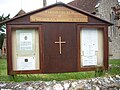
 Holy Rood Church, Church Lane, Empshott (NHLE Code 1094477) (May 2021) (Signboard).JPG 2,000 × 2,800; 2.05 MB
-
-

-

-
 1350689-CHURCH OF ST BARTHOLOMEW.jpg 3,912 × 4,016; 10.16 MB
-
 Hyde Church - geograph.org.uk - 1327148.jpg 640 × 428; 103 KB
-

-
-
 St John the Baptist Church, New Alresford 17.JPG 2,816 × 2,112; 1.48 MB
-

-

-
 Noticeboard at Chawton Parish Church - geograph.org.uk - 936486.jpg 640 × 480; 104 KB
-
 Old Church of St John, Greatham (NHLE Code 1094474) (July 2019) (Information Board).JPG 2,800 × 2,000; 2.27 MB
-
 Peel Common Mission Church, Newgate Lane, Peel Common, Fareham (April 2019) (Signboard).JPG 3,008 × 2,000; 2.68 MB
-
 Penton Mewsey - Holy Trinity Church - geograph.org.uk - 794702.jpg 640 × 480; 148 KB
-
 Priors Dean Church, Priors Dean (NHLE Code 1237077) (May 2021) (Signboard).JPG 2,000 × 3,008; 2.9 MB
-
 Saint Bartholomew's Church - geograph.org.uk - 2730594.jpg 640 × 480; 75 KB
-

-
 Sandy Lane Gospel Hall, Sandy Lane, Fair Oak (June 2019) (Signboard).JPG 2,000 × 2,200; 1.25 MB
-
 Seat outside St Mary Magdalen, Sheet - geograph.org.uk - 1195223.jpg 480 × 640; 106 KB
-
 Shalden Church, Hampshire 01.jpg 4,128 × 3,096; 7.79 MB
-
 Sign on Swanwick Shore Chapel - geograph.org.uk - 1436475.jpg 480 × 640; 109 KB
-
 Holy Family Catholic Church Sign - geograph.org.uk - 1719111.jpg 3,072 × 2,304; 1.27 MB
-
 St. Julien's church sign.JPG 2,304 × 3,072; 2.15 MB
-

-
 St Andrew's Church, Havant Road, Farlington (August 2017) (Signboard).JPG 3,000 × 3,800; 2.31 MB
-

-
 St Andrew's Church, Southwood Road, Hayling Island (May 2019) (Signboard).JPG 2,800 × 2,000; 1.74 MB
-
 St Columba's United Reformed Church, Elson Road, Elson, Gosport (April 2019) (Signboard).JPG 1,800 × 2,600; 2.05 MB
-
 St George's Church, Chapel Lane, Enham Alamein (July 2022) (Information Panel).jpg 3,000 × 2,000; 2.52 MB
-
 St George's Church, Chapel Lane, Enham Alamein (July 2022) (Signboard).jpg 2,000 × 2,200; 2.06 MB
-
 St George's Church, Church Lane, Damerham (NHLE Code 1094925) (June 2022) (Signboard).JPG 1,600 × 2,200; 1.74 MB
-

-

-
 St James's Church, Church Hill, West End (May 2019) (Signboard).JPG 2,200 × 1,800; 1.45 MB
-

-
 St John the Baptist's Church, Alexandra Road, Andover (July 2022) (Signboard).jpg 2,000 × 2,000; 1.43 MB
-

-

-
 St John the Baptist's Church, Church Road, Locks Heath (May 2019) (Signboard).JPG 1,800 × 1,800; 1.4 MB
-

-

-

-

-
 St John's Church, Horns Drove, Rownhams (NHLE Code 1093673) (July 2021) (Signboard).jpg 2,000 × 2,400; 1.99 MB
-

-
 St Luke's Church, Hedge End - sign - geograph.org.uk - 1427883.jpg 480 × 640; 131 KB
-

-
 St Mary Magdalene's Church, West Tisted (NHLE Code 1351153) (July 2019) (Signboard).JPG 1,800 × 2,000; 1.36 MB
-

-

-

-
 St Mary's Church, Abbotts Ann Road, Monxton (NHLE Code 1093882) (July 2022) (Signboard).jpg 2,000 × 2,600; 1.25 MB
-
 St Mary's Church, Church Lane, Bentley (NHLE Code 1094090) (May 2021) (Signboard).JPG 1,800 × 2,800; 2.08 MB
-
 St Mary's Church, Church Road, Hayling Island (May 2019) (Signboard).JPG 3,000 × 2,000; 2.16 MB
-
 St Mary's Church, Church Road, Portchester (May 2019) (Noticeboard).JPG 2,400 × 2,000; 2.14 MB
-
 St Mary's Church, Eling Hill, Eling (NHLE Code 1094344) (June 2022) (Signboard).JPG 1,600 × 1,600; 992 KB
-
 St Mary's Church, Peach Hill Lane, Crawley (NHLE Code 1350455) (May 2021) (Signboard).JPG 2,400 × 2,000; 2.11 MB
-
 St Mary's Church, Tufton (NHLE Code 1175684) (July 2022) (Signboard).jpg 2,000 × 3,000; 2.15 MB
-
 St Matthew's Church, Otterbourne Hill, Otterbourne (June 2019) (Signboard).JPG 2,800 × 2,000; 1.92 MB
-

-

-

-

-
 St Michael's Church, Park Lane, Quarley (NHLE Code 1339411) (July 2022) (Signboard).jpg 2,600 × 2,000; 1.81 MB
-

-
 St Nicholas' Church, Battenburg Avenue, Hilsea (March 2019) (Signboard).JPG 2,000 × 2,800; 2.51 MB
-
 St Nicholas' Church, Newnham, Hampshire 01.jpg 4,128 × 3,096; 5.64 MB
-
 St Nicholas' Church, Newnham, Hampshire 03.jpg 4,128 × 3,096; 4.48 MB
-
 St Paul's Church, B3347, Bisterne (NHLE Code 1095023) (June 2022) (Signboard).JPG 2,000 × 1,800; 1.48 MB
-

-

-
-
 St Peter's Church, Judds Hill, Bramshaw (NHLE Code 1301290) (July 2021) (Signboard).JPG 1,600 × 2,200; 1.69 MB
-

-
 St Peter's Church, Wellhouse Road, Beech (July 2019) (Signboard).JPG 2,000 × 1,800; 1.22 MB
-
 St Stephen's Church, Up Nately, Hampshire 32.jpg 4,128 × 3,096; 5.07 MB
-

-

-
 St Thomas a Becket's Church, Church Lane, Warblington (May 2019) (Signboard).JPG 2,000 × 2,400; 2.15 MB
-

-
 St. Peter's International Presbyterian Church, Liss 01.jpg 4,128 × 3,096; 4.59 MB
-
 St. Thomas' Church, Bedhampton 56.jpg 4,128 × 3,096; 4.72 MB
-
 Standford Gospel Hall, Standford Hill, Standford (July 2019) (Signboard).JPG 2,200 × 1,800; 1.28 MB
-
 Swanmore Methodist Church, Chapel Road, Swanmore (May 2019) (Signboard).JPG 2,400 × 1,600; 1.28 MB
-
 Duncan Road Church, Swanwick - geograph.org.uk - 608666.jpg 640 × 480; 64 KB
-
 The Welcome Gospel Hall, High Street, Winchester (June 2019) (Signboard).JPG 1,800 × 2,800; 1.77 MB
-

-
 Waterside Methodist Church, Chapel Lane, Fawley (July 2021) (Signboard).JPG 1,000 × 1,400; 603 KB
-
 Welcome board at Drayton Methodists - geograph.org.uk - 714174.jpg 640 × 480; 64 KB
-
 Wellow Wood Methodist Church, Wellow Wood Road, Plaitford Green (July 2021) (Signboard).jpg 1,400 × 1,800; 1.05 MB
-
 West Wellow Methodist Church, Maurys Lane, West Wellow (July 2021) (Signboard).jpg 2,600 × 2,000; 2.03 MB
-
 Parish notice board, Chilcomb - geograph.org.uk - 436373.jpg 427 × 640; 229 KB
_(June_2022)_(Signboard).JPG)
_(Signboard).JPG)
_(May_2021)_(Signboard).jpg)
_(July_2019)_(Signboard).JPG)
_(May_2021)_(Signboard).JPG)

_(May_2021)_(Signboard).JPG)
_(July_2021)_(Signboard).JPG)


_(Signboard).jpg)

_(Signboard).JPG)


_(Signboard).JPG)
_(Signboard).JPG)

,_107_Barlows_Lane,_Andover_(July_2022)_(Sign).jpg)
,_Tower_Road,_Liphook_(July_2019)_(Sign).JPG)
_(Sign).JPG)
_(Signboard).JPG)
_(Signboard).JPG)
_(Signboard).jpg)
_(Signboard).jpg)
_(July_2021)_(Signboard_and_Sculpture).JPG)
_(July_2022)_(Signboard).jpg)
_(July_2022)_(Signboard).jpg)
_(Signboard).JPG)
_(Information_Sign).JPG)
_(Signboard).JPG)
_(July_2022)_(Signboard).jpg)

_(July_2021)_(Signboard).JPG)
_(Sign).JPG)
_(Signboard)_(1).JPG)
_(Signboard)_(2).JPG)
_(Signboard).JPG)
_(Signboard).JPG)


_(Signboard).JPG)
_(Signboard).JPG)
_(Signboard).jpg)

_(Signboard).JPG)
_(Signboard).JPG)

_(May_2021)_(Signboard).JPG)
_(May_2021)_(Signboard).JPG)
_(May_2021)_(Signboard).JPG)

_(July_2022)_(Signboard).jpg)
_(May_2019)_(Signboard).JPG)


,_Copse_Lane,_Rowner,_Gosport_(April_2019)_(Signboard).JPG)


_(July_2019)_(Information_Board).JPG)
_(Signboard).JPG)

_(May_2021)_(Signboard).JPG)

,_Alderholt_Road,_Sandleheath_(June_2022)_(Signboard).JPG)
_(Signboard).JPG)


_(July_2022)_(Signboard).jpg)
_(Signboard).JPG)
_(July_2021)_(Signboard).jpg)
_(Signboard).JPG)
_(Signboard).JPG)
_(Information_Panel).jpg)
_(Signboard).jpg)
_(June_2022)_(Signboard).JPG)
_(June_2022)_(St_George_Sign_on_Lane).JPG)

_(Signboard).JPG)
_(July_2019)_(Signboard).JPG)
_(Signboard).jpg)
_(July_2021)_(Signboard).JPG)
_(June_2022)_(Signboard).JPG)
_(Signboard).JPG)
_(July_2019)_(Signboard).JPG)
_(July_2019)_(Signboard).JPG)
_(July_2019)_(Signboard).JPG)
_(July_2019)_(Signboard).JPG)
_(July_2021)_(Signboard).jpg)
_(July_2022)_(Signboard).jpg)

_(July_2021)_(Signboard).jpg)
_(July_2019)_(Signboard).JPG)

_(June_2019)_(Signboard).JPG)
_(June_2022)_(Signboard).JPG)
_(July_2022)_(Signboard).jpg)
_(May_2021)_(Signboard).JPG)
_(Signboard).JPG)
_(Noticeboard).JPG)
_(June_2022)_(Signboard).JPG)
_(May_2021)_(Signboard).JPG)
_(July_2022)_(Signboard).jpg)
_(Signboard).JPG)
_(June_2022)_(Signboard).JPG)
_(July_2022)_(Signboard).jpg)
_(July_2019)_(Signboard).JPG)
_(July_2022)_(Signboard).jpg)
_(July_2022)_(Signboard).jpg)
_(Sign_on_Doorway).JPG)
_(Signboard).JPG)


_(June_2022)_(Signboard).JPG)
_(July_2022)_(Signboard).jpg)
_(July_2022)_(Signboard).jpg)
_(July_2019)_(Signboard).JPG)
_(July_2021)_(Signboard).JPG)
_(July_2022)_(Signboard).jpg)
_(Signboard).JPG)

_(July_2019)_(Signboard).JPG)
_(June_2019)_(Signboard).JPG)
_(Signboard).JPG)
_(July_2022)_(Signboard).jpg)


_(Signboard).JPG)
_(Signboard).JPG)

_(Signboard).JPG)
_(July_2019)_(Signboard).JPG)
_(Signboard).JPG)

_(Signboard).jpg)
_(Signboard).jpg)
