Category:Cheadle, Staffordshire
Jump to navigation
Jump to search
English: Cheadle is a small market town near Stoke-on-Trent, Staffordshire, England, with a population of 12,158 according to the 2001 census. It is roughly from the Alton Towers leisure park.
Italiano: Cheadle è una cittadina di 12.158 abitanti, situata nella contea dello Staffordshire in Inghilterra.
Svenska: Cheadle är en liten köpstad nära Stoke-on-Trent i Staffordshire, England. Staden har 12 158 invånare (2001). Cheadle ligger 18 kilometer från Stoke-on-Trent, 80 kilometer norr om Birmingham och 80 kilometer söder om Manchester. Den ligger också cirka 8 kilometer från nöjesparken Alton Towers.
small market town near Stoke-on-Trent, Staffordshire, England  | |||||
| Upload media | |||||
| Instance of | |||||
|---|---|---|---|---|---|
| Location | Staffordshire Moorlands, Staffordshire, West Midlands, England | ||||
| Population |
| ||||
| Different from | |||||
| official website | |||||
 | |||||
Subcategories
This category has the following 9 subcategories, out of 9 total.
Media in category "Cheadle, Staffordshire"
The following 180 files are in this category, out of 180 total.
-
 12 and 14 Cross Street, Cheadle.jpg 1,600 × 1,200; 490 KB
-
 2 4 and 6 Cross Street, Cheadle.jpg 1,600 × 1,200; 587 KB
-
 A52 and milepost, Above Park - geograph.org.uk - 1879492.jpg 640 × 481; 195 KB
-
 A52 and milepost, Blakeley Lane - geograph.org.uk - 1879473.jpg 640 × 480; 140 KB
-
 A522 heading south, Cheadle - geograph.org.uk - 4070699.jpg 640 × 480; 57 KB
-
 A522 heading south, Teanford - geograph.org.uk - 4071101.jpg 640 × 480; 65 KB
-
 Aerial Mast former CSOS, Cheadle, Staffs.JPG 3,840 × 2,880; 5.04 MB
-
 Approaching Cheadle - geograph.org.uk - 2859372.jpg 1,024 × 769; 281 KB
-

-
 Ashboune 11 miles - geograph.org.uk - 4533621.jpg 640 × 480; 53 KB
-
 Ashbourne Road (B5032) - geograph.org.uk - 4533613.jpg 640 × 480; 76 KB
-
 Ashbourne Road (B5032) - geograph.org.uk - 4533618.jpg 640 × 480; 77 KB
-
 Ashbourne Road, Cheadle - geograph.org.uk - 2859589.jpg 4,000 × 2,248; 1.65 MB
-
 At the top of the hill is Croxden Quarry - geograph.org.uk - 2859828.jpg 4,000 × 2,248; 1.98 MB
-
 B5032 from east towards Cheadle - geograph.org.uk - 2859824.jpg 4,000 × 2,248; 2.38 MB
-
 Baddeley Street, Cheadle - geograph.org.uk - 4070705.jpg 640 × 480; 62 KB
-
 Bank Street, Cheadle - geograph.org.uk - 5017366.jpg 1,600 × 1,200; 601 KB
-
 Bate Lane - geograph.org.uk - 4533463.jpg 640 × 480; 62 KB
-
 Birchenfields Lane - geograph.org.uk - 4578331.jpg 640 × 480; 70 KB
-
 Boxing Day 2004.jpg 1,600 × 1,200; 418 KB
-
 Bramshaws Acre, Cheadle - geograph.org.uk - 2192491.jpg 640 × 480; 89 KB
-
 Brookhouse Road - geograph.org.uk - 4070453.jpg 640 × 480; 62 KB
-
 Car at home 5.2.12.JPG 3,840 × 2,880; 5.14 MB
-
 Cecilly Mills demolition and Cecilly Brook - geograph.org.uk - 5446799.jpg 1,280 × 960; 467 KB
-
 Cheadle Staffordshire old council offices.JPG 3,840 × 2,880; 5.15 MB
-
 Cheadle Community Fire Station - geograph.org.uk - 2859364.jpg 1,024 × 769; 153 KB
-
 Cheadle Community Fire Station - geograph.org.uk - 4539300.jpg 640 × 480; 44 KB
-
 Cheadle fire station - geograph.org.uk - 1909615.jpg 640 × 427; 179 KB
-
 Cheadle Police Station - geograph.org.uk - 3172719.jpg 1,024 × 768; 112 KB
-
 Cheadle Police Station - geograph.org.uk - 4070665.jpg 640 × 467; 62 KB
-
 Cheadle Post Office - geograph.org.uk - 3172712.jpg 1,024 × 768; 145 KB
-
 Cheadle Remembers the War Horse - geograph.org.uk - 4605614.jpg 1,600 × 1,067; 467 KB
-
 Cheadle Staffs (Crafty Urchin).JPG 2,880 × 3,840; 5.08 MB
-
 Cheadle Staffs (The Round House).JPG 3,840 × 2,880; 1.34 MB
-
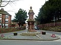
 Cheadle water fountain, churchyard.JPG 3,840 × 2,880; 5.11 MB
-
 Cheadle, "The Fountain" Staffordshire.JPG 2,880 × 3,840; 4.96 MB
-
 Cheadle, Cross Street - geograph.org.uk - 4939319.jpg 3,678 × 2,456; 4.59 MB
-
 Cheadle, electricity substation on Froghall Road - geograph.org.uk - 4455084.jpg 3,190 × 2,222; 2.18 MB
-
 Cheadle, footpath at end of Highfield Avenue - geograph.org.uk - 4369739.jpg 3,237 × 2,066; 2.41 MB
-
 Cheadle, Froghall Road looking north - geograph.org.uk - 4858350.jpg 3,264 × 2,448; 1.87 MB
-
 Cheadle, Highfield Avenue - geograph.org.uk - 4516748.jpg 3,249 × 1,839; 1.8 MB
-
 Cheadle, junction of Highfield Avenue and Froghall Road - geograph.org.uk - 4369733.jpg 3,164 × 2,161; 2.14 MB
-
 Cheadle, Morrisons - geograph.org.uk - 4762342.jpg 2,448 × 2,448; 1.19 MB
-
 Cheadle, Morrisons car park - geograph.org.uk - 4455102.jpg 3,264 × 2,448; 2.26 MB
-
 Church street, Cheadle.JPG 3,840 × 2,880; 4.95 MB
-
 Clamgoose Lane - geograph.org.uk - 4533482.jpg 640 × 480; 82 KB
-
 Closed Road Across Croxden Quarry - geograph.org.uk - 458895.jpg 640 × 480; 46 KB
-

-

-
 Crossroads at Brookhouses - geograph.org.uk - 4096370.jpg 1,600 × 1,200; 585 KB
-
 Culvert under the former Woodhead Tramroad - geograph.org.uk - 5446895.jpg 1,280 × 960; 677 KB
-
 Door, Les Oakes's Place - geograph.org.uk - 60658.jpg 432 × 640; 98 KB
-
 Draycott Cross Road, Brookhouses - geograph.org.uk - 4097346.jpg 1,600 × 1,200; 834 KB
-
 Draycott Cross Road, Brookhouses - geograph.org.uk - 4097368.jpg 1,200 × 1,600; 679 KB
-
 Drinking Fountain, Cheadle.jpg 1,024 × 768; 187 KB
-

-
 Farm building, Parkford Farm - geograph.org.uk - 4533464.jpg 640 × 480; 58 KB
-

-
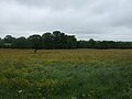
 Farmland off Bate Lane - geograph.org.uk - 4533459.jpg 640 × 480; 72 KB
-
 Farmland off Leek Road (A522) - geograph.org.uk - 4533604.jpg 640 × 480; 59 KB
-
 Field entrance off Clamgoose Lane - geograph.org.uk - 4533479.jpg 640 × 480; 84 KB
-
 First Buses Stoke on Trent (17122168451).jpg 1,658 × 1,218; 1.29 MB
-

-
 Footpath leaving Cheadle - geograph.org.uk - 2860044.jpg 768 × 1,024; 356 KB
-
 Footpath to Cheadle Grange - geograph.org.uk - 4626708.jpg 3,648 × 2,736; 2.89 MB
-
 Footpath to Dark Lane - geograph.org.uk - 4626722.jpg 1,200 × 900; 396 KB
-
 Former church in Charles Street, Cheadle - geograph.org.uk - 5017350.jpg 1,600 × 1,200; 683 KB
-
 Former workshop - geograph.org.uk - 3091339.jpg 2,592 × 1,936; 2.33 MB
-
 Freehay shop nr Cheadle Staffs.JPG 3,840 × 2,880; 5.13 MB
-
 From Huntley Wood towards Mobberley - geograph.org.uk - 2859671.jpg 4,000 × 3,000; 3.12 MB
-

-
 G-WPDB, Western Power,...JPG 2,374 × 1,746; 195 KB
-
 G-WPDB, Western Power...JPG 3,146 × 1,722; 296 KB
-
 G-WPDB, Western Power..JPG 1,595 × 1,220; 133 KB
-
 Gateway and sleeper on the Woodhead Tramroad - geograph.org.uk - 5446890.jpg 1,280 × 960; 792 KB
-
 Grass fields below Hill Top Farm - geograph.org.uk - 2859387.jpg 1,024 × 769; 174 KB
-
 Grazing and woodland - geograph.org.uk - 4533616.jpg 640 × 480; 77 KB
-
 Grazing east of Mobberley - geograph.org.uk - 4071089.jpg 640 × 480; 82 KB
-
 Grazing near Parkford Farm - geograph.org.uk - 4533475.jpg 640 × 480; 61 KB
-
 Grazing, Brookhouses - geograph.org.uk - 4070451.jpg 640 × 480; 76 KB
-
 Green Finchin.JPG 806 × 661; 119 KB
-
 Greendale Farm - geograph.org.uk - 2988377.jpg 1,200 × 900; 202 KB
-
 Houses on Sun Street, Cheadle - geograph.org.uk - 4070670.jpg 640 × 406; 65 KB
-
 Huntley Wood - geograph.org.uk - 2859643.jpg 4,000 × 2,248; 2.86 MB
-
 Huntley Wood quarry - geograph.org.uk - 2859662.jpg 4,000 × 2,248; 2.29 MB
-
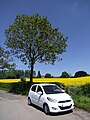 Hyundai i.10, Cheadle Staffs.JPG 2,880 × 3,840; 1.79 MB
-
 Hyundai, i10.JPG 3,840 × 2,880; 1.49 MB
-
 Icicles in Cheadle.JPG 3,785 × 2,528; 1.56 MB
-
 In Huntley Wood - geograph.org.uk - 2860035.jpg 1,024 × 768; 389 KB
-
 Ivy-smothered house - geograph.org.uk - 4616347.jpg 1,200 × 900; 546 KB
-
 Jackdaws admiring the view.JPG 3,840 × 2,880; 5.32 MB
-
 JCB Compact Products - geograph.org.uk - 221135.jpg 640 × 500; 45 KB
-
 JCB Earthmovers - geograph.org.uk - 221132.jpg 640 × 442; 50 KB
-
 JCB Earthmovers - geograph.org.uk - 4578478.jpg 640 × 480; 36 KB
-
 JCB test track, NW of Cheadle - geograph.org.uk - 5607592.jpg 5,184 × 2,920; 4.82 MB
-
 Joining Leek Road (A522) - geograph.org.uk - 4578337.jpg 640 × 480; 68 KB
-
 Junction View - geograph.org.uk - 5918360.jpg 800 × 561; 94 KB
-

-
 Kingsley, Thornbury Hall - geograph.org.uk - 4688419.jpg 1,024 × 768; 295 KB
-
 Lake Near Hawksmoor Wood, Staffordshire Way - geograph.org.uk - 6509580.jpg 2,000 × 1,333; 2.75 MB
-
 Lane near Parkford Farm - geograph.org.uk - 4533472.jpg 640 × 480; 90 KB
-
 Leek Road (A522) - geograph.org.uk - 4533606.jpg 640 × 480; 90 KB
-
 Les Oakes Place, Cheadle - geograph.org.uk - 1602792.jpg 640 × 231; 47 KB
-
 Les Oaks ^ Son's, Cheadle - geograph.org.uk - 5071567.jpg 1,500 × 1,004; 1.26 MB
-
 Light industry on the edge of Cheadle - geograph.org.uk - 479643.jpg 640 × 454; 84 KB
-
 Lockwood Hall Farm - geograph.org.uk - 4616333.jpg 1,200 × 900; 389 KB
-
 Looking down the Gibridding Incline - geograph.org.uk - 4626845.jpg 3,500 × 2,625; 3.69 MB
-
 Majors Barn, Brookhouses - geograph.org.uk - 4070476.jpg 640 × 480; 67 KB
-
 Memorials in the churchyard - geograph.org.uk - 3091349.jpg 1,936 × 2,592; 2 MB
-
 Men and Animals of the Great War - geograph.org.uk - 4961531.jpg 3,632 × 5,086; 3.08 MB
-
 Methodist Church, Cheadle - geograph.org.uk - 2096522.jpg 1,496 × 1,122; 473 KB
-
 Methodist Church, Cheadle - geograph.org.uk - 4070664.jpg 640 × 480; 64 KB
-
 Milepost, Above Park - geograph.org.uk - 1879500.jpg 480 × 640; 191 KB
-
 Milestone, Harewood.jpg 1,496 × 1,704; 492 KB
-
 Milestone, Leek Road, Cheadle.jpg 492 × 701; 59 KB
-

-
 Minor road near Birchenfields Farm - geograph.org.uk - 4578333.jpg 640 × 480; 74 KB
-
 Minor road towards the A522 - geograph.org.uk - 4578335.jpg 640 × 480; 89 KB
-
 Mobberley Brook - geograph.org.uk - 4071082.jpg 478 × 640; 126 KB
-
 Mushrooms^ Near Newfields Farm, Cheadle - geograph.org.uk - 2859630.jpg 4,000 × 2,248; 2.9 MB
-
 Nature taking over at north end of Croxden Quarry - geograph.org.uk - 2859822.jpg 4,000 × 2,248; 1.9 MB
-
 New Haden Road - geograph.org.uk - 480761.jpg 640 × 480; 99 KB
-

-

-
 Old road from Oakamoor to Cheadle - geograph.org.uk - 2046434.jpg 1,200 × 900; 260 KB
-
 Ollie, Boxing Day 2004 027 (cropped).jpg 688 × 687; 122 KB
-
 Ollie, Boxing Day 2004 027.jpg 1,053 × 859; 239 KB
-
 Our Home.JPG 3,840 × 2,880; 5.29 MB
-
 Parkhall Tramway bridge pier - geograph.org.uk - 5446848.jpg 1,280 × 960; 482 KB
-
 Parkhall Tramway embankment - geograph.org.uk - 5446854.jpg 1,280 × 960; 435 KB
-
 Plant Street, Cheadle - geograph.org.uk - 2192487.jpg 640 × 480; 64 KB
-
 Pond and old trailer by East Wall Farm - geograph.org.uk - 2153905.jpg 1,024 × 768; 263 KB
-
 Post office, Cheadle - geograph.org.uk - 1928097.jpg 1,866 × 1,346; 359 KB
-
 Post Office, Cheadle - geograph.org.uk - 4539302.jpg 640 × 480; 61 KB
-
 Railway bridge at Huntley - geograph.org.uk - 2860027.jpg 1,024 × 768; 299 KB
-
 Rape Field with Copper Beech tree.JPG 3,840 × 2,880; 5.14 MB
-
 Rhododendron Farm looking over Winnothdale - geograph.org.uk - 2859788.jpg 3,936 × 2,128; 1.74 MB
-
 Road towards supermarket, Cheadle - geograph.org.uk - 4070677.jpg 640 × 480; 70 KB
-
 Roman Catholic school, Cheadle - geograph.org.uk - 1912230.jpg 2,000 × 1,500; 476 KB
-
 Sand and gravel pit undergoing restoration - geograph.org.uk - 2859803.jpg 4,000 × 2,248; 1.59 MB
-
 School by Pugin - geograph.org.uk - 3091344.jpg 2,592 × 1,936; 2.09 MB
-
 Service station, Brookhouses - geograph.org.uk - 4070469.jpg 640 × 480; 76 KB
-
 South Moorlands Leisure Centre - geograph.org.uk - 224884.jpg 640 × 640; 53 KB
-
 Spooner and Son.JPG 3,048 × 2,472; 1,007 KB
-
 Spring at East Wall - geograph.org.uk - 4615262.jpg 1,200 × 900; 609 KB
-
 St Giles' School, Cheadle.jpg 3,678 × 2,456; 4.82 MB
-
 Stables in Winnothdale - geograph.org.uk - 2859511.jpg 1,024 × 770; 250 KB
-
 Steep track at the edge of Gibridding Wood - geograph.org.uk - 4626823.jpg 3,648 × 2,736; 3.56 MB
-
 Tape Street, Cheadle - geograph.org.uk - 5016408.jpg 1,600 × 1,200; 506 KB
-
 Tean Road, Mobberley (A522) - geograph.org.uk - 4071083.jpg 640 × 480; 72 KB
-
 Teanford Lane - geograph.org.uk - 4071098.jpg 640 × 480; 68 KB
-

-
 The A521 through Brookhouses - geograph.org.uk - 4070474.jpg 640 × 480; 79 KB
-
 The Blakeley Lane milepost in its setting - geograph.org.uk - 1731693.jpg 1,126 × 845; 167 KB
-
 The drive to Litley Farm - geograph.org.uk - 2860040.jpg 1,024 × 768; 249 KB
-
 The Gibridding Incline on the Woodhead Tramroad - geograph.org.uk - 4616502.jpg 1,200 × 900; 676 KB
-
 The Green - geograph.org.uk - 4070472.jpg 640 × 480; 66 KB
-
 The Pipits, Freehay - geograph.org.uk - 2859500.jpg 1,024 × 768; 292 KB
-
 The Terrace (A521), Cheadle - geograph.org.uk - 4070652.jpg 640 × 480; 89 KB
-

-
 The Woodhead Tramroad - geograph.org.uk - 4616467.jpg 1,200 × 900; 454 KB
-
 Tollgate House, Cheadle.jpg 1,022 × 768; 108 KB
-
 Top of Gorsty Hill Road - geograph.org.uk - 2859773.jpg 4,000 × 2,514; 2.16 MB
-
 Twisty section of Leek Road (A522) - geograph.org.uk - 4578339.jpg 640 × 480; 66 KB
-
 View towards JCB works from path NW of Cheadle - geograph.org.uk - 5607588.jpg 5,184 × 2,920; 6.03 MB
-
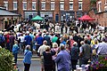
 War horses in Cross Street - geograph.org.uk - 4605672.jpg 1,064 × 1,600; 325 KB
-
 War horses in the Market Square - geograph.org.uk - 4605643.jpg 1,064 × 1,600; 419 KB
-
 Well Street, Cheadle - geograph.org.uk - 5016418.jpg 1,600 × 1,200; 637 KB
-
 Well Street, Cheadle - geograph.org.uk - 5016444.jpg 1,600 × 1,200; 603 KB
-
 Woodhead Tramroad embankment - geograph.org.uk - 4616530.jpg 1,200 × 900; 557 KB
-
 Woodhead Tramroad embankment - geograph.org.uk - 5446910.jpg 1,280 × 960; 589 KB
-
 Ye Olde Oatcake Shoppe, Cheadle - geograph.org.uk - 4842826.jpg 640 × 480; 87 KB
-
 Entrance to Hillside Industrial Park - geograph.org.uk - 480752.jpg 640 × 480; 83 KB
-
 Factory units at Brookhouses - geograph.org.uk - 480775.jpg 640 × 480; 98 KB
-

-
 Les Oakes's Place - geograph.org.uk - 60657.jpg 640 × 426; 67 KB
-
 Modern housing off Dilhorne Road - geograph.org.uk - 480839.jpg 640 × 475; 86 KB
-
 The Bethel - geograph.org.uk - 224454.jpg 640 × 480; 110 KB
-
 The ex-Wagon and Horses - geograph.org.uk - 531918.jpg 640 × 392; 62 KB
-
 The Sidings - geograph.org.uk - 224881.jpg 640 × 480; 102 KB


_-_geograph.org.uk_-_4533613.jpg)
_-_geograph.org.uk_-_4533618.jpg)


.JPG)
.JPG)


_-_geograph.org.uk_-_4533611.jpg)

_-_geograph.org.uk_-_4533604.jpg)

.jpg)


_-_geograph.org.uk_-_4578337.jpg)


_-_geograph.org.uk_-_4533606.jpg)


.jpg)

.jpg)


_-_geograph.org.uk_-_4071083.jpg)


,_Cheadle_-_geograph.org.uk_-_4070652.jpg)


_-_geograph.org.uk_-_4578339.jpg)


