Category:Cheadle, Greater Manchester
Jump to navigation
Jump to search
English: Cheadle is a village in the Metropolitan Borough of Stockport in Greater Manchester, England. It borders the districts of Cheadle Hulme, Gatley, Heald Green and Cheadle Heath in Stockport, and the Parrs Wood area of Manchester. As of 2001 it had a population of 14,261.
suburban village in the Metropolitan Borough of Stockport, Greater Manchester, England  | |||||
| Upload media | |||||
| Instance of | |||||
|---|---|---|---|---|---|
| Location | Stockport, Greater Manchester, North West England, England | ||||
| Area |
| ||||
| Different from | |||||
 | |||||
Subcategories
This category has the following 4 subcategories, out of 4 total.
H
T
Media in category "Cheadle, Greater Manchester"
The following 200 files are in this category, out of 230 total.
(previous page) (next page)-
 "Sea It Fresh" open on Good Friday - geograph.org.uk - 2884401.jpg 640 × 427; 100 KB
-
 A driveway of Bruntwood Park - geograph.org.uk - 4634505.jpg 3,569 × 2,379; 2.34 MB
-
 A duck pond, Cheadle Royal Business Park - geograph.org.uk - 2161442.jpg 3,968 × 2,232; 4.19 MB
-
 A house on Bruntwood Lane, Cheadle - geograph.org.uk - 1536181.jpg 640 × 360; 95 KB
-
 A house, Bruntwood Lane, Cheadle - geograph.org.uk - 1536829.jpg 640 × 360; 91 KB
-
 A long way back from the lights - geograph.org.uk - 6023339.jpg 6,032 × 4,014; 4.84 MB
-
 A pre-Worboys No Through Road sign - geograph.org.uk - 4652903.jpg 1,000 × 1,000; 894 KB
-
 A unit on Hercules Office Park - geograph.org.uk - 3689944.jpg 3,872 × 2,592; 2.74 MB
-
 A wet morning on Lakeside office complex - geograph.org.uk - 3969203.jpg 1,024 × 768; 142 KB
-
 A34 Kingsway - geograph.org.uk - 52432.jpg 640 × 480; 68 KB
-
 A34 underpass cheadle.jpg 3,024 × 4,032; 6.01 MB
-

-
 Access path to Bruntwood Park - geograph.org.uk - 3329409.jpg 3,421 × 2,281; 2.07 MB
-

-
 Adswood Railway Bridge - geograph.org.uk - 77802.jpg 640 × 480; 146 KB
-
 Aerial View of Kingsway School, Cheadle - geograph.org.uk - 5048716.jpg 640 × 480; 504 KB
-
 An old Cheadle ^ Gatley U.D.C. sign - geograph.org.uk - 4654043.jpg 1,000 × 882; 598 KB
-
 Apartments on the A560 - geograph.org.uk - 2828943.jpg 3,646 × 2,255; 3.45 MB
-
 Atlas House - geograph.org.uk - 3689920.jpg 3,872 × 2,592; 2.78 MB
-
 Barclays Bank - geograph.org.uk - 1969553.jpg 640 × 507; 126 KB
-
 Barnes Hospital from the air (geograph 4032946).jpg 640 × 511; 209 KB
-
 Beautiful garden in Cheadle - geograph.org.uk - 6294353.jpg 4,000 × 3,000; 2.88 MB
-
 Box by Micker Brook weir, Cheadle - geograph.org.uk - 1901028.jpg 640 × 640; 577 KB
-
 Bradshaw Aggregates, Cheadle - geograph.org.uk - 4698839.jpg 1,024 × 768; 429 KB
-
 Brick railway arch spanning Brook Road - geograph.org.uk - 3390475.jpg 3,259 × 2,172; 1.65 MB
-
 Bridge over stream at Cheadle Royal Business Park (geograph 6719261).jpg 3,456 × 4,608; 6.99 MB
-
 Brooklyn Park - geograph.org.uk - 1539651.jpg 640 × 446; 157 KB
-
 Brooklyn Park - geograph.org.uk - 1539788.jpg 538 × 640; 188 KB
-
 Brooklyn Park Bench - geograph.org.uk - 1539758.jpg 640 × 480; 169 KB
-
 Bruntwood Hall from the air - geograph.org.uk - 5955075.jpg 1,024 × 524; 241 KB
-
 Bruntwood Hall, Cheadle - geograph.org.uk - 1533378.jpg 640 × 459; 82 KB
-
 Bruntwood Park, Cheadle - geograph.org.uk - 6719232.jpg 4,608 × 3,456; 7.48 MB
-
 Bruntwood Park, Cheadle - geograph.org.uk - 6719237.jpg 4,608 × 3,456; 7.56 MB
-
 Bruntwood Park, Cheadle - geograph.org.uk - 6719239.jpg 4,608 × 3,456; 7.03 MB
-
 Bulkeley Road - geograph.org.uk - 4575551.jpg 1,000 × 640; 511 KB
-
 Bulkeley Road - geograph.org.uk - 4652887.jpg 1,000 × 789; 569 KB
-
-
 Canada Geese at Cheadle Royal Business Park.jpg 4,032 × 3,024; 4.52 MB
-
 Canada Geese, Cheadle.jpg 4,032 × 3,024; 5.67 MB
-
 Carpet right - geograph.org.uk - 2949958.jpg 640 × 520; 129 KB
-
 Cheadle Angling Club - geograph.org.uk - 1952720.jpg 640 × 480; 202 KB
-
 Cheadle Bridge - geograph.org.uk - 1952725.jpg 640 × 480; 183 KB
-
 Cheadle Bridge, River Mersey - geograph.org.uk - 3515031.jpg 640 × 480; 107 KB
-
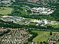
 Cheadle College from the air - geograph.org.uk - 5904812.jpg 1,600 × 1,065; 711 KB
-
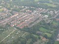 Cheadle from the air - geograph.org.uk - 3140813.jpg 3,264 × 2,448; 3.44 MB
-
 Cheadle from the air - geograph.org.uk - 4029817.jpg 640 × 480; 237 KB
-
 Cheadle from the air - geograph.org.uk - 4029831.jpg 640 × 480; 253 KB
-
 Cheadle from the air - geograph.org.uk - 4029842.jpg 640 × 480; 245 KB
-
 Cheadle Golf Course - geograph.org.uk - 2624919.jpg 640 × 480; 200 KB
-
 Cheadle Green - geograph.org.uk - 3061613.jpg 640 × 480; 240 KB
-
 Cheadle Green - geograph.org.uk - 4560579.jpg 1,000 × 750; 759 KB
-
 Cheadle Green - geograph.org.uk - 4560626.jpg 1,000 × 750; 720 KB
-
 Cheadle House - geograph.org.uk - 4653891.jpg 1,000 × 1,000; 783 KB
-

-
 Cheadle Makers Market - geograph.org.uk - 4560413.jpg 1,000 × 762; 844 KB
-
 Cheadle Makers Market on Cheadle Green - geograph.org.uk - 4560407.jpg 1,000 × 750; 737 KB
-
 Cheadle Post Office - geograph.org.uk - 2167522.jpg 800 × 600; 287 KB
-
 Cheadle Post Office, Old Rectory Gardens - geograph.org.uk - 1900901.jpg 640 × 480; 521 KB
-

-
 Cheadle Royal - geograph.org.uk - 2167511.jpg 800 × 600; 279 KB
-
 Cheadle Royal Business Park - geograph.org.uk - 1190356.jpg 600 × 369; 64 KB
-
 Cheadle sewage works from the air - geograph.org.uk - 3445422.jpg 640 × 480; 152 KB
-
 Cheadle sewage works from the air - geograph.org.uk - 4029403.jpg 640 × 480; 218 KB
-
 Cheadle Social Club - geograph.org.uk - 1931089.jpg 640 × 427; 105 KB
-
 Cheadle Social Club, Ashfield Crescent - geograph.org.uk - 1900871.jpg 640 × 480; 371 KB
-
 Cheadle Village - geograph.org.uk - 2167520.jpg 800 × 600; 292 KB
-
 Cheadle Village Hall, Brook Road - geograph.org.uk - 1901017.jpg 640 × 480; 367 KB
-
 Cheadle, delivery office - geograph.org.uk - 1312375.jpg 640 × 480; 77 KB
-
 Cheadle, park - geograph.org.uk - 1549761.jpg 640 × 480; 144 KB
-
 Cheadle, St Mary - geograph.org.uk - 6362783.jpg 4,608 × 3,456; 5.29 MB
-
 CheadleGraph.png 1,142 × 668; 17 KB
-
 CheadleGraph3.png 979 × 533; 35 KB
-
 Churchyard wall, Hall Street, Cheadle - geograph.org.uk - 1900983.jpg 640 × 463; 543 KB
-
 Containers, Charlotte Street, Cheadle - geograph.org.uk - 1900891.jpg 640 × 480; 545 KB
-
 Converted Mill - geograph.org.uk - 6512627.jpg 4,032 × 3,024; 1.93 MB
-
 Costa, Cheadle - geograph.org.uk - 4653808.jpg 1,000 × 811; 584 KB
-
 Councillor Lane - geograph.org.uk - 1376915.jpg 640 × 506; 108 KB
-
 Councillor Lane, Cheadle - geograph.org.uk - 2624865.jpg 640 × 480; 212 KB
-
 Daisies on Cheadle Bridge - geograph.org.uk - 1952687.jpg 640 × 480; 146 KB
-
 Daylesford Close - geograph.org.uk - 3772752.jpg 640 × 480; 122 KB
-
 Deanprint, Cheadle - geograph.org.uk - 1376555.jpg 640 × 369; 86 KB
-
 Delamere Road and Foxland Road, Cheadle - geograph.org.uk - 3351193.jpg 4,000 × 3,000; 4.66 MB
-
 Demmings Road, Cheadle - geograph.org.uk - 2624873.jpg 640 × 480; 251 KB
-
 Depleach Road, Cheadle - geograph.org.uk - 1900883.jpg 640 × 480; 470 KB
-
 Development site, Brookside Close - geograph.org.uk - 3772710.jpg 640 × 480; 105 KB
-
 Eden Place - geograph.org.uk - 4653613.jpg 1,000 × 656; 507 KB
-
 Emma Field, Cheadle - geograph.org.uk - 2107554.jpg 3,968 × 2,232; 4.29 MB
-

-
 Filling Station at Cheadle Royal - geograph.org.uk - 1536639.jpg 640 × 360; 76 KB
-
 Footbridge over M60 - A34 link road - geograph.org.uk - 2474996.jpg 800 × 608; 75 KB
-
 Footbridge over the A34, Cheadle Royal - geograph.org.uk - 6719224.jpg 4,608 × 3,456; 7.31 MB
-
 Footpath at Brooks Drive, Cheadle Royal Business Park - geograph.org.uk - 6721256.jpg 4,608 × 3,456; 6.58 MB
-

-
 Footpath to Brook Road, Cheadle - geograph.org.uk - 1901021.jpg 640 × 480; 694 KB
-
 Forecourt not a Highway - geograph.org.uk - 4580132.jpg 1,000 × 760; 766 KB
-
 Gargoyle on Abney Hall.jpg 1,395 × 802; 601 KB
-
 Gate to Mill House, Mill Lane, Cheadle - geograph.org.uk - 1901034.jpg 640 × 480; 515 KB
-
 Gates to the old station - geograph.org.uk - 4653570.jpg 1,000 × 622; 671 KB
-
 Gatley Road - geograph.org.uk - 4582147.jpg 1,000 × 1,000; 658 KB
-
 Gatley Road, Cheadle - panoramio.jpg 3,072 × 2,304; 1.85 MB
-
 Gatley Road, Cheadle 1908.png 653 × 424; 392 KB
-
 George ^ Dragon - geograph.org.uk - 3061733.jpg 640 × 499; 136 KB
-
 Gill Lane bridge Stanley Green.jpg 4,032 × 3,024; 5.74 MB
-
 Go Outdoors, Cheadle - geograph.org.uk - 3105103.jpg 3,872 × 2,592; 3.27 MB
-
 Green Space in Cheadle - geograph.org.uk - 6022961.jpg 5,859 × 3,767; 4.39 MB
-
 Grove Lane Park - geograph.org.uk - 1358566.jpg 640 × 480; 123 KB
-
 Grove Lane Park - geograph.org.uk - 1358581.jpg 640 × 480; 111 KB
-
 Heathside Park Road - geograph.org.uk - 1376592.jpg 511 × 640; 171 KB
-
 High Street, Cheadle - geograph.org.uk - 1900910.jpg 640 × 480; 393 KB
-
 Hole in the road - geograph.org.uk - 4582137.jpg 1,000 × 1,000; 734 KB
-
 Horse on Manchester Road, Cheadle - geograph.org.uk - 4560399.jpg 1,000 × 856; 645 KB
-
 Hospital outbuilding, Cheadle Royal - geograph.org.uk - 3320819.jpg 2,848 × 2,136; 1.43 MB
-
 Hydes Queen's Brewery Ales - geograph.org.uk - 3061766.jpg 640 × 738; 183 KB
-
 In Memory of Charles James Cummings - geograph.org.uk - 4580829.jpg 1,000 × 714; 668 KB
-
 John Lewis and Sainsbury's, Cheadle Hume, from the air - geograph.org.uk - 5904816.jpg 1,600 × 1,065; 762 KB
-
 John Lewis store, Cheadle Royal - geograph.org.uk - 2739063.jpg 4,000 × 3,000; 2.63 MB
-
 John Lewis, Cheadle, Stockport - geograph.org.uk - 4909974.jpg 6,000 × 4,000; 3.31 MB
-
 John Lewis-Sainsbury's, Cheadle - geograph.org.uk - 3206181.jpg 2,560 × 1,920; 2.77 MB
-

-
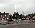
 Kingsway (A34) - geograph.org.uk - 2167506.jpg 800 × 600; 271 KB
-
 Kingsway (A34), Cheadle Royal - geograph.org.uk - 2167505.jpg 800 × 600; 221 KB
-
 Kingsway looking north - geograph.org.uk - 3417484.jpg 640 × 479; 46 KB
-
 Kingsway School from the air - geograph.org.uk - 3445407.jpg 640 × 480; 170 KB
-
 Kingsway School, Cheadle - geograph.org.uk - 3351201.jpg 4,000 × 3,000; 5.02 MB
-
 Kingsway, Cheadle - geograph.org.uk - 3969205.jpg 1,024 × 671; 93 KB
-
 La Cucina, Italiano ristorante - geograph.org.uk - 2370903.jpg 1,600 × 1,066; 657 KB
-
 Lakeside 5000, Cheadle Royal Business Park - geograph.org.uk - 2161380.jpg 3,968 × 2,232; 4.26 MB
-
 Lakeside office park Cheadle - geograph.org.uk - 3969198.jpg 1,024 × 592; 96 KB
-
 Literary Institute - geograph.org.uk - 3061700.jpg 640 × 539; 195 KB
-

-
 Loose Change Buskers - geograph.org.uk - 4560419.jpg 1,000 × 730; 857 KB
-
 Loose Change Buskers - geograph.org.uk - 4653327.jpg 1,000 × 912; 857 KB
-
 Loose Change Buskers in Cheadle - geograph.org.uk - 4653323.jpg 1,000 × 750; 787 KB
-
 Loose Change Buskers on Cheadle Green - geograph.org.uk - 4560603.jpg 1,000 × 650; 642 KB
-
 M60 Motorway underconstruction - May 2007 - panoramio.jpg 2,048 × 1,536; 978 KB
-
 MAN Landing video (7863042000).jpg 1,280 × 720; 308 KB
-
 Manchester overspill council homes on Councillor Lane - panoramio.jpg 2,048 × 1,536; 581 KB
-
 Manchester Paper Box - geograph.org.uk - 3072589.jpg 640 × 480; 139 KB
-
 Manchester Road north out of Cheadle - geograph.org.uk - 1901051.jpg 640 × 472; 404 KB
-
 Manchester Road, Cheadle on Cheadle Bridge - geograph.org.uk - 2929646.jpg 3,872 × 2,592; 5.19 MB
-
 Massie Street car park, Cheadle - geograph.org.uk - 1805937.jpg 640 × 480; 94 KB
-
 Memorial fountain, Queen's Gardens, Cheadle.jpg 640 × 742; 266 KB
-
 Memorial Fountain, Queens Gardens - geograph.org.uk - 3061516.jpg 640 × 853; 242 KB
-
 Micker Brook, Cheadle - geograph.org.uk - 2624876.jpg 1,280 × 960; 1.01 MB
-

-
 Mock Tudor building in Cheadle town centre - geograph.org.uk - 6053396.jpg 4,032 × 3,024; 2.96 MB
-
 Mornington Avenue - geograph.org.uk - 3772725.jpg 640 × 480; 85 KB
-
 MUGA off Massie Street car park east - geograph.org.uk - 1900879.jpg 640 × 480; 402 KB
-
 New Hey Road - geograph.org.uk - 4575544.jpg 1,000 × 793; 542 KB
-
 Newlands House.jpg 4,608 × 2,592; 5.82 MB
-
 North end of Ashfield Road, Cheadle - geograph.org.uk - 1901095.jpg 640 × 480; 358 KB
-
 Northenden Road, Cheadle - geograph.org.uk - 3351190.jpg 4,000 × 3,000; 5 MB
-
 Notice Board Abney Hall Park Cheadle.jpg 4,032 × 3,024; 6.51 MB
-
 Office space to let (geograph 6022962).jpg 5,907 × 3,820; 3.98 MB
-
 Old Co-op sign - geograph.org.uk - 3351210.jpg 4,000 × 3,000; 4.28 MB
-
 Old workshops, Hall Street, Cheadle - geograph.org.uk - 1900973.jpg 640 × 480; 419 KB
-
 Open space in Bruntwood Park - geograph.org.uk - 3329590.jpg 3,691 × 2,460; 2.36 MB
-
 Outbuilding, close to Bruntwood Hall - geograph.org.uk - 1533461.jpg 640 × 360; 72 KB
-
 Park beside Micker Brook - geograph.org.uk - 390131.jpg 640 × 480; 106 KB
-
 Park Way - geograph.org.uk - 6358344.jpg 1,280 × 960; 1.28 MB
-
 Path through High Grove woods at Cheadle Royal Business Park - geograph.org.uk - 6719266.jpg 4,608 × 3,456; 6.96 MB
-
 Path towards High Grove woods at Cheadle Royal Business Park - geograph.org.uk - 6719257.jpg 3,456 × 4,608; 7.16 MB
-

-
 Pond at Cheadle Royal Business Park, Manchester.jpg 4,160 × 3,120; 2.94 MB
-
 Postbox on Cheadle High Street - geograph.org.uk - 4580058.jpg 1,000 × 1,000; 745 KB
-
 Priory Hospital Cheadle Royal from the air - geograph.org.uk - 5904819.jpg 1,600 × 1,065; 650 KB
-
 Public footpath under A34, Royal Crescent, Cheadle - geograph.org.uk - 6719208.jpg 4,608 × 3,456; 7.53 MB
-
 Public footpaths under the A34 Cheadle Royal Roundabout - geograph.org.uk - 6719243.jpg 4,608 × 3,456; 7.41 MB
-
 Queen's Road, Cheadle - geograph.org.uk - 2624878.jpg 640 × 480; 259 KB
-

-
 Railway bridge, Brook Road, Cheadle - geograph.org.uk - 1901007.jpg 640 × 480; 520 KB
-
 Railway line to Stockport - geograph.org.uk - 3351156.jpg 4,000 × 3,000; 4.85 MB
-

-
 Rapunzels Hair Design - Cheadle - geograph.org.uk - 2828949.jpg 3,488 × 2,194; 3.59 MB
-

-

-
 Recent housing, Abney Place, Cheadle - geograph.org.uk - 1900895.jpg 640 × 480; 349 KB
-
 Red pillar-box on Broadway, Cheadle - geograph.org.uk - 1533807.jpg 640 × 413; 73 KB
-
 Reservoir cheadle royal.jpg 4,224 × 3,343; 5.55 MB
-
 River Mersey, Cheadle - panoramio.jpg 2,048 × 1,536; 1.18 MB
-
 Roundabout on Morrisons' access road - geograph.org.uk - 1528539.jpg 640 × 360; 53 KB
-

-
 Sainsbury's carpark at Cheadle Royal - geograph.org.uk - 2383739.jpg 1,600 × 925; 317 KB
-
 Sainsbury's Local (10274223205).jpg 2,048 × 1,150; 448 KB
-
 Sainsbury's, Cheadle, Stockport - geograph.org.uk - 4909964.jpg 6,000 × 4,000; 7.78 MB
-
 Sainsburys and John Lewis, A34 Cheadle..jpg 800 × 600; 105 KB
-
 Saturday parking - geograph.org.uk - 4571963.jpg 1,024 × 768; 140 KB
-
 Scholes Park playground - geograph.org.uk - 5956683.jpg 1,024 × 675; 303 KB
-
 Scotch Bob on Cheadle Green - geograph.org.uk - 4560596.jpg 1,000 × 1,000; 1.07 MB
-
 Shops on Massey Street - geograph.org.uk - 2417655.jpg 1,600 × 1,047; 348 KB
-
 Slip road near Cheadle Royal - geograph.org.uk - 2161493.jpg 3,776 × 2,520; 4.64 MB
-
 Small lake at Cheadle Royal Business Park - geograph.org.uk - 6721273.jpg 4,608 × 3,456; 6.98 MB
-
 Spur to the M60 - geograph.org.uk - 1376590.jpg 640 × 511; 151 KB
-
 Stalls on Cheadle Makers Market - geograph.org.uk - 4653318.jpg 1,000 × 750; 655 KB
-
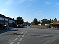
 Stockport Road, Cheadle - geograph.org.uk - 1376562.jpg 640 × 472; 107 KB
-
 Stockport Road, Cheadle - geograph.org.uk - 1376588.jpg 609 × 640; 141 KB
-
 Stockport Road, Cheadle - geograph.org.uk - 1376599.jpg 640 × 480; 128 KB
-
 Stockport Road, Cheadle - geograph.org.uk - 1376605.jpg 640 × 633; 94 KB
-
 Stockport Road, Cheadle - geograph.org.uk - 3061466.jpg 640 × 425; 134 KB
-
 Stockport Road, Cheadle - geograph.org.uk - 6053422.jpg 3,648 × 2,432; 2.72 MB


.jpg)


.jpg)


_-_geograph.org.uk_-_2167506.jpg)
,_Cheadle_Royal_-_geograph.org.uk_-_2167505.jpg)


.jpg)


.jpg)


.jpg)


