Category:Cathkin Braes
Jump to navigation
Jump to search
hills to the south east of Glasgow, Scotland, UK  | |||||
| Upload media | |||||
| Instance of | |||||
|---|---|---|---|---|---|
| Location | Glasgow City, Scotland | ||||
 | |||||
Subcategories
This category has the following 2 subcategories, out of 2 total.
2
Media in category "Cathkin Braes"
The following 80 files are in this category, out of 80 total.
-
 Across Glasgow from the Cathkin Braes - geograph.org.uk - 1498279.jpg 640 × 480; 110 KB
-
 Ardencraig Street - geograph.org.uk - 1301831.jpg 640 × 480; 125 KB
-
 Big Wood and grassland - geograph.org.uk - 4462273.jpg 2,048 × 1,536; 920 KB
-
 Big Wood and new ponds - geograph.org.uk - 4460821.jpg 2,048 × 1,536; 1.01 MB
-
 Big Wood and wind turbine - geograph.org.uk - 4462233.jpg 2,048 × 1,536; 772 KB
-
 Boardwalk in Cathkin Marsh Wildlife Reserve (geograph 3721250).jpg 640 × 480; 92 KB
-
 British Library digitised image from page 137 of "Glasgow Public Parks, etc".jpg 2,032 × 1,540; 771 KB
-
 Castlemilk and Cathkin Braes from the air (geograph 4517246).jpg 640 × 480; 209 KB
-
 Castlemilk and Cathkin Braes Park (geograph 4843847).jpg 1,600 × 1,200; 393 KB
-
 Castlemilk from the Cathkin Braes - geograph.org.uk - 1498283.jpg 640 × 480; 141 KB
-
 Cathkin Braes - geograph.org.uk - 886985.jpg 640 × 480; 68 KB
-
 Cathkin Braes car park - geograph.org.uk - 1497869.jpg 640 × 480; 117 KB
-
 Cathkin Braes Country Park - geograph.org.uk - 4462257.jpg 1,727 × 1,148; 544 KB
-
-
 Cathkin Braes from the air - geograph.org.uk - 4517241.jpg 640 × 480; 188 KB
-
 Cathkin Braes Golf Course - Clubhouse (geograph 3241733).jpg 640 × 480; 63 KB
-
 Cathkin Braes Golf Course - geograph.org.uk - 1497883.jpg 640 × 480; 112 KB
-
 Cathkin Braes radio mast (geograph 4175574).jpg 1,200 × 1,600; 375 KB
-
 Cathkin Braes Trig Point - geograph.org.uk - 3293953.jpg 1,600 × 1,200; 605 KB
-
 Cathkin Braes trig point - geograph.org.uk - 4175586.jpg 1,600 × 1,200; 490 KB
-
 Cathkin Braes wind turbine (geograph 3570374).jpg 3,000 × 2,255; 1.56 MB
-
 Cathkin Braes wind turbine (geograph 5572941).jpg 589 × 640; 91 KB
-
 Cathkin Braes woodland - geograph.org.uk - 4175116.jpg 1,600 × 1,200; 686 KB
-
 Cathkin Landfill Site - geograph.org.uk - 96160.jpg 640 × 480; 101 KB
-
 Cathkin Marsh (geograph 4384887).jpg 1,600 × 1,200; 364 KB
-
 Cathkin Marsh Wildlife Reserve (geograph 3721226).jpg 640 × 480; 72 KB
-
 Cathkin path (geograph 4383840).jpg 1,600 × 1,200; 381 KB
-
 Cathkin Road - geograph.org.uk - 1497229.jpg 640 × 480; 114 KB
-
 Cattle, Cathkin Braes - geograph.org.uk - 2991011.jpg 640 × 480; 319 KB
-
 Clubhouse of Cathkin Braes Golf Course - geograph.org.uk - 1498258.jpg 640 × 480; 154 KB
-
 Coulters Wood (geograph 4383844).jpg 1,600 × 1,200; 417 KB
-

-
 Double Dare (geograph 4175389).jpg 1,600 × 1,200; 604 KB
-
 Entrance to Cathkin Braes Country Park (geograph 4648546).jpg 1,600 × 1,200; 477 KB
-

-
 Footbridge in Cathkin Braes Country Park - geograph.org.uk - 3241672.jpg 640 × 480; 114 KB
-
 Footbridge in Cathkin Braes Country Park - geograph.org.uk - 948639.jpg 640 × 480; 114 KB
-
 Footbridge in Cathkin Braes Park (geograph 4843809).jpg 1,200 × 1,600; 684 KB
-
 Forest Path on Cathkin Braes - geograph.org.uk - 125833.jpg 640 × 480; 186 KB
-
 Forestry by the B759 - geograph.org.uk - 1497881.jpg 640 × 480; 128 KB
-
 Gap in the fence beside Cathkin Braes woodland (geograph 4175155).jpg 1,600 × 1,200; 632 KB
-
 Glasgow - geograph.org.uk - 13033.jpg 640 × 179; 32 KB
-
 Glasgow rooftops - geograph.org.uk - 3629337.jpg 640 × 416; 121 KB
-
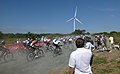
 Heading up the track, XC National Championships (geograph 3574131).jpg 2,369 × 2,369; 1.61 MB
-
 Houses on Kirkconnel Drive (geograph 5410041).jpg 640 × 406; 123 KB
-

-
 Mountain bike track, Cathkin Braes (geograph 3976706).jpg 640 × 480; 220 KB
-
 New housing on Ardencraig Road - geograph.org.uk - 1301850.jpg 640 × 480; 132 KB
-
 North side of Cathkin Braes (geograph 4175581).jpg 1,600 × 1,200; 424 KB
-
 On the final climb, XC National Championships - geograph.org.uk - 3574157.jpg 3,000 × 1,778; 1.53 MB
-
 Path in Cathkin Braes Country Park - geograph.org.uk - 3241683.jpg 640 × 480; 118 KB
-
 Path in Cathkin Marsh reserve (geograph 4384907).jpg 1,600 × 1,200; 479 KB
-

-
 Path, Cathkin Braes Country Park - geograph.org.uk - 3472939.jpg 640 × 480; 91 KB
-
 Pillar no longer marking high point - geograph.org.uk - 1605043.jpg 480 × 640; 114 KB
-
 Please Close Gate - geograph.org.uk - 1497867.jpg 640 × 480; 193 KB
-
 Police radio mast - geograph.org.uk - 948591.jpg 480 × 640; 62 KB
-
 Preparing for an excursion to Cathkin Braes (geograph 5354175).jpg 1,600 × 1,049; 321 KB
-

-
 Small church on Ardencraig Road - geograph.org.uk - 1302128.jpg 640 × 480; 137 KB
-
 Start of the Men's Race, XC National Championships - geograph.org.uk - 3569182.jpg 3,000 × 1,841; 1.18 MB
-
 Start of the MTB XC National Championships, Senior Women - geograph.org.uk - 3567892.jpg 3,000 × 2,120; 1.51 MB
-
 Top o' the Braes - geograph.org.uk - 1850257.jpg 604 × 453; 29 KB
-
 Track in Cathkin Braes Country Park (geograph 3241660).jpg 640 × 480; 106 KB
-
 Track to Cathkin Braes - geograph.org.uk - 1302127.jpg 640 × 480; 148 KB
-
 Track to Communication Mast (geograph 3745110).jpg 640 × 458; 75 KB
-
 Trig point on Queen Mary's Seat - geograph.org.uk - 1498304.jpg 640 × 480; 123 KB
-
 Under and over the tunnel, XC National Championships (geograph 3574109).jpg 2,400 × 2,400; 1.86 MB
-

-
-
 View to Carmunnock from Cathkin Braes - geograph.org.uk - 1497855.jpg 640 × 480; 104 KB
-
 Viewpoint on Cathkin Braes - geograph.org.uk - 1498275.jpg 640 × 480; 104 KB
-
 Women's podium, XC National Championships - geograph.org.uk - 3574228.jpg 3,000 × 2,196; 1.31 MB
-
 Woodland Path on Cathkin Braes - geograph.org.uk - 3721202.jpg 480 × 640; 138 KB
-
 Woodland path, Cathkin Braes - geograph.org.uk - 1498269.jpg 640 × 480; 174 KB
-
 XC National Championships course (geograph 3570267).jpg 3,000 × 2,134; 1.58 MB
-
 XC National Championships course, heading towards the woods (geograph 3569154).jpg 3,000 × 2,398; 1.79 MB
-
 XC track, Cathkin Braes - geograph.org.uk - 3970309.jpg 640 × 480; 239 KB
-
 Muir Farm - geograph.org.uk - 96178.jpg 640 × 480; 119 KB
-


.jpg)

.jpg)
.jpg)


.jpg)

.jpg)


.jpg)
.jpg)


.jpg)
.jpg)
.jpg)


.jpg)

.jpg)
.jpg)


.jpg)


.jpg)

.jpg)
.jpg)

.jpg)

.jpg)


.jpg)


.jpg)


.jpg)

.jpg)

.jpg)


.jpg)
.jpg)


