Category:Carmunnock
Jump to navigation
Jump to search
conservation village at the south-east border of Glasgow .jpg) | |||||
| Upload media | |||||
| Instance of | |||||
|---|---|---|---|---|---|
| Location |
| ||||
| Population |
| ||||
 | |||||
Subcategories
This category has the following 6 subcategories, out of 6 total.
Media in category "Carmunnock"
The following 23 files are in this category, out of 23 total.
-

-
 Bankhead Road - geograph.org.uk - 1492353.jpg 640 × 480; 119 KB
-
 Busby Road enters Carmunnock - geograph.org.uk - 1492309.jpg 640 × 480; 149 KB
-
 Busby Road, Carmunnock (geograph 6755694).jpg 1,600 × 1,200; 537 KB
-
 Carmunnock from the Bypass - geograph.org.uk - 1492300.jpg 640 × 480; 91 KB
-
 Carmunnock village - geograph.org.uk - 6042244.jpg 2,000 × 1,333; 2.64 MB
-
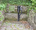 Doo Well site, Carmunnock Village, Scotland.JPG 3,701 × 3,016; 5.09 MB
-
 Doo Well, Carmunnock, Glasgow.JPG 2,051 × 1,714; 1.31 MB
-
 Gallowhill, Carmunnock - geograph.org.uk - 1492379.jpg 640 × 480; 109 KB
-
 Greenside, Carmunnock - geograph.org.uk - 92219.jpg 640 × 480; 158 KB
-
 Housing at Carmunnock - geograph.org.uk - 6042241.jpg 2,000 × 1,333; 3.08 MB
-
 Housing in Carmunnock - geograph.org.uk - 1492345.jpg 640 × 480; 134 KB
-
 Kirk Road, Carmunnock - geograph.org.uk - 1492361.jpg 640 × 480; 116 KB
-
 Linn ward.PNG 418 × 342; 11 KB
-
 Map of Lanarkshire Sheet 010, Ordnance Survey, 1863-1865.jpg 10,680 × 7,158; 7.6 MB
-
 Map of Lanarkshire Sheet 010, Ordnance Survey, 1863-1865.tiff 10,680 × 7,158; 218.72 MB
-
 New sign at start of Picketlaw Farm Road - geograph.org.uk - 1492340.jpg 640 × 480; 128 KB
-
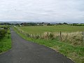
 Path between Carmunnock and Castlemilk - geograph.org.uk - 4648559.jpg 1,600 × 1,200; 564 KB
-
 Road Sign in Carmunnock - geograph.org.uk - 60172.jpg 640 × 480; 166 KB
-
 Sign at bottom of Cathkin Road - geograph.org.uk - 1492372.jpg 640 × 480; 139 KB
-

-
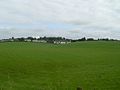
 View to Carmunnock from Cathkin Braes - geograph.org.uk - 1497855.jpg 640 × 480; 104 KB
-
 Waterside Road, Carmunnock - geograph.org.uk - 1492377.jpg 640 × 480; 118 KB
_-_geograph.org.uk_-_3241699.jpg)


.jpg)


