Category:Cathcart, Scotland (civil parish)
Jump to navigation
Jump to search
Scottish parish | |||||
| Upload media | |||||
| Instance of | |||||
|---|---|---|---|---|---|
| Part of |
| ||||
| Named after | |||||
| Location |
| ||||
| Population |
| ||||
| Area |
| ||||
 | |||||
Subcategories
This category has only the following subcategory.
G
- Part of Cathcart in Glasgow (empty)
Media in category "Cathcart, Scotland (civil parish)"
The following 200 files are in this category, out of 225 total.
(previous page) (next page)-
 A closed restaurant - geograph.org.uk - 5880910.jpg 2,000 × 1,324; 1.99 MB
-
 A green place, Mount Florida - geograph.org.uk - 2637476.jpg 640 × 480; 81 KB
-

-
 A view from Queen's Park - geograph.org.uk - 5694287.jpg 3,888 × 2,592; 1.45 MB
-
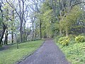 A woodland walk in Queen's Park - geograph.org.uk - 3953893.jpg 640 × 480; 155 KB
-
 Abandoned black stiletto shoes - geograph.org.uk - 5565025.jpg 640 × 444; 176 KB
-
 Afton Street - Tantallon Road, G41 - geograph.org.uk - 2138442.jpg 640 × 480; 100 KB
-
 Afton Street, G41 - geograph.org.uk - 2138433.jpg 640 × 480; 82 KB
-
 Algie Street - geograph.org.uk - 3437561.jpg 640 × 480; 132 KB
-
 Axle Group Holdings - geograph.org.uk - 3438087.jpg 640 × 480; 91 KB
-
 Back lane, between Queen's Drive and Balvicar Street - geograph.org.uk - 5304162.jpg 1,600 × 1,067; 492 KB
-
 Bakery beside the burn - geograph.org.uk - 6346866.jpg 1,327 × 1,600; 536 KB
-
 Battlefield Monument - geograph.org.uk - 4459859.jpg 599 × 800; 76 KB
-
 Beechings - geograph.org.uk - 3472905.jpg 640 × 480; 102 KB
-
 Beechings Bar - geograph.org.uk - 2142069.jpg 640 × 390; 119 KB
-
 Beechings Bar - geograph.org.uk - 2142077.jpg 640 × 401; 125 KB
-
 Beechings Bar - geograph.org.uk - 2142085.jpg 640 × 480; 148 KB
-
 Bin on White Cart Walkway - geograph.org.uk - 2095187.jpg 480 × 640; 118 KB
-
 Blairhall Avenue - geograph.org.uk - 5305350.jpg 1,136 × 1,600; 368 KB
-
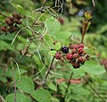 Brambles in Linn Park - geograph.org.uk - 3641768.jpg 1,600 × 1,515; 315 KB
-
 Brenfield Road - geograph.org.uk - 3438550.jpg 640 × 480; 133 KB
-
 Building beside Queens Depot, Queen's Park - geograph.org.uk - 5305444.jpg 1,600 × 975; 396 KB
-
 Building in Queens Park - geograph.org.uk - 2537978.jpg 640 × 325; 97 KB
-
 Busby Road - geograph.org.uk - 6346598.jpg 1,600 × 1,163; 413 KB
-
 Busby Road at Sheddens Roundabout - geograph.org.uk - 6346592.jpg 1,600 × 1,122; 337 KB
-
 Bute gardens - geograph.org.uk - 5762803.jpg 2,000 × 1,333; 2.44 MB
-
 Car dealership - geograph.org.uk - 6346858.jpg 1,600 × 842; 246 KB
-
 Carmunnock Lane - geograph.org.uk - 2637457.jpg 640 × 480; 100 KB
-
 Carolside Medical Centre - geograph.org.uk - 6346602.jpg 1,600 × 1,105; 346 KB
-
 Carpet Studio on Muirend Road - geograph.org.uk - 3438539.jpg 640 × 379; 105 KB
-
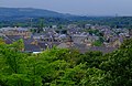
 Cathcart view - geograph.org.uk - 5270165.jpg 1,400 × 933; 845 KB
-
 Cecil Street, Clarkston - geograph.org.uk - 6346648.jpg 1,600 × 1,200; 442 KB
-

-
 Clarkston Road - Brunton Street, G44 - geograph.org.uk - 2143680.jpg 640 × 480; 80 KB
-
 Clarkston Road - geograph.org.uk - 2142094.jpg 640 × 428; 131 KB
-
 Clarkston Road - geograph.org.uk - 3438541.jpg 640 × 480; 139 KB
-
 Clarkston Road - geograph.org.uk - 3438547.jpg 640 × 465; 148 KB
-
 Clarkston Road - geograph.org.uk - 3438663.jpg 640 × 480; 140 KB
-
 Clarkston Road at Clarkston Library - geograph.org.uk - 2095294.jpg 640 × 480; 103 KB
-
 Clarkston Road, G44 - geograph.org.uk - 2143686.jpg 640 × 480; 90 KB
-
 Clarkston small businesses - geograph.org.uk - 5138253.jpg 1,600 × 1,200; 309 KB
-
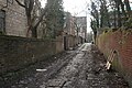
 Cobbled lane off Torrisdale Street - geograph.org.uk - 5303252.jpg 1,600 × 1,067; 348 KB
-
 Cogs and Wheels - geograph.org.uk - 3376052.jpg 4,608 × 3,456; 5.81 MB
-
 Commemorative trees in Queens Park - geograph.org.uk - 2537988.jpg 640 × 444; 191 KB
-
 Court Knowe monument - geograph.org.uk - 2468617.jpg 800 × 600; 112 KB
-
 Crane beside Clarkston Road - geograph.org.uk - 3277059.jpg 480 × 640; 58 KB
-
 Deanwood Avenue - Deanwood Road, G44 - geograph.org.uk - 2144386.jpg 640 × 480; 74 KB
-
 Deanwood Road, G44 - geograph.org.uk - 2144399.jpg 640 × 480; 82 KB
-
 Delvin Road - geograph.org.uk - 2140222.jpg 640 × 404; 150 KB
-
 Earlspark Avenue - geograph.org.uk - 2142731.jpg 640 × 525; 152 KB
-
 Earlspark Avenue - geograph.org.uk - 2142751.jpg 640 × 376; 109 KB
-
 Earlspark Avenue - geograph.org.uk - 2142753.jpg 431 × 640; 113 KB
-
 Earlspark Avenue sign - geograph.org.uk - 2142746.jpg 640 × 481; 203 KB
-
 Eastwoodmains Road - geograph.org.uk - 5138270.jpg 1,600 × 1,200; 361 KB
-

-
-

-

-

-

-

-

-

-
-
-

-

-
-
 Flood protection work - geograph.org.uk - 5881247.jpg 2,000 × 1,333; 2.68 MB
-
 Footpath under the railway viaduct - geograph.org.uk - 2183356.jpg 480 × 640; 81 KB
-
 Gap Site - geograph.org.uk - 3438111.jpg 640 × 405; 131 KB
-
 Garage, Lethington Avenue - geograph.org.uk - 5305334.jpg 1,600 × 1,226; 507 KB
-
 Ghost sign on Clarkston Road - geograph.org.uk - 3438621.jpg 383 × 640; 149 KB
-
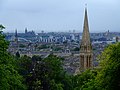
 Glasgow city centre from Queens Park - geograph.org.uk - 3437271.jpg 640 × 480; 182 KB
-
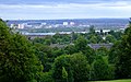
 Glasgow from Queens Park - geograph.org.uk - 2539030.jpg 640 × 352; 104 KB
-
 Glasgow from Queens Park - geograph.org.uk - 2539179.jpg 640 × 480; 143 KB
-
 Glasgow from Queens Park - geograph.org.uk - 2539448.jpg 640 × 399; 127 KB
-
 Glasgow from Queens Park - geograph.org.uk - 2540185.jpg 640 × 400; 132 KB
-
 Glasgow from Queens Park - geograph.org.uk - 2540290.jpg 640 × 414; 143 KB
-
 Glasgow Style fence ornament - geograph.org.uk - 2141739.jpg 640 × 480; 170 KB
-
 Grassy slope, Queen's Park - geograph.org.uk - 5305406.jpg 1,600 × 1,049; 302 KB
-
 Grey squirrel, Queen's Park - geograph.org.uk - 3574341.jpg 4,608 × 3,456; 6.23 MB
-
 Hangingshaw Place - geograph.org.uk - 1920460.jpg 640 × 480; 77 KB
-
 Holmhead Crescent - geograph.org.uk - 2141751.jpg 640 × 480; 140 KB
-
 Houses in Deanwood Avenue, G44 (2) - geograph.org.uk - 2144393.jpg 640 × 480; 104 KB
-
 Houses in Langside Drive, G43 - geograph.org.uk - 2140631.jpg 640 × 480; 70 KB
-
 Houses, Carolside Avenue, Clarkston - geograph.org.uk - 6346659.jpg 1,600 × 1,109; 447 KB
-
 Jessie Niven MacLachlan headstone 01.jpg 4,032 × 3,024; 5 MB
-
 Jessie Niven MacLachlan headstone 02.jpg 4,032 × 3,024; 5.14 MB
-
 Jessie Niven MacLachlan headstone 03.jpg 4,032 × 3,024; 5.7 MB
-
 Jessie Niven MacLachlan headstone 04.jpg 4,032 × 3,024; 5.22 MB
-
 King's Park - geograph.org.uk - 5451582.jpg 1,600 × 1,001; 376 KB
-
 Kintore Road - geograph.org.uk - 2142739.jpg 640 × 385; 115 KB
-
 Lane behind Carmichael Place - geograph.org.uk - 3438099.jpg 480 × 640; 159 KB
-
 Lane behind St. Joseph's church - geograph.org.uk - 6346644.jpg 1,600 × 1,200; 565 KB
-
 Lane off Torrisdale Street - geograph.org.uk - 5303260.jpg 1,600 × 1,067; 302 KB
-
 Langside Court and Battlefield Court - geograph.org.uk - 3437340.jpg 640 × 480; 115 KB
-
 Langside Drive - geograph.org.uk - 2177606.jpg 640 × 480; 87 KB
-
 Langside Drive - Quadrant Road, G43 - geograph.org.uk - 2140618.jpg 640 × 480; 84 KB
-
 Langside Drive, G43 (2) - geograph.org.uk - 2140645.jpg 640 × 480; 110 KB
-
 Langside Drive, G43 - geograph.org.uk - 2140624.jpg 640 × 480; 77 KB
-
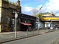
 Langside Library - geograph.org.uk - 6620251.jpg 1,024 × 489; 117 KB
-
 Large tree stump, Queen's Park - geograph.org.uk - 5304488.jpg 1,600 × 1,067; 512 KB
-
 Largie Road - geograph.org.uk - 4426365.jpg 480 × 640; 122 KB
-
 Laundry Express, Stamperland - geograph.org.uk - 5138274.jpg 1,600 × 1,200; 529 KB
-
 Linn Crematorium - geograph.org.uk - 6347853.jpg 1,253 × 1,600; 581 KB
-
 Linn Park - geograph.org.uk - 2637448.jpg 640 × 480; 158 KB
-
 Linn Park - geograph.org.uk - 5879845.jpg 3,105 × 3,119; 1.63 MB
-
 Lochinver Drive Cathcart - geograph.org.uk - 5270168.jpg 1,400 × 933; 1.07 MB
-
 Lockerbie Avenue - geograph.org.uk - 2142735.jpg 640 × 394; 135 KB
-
 Looking across Sainsbury's car park - geograph.org.uk - 5878920.jpg 2,000 × 1,333; 1.67 MB
-

-
 Looking along Cathkin Road - geograph.org.uk - 2177622.jpg 480 × 640; 66 KB
-
 Looking down Busby Road - geograph.org.uk - 2095258.jpg 480 × 640; 46 KB
-
 Looking north along Langside Drive - geograph.org.uk - 2177610.jpg 480 × 640; 94 KB
-
 Lubnaig Road - geograph.org.uk - 4713812.jpg 3,230 × 2,270; 3.07 MB
-
 Manhole cover revealed in the snow - geograph.org.uk - 2187573.jpg 480 × 640; 42 KB
-
 Maybank Lane - geograph.org.uk - 5306213.jpg 1,184 × 1,600; 394 KB
-
 Maybank Street - geograph.org.uk - 5306204.jpg 1,600 × 973; 298 KB
-
 Merryvale Car park - geograph.org.uk - 6346810.jpg 1,600 × 1,074; 307 KB
-
 Millbrae Road - geograph.org.uk - 3438088.jpg 640 × 439; 124 KB
-
 Millbrae Road - geograph.org.uk - 3438090.jpg 640 × 395; 97 KB
-
 Millbrae Road - geograph.org.uk - 3438091.jpg 640 × 480; 146 KB
-
 Modern flats on Clarkston Road - geograph.org.uk - 2932212.jpg 480 × 640; 49 KB
-
 Muirend Road - geograph.org.uk - 3438518.jpg 640 × 480; 127 KB
-
 Muirend Road - geograph.org.uk - 3438524.jpg 640 × 480; 130 KB
-
 Muirend Road - geograph.org.uk - 3438526.jpg 640 × 310; 83 KB
-
 Netherlee Road passing through Cathcart Cemetery - geograph.org.uk - 6721356.jpg 3,648 × 2,736; 4.43 MB
-
 Newlands Road - geograph.org.uk - 3439854.jpg 640 × 480; 304 KB
-
 Newlands Road - geograph.org.uk - 4713822.jpg 3,504 × 2,336; 4.19 MB
-
 Old gas lamp stand - geograph.org.uk - 2140231.jpg 480 × 640; 236 KB
-
 Open space behind Clarkston Library - geograph.org.uk - 2095478.jpg 640 × 480; 84 KB
-
 Park at Orchy Street - geograph.org.uk - 2141495.jpg 640 × 480; 163 KB
-
 Park at Orchy Street - geograph.org.uk - 2141502.jpg 640 × 480; 143 KB
-
 Park at Orchy Street - geograph.org.uk - 2141509.jpg 640 × 418; 144 KB
-
 Park at Orchy Street - geograph.org.uk - 2141527.jpg 640 × 480; 131 KB
-

-
 Path beside the White Cart - geograph.org.uk - 2095197.jpg 480 × 640; 78 KB
-
 Path in Queens Park - geograph.org.uk - 2539021.jpg 640 × 480; 212 KB
-
 Path in Queens Park - geograph.org.uk - 2540300.jpg 640 × 480; 216 KB
-
 Path in Queens Park - geograph.org.uk - 2540304.jpg 480 × 640; 212 KB
-
 Path leading into Linn Park - geograph.org.uk - 3641719.jpg 768 × 1,024; 261 KB
-
 Path through Queen's Park - geograph.org.uk - 5303345.jpg 1,600 × 1,055; 559 KB
-
 Path through Queen's Park - geograph.org.uk - 5304485.jpg 1,600 × 1,067; 523 KB
-
 Path, Queen's Park - geograph.org.uk - 5305389.jpg 1,600 × 1,067; 510 KB
-
 Play apparatus, Linn Park - geograph.org.uk - 2637447.jpg 640 × 467; 149 KB
-
 Playpark platform - geograph.org.uk - 3919944.jpg 1,094 × 821; 137 KB
-
 Postbox under a tree - geograph.org.uk - 3544357.jpg 724 × 968; 265 KB
-
 Prospecthill Road - geograph.org.uk - 3438225.jpg 640 × 480; 109 KB
-
 Prospecthill Road - geograph.org.uk - 3438248.jpg 480 × 640; 139 KB
-
 Prospecthill Way - geograph.org.uk - 3438247.jpg 480 × 640; 112 KB
-
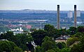
 Provan gas works from Queens Park - geograph.org.uk - 3437256.jpg 640 × 480; 115 KB
-
 Queen's Park - geograph.org.uk - 3376050.jpg 3,936 × 2,692; 4.04 MB
-
 Queen's Park - geograph.org.uk - 3439848.jpg 640 × 510; 356 KB
-
 Queen's Park - geograph.org.uk - 3439851.jpg 640 × 480; 365 KB
-
 Queen's Park - geograph.org.uk - 4533112.jpg 2,560 × 1,920; 2.4 MB
-
 Queen's Park Baptist Church and flats on Balvicar Street - geograph.org.uk - 5304382.jpg 1,600 × 1,067; 351 KB
-
 Queen's Park path - geograph.org.uk - 4604419.jpg 1,600 × 1,200; 623 KB
-

-
 Queens Depot, Queen's Park - geograph.org.uk - 5305416.jpg 1,600 × 983; 403 KB
-
 Queens Park - geograph.org.uk - 2537776.jpg 640 × 480; 199 KB
-
 Queens Park - geograph.org.uk - 2537959.jpg 640 × 357; 153 KB
-
 Queens Park - geograph.org.uk - 2537963.jpg 640 × 324; 90 KB
-
 Queens Park - geograph.org.uk - 2539136.jpg 640 × 480; 141 KB
-
 Queens Park - geograph.org.uk - 3437231.jpg 640 × 480; 134 KB
-
 Queens Park - geograph.org.uk - 3437287.jpg 480 × 640; 134 KB
-
 Queens Park - geograph.org.uk - 3437343.jpg 640 × 480; 149 KB
-
 Queens Park - geograph.org.uk - 3437386.jpg 640 × 480; 198 KB
-
 Queens Park - geograph.org.uk - 3437521.jpg 480 × 640; 139 KB
-
 Queens Park - geograph.org.uk - 3437523.jpg 480 × 640; 176 KB
-
 Queens Park - geograph.org.uk - 3437531.jpg 640 × 480; 171 KB
-
 Queens Park - geograph.org.uk - 3437545.jpg 480 × 640; 228 KB
-
 Queens Park - geograph.org.uk - 3437548.jpg 640 × 480; 217 KB
-
 Queens Park Arena - geograph.org.uk - 3437205.jpg 640 × 480; 134 KB
-
 Queens Park Arena - geograph.org.uk - 3437210.jpg 640 × 480; 149 KB
-
 Queens Park Arena - geograph.org.uk - 3437223.jpg 640 × 480; 139 KB
-
 Queens Park Arena - geograph.org.uk - 3437226.jpg 640 × 480; 128 KB
-
 Queens Park flagpole - geograph.org.uk - 2539035.jpg 480 × 640; 96 KB
-
 Queens Park flagpole - geograph.org.uk - 2539039.jpg 640 × 480; 172 KB
-
 Queens Park stone circle - geograph.org.uk - 2540319.jpg 640 × 480; 222 KB
-
 Railway bridge over Kintore Road - geograph.org.uk - 2142743.jpg 640 × 480; 153 KB
-
 Rannoch Street - geograph.org.uk - 2141540.jpg 640 × 480; 149 KB
-
 Red Road Flats from Queens Park - geograph.org.uk - 3437265.jpg 640 × 480; 173 KB
-
 Reflections in an old school yard - geograph.org.uk - 2140289.jpg 640 × 436; 166 KB
-
 Reinforced gable end - geograph.org.uk - 3438285.jpg 480 × 640; 177 KB
-
 Roundabout in Muirend - geograph.org.uk - 3241500.jpg 640 × 480; 76 KB
-
 Scene in Linn Park - geograph.org.uk - 3641860.jpg 929 × 754; 110 KB
-
 Sign by the Halabja Tree - geograph.org.uk - 2537980.jpg 640 × 480; 97 KB
-
 Sign for The butterfly and the pig - geograph.org.uk - 6243234.jpg 1,600 × 968; 233 KB
-
 Sign for the Georgic - geograph.org.uk - 6243149.jpg 1,195 × 1,600; 291 KB
-

-
 Sinclair Nursery - geograph.org.uk - 3438110.jpg 640 × 402; 133 KB
-
 Sinclair Nursery - geograph.org.uk - 3438119.jpg 640 × 448; 161 KB
-
 Small building in Queens Park - geograph.org.uk - 3437154.jpg 640 × 480; 193 KB
-
 Small pond in Queen's Park - geograph.org.uk - 4604429.jpg 1,200 × 1,600; 674 KB
-

-
 Squirrel in Queen's Park - geograph.org.uk - 3574340.jpg 4,608 × 3,456; 6.14 MB
-
 St Bride's Road - geograph.org.uk - 3440978.jpg 640 × 480; 230 KB
-
 St Bride's Road - geograph.org.uk - 3440982.jpg 640 × 480; 313 KB
-
 St. Joseph's R.C. Church, Clarkston - geograph.org.uk - 6346636.jpg 1,600 × 981; 214 KB


_-_geograph.org.uk_-_2144393.jpg)


_-_geograph.org.uk_-_2140645.jpg)


&filefrom=Stained+glass+celebrating+Glasgow+-+geograph.org.uk+-+3376054.jpg#mw-category-media)