Category:Carmichael (civil parish)
Jump to navigation
Jump to search
Scottish parish in South Lanarkshire, Scotland, UK | |||||
| Upload media | |||||
| Instance of | |||||
|---|---|---|---|---|---|
| Part of |
| ||||
| Named after | |||||
| Location |
| ||||
| Population |
| ||||
| Area |
| ||||
 | |||||
Subcategories
This category has the following 3 subcategories, out of 3 total.
Media in category "Carmichael (civil parish)"
The following 200 files are in this category, out of 347 total.
(previous page) (next page)-
 A freshly harvested field - geograph.org.uk - 3691889.jpg 640 × 480; 85 KB
-
 A gate in to the fields beyond - geograph.org.uk - 3691878.jpg 640 × 480; 99 KB
-
 A plaque on the Old Carmichael House - geograph.org.uk - 2419204.jpg 640 × 481; 101 KB
-
 A70 crosses River Clyde over Hyndford Bridge - geograph.org.uk - 2493721.jpg 3,648 × 2,552; 1.47 MB
-

-
 A70 junction by Rigside - geograph.org.uk - 894230.jpg 638 × 419; 65 KB
-
 A73 approaches Hyndford Bridge - geograph.org.uk - 2479085.jpg 640 × 480; 299 KB
-

-
 Approaching the shallow col between Lochlyock Hill and Tinto - geograph.org.uk - 2877655.jpg 4,608 × 3,456; 6.16 MB
-
 Ascending Tinto from the direction of Lochlyock Hill - geograph.org.uk - 2877638.jpg 4,608 × 3,456; 5.82 MB
-
 B7055, Rigside - geograph.org.uk - 2997290.jpg 640 × 480; 239 KB
-
 Barley field and Syde - geograph.org.uk - 894354.jpg 640 × 480; 74 KB
-
 Barley field below Black Hill - geograph.org.uk - 893845.jpg 640 × 480; 59 KB
-
 Bench by Lochlyoch Reservoir - geograph.org.uk - 5603725.jpg 4,608 × 3,456; 5.16 MB
-
 Beside The Track - geograph.org.uk - 858329.jpg 422 × 600; 68 KB
-
 Bio-fuel production - geograph.org.uk - 3477354.jpg 640 × 441; 88 KB
-
 Bio-fuel Production - geograph.org.uk - 3477387.jpg 640 × 480; 107 KB
-
 Black Hill - geograph.org.uk - 894314.jpg 640 × 359; 67 KB
-
 Bottom of a track to Tinto End - geograph.org.uk - 6365036.jpg 5,152 × 3,864; 5.31 MB
-
 Boundary wall on Lochlyock Hill - geograph.org.uk - 5195642.jpg 1,024 × 751; 125 KB
-
 Breeks Wood - geograph.org.uk - 4393080.jpg 800 × 533; 211 KB
-
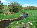
 Burn near Thankerton - geograph.org.uk - 1869954.jpg 640 × 480; 160 KB
-
 Cairn, Tinto - geograph.org.uk - 3359867.jpg 640 × 360; 72 KB
-
 Cairn, Tinto - geograph.org.uk - 3359877.jpg 640 × 360; 90 KB
-
 Cairn, Tinto - geograph.org.uk - 3361105.jpg 640 × 360; 97 KB
-
 Cairngryffe Hill - geograph.org.uk - 2910922.jpg 640 × 360; 183 KB
-
 Cairngryffe Parish Kirk and Cemetery - geograph.org.uk - 5878133.jpg 1,024 × 762; 209 KB
-
 Cairngryffe Parish Kirk, from the south east - geograph.org.uk - 5886137.jpg 1,024 × 768; 253 KB
-
 Cairngryffe Parish Kirk, north side - geograph.org.uk - 5886124.jpg 1,024 × 768; 246 KB
-
 Carmichael - geograph.org.uk - 3691587.jpg 640 × 480; 61 KB
-
 Carmichael - geograph.org.uk - 893897.jpg 640 × 480; 70 KB
-
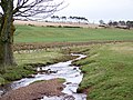
 Carmichael Burn - geograph.org.uk - 3477341.jpg 640 × 480; 118 KB
-
 Carmichael Burn - geograph.org.uk - 3477348.jpg 640 × 480; 137 KB
-
 Carmichael Burn - geograph.org.uk - 3634877.jpg 640 × 480; 82 KB
-
 Carmichael Burn - geograph.org.uk - 4253679.jpg 640 × 398; 71 KB
-
 Carmichael Burn View - geograph.org.uk - 4253673.jpg 640 × 453; 109 KB
-
 Carmichael Estate road - geograph.org.uk - 3691611.jpg 640 × 480; 124 KB
-
 Carmichael from Carmichael Hill - geograph.org.uk - 4789896.jpg 4,896 × 3,672; 6.58 MB
-
 Carmichael Hill - geograph.org.uk - 3293753.jpg 1,600 × 1,200; 764 KB
-
 Carmichael Hill - geograph.org.uk - 4789916.jpg 4,896 × 3,672; 6.13 MB
-

-
 Carmichael House - geograph.org.uk - 3361077.jpg 640 × 360; 82 KB
-
 Carmichael kirk and graveyard - geograph.org.uk - 5971682.jpg 2,592 × 1,944; 1.64 MB
-
 Carmichael Parish Kirk - geograph.org.uk - 4191559.jpg 4,000 × 3,000; 3.53 MB
-
 Carmichael Primary School - geograph.org.uk - 5886129.jpg 1,024 × 768; 231 KB
-
 Carmichael View - geograph.org.uk - 3477333.jpg 640 × 447; 83 KB
-
 Cattle grid near Woodend - geograph.org.uk - 1059092.jpg 640 × 480; 99 KB
-
 Cereals near Hyndford Bridge - geograph.org.uk - 2476848.jpg 640 × 480; 292 KB
-
 Chapel Hill - geograph.org.uk - 893903.jpg 640 × 480; 65 KB
-
 Clear fell, Stonehouse Wood - geograph.org.uk - 4394819.jpg 800 × 450; 187 KB
-
 Cleuch Burn - geograph.org.uk - 4393086.jpg 800 × 533; 222 KB
-
 Cleuch Reservoir, now disused - geograph.org.uk - 1058861.jpg 640 × 480; 79 KB
-
 Cloburn Quarry - geograph.org.uk - 3359842.jpg 640 × 360; 87 KB
-
 Cloburn Quarry from Carmichael Hill - geograph.org.uk - 4789931.jpg 4,896 × 3,672; 6.67 MB
-
 Clyde Valley Flood Plain - geograph.org.uk - 3320790.jpg 640 × 417; 63 KB
-

-
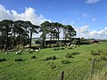
 Cows and calves near Crookboat - geograph.org.uk - 2906093.jpg 640 × 360; 185 KB
-
 Cross Ridge View - geograph.org.uk - 3477362.jpg 640 × 421; 71 KB
-
 Cross Ridge View - geograph.org.uk - 3477368.jpg 640 × 441; 107 KB
-
 Cross Ridge View - geograph.org.uk - 3477378.jpg 640 × 418; 66 KB
-
 Cross Ridge View - geograph.org.uk - 3477381.jpg 640 × 480; 79 KB
-
 Crossing Carmichael Burn - geograph.org.uk - 3477340.jpg 640 × 454; 104 KB
-
 Crossroads at Carmichael - geograph.org.uk - 3790601.jpg 4,608 × 3,456; 5.48 MB
-
 Crossroads at Harleyholm, Carmichael - geograph.org.uk - 4789551.jpg 4,896 × 3,672; 7.12 MB
-
 Crossroads, Carmichael - geograph.org.uk - 2910962.jpg 640 × 360; 228 KB
-
 Dead tree, Tinto - geograph.org.uk - 2105582.jpg 480 × 640; 26 KB
-
 Descending west from Tinto - geograph.org.uk - 2877617.jpg 4,312 × 3,016; 2.55 MB
-
 Devonside Road at Devonside - geograph.org.uk - 6203741.jpg 4,000 × 3,000; 3.99 MB
-
 Did the ferryman shortchange his customers^ - geograph.org.uk - 3237937.jpg 2,592 × 1,944; 2.93 MB
-
 Direction Sign – Signpost - geograph.org.uk - 6524979.jpg 720 × 960; 169 KB
-
 Disused Railway Bridge - geograph.org.uk - 2079265.jpg 3,354 × 1,822; 1.82 MB
-
 Douglas Branch - geograph.org.uk - 2910936.jpg 640 × 360; 219 KB
-
 Douglas Water - geograph.org.uk - 2079218.jpg 3,462 × 2,000; 2.76 MB
-
 Douglas Water - geograph.org.uk - 2079227.jpg 2,241 × 2,832; 1.9 MB
-
 Douglas Water - geograph.org.uk - 2079239.jpg 2,736 × 2,430; 1.81 MB
-
 Douglas Water - geograph.org.uk - 3405441.jpg 640 × 480; 250 KB
-
 Douglas Water - geograph.org.uk - 3405445.jpg 640 × 480; 230 KB
-
 Douglas Water - geograph.org.uk - 4392021.jpg 800 × 533; 211 KB
-
 Douglas Water - geograph.org.uk - 4904788.jpg 1,024 × 684; 97 KB
-
 Douglas Water - geograph.org.uk - 5190797.jpg 640 × 415; 82 KB
-
 Douglas Water - geograph.org.uk - 5190841.jpg 640 × 408; 83 KB
-
 Douglas Water and the River Clyde from the air - geograph.org.uk - 6383487.jpg 1,024 × 768; 313 KB
-
 Douglas Water from the air - geograph.org.uk - 6383478.jpg 768 × 1,024; 277 KB
-
 Douglas Water village - geograph.org.uk - 2437704.jpg 2,592 × 1,944; 2.07 MB
-

-
 Douglas Water, South Lanarkshire - geograph.org.uk - 2045292.jpg 800 × 531; 158 KB
-
 Douglasmouth Bridge - geograph.org.uk - 2079247.jpg 3,380 × 1,935; 2.31 MB
-
 Douglasmouth Bridge - geograph.org.uk - 3389668.jpg 1,024 × 554; 181 KB
-
 Douglasmouth Bridge - geograph.org.uk - 4904785.jpg 1,024 × 684; 171 KB
-
 Douglasmouth Bridge - geograph.org.uk - 5116888.jpg 640 × 481; 57 KB
-
 Douglasmouth Bridge - geograph.org.uk - 5172611.jpg 4,000 × 3,000; 3.88 MB
-
 Douglasmouth Bridge View - geograph.org.uk - 5190837.jpg 640 × 433; 97 KB
-
 Douglaswater Bridge - geograph.org.uk - 2045268.jpg 800 × 531; 174 KB
-
 Douglaswater Bridge - geograph.org.uk - 2350725.jpg 640 × 480; 71 KB
-
 Douglaswater Bridge - geograph.org.uk - 3565383.jpg 2,527 × 1,280; 1.98 MB
-
 Douglaswater Bridge Again - geograph.org.uk - 5190787.jpg 640 × 398; 95 KB
-
 Down The Douglas Water - geograph.org.uk - 5190845.jpg 640 × 403; 99 KB
-
 Down The Track - geograph.org.uk - 858337.jpg 640 × 480; 99 KB
-
 Drumalbin - geograph.org.uk - 2906111.jpg 640 × 360; 218 KB
-
 Drumalbin - geograph.org.uk - 2910951.jpg 640 × 360; 207 KB
-
 Drumalbin Burn - geograph.org.uk - 3477316.jpg 640 × 480; 106 KB
-
 Drumalbin Burn - geograph.org.uk - 3634770.jpg 640 × 480; 91 KB
-
 Drumalbin Farm - geograph.org.uk - 3634889.jpg 640 × 480; 62 KB
-
 Drumalbin Farm - geograph.org.uk - 5172369.jpg 4,000 × 3,000; 2.44 MB
-
 Dykes on Whitecastle Hill - geograph.org.uk - 2906767.jpg 640 × 360; 211 KB
-
 Entrance, Loudon Pond Nature reserve - geograph.org.uk - 4392018.jpg 800 × 533; 245 KB
-
 Evening light on Carmichael Hill - geograph.org.uk - 5410884.jpg 4,894 × 3,262; 2.42 MB
-
 Farm track near to Howgate - geograph.org.uk - 6203754.jpg 4,000 × 3,000; 2.74 MB
-
 Farmyard at Bowhouse - geograph.org.uk - 4191582.jpg 4,000 × 3,000; 3.57 MB
-

-

-
 Fence junction, Tinto - geograph.org.uk - 3359873.jpg 640 × 360; 79 KB
-
 Fence on Tinto - geograph.org.uk - 3359846.jpg 640 × 360; 54 KB
-
 Fence on Tinto - geograph.org.uk - 3361082.jpg 640 × 360; 93 KB
-
 Fence-lined minor road between Crookboat and Prettsmill - geograph.org.uk - 6203731.jpg 4,000 × 3,000; 2.77 MB
-
 Fence-lined minor road between Howgate and The Kames - geograph.org.uk - 6203759.jpg 4,000 × 3,000; 2.91 MB
-
 Fence-lined track leading to Dyke - geograph.org.uk - 6175240.jpg 4,000 × 3,000; 3.01 MB
-
 Field, Howgate - geograph.org.uk - 4396843.jpg 800 × 533; 215 KB
-
 Fields at Drumalbin Farm - geograph.org.uk - 3477304.jpg 640 × 458; 83 KB
-
 Fields, Carmichael - geograph.org.uk - 3359836.jpg 640 × 360; 89 KB
-
 Filter beds at Cleuch Reservoir - geograph.org.uk - 1058858.jpg 640 × 480; 79 KB
-
 Filter beds, Lochlyoch Reservoir - geograph.org.uk - 5603677.jpg 4,608 × 3,456; 5.68 MB
-
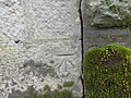
 Flush bracket, Tinto - geograph.org.uk - 3361101.jpg 363 × 640; 91 KB
-
 From Shawhill Wood - geograph.org.uk - 858324.jpg 640 × 480; 111 KB
-
 Gate and the Tinto Hills - geograph.org.uk - 5886212.jpg 1,024 × 768; 213 KB
-
 Gates and steps, Carmichael - geograph.org.uk - 5886132.jpg 1,024 × 768; 207 KB
-
 Gates on hillside between Tinto End and Howgate Hill - geograph.org.uk - 6365050.jpg 5,152 × 3,864; 4.7 MB
-
 Glasgow, seen from Tinto - geograph.org.uk - 3359893.jpg 640 × 360; 65 KB
-
 Grassland near Lochlyoch - geograph.org.uk - 5878116.jpg 1,024 × 768; 156 KB
-
 Grassland, Burnhouse - geograph.org.uk - 2906104.jpg 640 × 360; 206 KB
-
 Grazing cattle, Devonside - geograph.org.uk - 2906084.jpg 640 × 360; 167 KB
-
 Gulls plus Cairngryffe - geograph.org.uk - 2906070.jpg 640 × 360; 177 KB
-
 Heading downhill - geograph.org.uk - 3691583.jpg 640 × 480; 78 KB
-
 Heading for Carmichael - geograph.org.uk - 3477323.jpg 640 × 453; 76 KB
-
 Heading for Carmichael village - geograph.org.uk - 3691883.jpg 640 × 480; 64 KB
-
 Heading for Carmichael village - geograph.org.uk - 5116870.jpg 640 × 481; 46 KB
-
 Heading west from Carmichael - geograph.org.uk - 5116875.jpg 640 × 481; 43 KB
-
 Heading west from Carmichael - geograph.org.uk - 5116878.jpg 640 × 481; 39 KB
-
 Hillside and path a little way below the summit of Tinto - geograph.org.uk - 5551217.jpg 1,559 × 1,169; 731 KB
-
 House at Midtown - geograph.org.uk - 1058852.jpg 640 × 480; 75 KB
-
 Howgate Forest - geograph.org.uk - 4394832.jpg 800 × 450; 223 KB
-
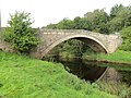
 Hyndford Bridge - geograph.org.uk - 1869916.jpg 640 × 480; 136 KB
-
 Hyndford Bridge - geograph.org.uk - 1876231.jpg 640 × 390; 161 KB
-
 Hyndford Bridge - geograph.org.uk - 2328159.jpg 2,048 × 1,536; 1.99 MB
-
 Hyndford Bridge - geograph.org.uk - 2328161.jpg 2,048 × 1,536; 2.17 MB
-
 Hyndford Bridge - geograph.org.uk - 2479081.jpg 640 × 480; 301 KB
-
 Hyndford Bridge - geograph.org.uk - 3382495.jpg 4,320 × 3,240; 2.74 MB
-
 Hyndford Bridge - geograph.org.uk - 3382577.jpg 4,320 × 3,240; 2.72 MB
-
 Hyndford Bridge - geograph.org.uk - 4634337.jpg 2,560 × 1,439; 1.62 MB
-
 Hyndford Bridge - geograph.org.uk - 4904833.jpg 1,024 × 684; 131 KB
-
 Hyndford Bridge - geograph.org.uk - 5787911.jpg 640 × 427; 399 KB
-
 Hyndford Bridge - geograph.org.uk - 5787912.jpg 640 × 427; 349 KB
-
 Hyndford Bridge from the air - geograph.org.uk - 5669648.jpg 640 × 480; 134 KB
-
 Hyndford Bridge from the air - geograph.org.uk - 5669650.jpg 640 × 480; 137 KB
-
 Hyndford Bridge View - geograph.org.uk - 1109363.jpg 640 × 417; 119 KB
-
 Hyndford Bridge View - geograph.org.uk - 3320784.jpg 640 × 477; 144 KB
-
 Hyndford Monument - geograph.org.uk - 4789937.jpg 4,896 × 3,672; 5.92 MB
-
 Hyndford Monument and Tinto - geograph.org.uk - 5410890.jpg 4,896 × 3,672; 6.85 MB
-
 Junction at Hyndford Bridge - geograph.org.uk - 2476855.jpg 640 × 480; 291 KB
-
 Kame and kettle terrain, Sandilands - geograph.org.uk - 4391493.jpg 800 × 533; 198 KB
-
 Late Snowfall on Tinto Hill - geograph.org.uk - 3466665.jpg 640 × 440; 73 KB
-
 Leaving Carmichael - geograph.org.uk - 3477357.jpg 640 × 456; 108 KB
-
 Leaving Stonehill Wood - geograph.org.uk - 3477296.jpg 640 × 480; 133 KB
-
 Lochlyoch and Rigside from the air. - geograph.org.uk - 2231107.jpg 1,934 × 1,775; 2.02 MB
-
 Lochlyoch Farm - geograph.org.uk - 5878112.jpg 1,024 × 768; 243 KB
-
 Lochlyoch Reservoir - geograph.org.uk - 5603662.jpg 4,606 × 3,071; 1.88 MB
-

-
 Lower slopes of Lochlyock Hill above Howgate Mouth - geograph.org.uk - 2877675.jpg 4,608 × 3,456; 6.09 MB
-
 Martingill Cleuch on Tinto - geograph.org.uk - 2882430.jpg 4,506 × 3,316; 2.36 MB
-
 Maurice's Cleuch, Tinto - geograph.org.uk - 4022787.jpg 1,024 × 678; 200 KB
-
 Millhill Burn - geograph.org.uk - 2905696.jpg 640 × 360; 178 KB
-
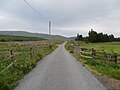
 Minor road (track) approaching Howgate - geograph.org.uk - 6203762.jpg 4,000 × 3,000; 3.64 MB
-
 Minor road (Track) heading towards Howgate - geograph.org.uk - 6203749.jpg 4,000 × 3,000; 2.76 MB
-
 Minor road and Stoneyknowe Cottage at Townhead - geograph.org.uk - 6175246.jpg 4,000 × 3,000; 2.74 MB
-
 Minor road approaching Prettsmill - geograph.org.uk - 6203734.jpg 4,000 × 3,000; 2.73 MB
-
 Minor road at Lochlyoch - geograph.org.uk - 6203781.jpg 4,000 × 3,000; 2.88 MB
-

-
-

-
 Minor road near to Crookboat - geograph.org.uk - 6203727.jpg 4,000 × 3,000; 2.56 MB
-

-
 Minor road passing through the buildings at Sandilands Farm - geograph.org.uk - 6175237.jpg 4,000 × 3,000; 3.18 MB
-
 Minor road that leads to Cross Ridge - geograph.org.uk - 6175256.jpg 4,000 × 3,000; 2.97 MB
-
 Minor road winding through pass - geograph.org.uk - 4904794.jpg 1,024 × 684; 103 KB
-
 Minor road, Douglas Water - geograph.org.uk - 4391516.jpg 800 × 533; 175 KB
-
 Minor road, Douglas Water - geograph.org.uk - 4391528.jpg 640 × 426; 45 KB
-
 Monument to the 2nd Earl of Hyndford - geograph.org.uk - 2419215.jpg 640 × 481; 52 KB
-
 Monument To The 2nd Earl Of Hyndford - geograph.org.uk - 3293759.jpg 1,600 × 1,200; 375 KB
-
 Near Howgate - geograph.org.uk - 4394843.jpg 800 × 450; 185 KB
-
 New power lines Carmichael - geograph.org.uk - 893896.jpg 640 × 480; 51 KB
-
 New viewing table at Tinto - geograph.org.uk - 3144872.jpg 640 × 480; 88 KB
-
 Old Carmichael House - geograph.org.uk - 2419199.jpg 640 × 481; 122 KB
-
 Old signpost, Carmichael - geograph.org.uk - 3790617.jpg 4,608 × 3,456; 5.5 MB
-
 On top of Tinto - geograph.org.uk - 3708276.jpg 1,024 × 591; 160 KB
-
 Ordnance Survey Cut Mark - geograph.org.uk - 4261406.jpg 4,000 × 3,000; 4.23 MB
-
 Ordnance Survey Cut Mark - geograph.org.uk - 5172353.jpg 4,000 × 3,000; 4.6 MB
-
 Ordnance Survey Cut Mark - geograph.org.uk - 6178049.jpg 4,000 × 3,000; 5.25 MB
-
 Ordnance Survey Cut Mark - geograph.org.uk - 6178059.jpg 4,000 × 3,000; 5.29 MB
-
 Ordnance Survey Flush Bracket G456 - geograph.org.uk - 5172603.jpg 4,000 × 3,000; 4.68 MB
-
 Ordnance Survey Flush Bracket G457 - geograph.org.uk - 5172367.jpg 3,955 × 2,965; 3.54 MB


_approaching_Howgate_-_geograph.org.uk_-_6203762.jpg)
_heading_towards_Howgate_-_geograph.org.uk_-_6203749.jpg)


&filefrom=Ordnance+Survey+Flush+Bracket+G459+-+geograph.org.uk+-+4261403.jpg#mw-category-media)