Category:CIA World Factbook maps of Liechtenstein
Jump to navigation
Jump to search
Media in category "CIA World Factbook maps of Liechtenstein"
The following 23 files are in this category, out of 23 total.
-
 000 Lihtenshtajni harta.PNG 328 × 355; 11 KB
-
 Liechtenstein CIA map PL.png 330 × 355; 6 KB
-
 Liechtenstein Kaart cia.png 328 × 355; 8 KB
-
 Liechtenstein Map arabic.png 351 × 377; 35 KB
-
 Liechtenstein-CIA WFB Map (2004).png 330 × 355; 6 KB
-
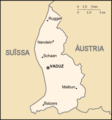
 Liechtenstein-CIA WFB Map-sv.png 325 × 352; 21 KB
-
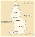
 Liechtenstein-CIA WFB Map.png 325 × 352; 9 KB
-
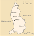
 Liechtenstein-locator.png 328 × 355; 12 KB
-
 Liechtenstein-map-fr.JPG 325 × 352; 35 KB
-
 Liechtenstein-map-german.png 351 × 377; 43 KB
-
 Liechtenstein-map.jpg 351 × 377; 55 KB
-
 Liechtensteinit.png 324 × 346; 6 KB
-
 Lihtensht be.PNG 350 × 379; 42 KB
-
 Ls-map-CA.png 330 × 355; 6 KB
-
 Ls-map-es.png 330 × 355; 10 KB
-
 Ls-map-he.png 328 × 355; 21 KB
-
 Ls-map-nn.png 328 × 355; 26 KB
-
 Ls-map-no.png 328 × 355; 26 KB
-
 Ls-map.png 328 × 355; 25 KB
-
 Mapa Lichtenštejnska.PNG 328 × 355; 33 KB
-
 Mapo Liĥtenŝtejno.png 330 × 355; 12 KB
-
 World Factbook (1982) Liechtenstein.jpg 586 × 589; 70 KB
-
 World Factbook (1990) Liechtenstein.jpg 419 × 549; 72 KB


.png)


_Liechtenstein.jpg)
_Liechtenstein.jpg)