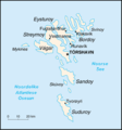
Category:CIA World Factbook maps of the Faroe Islands
Jump to navigation
Jump to search
Media in category "CIA World Factbook maps of the Faroe Islands"
The following 8 files are in this category, out of 8 total.
-
Faroe islands map-HU.gif 330 × 355; 10 KB
-
Faroe Islands-CIA WFB Map.png 328 × 352; 12 KB
-
Faroerit.png 330 × 355; 23 KB
-
Fo-map.gif 330 × 355; 9 KB
-
Færøyene-kart.png 328 × 352; 21 KB
-
Kaart Faeröer.png 330 × 355; 9 KB
-
Kaart Faroer.png 330 × 355; 7 KB
-
World Factbook (1990) Faroe Islands.jpg 571 × 560; 68 KB


