Category:Buittle
Jump to navigation
Jump to search
ecclesiastical and civil parish in Dumfries and Galloway, southwest Scotland | |||||
| Upload media | |||||
| Instance of | |||||
|---|---|---|---|---|---|
| Location |
| ||||
| Population |
| ||||
| Area |
| ||||
 | |||||
Buittle Civil Parish
For placenames in Buittle, see : http://www.kirkcudbright.co/places.asp?ID=2
Subcategories
This category has the following 5 subcategories, out of 5 total.
B
- Buittle Bridge (6 F)
- Buittle Castle (2 F)
- Buittle Place (32 F)
- Buittle railway station (2 F)
P
Media in category "Buittle"
The following 200 files are in this category, out of 773 total.
(previous page) (next page)-
 "Black Bird" Palnackie - geograph.org.uk - 6615572.jpg 2,760 × 1,984; 957 KB
-
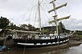 "La Malouine" Palnackie Harbour - geograph.org.uk - 6615602.jpg 2,976 × 1,984; 2.3 MB
-

-
 7 Stanes cyclists, Dalbeattie - geograph.org.uk - 2040203.jpg 1,200 × 1,600; 1.02 MB
-
 A bend in Urr Water - geograph.org.uk - 3176585.jpg 2,462 × 1,780; 1.37 MB
-
 A boulder on Moyl - geograph.org.uk - 2950804.jpg 640 × 465; 278 KB
-
 A bridge over the Doach Burn on the B736 - geograph.org.uk - 3180765.jpg 2,325 × 1,786; 1.37 MB
-
 A Cloud of Tadpoles - geograph.org.uk - 2980385.jpg 640 × 480; 93 KB
-

-
 A headstone in Buittle Old Kirkyard - geograph.org.uk - 3492587.jpg 438 × 640; 191 KB
-
 A minor road to Palnackie - geograph.org.uk - 3180740.jpg 2,560 × 1,920; 2.83 MB
-
 A path at Gibb's Hole Wood - geograph.org.uk - 2950779.jpg 640 × 480; 220 KB
-
 A sheep with lambs at Almorness - geograph.org.uk - 2950822.jpg 640 × 439; 214 KB
-
 A turning to Castle Douglas - geograph.org.uk - 3182207.jpg 2,142 × 1,490; 558 KB
-
 A711 and the junction with the B736 - geograph.org.uk - 2113451.jpg 1,925 × 1,454; 660 KB
-
 A711 in Palnackie - geograph.org.uk - 2980865.jpg 480 × 640; 77 KB
-
 A711 to Dalbeattie - geograph.org.uk - 2980932.jpg 467 × 640; 88 KB
-
 A711 to Dalbeattie - geograph.org.uk - 2980970.jpg 480 × 640; 125 KB
-
 A711 to Dalbeattie - geograph.org.uk - 2981009.jpg 640 × 480; 93 KB
-
 A711 to Kirkcudbright - geograph.org.uk - 2980398.jpg 480 × 640; 109 KB
-
 A711 to Palnackie - geograph.org.uk - 2980926.jpg 480 × 640; 117 KB
-
 A711 to Palnackie - geograph.org.uk - 2981001.jpg 640 × 480; 95 KB
-
 A745 Castle Douglas to Dalbeattie road - geograph.org.uk - 3613873.jpg 800 × 451; 169 KB
-
 A745 Layby - geograph.org.uk - 2633526.jpg 640 × 480; 57 KB
-
 Abandoned - geograph.org.uk - 910119.jpg 640 × 365; 79 KB
-
 Above Coalhole Wood - geograph.org.uk - 3727702.jpg 640 × 424; 134 KB
-
 Across the Beach - geograph.org.uk - 1301379.jpg 640 × 480; 170 KB
-
 Across the clearfell - geograph.org.uk - 3445035.jpg 640 × 424; 76 KB
-
 Allan Bank - geograph.org.uk - 2633533.jpg 640 × 480; 56 KB
-
 Allan Bank - geograph.org.uk - 2633540.jpg 640 × 480; 55 KB
-
 Allan Bank - geograph.org.uk - 2633549.jpg 640 × 480; 86 KB
-
 Allan Bank - geograph.org.uk - 682955.jpg 640 × 480; 77 KB
-
 Almorness Gate - geograph.org.uk - 2213220.jpg 640 × 427; 71 KB
-
 Almorness Gate - geograph.org.uk - 4702641.jpg 3,261 × 2,087; 2.37 MB
-
 Almorness Gates and Car Park - geograph.org.uk - 2049660.jpg 1,000 × 750; 578 KB
-
 Almorness House - geograph.org.uk - 4708892.jpg 3,197 × 2,046; 2.23 MB
-
 Almorness House - geograph.org.uk - 5162958.jpg 1,600 × 862; 197 KB
-
 Almorness Point - geograph.org.uk - 5630304.jpg 4,378 × 2,918; 7.82 MB
-
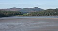
 Almorness, from above the Nith Estuary - geograph.org.uk - 5461505.jpg 3,264 × 2,448; 3.76 MB
-
 Along the old railway near Buittle Station. - geograph.org.uk - 2052139.jpg 1,000 × 750; 610 KB
-
 An entrance into Blackbellie Plantation - geograph.org.uk - 3180759.jpg 2,560 × 1,920; 1.64 MB
-
 An overgrown burn - geograph.org.uk - 3180717.jpg 2,560 × 1,920; 1.77 MB
-
 An Unlikely Ford - geograph.org.uk - 5999711.jpg 640 × 424; 106 KB
-
 Approaching a crossroads on the A711 - geograph.org.uk - 3176680.jpg 2,273 × 1,616; 676 KB
-
 Approaching a T junction - geograph.org.uk - 3180722.jpg 2,380 × 1,767; 1.53 MB
-
 Approaching Buittle Cemetery - geograph.org.uk - 6148971.jpg 2,976 × 1,984; 4.91 MB
-
 Approaching Old Douganhill - geograph.org.uk - 3180743.jpg 2,510 × 1,850; 988 KB
-
 Approaching Orchardton Tower - geograph.org.uk - 3180731.jpg 2,560 × 1,920; 1.39 MB
-
 Arriving at Palnackie - geograph.org.uk - 3940709.jpg 1,920 × 1,280; 1.78 MB
-
 Ash Flower - geograph.org.uk - 1277642.jpg 480 × 640; 112 KB
-
 Ash Keys - geograph.org.uk - 3697885.jpg 640 × 424; 147 KB
-
 Ashore at White Port - geograph.org.uk - 3492612.jpg 640 × 427; 195 KB
-
 At the summit of Moyl - geograph.org.uk - 2950812.jpg 640 × 472; 376 KB
-
 Autumn Colour at North Glen - geograph.org.uk - 1289074.jpg 640 × 480; 305 KB
-

-
 Autumn colour on the Palnackie road - geograph.org.uk - 3198757.jpg 481 × 640; 94 KB
-
 Autumn Colours - North Glen Wood - geograph.org.uk - 1289101.jpg 640 × 480; 311 KB
-
 Autumn Colours on Kirkennan Hill - geograph.org.uk - 1288197.jpg 640 × 480; 252 KB
-
 Autumn Colours on the Glen Road - geograph.org.uk - 1289071.jpg 640 × 480; 304 KB
-
 B727 at the junction with A745 - geograph.org.uk - 2040342.jpg 1,600 × 1,200; 703 KB
-
 B727 near Castlegower - geograph.org.uk - 4900995.jpg 3,504 × 2,336; 3.47 MB
-
 B727 near Craigton Hill - geograph.org.uk - 4900957.jpg 3,504 × 2,336; 3.86 MB
-
 B727 to Gelston - geograph.org.uk - 4476997.jpg 1,920 × 1,280; 1.71 MB
-
 B736 at Doach - geograph.org.uk - 5578436.jpg 1,600 × 1,029; 389 KB
-
 B736 at Doach Wood - geograph.org.uk - 5578445.jpg 1,600 × 1,067; 392 KB
-
 B736 road past Doach Car Park to Doach cottage - geograph.org.uk - 2051251.jpg 1,000 × 750; 628 KB
-
 Barchain, Buittle - geograph.org.uk - 735791.jpg 640 × 480; 84 KB
-
 Barlae Hill - geograph.org.uk - 2980227.jpg 480 × 640; 112 KB
-
 Barlochan Glen - geograph.org.uk - 1288183.jpg 640 × 480; 108 KB
-
 Barlochan House - geograph.org.uk - 2980859.jpg 640 × 480; 117 KB
-
 Barrsyard - geograph.org.uk - 685938.jpg 640 × 480; 61 KB
-
 Barskeoch Hill - geograph.org.uk - 2285173.jpg 3,873 × 2,569; 1.16 MB
-
 Barskeoch Hill - geograph.org.uk - 3349195.jpg 640 × 373; 70 KB
-
 Barskeoch Hill - geograph.org.uk - 37521.jpg 427 × 640; 65 KB
-
 Barskeoch Hill Trig - geograph.org.uk - 932915.jpg 640 × 435; 75 KB
-
 Barwhanny - geograph.org.uk - 2980404.jpg 480 × 640; 75 KB
-
 Beech Trees in Ramshaw Wood - geograph.org.uk - 3258426.jpg 424 × 640; 108 KB
-
 Beech, Gorse, and Urr bends - geograph.org.uk - 1274072.jpg 640 × 480; 139 KB
-
 Beechbud Opening - geograph.org.uk - 1307966.jpg 480 × 640; 65 KB
-
 Bend on the B727 - geograph.org.uk - 4900945.jpg 3,504 × 2,336; 4.1 MB
-
 Bend on the Urr Water - geograph.org.uk - 5352026.jpg 640 × 480; 69 KB
-
 Bends in Road - geograph.org.uk - 1087595.jpg 640 × 480; 102 KB
-
 Beside the Gelston road - geograph.org.uk - 3331676.jpg 640 × 397; 81 KB
-
 Beware of Bull - geograph.org.uk - 932947.jpg 640 × 480; 107 KB
-
 Big Barwhanny Loch - geograph.org.uk - 2980366.jpg 480 × 640; 92 KB
-
 Big Barwhanny Loch - geograph.org.uk - 2980371.jpg 476 × 640; 89 KB
-
 Big Barwhanny Loch - geograph.org.uk - 3940818.jpg 1,920 × 1,280; 2.78 MB
-
 Big Barwhanny Loch - geograph.org.uk - 3940831.jpg 1,920 × 1,280; 3.14 MB
-
 Big Barwhanny Loch - geograph.org.uk - 3940835.jpg 1,920 × 1,280; 1.92 MB
-
 Big Pine - geograph.org.uk - 1280381.jpg 341 × 640; 126 KB
-
 Big Pine in Oakbank Wood - geograph.org.uk - 1280391.jpg 640 × 480; 184 KB
-
 Birkland Bridge - geograph.org.uk - 2633580.jpg 640 × 480; 49 KB
-
 Birkland Bridge - geograph.org.uk - 2633588.jpg 640 × 480; 50 KB
-
 Birkland Burn - geograph.org.uk - 2633596.jpg 640 × 480; 99 KB
-
 Blackbellie - geograph.org.uk - 3207677.jpg 640 × 339; 88 KB
-
 Blackbellie - geograph.org.uk - 3207682.jpg 640 × 481; 91 KB
-
 Blackbellie Hill - geograph.org.uk - 2980326.jpg 531 × 640; 106 KB
-
 Blackbellie Hill - geograph.org.uk - 714120.jpg 640 × 480; 65 KB
-
 Blackbellie in spring - geograph.org.uk - 3514789.jpg 640 × 443; 91 KB
-

-
 Blaeberry Bank - geograph.org.uk - 1301227.jpg 640 × 480; 365 KB
-
 Bluebell blossoms - geograph.org.uk - 3483325.jpg 427 × 640; 188 KB
-
 Bluebells at Cocklehaen - geograph.org.uk - 1301545.jpg 640 × 469; 289 KB
-
 Bluebells near Almorness House - geograph.org.uk - 3483320.jpg 640 × 427; 194 KB
-
 Boardwalk at Big Barwhanny Loch - geograph.org.uk - 3940844.jpg 1,920 × 1,280; 2.95 MB
-
 Boardwalk on the Carlingwark Circular - geograph.org.uk - 4476449.jpg 1,920 × 1,280; 1.57 MB
-
 Boardwalk on the Carlingwark Circular - geograph.org.uk - 4476950.jpg 1,920 × 1,280; 1.62 MB
-
 Boardwalk on the Carlingwark Circular - geograph.org.uk - 4476951.jpg 1,920 × 1,280; 1.62 MB
-
 Boardwalk on the Carlingwark Circular - geograph.org.uk - 4476956.jpg 1,920 × 1,280; 1.74 MB
-
 Boardwalk south of Carlingwark Loch - geograph.org.uk - 6616693.jpg 480 × 640; 97 KB
-
 Boardwalk to Big Barwhanny Loch near Palnackie - geograph.org.uk - 3940811.jpg 1,920 × 1,280; 3.05 MB
-
 Boat at Kippford - geograph.org.uk - 5574924.jpg 1,600 × 900; 308 KB
-
 Bracket Fungus in Torglass Wood - geograph.org.uk - 2074749.jpg 2,272 × 1,704; 1.44 MB
-
 Breckoniehill - geograph.org.uk - 3256448.jpg 640 × 424; 50 KB
-
 Breckoniehill - geograph.org.uk - 685993.jpg 640 × 480; 81 KB
-
 Breoch Cottage - geograph.org.uk - 3182172.jpg 2,380 × 1,660; 1.08 MB
-
 Broomisle - geograph.org.uk - 2980994.jpg 480 × 640; 130 KB
-
 Broomisle - geograph.org.uk - 854447.jpg 640 × 388; 89 KB
-
 Broomisle in Winter - geograph.org.uk - 3256438.jpg 640 × 424; 132 KB
-
 Buittle Burn from Stepend Bridge - geograph.org.uk - 2054836.jpg 1,000 × 750; 725 KB
-
 Buittle Castle - geograph.org.uk - 4474206.jpg 2,336 × 3,248; 4.53 MB
-
 Buittle Castle - geograph.org.uk - 5999554.jpg 640 × 436; 131 KB
-
 Buittle Castle Remains - geograph.org.uk - 5999555.jpg 640 × 465; 108 KB
-
 Buittle Castle View - geograph.org.uk - 5999559.jpg 640 × 452; 123 KB
-
 Buittle Cemetery - geograph.org.uk - 6148955.jpg 2,976 × 1,984; 3.17 MB
-
 Buittle Cemetery - geograph.org.uk - 6148961.jpg 2,976 × 1,984; 3.28 MB
-
 Buittle Cemetery - geograph.org.uk - 6148962.jpg 2,976 × 1,984; 2.94 MB
-
 Buittle Cemetery - geograph.org.uk - 6148964.jpg 2,976 × 1,984; 3.54 MB
-
 Buittle Cemetery - geograph.org.uk - 6148976.jpg 2,976 × 1,984; 1,022 KB
-
 Buittle Cemetery - geograph.org.uk - 697698.jpg 640 × 480; 95 KB
-
 Buittle Church - geograph.org.uk - 2040343.jpg 1,600 × 1,200; 708 KB
-
 Buittle Church - geograph.org.uk - 4900539.jpg 3,228 × 2,089; 2.43 MB
-
 Buittle Church - geograph.org.uk - 4900553.jpg 2,128 × 2,891; 2.22 MB
-
 Buittle Church - geograph.org.uk - 4900591.jpg 3,504 × 2,336; 4.61 MB
-
 Buittle Church - geograph.org.uk - 6148968.jpg 2,976 × 1,984; 3.97 MB
-
 Buittle Church - geograph.org.uk - 6148974.jpg 2,802 × 1,761; 1.36 MB
-
 Buittle Church - geograph.org.uk - 6149137.jpg 2,976 × 1,984; 3.38 MB
-
 Buittle Church - geograph.org.uk - 6149139.jpg 2,976 × 1,984; 2.72 MB
-
 Buittle crossroads - geograph.org.uk - 3613869.jpg 800 × 451; 184 KB
-
 Buittle Hill - geograph.org.uk - 3349213.jpg 640 × 424; 99 KB
-
 Buittle Kirk Graveyard - geograph.org.uk - 5999544.jpg 640 × 432; 117 KB
-
 Buittle Mains - geograph.org.uk - 2633496.jpg 640 × 475; 87 KB
-
 Buittle Mains - geograph.org.uk - 2633504.jpg 640 × 467; 68 KB
-
 Buittle Mains - geograph.org.uk - 2633511.jpg 640 × 480; 62 KB
-
 Buittle Mains - geograph.org.uk - 3182246.jpg 2,540 × 1,894; 1.14 MB
-
 Buittle Mains - geograph.org.uk - 3256460.jpg 640 × 380; 46 KB
-
 Buittle Mains - geograph.org.uk - 685843.jpg 640 × 480; 70 KB
-
 Buittle Mains - geograph.org.uk - 791571.jpg 640 × 361; 59 KB
-
 Buittle Old Kirk - geograph.org.uk - 225429.jpg 432 × 285; 26 KB
-
 Buittle Old Kirk - geograph.org.uk - 3087008.jpg 1,600 × 1,200; 542 KB
-
 Buittle Old Kirk - geograph.org.uk - 4900573.jpg 3,504 × 2,336; 4.08 MB
-
 Buittle Old Kirk - geograph.org.uk - 4900580.jpg 3,504 × 2,336; 4.09 MB
-
 Buittle Old Kirk - geograph.org.uk - 5999550.jpg 640 × 418; 90 KB
-
 Buittle Old Kirk - geograph.org.uk - 680911.jpg 640 × 480; 99 KB
-
 Buittle Old Kirk, near Castle Douglas - geograph.org.uk - 69641.jpg 640 × 480; 73 KB
-
 Buittle Parish Church - geograph.org.uk - 5999546.jpg 640 × 432; 109 KB
-
 Buittle Place - geograph.org.uk - 5999552.jpg 640 × 448; 81 KB
-
 Buittle Place - geograph.org.uk - 685870.jpg 640 × 480; 79 KB
-
 Buittle ponds - geograph.org.uk - 3330144.jpg 640 × 424; 118 KB
-
 Burial vault of Robert Stuart - geograph.org.uk - 4900565.jpg 2,854 × 1,987; 1.92 MB
-
 Caigton Pond - geograph.org.uk - 791596.jpg 640 × 462; 120 KB
-
 Carlingwark Circular - geograph.org.uk - 4476960.jpg 1,920 × 1,280; 2 MB
-
 Carlingwark Circular - geograph.org.uk - 4476963.jpg 1,920 × 1,280; 2.01 MB
-
 Carlingwark Circular - geograph.org.uk - 4476965.jpg 1,920 × 1,280; 2.07 MB
-
 Carlingwark Circular - geograph.org.uk - 4476968.jpg 1,920 × 1,280; 1.94 MB
-
 Carlingwark Circular with Kissing Gates - geograph.org.uk - 4476457.jpg 1,920 × 1,280; 2.09 MB
-
 Carlingwark Circular with Kissing Gates - geograph.org.uk - 4476959.jpg 1,920 × 1,280; 1.65 MB
-
 Carlingwark Loch Circular Walk - geograph.org.uk - 4085465.jpg 1,920 × 1,280; 2.12 MB
-
 Castle Douglas dog walk - geograph.org.uk - 3460353.jpg 640 × 424; 78 KB
-
 Castlegower Farm - geograph.org.uk - 2734286.jpg 1,200 × 900; 314 KB
-
 Chapelcroft - geograph.org.uk - 1498806.jpg 640 × 480; 156 KB
-
 Chapelcroft - geograph.org.uk - 2285670.jpg 2,622 × 1,266; 339 KB
-
 Chapelcroft - geograph.org.uk - 2292711.jpg 3,888 × 2,592; 1.78 MB
-
 Chapelcroft - geograph.org.uk - 444352.jpg 640 × 480; 116 KB
-
 Chapelcroft Farm - geograph.org.uk - 1173724.jpg 640 × 341; 35 KB
-
 Chapelcroft Farm - geograph.org.uk - 1344426.jpg 640 × 480; 167 KB
-
 Chapelcroft Farm - geograph.org.uk - 3940470.jpg 1,920 × 1,280; 1.81 MB
-
 Cheeky Red Squirrel - geograph.org.uk - 5578472.jpg 1,067 × 1,600; 474 KB
-
 Circular knoll on Barchain Farm - geograph.org.uk - 2055313.jpg 1,000 × 670; 492 KB
-
 Clone, Buittle - geograph.org.uk - 2055341.jpg 1,000 × 670; 613 KB
-
 Closed Gate, Almorness - geograph.org.uk - 4486257.jpg 3,504 × 2,336; 3.91 MB
-
 Cock O' the Walk - geograph.org.uk - 1276024.jpg 640 × 409; 146 KB
-
 Cockleaths - geograph.org.uk - 5773728.jpg 1,600 × 968; 439 KB
-
 Cocklehaen Gate - geograph.org.uk - 1301188.jpg 640 × 480; 142 KB
-
 Cocklehaen, Nestled in the Woods - geograph.org.uk - 1301479.jpg 640 × 480; 510 KB
-
 Confluence - geograph.org.uk - 3246150.jpg 640 × 424; 59 KB
-
 Cooling Off - geograph.org.uk - 2734265.jpg 1,200 × 900; 499 KB
-
 Copse - geograph.org.uk - 769154.jpg 640 × 389; 80 KB
-
 Corra - geograph.org.uk - 2981248.jpg 480 × 640; 68 KB
-
 Corra - geograph.org.uk - 2981256.jpg 640 × 480; 74 KB
-
 Corra Farm - geograph.org.uk - 5578185.jpg 1,600 × 1,033; 277 KB
-
 Corra Farm - geograph.org.uk - 791604.jpg 640 × 273; 39 KB
-
 Corra Farm, Castle Douglas - geograph.org.uk - 2048292.jpg 1,000 × 359; 221 KB
-
 Corra Lane - geograph.org.uk - 2981268.jpg 480 × 640; 101 KB
-
 Corra Lane - geograph.org.uk - 2981277.jpg 480 × 640; 116 KB
-
 Corra Lane from the road - geograph.org.uk - 2051263.jpg 1,000 × 750; 519 KB
-
 Cottages beside the B727 - geograph.org.uk - 3182224.jpg 2,185 × 1,802; 1.37 MB
-
 Couch - 1 - geograph.org.uk - 2977325.jpg 640 × 480; 136 KB
-
 Couch - 2 - geograph.org.uk - 2977333.jpg 640 × 480; 129 KB
-
 Couch - 3 - geograph.org.uk - 2977341.jpg 480 × 640; 129 KB


