Category:Broughton, Glenholm and Kilbucho
Jump to navigation
Jump to search
Scottish parish in Scottish Borders, Scotland, UK  | |||||
| Upload media | |||||
| Instance of | |||||
|---|---|---|---|---|---|
| Part of |
| ||||
| Location |
| ||||
| Population |
| ||||
| Area |
| ||||
 | |||||
Media in category "Broughton, Glenholm and Kilbucho"
The following 200 files are in this category, out of 1,241 total.
(previous page) (next page)-
 'Beware of the Shepherd' - geograph.org.uk - 2519897.jpg 800 × 530; 155 KB
-
 20mph speed limit, Broughton - geograph.org.uk - 6696164.jpg 1,600 × 1,060; 617 KB
-

-

-

-
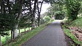
 A country road at Glenholm - geograph.org.uk - 2384657.jpg 640 × 427; 187 KB
-
 A fairy in the forest at Broughtonknowe - geograph.org.uk - 3065004.jpg 533 × 800; 173 KB
-
 A fork in the road at Kilbucho - geograph.org.uk - 2087835.jpg 640 × 481; 71 KB
-
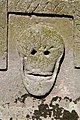 A gravestone detail at Glenholm - geograph.org.uk - 2384651.jpg 427 × 640; 190 KB
-
 A kestrel's larder^ - geograph.org.uk - 2573645.jpg 800 × 530; 123 KB
-
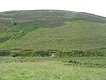
 A moorland bowl - geograph.org.uk - 3226322.jpg 640 × 480; 302 KB
-
 A peep through the trees - geograph.org.uk - 1906342.jpg 640 × 480; 100 KB
-
 A rutted track, Mitchell Hill - geograph.org.uk - 2790040.jpg 640 × 360; 239 KB
-
-

-
 A scene near Woodend in Peeblesshire - geograph.org.uk - 1737435.jpg 640 × 480; 71 KB
-
 A signpost quandry^ - geograph.org.uk - 6664842.jpg 1,024 × 575; 252 KB
-
 A small graveyard at Glenholm - geograph.org.uk - 2384644.jpg 640 × 427; 177 KB
-
-
 A view over the fields Kaimrig End - geograph.org.uk - 1906357.jpg 640 × 480; 60 KB
-

-
 A701 - geograph.org.uk - 4145953.jpg 800 × 450; 329 KB
-
 A701 at Broughton - geograph.org.uk - 6521711.jpg 800 × 601; 451 KB
-
 A701 at Rachan Mill - geograph.org.uk - 6521715.jpg 800 × 533; 370 KB
-
 A701 in the Scottish Borders - geograph.org.uk - 6521728.jpg 1,024 × 683; 570 KB
-
 A701 near Stanhope - geograph.org.uk - 4747867.jpg 4,608 × 3,456; 5.07 MB
-
 A701 near to Broughton - geograph.org.uk - 6521560.jpg 800 × 533; 442 KB
-
 A701 near Wrea hill - geograph.org.uk - 6521719.jpg 800 × 600; 343 KB
-
 A701 north of Broughton - geograph.org.uk - 3064994.jpg 800 × 533; 77 KB
-
 A701 south of Broughton - geograph.org.uk - 6521714.jpg 800 × 600; 412 KB
-
 A701 south of Kaimrig End - geograph.org.uk - 6519213.jpg 1,024 × 682; 460 KB
-
 A701 to Broughton - geograph.org.uk - 3064999.jpg 800 × 533; 69 KB
-
 A701 under Worm Hill - geograph.org.uk - 3197371.jpg 640 × 480; 272 KB
-
 A701 under Worm Hill - geograph.org.uk - 3197377.jpg 640 × 480; 306 KB
-
 A701, Broughton - geograph.org.uk - 3120851.jpg 640 × 480; 132 KB
-
 A701, Broughton - geograph.org.uk - 3120855.jpg 640 × 480; 104 KB
-
 A701, Broughton - geograph.org.uk - 3218595.jpg 640 × 480; 327 KB
-
 A701, Tweeddale - geograph.org.uk - 3197364.jpg 640 × 480; 303 KB
-
 A701, Tweeddale - geograph.org.uk - 4135733.jpg 800 × 450; 359 KB
-
 A701, Tweeddale - geograph.org.uk - 6521726.jpg 1,024 × 683; 572 KB
-
 Aim for that photographer... - geograph.org.uk - 3935664.jpg 1,024 × 733; 118 KB
-

-

-
 Ancient settlements above Kilbucho - geograph.org.uk - 2481481.jpg 800 × 530; 158 KB
-
 Applegarth house at Kilbucho - geograph.org.uk - 6664833.jpg 1,024 × 575; 152 KB
-
 Approaching Cardon Hill - geograph.org.uk - 5091553.jpg 1,024 × 768; 156 KB
-
 Approaching Kilbucho - geograph.org.uk - 6664831.jpg 1,024 × 575; 160 KB
-
 Approaching the junction, Kilbucho - geograph.org.uk - 6385825.jpg 1,600 × 1,060; 375 KB
-
 Approaching the summit of Pyked Stane Hill - geograph.org.uk - 3197901.jpg 4,356 × 3,268; 6.69 MB
-
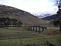
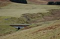 Aqueduct bridge over the Logan Burn - geograph.org.uk - 2217740.jpg 800 × 530; 166 KB
-
 Arable land, Glenholm - geograph.org.uk - 3224886.jpg 640 × 360; 221 KB
-
 Arc of trees at Mossfennan - geograph.org.uk - 6180795.jpg 1,600 × 1,060; 294 KB
-
 Autumn colours around Broughton Place - geograph.org.uk - 5172724.jpg 1,024 × 711; 167 KB
-
 Back Burn - geograph.org.uk - 2399432.jpg 640 × 480; 290 KB
-
 Back Burn - geograph.org.uk - 2409991.jpg 640 × 480; 310 KB
-
 Back Burn - geograph.org.uk - 2913747.jpg 640 × 360; 212 KB
-
 Back Burn and new plantation, Stirkfield Rig - geograph.org.uk - 6489601.jpg 1,600 × 1,060; 577 KB
-
 Back Ditch - geograph.org.uk - 2543361.jpg 640 × 480; 300 KB
-
 Back Ditch, Mitchelhill - geograph.org.uk - 4417771.jpg 1,024 × 682; 221 KB
-
 Back Ditch, Mitchelhill - geograph.org.uk - 6664111.jpg 1,600 × 1,060; 571 KB
-
 Back Road near Rachan Home Farm - geograph.org.uk - 3181121.jpg 800 × 600; 177 KB
-
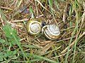 Banded Snails enjoying the damp - geograph.org.uk - 1907896.jpg 768 × 576; 86 KB
-
 Bank erosion on the Holms Water - geograph.org.uk - 5476063.jpg 3,264 × 2,448; 3.65 MB
-
 Barley and grass - geograph.org.uk - 5476450.jpg 3,264 × 2,448; 3.94 MB
-
 Barley at Glenhighton - geograph.org.uk - 5477351.jpg 3,264 × 2,448; 4.3 MB
-
 Barley at Glenholm - geograph.org.uk - 5476495.jpg 3,264 × 2,448; 3.99 MB
-
 Barley field - geograph.org.uk - 2582119.jpg 640 × 480; 323 KB
-
 Barns at Broughton Place Farm - geograph.org.uk - 2573562.jpg 800 × 530; 187 KB
-
 Barrow Rig from Glenkirk - geograph.org.uk - 5476073.jpg 3,264 × 2,448; 4.13 MB
-
 Beech lined road on Threepland Road - geograph.org.uk - 2582932.jpg 640 × 359; 268 KB
-
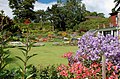 Beechgrove Garden, Broughton - geograph.org.uk - 2512034.jpg 800 × 530; 228 KB
-
 Benner Leishlie Burn and Culter Fell - geograph.org.uk - 2517984.jpg 800 × 530; 142 KB
-
 Benshaw Hill summit fence - geograph.org.uk - 2218844.jpg 800 × 530; 112 KB
-
 Biggar - geograph.org.uk - 2933620.jpg 640 × 480; 284 KB
-
 Biggar And Better - geograph.org.uk - 3767121.jpg 4,592 × 3,448; 4.09 MB
-
 Biggar and Better - geograph.org.uk - 6385811.jpg 1,600 × 1,141; 603 KB
-
 Biggar from Knowehead Hill - geograph.org.uk - 6405169.jpg 1,600 × 1,067; 289 KB
-
 Biggar is getting bigger - geograph.org.uk - 2925838.jpg 640 × 480; 224 KB
-
 Biggar Water - geograph.org.uk - 3181082.jpg 800 × 600; 124 KB
-
 Biggar Water - geograph.org.uk - 3935832.jpg 1,024 × 678; 265 KB
-
 Biggar Water and Parkgatestone Hill - geograph.org.uk - 2774334.jpg 800 × 530; 140 KB
-
 Biggar Water near Bamflatt - geograph.org.uk - 3935806.jpg 1,024 × 678; 257 KB
-
 Bins, Broughton Knowe - geograph.org.uk - 2913752.jpg 640 × 360; 257 KB
-
 Birnies Bowrock - geograph.org.uk - 5091544.jpg 1,024 × 768; 158 KB
-
 Blendewing farm - geograph.org.uk - 2481459.jpg 800 × 530; 121 KB
-
 Blendewing, from near Pisallie Bridge - geograph.org.uk - 1906105.jpg 1,024 × 768; 123 KB
-
 Boundary sign, Threepland Hill - geograph.org.uk - 6405863.jpg 1,600 × 1,196; 648 KB
-
 Brewery at Broughton - geograph.org.uk - 5347804.jpg 1,024 × 682; 164 KB
-
 Bridge and farm, Rachan - geograph.org.uk - 2775074.jpg 800 × 530; 205 KB
-
 Bridge at Rachan - geograph.org.uk - 2775076.jpg 800 × 530; 182 KB
-

-
 Bridge over Broughton Burn - geograph.org.uk - 2775384.jpg 800 × 530; 178 KB
-
 Bridge over the Holms Water - geograph.org.uk - 6696129.jpg 1,600 × 1,060; 613 KB
-
-
 Bridge over the River Tweed at Stanhope - geograph.org.uk - 6096645.jpg 3,264 × 2,448; 3.87 MB
-
 Bridge over the Talla railway - geograph.org.uk - 6531394.jpg 1,024 × 683; 239 KB
-
 Bridge remains at Woodend - geograph.org.uk - 1726555.jpg 1,024 × 768; 155 KB
-
 Broomy Law - geograph.org.uk - 3059929.jpg 640 × 360; 199 KB
-
 Broomy Law - geograph.org.uk - 3059930.jpg 640 × 360; 173 KB
-
 Broomy Law summit fence - geograph.org.uk - 2517065.jpg 800 × 530; 148 KB
-
 Broughton , The A701 - geograph.org.uk - 4940141.jpg 6,000 × 4,000; 5.53 MB
-
 Broughton , The A701 - geograph.org.uk - 4940142.jpg 6,000 × 4,000; 7.88 MB
-
 Broughton , The A701 - geograph.org.uk - 4940202.jpg 6,000 × 4,000; 6.08 MB
-
 Broughton - geograph.org.uk - 3322402.jpg 640 × 480; 259 KB
-
 Broughton - geograph.org.uk - 4149061.jpg 800 × 600; 474 KB
-
 Broughton - geograph.org.uk - 4930432.jpg 1,024 × 683; 297 KB
-
 Broughton and its hills - geograph.org.uk - 6385828.jpg 1,600 × 1,060; 316 KB
-
 Broughton and Ratchill Hill - geograph.org.uk - 4906378.jpg 3,264 × 2,448; 4.06 MB
-
 Broughton at the junction of the A701 and the B7016 - geograph.org.uk - 3924637.jpg 3,264 × 2,448; 1.76 MB
-
 Broughton Burn - geograph.org.uk - 1906302.jpg 640 × 480; 110 KB
-
 Broughton Burn - geograph.org.uk - 2573810.jpg 640 × 480; 319 KB
-
 Broughton Burn - geograph.org.uk - 6205166.jpg 1,600 × 1,060; 589 KB
-
 Broughton Burn - geograph.org.uk - 6515921.jpg 1,600 × 1,066; 525 KB
-
 Broughton Burn joins the Biggar Water - geograph.org.uk - 6515910.jpg 1,600 × 1,066; 585 KB
-
 Broughton Burn near Stirkfield - geograph.org.uk - 937496.jpg 640 × 480; 66 KB
-
 Broughton from above Goseland Hill - geograph.org.uk - 3176754.jpg 3,264 × 2,448; 2.74 MB
-
 Broughton from Cat Cleuch Head - geograph.org.uk - 5172735.jpg 1,024 × 654; 180 KB
-
 Broughton Heights - geograph.org.uk - 2409948.jpg 640 × 480; 286 KB
-
 Broughton Heights - geograph.org.uk - 2925177.jpg 640 × 480; 79 KB
-
 Broughton Heights - geograph.org.uk - 3223755.jpg 640 × 480; 270 KB
-
 Broughton Heights from A701 - geograph.org.uk - 3934777.jpg 1,024 × 681; 143 KB
-
 Broughton Heights from Cowiemuir Hass - geograph.org.uk - 6451864.jpg 1,024 × 300; 84 KB
-
 Broughton Heights viewed from above Broughton Place - geograph.org.uk - 3182778.jpg 3,062 × 2,288; 3.14 MB
-
-

-
 Broughton Hope - geograph.org.uk - 1563055.jpg 640 × 480; 120 KB
-
 Broughton Hope - geograph.org.uk - 1563062.jpg 640 × 469; 65 KB
-
 Broughton Hope - geograph.org.uk - 2912808.jpg 640 × 360; 208 KB
-
 Broughton Hope - geograph.org.uk - 3180189.jpg 4,608 × 3,456; 5.76 MB
-
 Broughton Hope - geograph.org.uk - 5172711.jpg 1,024 × 682; 178 KB
-
 Broughton Hope and Hammer Head - geograph.org.uk - 6488676.jpg 1,600 × 1,060; 458 KB
-
 Broughton Hope and Worm Hill - geograph.org.uk - 6614203.jpg 1,600 × 1,066; 477 KB
-
 Broughton Hope, early autumn - geograph.org.uk - 6614170.jpg 1,600 × 1,066; 454 KB
-
 Broughton main street - geograph.org.uk - 3934457.jpg 1,024 × 678; 163 KB
-
 Broughton Old Kirk - geograph.org.uk - 4195314.jpg 640 × 427; 486 KB
-
 Broughton Old Parish Church - geograph.org.uk - 984933.jpg 427 × 615; 129 KB
-

-
 Broughton Place - geograph.org.uk - 1906294.jpg 640 × 480; 66 KB
-
 Broughton Place - geograph.org.uk - 2573569.jpg 800 × 530; 185 KB
-
 Broughton Place - geograph.org.uk - 2912799.jpg 640 × 360; 188 KB
-
 Broughton Place - geograph.org.uk - 2925675.jpg 640 × 480; 71 KB
-
 Broughton Place - geograph.org.uk - 5395346.jpg 640 × 427; 99 KB
-
 Broughton Place and Shepherd's Cottage - geograph.org.uk - 3182837.jpg 4,608 × 3,456; 6.02 MB
-
 Broughton Place and Tinto - geograph.org.uk - 6617480.jpg 1,600 × 1,122; 296 KB
-
 Broughton Place drive - geograph.org.uk - 3226329.jpg 480 × 640; 376 KB
-
 Broughton Place from Clover Law - geograph.org.uk - 2573607.jpg 800 × 508; 124 KB
-
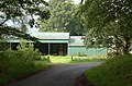
 Broughton School - geograph.org.uk - 1726536.jpg 800 × 600; 175 KB
-
 Broughton School - geograph.org.uk - 3924629.jpg 3,264 × 2,448; 1.96 MB
-
 Broughton Smithy commemorated - geograph.org.uk - 6205161.jpg 1,600 × 1,060; 584 KB
-
 Broughton village - geograph.org.uk - 3935837.jpg 1,024 × 584; 141 KB
-
 Broughton Village Hall - geograph.org.uk - 2790176.jpg 640 × 360; 189 KB
-
 Broughton village hall - geograph.org.uk - 2925680.jpg 640 × 480; 68 KB
-
 Broughton Village Hall - geograph.org.uk - 4502302.jpg 5,184 × 3,456; 7.19 MB
-
 Broughton Village Hall - geograph.org.uk - 4995321.jpg 3,998 × 2,998; 3.98 MB
-
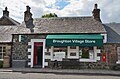 Broughton Village Store - geograph.org.uk - 6205155.jpg 1,600 × 1,060; 389 KB
-
 Broughtonknowe farm - geograph.org.uk - 3065009.jpg 800 × 533; 89 KB
-
 Broughtonknowe Woodland - geograph.org.uk - 937488.jpg 640 × 480; 88 KB
-
 Broughtonknowe Woodland from the A701 - geograph.org.uk - 937494.jpg 640 × 480; 86 KB
-
 Broughtonknowe Woods - geograph.org.uk - 3913727.jpg 640 × 480; 276 KB
-
 Broughtonknowe Woods - geograph.org.uk - 5971227.jpg 1,024 × 683; 429 KB
-
 BT building at Woodend in Tweeddale - geograph.org.uk - 1107326.jpg 640 × 480; 58 KB
-
 Burn passing Kilbucho Church - geograph.org.uk - 1905842.jpg 640 × 480; 132 KB
-
 Burnetland Farm - geograph.org.uk - 2774440.jpg 800 × 530; 213 KB
-
 Burnetland Hill - geograph.org.uk - 1181365.jpg 640 × 359; 65 KB
-
 Burnfoot Farm - geograph.org.uk - 1906093.jpg 1,024 × 768; 133 KB
-
 Burnfoot Farm - geograph.org.uk - 1906208.jpg 640 × 480; 76 KB
-
 Burnfoot Farm - geograph.org.uk - 3935652.jpg 1,024 × 678; 136 KB
-
 Burnfoot Pool on the River Tweed - geograph.org.uk - 2370549.jpg 2,048 × 1,536; 2.34 MB
-
 Burnt gorse on Oak Brae, Goseland Hill - geograph.org.uk - 2481446.jpg 800 × 530; 203 KB
-
 Burnt heather, Broughton Hope - geograph.org.uk - 6489256.jpg 1,600 × 1,060; 743 KB
-
 Bus Shelter at Broughton School - geograph.org.uk - 1093056.jpg 640 × 425; 49 KB
-
 Butter Knowe - geograph.org.uk - 2543471.jpg 640 × 480; 239 KB
-
 Cairn on Langlaw Hill - geograph.org.uk - 5779908.jpg 4,608 × 3,456; 5.1 MB
-
 Cairn on the summit of Hammer Head - geograph.org.uk - 2854593.jpg 640 × 480; 71 KB
-
 Cairn on the summit of Hammer Head - geograph.org.uk - 6557019.jpg 1,024 × 576; 217 KB
-
 Cairn on Worm Hill - geograph.org.uk - 2217745.jpg 800 × 530; 155 KB
-
 Calzeat House - geograph.org.uk - 946546.jpg 640 × 480; 94 KB
-
 Calzeat, Broughton - geograph.org.uk - 5844926.jpg 2,270 × 2,420; 2.35 MB
-
 Cardon at Glenholm - geograph.org.uk - 5476488.jpg 3,264 × 2,448; 3.37 MB
-
 Cardon Hill - geograph.org.uk - 2548549.jpg 640 × 480; 260 KB
-
 Cardon Hill - geograph.org.uk - 2787225.jpg 640 × 480; 320 KB
-
 Cardon Hill - geograph.org.uk - 2790028.jpg 640 × 415; 277 KB
-
 Cardon Hill - geograph.org.uk - 2925828.jpg 640 × 480; 359 KB
-
 Cardon Hill - geograph.org.uk - 2933572.jpg 640 × 360; 254 KB
-
 Cardon Hill from the southwest - geograph.org.uk - 4417425.jpg 1,024 × 682; 206 KB
-
 Cat Cleuch from Elmsfield - geograph.org.uk - 937632.jpg 640 × 480; 79 KB
-
 Cat Cleuch Head - geograph.org.uk - 3218589.jpg 640 × 480; 298 KB
-
 Cattle grid in Glen Holm - geograph.org.uk - 5476091.jpg 3,264 × 2,448; 4.6 MB
-
 Cattle grid near Glenhighton - geograph.org.uk - 2519936.jpg 800 × 530; 143 KB
-
 Cattle, Cleugh - geograph.org.uk - 2582148.jpg 640 × 480; 240 KB
-
 Chapelgill Hill - geograph.org.uk - 2790029.jpg 640 × 480; 302 KB
-
 Chapelgill Hill - geograph.org.uk - 2926251.jpg 640 × 360; 233 KB
-
 Chapelgill Hill - geograph.org.uk - 3223782.jpg 640 × 480; 255 KB
-
 Chapelgill Hill - geograph.org.uk - 4149046.jpg 800 × 600; 405 KB
-
 Chapelgill Hill - geograph.org.uk - 5091533.jpg 1,024 × 768; 163 KB
-
 Chapelgill Hill and Glencotho - geograph.org.uk - 3794787.jpg 4,608 × 3,456; 5.52 MB
-
 Chapelgill Hill from Culter Fell - geograph.org.uk - 3572978.jpg 1,024 × 678; 169 KB
-
 Chapelgill Hill from Culter Fell - geograph.org.uk - 4903647.jpg 4,896 × 3,672; 6.9 MB
-
 Chapelgill Hill from the air - geograph.org.uk - 6391963.jpg 1,024 × 768; 241 KB
-
 Chapelgill Hill ^ Glencotho from near Cocklie Rig Head - geograph.org.uk - 6489977.jpg 1,799 × 1,199; 373 KB


