
Category:Bridges in the United States photographed in 2015
Subcategories
This category has the following 4 subcategories, out of 4 total.
B
- Brooklyn Bridge in 2015 (59 F)
G
- Golden Gate Bridge in 2015 (39 F)
Q
- Queensboro Bridge in 2015 (12 F)
W
Media in category "Bridges in the United States photographed in 2015"
The following 200 files are in this category, out of 316 total.
(previous page) (next page)-

-
 2015-08 views of San Francisco.jpg 4,608 × 3,456; 3.35 MB
-

-

-

-
-
 2015-36 views of San Francisco.jpg 4,608 × 3,456; 3.49 MB
-
 2015-37 views of San Francisco.jpg 4,608 × 3,456; 3.74 MB
-
 6th St Overpass, Griffin (looking North at SB lanes).JPG 4,608 × 3,456; 4.84 MB
-
 6th St Overpass, Griffin (SE corner).JPG 4,608 × 3,456; 5.51 MB
-
 6th St Overpass, Griffin (SW corner).JPG 4,608 × 3,456; 5.53 MB
-
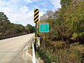
 Alapaha River, US41nb, west of Jasper.JPG 4,608 × 3,456; 4.84 MB
-
 Altamaha River with US 17 bridge, Georgia, USA.jpg 6,000 × 4,000; 3.92 MB
-
 Alte Bay Bridge, Rest im Juli 2015.JPG 4,000 × 3,000; 3.2 MB
-
 Another bridge where 101 crosses Eel River (21742488738).jpg 2,048 × 1,536; 2.13 MB
-
 At foot bridge heading South to White Springs Bath site.jpg 4,608 × 3,456; 5.85 MB
-
 At San Francisco 2015 060.jpg 5,184 × 3,456; 3.93 MB
-
 Avenue of the Giants goes under 101 and 101 crosses Eel River (21742483308).jpg 2,048 × 1,536; 1.8 MB
-
 Azalea Festival 2015 34.JPG 4,608 × 3,456; 6.23 MB
-
 Bay Bridge, alt und neu.JPG 3,000 × 4,000; 2.41 MB
-
 Bay Bridge, Hängebrücke und Stahlseile.JPG 3,000 × 4,000; 2.34 MB
-
 Big Spring Creek Lewistown Montana 09.JPG 3,264 × 2,448; 3.49 MB
-
 Big Spring Creek Lewistown Montana 11.JPG 3,264 × 2,448; 3.42 MB
-
 Big Spring Creek Lewistown Montana 12.JPG 3,264 × 2,448; 3.43 MB
-
 Big Spring Creek Lewistown Montana 13.JPG 3,264 × 2,448; 3.49 MB
-
 Big Spring Creek Lewistown Montana 27.JPG 3,264 × 2,448; 3.73 MB
-
 Big Spring Creek Lewistown Montana 30.JPG 3,264 × 2,448; 3.64 MB
-
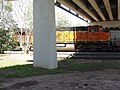 BNSF 7423 in Griffin.JPG 4,608 × 3,456; 6.14 MB
-
 Bridge In Boston (106013173).jpeg 2,048 × 1,365; 648 KB
-
 Bridge Mountain Biker (22820008813).jpg 4,144 × 3,056; 5.29 MB
-
 Bridge pan 2 sm.jpg 3,456 × 1,314; 2.99 MB
-
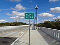
 Broad Ave Bridge over Flint River.JPG 4,608 × 3,456; 6.13 MB
-
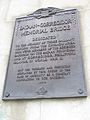
 Broad Avenue Memorial Bridge a.JPG 5,152 × 3,864; 7.81 MB
-
 Broad Avenue Memorial Bridge plaque A.JPG 5,152 × 3,864; 7.9 MB
-
 Broad Avenue Memorial Bridge plaque B.JPG 5,152 × 3,864; 7.67 MB
-
 Broad Avenue Memorial Bridge, Flint River sign.JPG 5,152 × 3,864; 7.82 MB
-
 Broad Avenue Memorial Bridge, North face.JPG 5,152 × 3,864; 7.79 MB
-
 Broad Avenue Memorial Bridge, South face a.JPG 5,152 × 3,864; 7.9 MB
-
 Broad Avenue Memorial Bridge, South face b.JPG 5,152 × 3,864; 7.8 MB
-
 Brooklyn Botanic Garden New York May 2015 panorama 2.jpg 9,600 × 4,800; 25.95 MB
-
 Canada Geese and footbridge, Tom Brown Park.jpg 4,608 × 3,456; 5.45 MB
-
 Carroll Bridge Looking West.jpg 3,992 × 5,976; 4.01 MB
-
 Cattails and pedestrian bridge to island in Reed Bingham Lake.JPG 4,608 × 3,456; 5.64 MB
-
 Cedar Avenue at Lake Nokomis.jpg 1,677 × 1,081; 547 KB
-
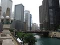 Chicago, June 2015 - 114.jpg 4,000 × 3,000; 2.75 MB
-
 Chicago, June 2015 - 117.jpg 4,000 × 3,000; 3.44 MB
-
 Chicago, June 2015 - 122.jpg 3,000 × 4,000; 2.22 MB
-
 Chicago, June 2015 - 130.jpg 3,000 × 4,000; 2.61 MB
-
 Chicago, June 2015 - 131.jpg 4,000 × 3,000; 2.67 MB
-
 Chicago, June 2015 - 133.jpg 4,000 × 3,000; 3.1 MB
-
 Chicago, June 2015 - 135.jpg 3,000 × 4,000; 3.75 MB
-
 Claremont Hills, Oakland, CA, USA - panoramio (2).jpg 5,184 × 3,456; 5.57 MB
-
 Closer look at railroad trestle over Suwannee River, Hamilton County.JPG 4,608 × 3,456; 6.46 MB
-
 Colquitt County limit, Kinard Bridge Rd.JPG 5,152 × 3,864; 7.92 MB
-
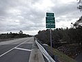 Columbia County border, US41SB.JPG 4,608 × 3,456; 3.93 MB
-
 Corner of footbridge at Lake Leon, Tom Brown Park.JPG 4,608 × 3,456; 5.34 MB
-
 County Rd 158 Overpass, I-10 WB.JPG 4,608 × 3,456; 4.97 MB
-
 CSX Yeoman Subdivision Bridge over Blackwater Creek.JPG 5,152 × 3,864; 4.27 MB
-
 Curved bridge with railings.jpg 2,048 × 1,536; 2.02 MB
-
 Driving along Sidney Lanier Bridge a.JPG 4,608 × 3,456; 3.54 MB
-
 Driving along Sidney Lanier Bridge b.JPG 4,608 × 3,456; 3.63 MB
-
 Driving along Sidney Lanier Bridge c.JPG 4,608 × 3,456; 3.81 MB
-
 Driving along Sidney Lanier Bridge d.JPG 4,608 × 3,456; 3.92 MB
-
 Driving along Sidney Lanier Bridge e.JPG 4,608 × 3,456; 4 MB
-
 Driving along Sidney Lanier Bridge f.JPG 4,608 × 3,456; 3.75 MB
-
 DSC05641 (22082669115).jpg 5,456 × 3,632; 5.56 MB
-
 DSC05644 (21459798114).jpg 5,456 × 3,632; 7.09 MB
-
 DSC05647 (22070151122).jpg 5,456 × 3,632; 8.41 MB
-
 DSC05648 (21894735678).jpg 5,456 × 3,632; 5.34 MB
-
 DSC05651 (21459770954).jpg 5,456 × 3,632; 6.47 MB
-
 DSC05652 (22092630981).jpg 3,632 × 5,456; 5.06 MB
-
 DSC05653 (21894718148).jpg 5,456 × 3,632; 6.5 MB
-
 DSC05654 (21895702109).jpg 3,632 × 5,456; 4.59 MB
-
 DSC05659 (21461457513).jpg 5,456 × 3,632; 8.63 MB
-
 DSC05660 (21894393060).jpg 5,456 × 3,632; 7.78 MB
-
 DSC05670 (22092568711).jpg 8,192 × 1,856; 4.81 MB
-
 DSC05671 (21895644429).jpg 8,192 × 1,856; 5 MB
-
 DSC05672 (22082557915).jpg 5,456 × 3,632; 5.72 MB
-
 DSC05673 (21894651038).jpg 5,456 × 3,632; 6.22 MB
-
 DSC05676 (21461399453).jpg 5,456 × 3,632; 5.44 MB
-
 DSC05689 (22069998112).jpg 5,456 × 3,632; 5.91 MB
-
 DSC05690 (21461340003).jpg 5,456 × 3,632; 5.69 MB
-
 DSC05693 (22069982082).jpg 5,456 × 3,632; 8.66 MB
-
 DSC05694 (22092473471).jpg 5,456 × 3,632; 5.5 MB
-
 DSC05695 (21894259210).jpg 5,456 × 3,632; 6.59 MB
-
 DSC05710 (21894501798).jpg 5,456 × 3,632; 7.97 MB
-
 DSC05711 (21895484239).jpg 5,456 × 3,632; 8.53 MB
-
 DSC05718 (21894467658).jpg 5,456 × 3,632; 8.03 MB
-
 DSC05719 (22092372291).jpg 5,456 × 3,632; 7.66 MB
-
 DSC05725 (21895425979).jpg 3,632 × 5,456; 8.38 MB
-
 DSC05726 (21895421119).jpg 5,456 × 3,632; 4.13 MB
-
 DSC05756 (21459369894).jpg 5,456 × 3,632; 8.19 MB
-
 DSC05790 (22055882196).jpg 5,456 × 3,632; 5.31 MB
-
 DSC05791 (22069576922).jpg 5,456 × 3,632; 5.13 MB
-
 DSC05792 (22069573782).jpg 5,456 × 3,632; 8.31 MB
-
 DSC05825 (21460784833).jpg 5,456 × 3,632; 4.5 MB
-
 DSC05826 (21895009679).jpg 5,456 × 3,632; 4.78 MB
-
 Early County line, Georgia State border, US84EB.JPG 4,608 × 3,456; 5.45 MB
-
 Exit 209A offramp looking at I10, Mahan Dr US90.JPG 4,608 × 3,456; 4.69 MB
-
 Exit to Ambassador Bridge, Detroit, Michigan (21585686279).jpg 3,840 × 2,880; 5.76 MB
-
 Fancy Bluff Creek bridge, GA520WB.JPG 4,608 × 3,456; 4.49 MB
-
 Father Hennepin Bridge.jpg 4,896 × 2,094; 4.65 MB
-
 Father Hennepin bridge.jpg 4,896 × 3,264; 9.74 MB
-
 First Street Bridge in Miami with bascule span raised (2015).jpg 5,184 × 3,456; 3.57 MB
-
 FL 39 Blackwater Creek Bridge; FDOT Marker-1.JPG 5,152 × 3,864; 4.23 MB
-
 FL 39 Blackwater Creek Bridge; FDOT Marker-2.JPG 5,152 × 3,864; 4.17 MB
-
 FL 39 Hillsborough River Bridge; Distant NB Shot.JPG 5,152 × 3,864; 4.19 MB
-
 FL 39 over Hillsborough River; FDOT Number.JPG 5,152 × 3,864; 4.06 MB
-
 FL 39 over Hillsborough River; Rebuilt in 2010.JPG 5,152 × 3,864; 4.1 MB
-
 Florida I10eb Baum Rd Overpass.JPG 4,608 × 3,456; 4.91 MB
-
 Florida I10eb Capital Circle Overpass.JPG 4,608 × 3,456; 4.73 MB
-
 Florida I10eb Centerville Rd Overpass.JPG 4,608 × 3,456; 4.67 MB
-
 Florida I10eb Exit Meridian Rd Overpass.JPG 4,608 × 3,456; 4.98 MB
-
 Florida I10eb Old Lloyd Rd Overpass.JPG 4,608 × 3,456; 4.55 MB
-
 Florida I10eb Olson Rd Overpass.JPG 4,608 × 3,456; 4.64 MB
-
 Florida I10eb Sharer Rd Overpass.JPG 4,608 × 3,456; 4.91 MB
-
 Florida I10eb Waukeenah Hwy overpass.JPG 4,608 × 3,456; 4.58 MB
-
 Florida I10wb Baum Rd Overpass.JPG 4,608 × 3,456; 5.01 MB
-
 Florida I10wb Chaires Rd Overpass.JPG 4,608 × 3,456; 5.04 MB
-
 Florida I75sb Bellville Rd Overpass.JPG 4,608 × 3,456; 3.45 MB
-
 Florida I75sb CR132 Overpass.JPG 4,608 × 3,456; 3.51 MB
-
 Florida I75sb CR136 Overpass and I75.JPG 4,608 × 3,456; 4.59 MB
-
 Florida I75sb CR141 Overpass.JPG 4,608 × 3,456; 3.33 MB
-
 Florida I75sb CR152 Overpass.JPG 4,608 × 3,456; 3.86 MB
-
 Florida I75sb CR249 Overpass.JPG 4,608 × 3,456; 3.37 MB
-
 Florida I75sb Exit 439.JPG 4,608 × 3,456; 3.46 MB
-
 Florida I75sb FL143 Overpass.JPG 4,608 × 3,456; 3.65 MB
-
 Florida I75sb King Hill Rd Overpass close.jpg 5,184 × 3,456; 4.23 MB
-
 Florida I75sb King Hill Rd Overpass.JPG 4,608 × 3,456; 3.48 MB
-
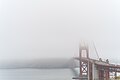 Foggy Weather In San Francisco (Unsplash).jpg 4,240 × 2,832; 3.45 MB
-
 Foot bridge heading North from White Springs Bath site..JPG 4,608 × 3,456; 5.71 MB
-
 Footbridge at Lake Leon, Tom Brown Park.JPG 4,608 × 3,456; 6.46 MB
-
 Former Corona LIRR Station.JPG 5,152 × 3,864; 7.5 MB
-
 Franks Creek Rd Overpass (Guardrail end on bridge and date).JPG 4,608 × 3,456; 5.53 MB
-
 Franks Creek Rd Overpass (South face).JPG 4,608 × 3,456; 5.61 MB
-
 Franks Creek Rd Overpass (Southwest corner).JPG 4,608 × 3,456; 6.29 MB
-
 Franks Creek Rd Overpass (Southwest face).JPG 4,608 × 3,456; 4.83 MB
-
 Franks Creek Rd Overpass (West approach).JPG 4,608 × 3,456; 6.14 MB
-
 GA25nRoad-JamesHoulihanBridge (30656122604).jpg 2,400 × 1,600; 2.26 MB
-
 GA333 railroad overpass, Quitman 1.JPG 5,152 × 3,864; 7.92 MB
-
 GA333 railroad overpass, Quitman 2.JPG 5,152 × 3,864; 7.93 MB
-
 GA333 railroad overpass, Quitman 3.JPG 5,152 × 3,864; 7.92 MB
-
 GA64 bridge over Satilla River a.JPG 5,152 × 3,864; 7.94 MB
-
 GA64 bridge over Satilla River b.JPG 5,152 × 3,864; 7.99 MB
-
 GA64 bridge over Satilla River c.JPG 5,152 × 3,864; 7.93 MB
-
 George-Washington-Bridge - panoramio.jpg 4,608 × 2,304; 4.36 MB
-
 Georgia Coast Rail-Trail, Satilla River bridge b.JPG 4,608 × 3,456; 4.66 MB
-
 Georgia Coast Rail-Trail, Satilla River Bridge.JPG 4,608 × 3,456; 4.97 MB
-
 Georgia I75sb GA31 Overpass.JPG 4,608 × 3,456; 3.75 MB
-
 Georgia I75sb Old Clyattville Rd Overpass.JPG 4,608 × 3,456; 3.38 MB
-
 Georgia I95nb Turtle River.JPG 4,608 × 3,456; 3.5 MB
-
 Georgia State Route 31 bridge Brooks County NB 01.JPG 4,608 × 3,456; 3.65 MB
-
 Georgia State Route 31 bridge Brooks County NB 02.JPG 4,608 × 3,456; 3.96 MB
-
 Georgia State Route 31 bridge Brooks County NB 03.JPG 4,608 × 3,456; 3.68 MB
-
 Georgia State Route 31 bridge Brooks County NB 04.JPG 4,608 × 3,456; 3.66 MB
-
 Georgia State Route 31 bridge Brooks County NB 05.JPG 4,608 × 3,456; 4.01 MB
-
 Georgia State Route 31 bridge Brooks County NB 06.JPG 4,608 × 3,456; 3.54 MB
-
 Georgia State Route 31 bridge Brooks County SB 01.JPG 4,608 × 3,456; 3.48 MB
-
 Georgia State Route 31 bridge Brooks County SB 02.JPG 4,608 × 3,456; 3.54 MB
-
 Georgia State Route 31 bridge Brooks County SB 03.JPG 4,608 × 3,456; 3.39 MB
-
 Georgia State Route 31 bridge Brooks County SB 04.JPG 4,608 × 3,456; 3.49 MB
-
 Georgia State Route 31 bridge Brooks County SB 05.JPG 4,608 × 3,456; 3.54 MB
-
 Georgia State Route 31 bridge Brooks County SB 06.JPG 4,608 × 3,456; 3.36 MB
-
 Georgia State Route 31 bridge Brooks County SB 07.JPG 4,608 × 3,456; 3.62 MB
-
 Georgia State Route 31 bridge, Aug 2015 a.JPG 5,152 × 3,864; 7.77 MB
-
 Georgia State Route 31 bridge, Aug 2015 b.JPG 5,152 × 3,864; 7.81 MB
-
 Georgia State Route 31 bridge, Aug 2015 c.JPG 5,152 × 3,864; 7.91 MB
-
 Georgia State Route 31 bridge, Aug 2015 d.JPG 5,152 × 3,864; 7.67 MB
-
 6th St Overpass, Griffin (southside year marker).JPG 4,608 × 3,456; 6.03 MB
-
 Hamilton County border, US41NB.JPG 4,608 × 3,456; 4.2 MB
-
 Hamilton County, CR136EB.JPG 4,608 × 3,456; 5.96 MB
-
 Hampton Springs Hotel 09.JPG 4,608 × 3,456; 6.11 MB
-
 Hampton Springs Hotel 10.JPG 4,608 × 3,456; 6.13 MB
-
 Hampton Springs Hotel 11.JPG 4,608 × 3,456; 6.45 MB
-
 Hastings Bride (148714425).jpeg 2,048 × 1,365; 653 KB
-
 Hastings Bridge (159222655).jpeg 2,048 × 1,366; 706 KB
-
 Heading east; 1st RR bridge over E 60th Ave, Commerce City, CO.jpg 2,560 × 1,306; 603 KB
-
 Heading east; 2nd RR bridge over E 60th Ave, Commerce City, CO.jpg 2,560 × 1,536; 865 KB
-
 Heading east; 3rd RR bridge over E 60th Ave, Commerce City, CO.jpg 2,560 × 1,536; 1.15 MB
-
 High Bridge from upriver.jpg 2,560 × 953; 1.86 MB
-
 High Falls Road bridge a.JPG 4,608 × 3,456; 5.11 MB
-
 High Falls Road bridge b.JPG 4,608 × 3,456; 5.68 MB
-
 High Falls Road bridge c.JPG 4,608 × 3,456; 5.72 MB
-
 Hillsborough River Wetlands; NW from FL 39 Bridge.JPG 5,152 × 3,864; 4.14 MB
-
 Hillsborough River; NE from FL 39 Bridge.JPG 5,152 × 3,864; 4.32 MB
-
 Hillsborough River; SW from FL 39 Bridge.JPG 5,152 × 3,864; 4.21 MB
-
 Howland Dam bypass, Maine 1.jpg 4,320 × 2,432; 3.72 MB
-
 Howland Dam bypass, Maine 3.jpg 3,264 × 2,448; 2.32 MB
-
 I-4 East - Exit 82A - FL408 (43910399054).jpg 2,400 × 1,600; 1.51 MB
-
 I-4 East - Orlando Downtown City Skyline (43720081585).jpg 2,400 × 1,600; 1.68 MB
-
 I-85 North GA - Exit 1 - SC11 Cherokee Foothills Scenic Highway (41495519585).jpg 2,400 × 1,600; 1.5 MB
-
 Int10eRoad-Exit153-AZ143 (30482984152).jpg 2,400 × 1,600; 1.79 MB
-
 Int10wRoad-Exit150A-Int17nUS60wWhiteGreenBGS (29967972704).jpg 2,400 × 1,600; 1.77 MB
-
 Int285s-Exit52-Int675sOneMile (32908204945).jpg 2,400 × 1,600; 1.73 MB
-
 Int95nRoadSC-Exit22-US17sSign (31350868592).jpg 2,400 × 1,600; 1.86 MB
-
 Ivey Edward Cannon Memorial Bridge sign.JPG 5,152 × 3,864; 4.08 MB
-
 Jacksonville Main Street Bridge with lift span raised (2015).jpg 5,312 × 2,988; 5.26 MB
-
 Jeff Davis County border and bridge over Altamaha River, US221SB.JPG 5,152 × 3,864; 8.02 MB
-
 Kobelco CK1000-II crane left side.JPG 5,152 × 3,864; 7.84 MB
-
 Korean Veterans Blvd bridge over Cumberland River.JPG 4,608 × 3,456; 5.09 MB
_viewed_from_the_Ewing,_New_Jersey_shore_of_the_Delaware_River.jpg)

_in_South_Salt_Lake,_Utah.jpg)
_in_South_Salt_Lake,_Utah.jpg)
_in_Salt_Lake_City,_Utah.jpg)
_entering_South_Salt_Lake,_Utah_from_Salt_Lake_City.jpg)


.JPG)
.JPG)
.JPG)


.jpg)


.jpg)


.jpeg)
.jpg)


.jpg)


.jpg)
.jpg)
.jpg)
.jpg)
.jpg)
.jpg)
.jpg)
.jpg)
.jpg)
.jpg)
.jpg)
.jpg)
.jpg)
.jpg)
.jpg)
.jpg)
.jpg)
.jpg)
.jpg)
.jpg)
.jpg)
.jpg)
.jpg)
.jpg)
.jpg)
.jpg)
.jpg)
.jpg)
.jpg)
.jpg)


.jpg)


.jpg)


.jpg)


.JPG)
.JPG)
.JPG)
.JPG)
.JPG)
.jpg)


.JPG)


.jpeg)
.jpeg)


.jpg)
.jpg)
.jpg)
.jpg)
.jpg)
.jpg)
.jpg)

.jpg)


.jpg)
.jpg)