Category:Bridges in the United States photographed in 2014
Jump to navigation
Jump to search
Media in category "Bridges in the United States photographed in 2014"
The following 200 files are in this category, out of 325 total.
(previous page) (next page)-
 2014 SOS Venezuela Golden Gate Bridge.jpg 5,343 × 3,430; 3 MB
-
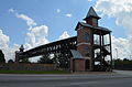
 20140310 52 Lincoln Highway, near Calamus, Iowa.jpg 2,816 × 2,112; 2.01 MB
-
 20140310 53 Lincoln Highway, near Calamus, Iowa.jpg 2,816 × 2,112; 1.89 MB
-
 20140310 54 Lincoln Highway, near Calamus, Iowa.jpg 2,816 × 2,112; 1.77 MB
-
 Acela crosses Little Hell Gate SB fr under TBB jeh cropped.jpg 2,670 × 1,638; 581 KB
-
 Acosta Bridge from Jacksonville Landing.JPG 4,320 × 3,240; 4.53 MB
-

-
 AL69sUS43sRoad-Bridge-Tuscaloosa (26103726488).jpg 2,400 × 1,600; 1.43 MB
-
 Auchumpkee Creek Bridge 01.JPG 4,320 × 3,240; 4.51 MB
-
 Auchumpkee Creek Bridge 02.JPG 4,320 × 3,240; 4.49 MB
-
 Auchumpkee Creek Bridge 03.JPG 4,320 × 3,240; 4.48 MB
-
 Auchumpkee Creek Bridge 04.JPG 4,320 × 3,240; 4.46 MB
-
 Auchumpkee Creek Bridge 05.JPG 4,320 × 3,240; 4.48 MB
-
 Auchumpkee Creek Bridge sign.JPG 4,320 × 3,240; 4.45 MB
-
 Benedict Bridge & ACL RR Bridge from Lake Monroe Bridge.JPG 4,000 × 3,000; 2.52 MB
-
 Benedict Bridge & Lake Monroe Bridge from Wayside Park.JPG 4,000 × 3,000; 2.55 MB
-
 Benedict Bridge from Lake Monroe Bridge.JPG 4,000 × 3,000; 2.58 MB
-
 Blurry NB View; Rowlett Park Drive Bridge.JPG 4,000 × 3,000; 2.25 MB
-
 Bridge 12000.jpg 2,188 × 1,051; 1.7 MB
-
 Bridge of Lions (NW face) and fishing pier.JPG 4,320 × 3,240; 4.47 MB
-
 Bridge of Lions (NW face).JPG 4,320 × 3,240; 4.5 MB
-
 Bridge of Lions (SW face 03).JPG 4,320 × 3,240; 4.42 MB
-
 Bridge of Lions (SW face) and ships.JPG 4,320 × 3,240; 4.41 MB
-
 Bridge of Lions (SW face).JPG 4,320 × 3,240; 4.54 MB
-
 Bridge of Lions South side sidewalk.jpg 4,320 × 3,240; 4.5 MB
-
 Bridge over Mill Creek feeding into Lake Irma, Lakeland.JPG 4,320 × 3,240; 4.45 MB
-
 Brooks County line, SR133 NW.JPG 4,320 × 3,240; 4.44 MB
-
 CA Bill Benedict Bridge Channel.JPG 4,000 × 3,000; 2.81 MB
-
 CA Bill Benedict Bridge; Memorial Sign.JPG 4,000 × 3,000; 2.49 MB
-
 Cambridge Springs Bridge site.jpg 6,016 × 4,000; 6.07 MB
-

-
 Chicago River from Wabash - panoramio.jpg 5,340 × 3,560; 12.1 MB
-
 Clinch County border, GA94 EB.JPG 4,320 × 3,240; 4.51 MB
-
 Columbus Drive Swing Span Bridge from North Riverside Drive.JPG 4,000 × 3,000; 2.72 MB
-
 ConantCreekBridge.JPG 5,184 × 3,456; 7.7 MB
-
 Crossing the Golden Gate Bridge in the Fog (15598196571).jpg 3,082 × 4,925; 5.32 MB
-
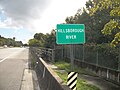
 CSX Clearwater Subdivision over Hillsborough River.JPG 4,000 × 3,000; 2.4 MB
-
 CSX Port Tampa Spur Bridge from Cass Street Bridge.JPG 4,000 × 3,000; 2.25 MB
-
 Decatur Bridge - panoramio.jpg 1,920 × 1,278; 533 KB
-
 Draw Bridge (126303785).jpeg 2,048 × 1,152; 483 KB
-
 DuSable Bridge with only one of its bascule leaves opened for a boat (2014).jpg 1,536 × 2,304; 1.01 MB
-
 East - panoramio (3).jpg 1,920 × 873; 1,012 KB
-
 East Point pedestrian bridge.JPG 2,464 × 1,632; 1.49 MB
-
 EB Fletcher Avenue Bridge over Hillsborough River from Shoulder.JPG 4,000 × 3,000; 2.78 MB
-
 EB Fletcher Avenue Bridge over Hillsborough River from Sidewalk.JPG 4,000 × 3,000; 2.63 MB
-
 EB Fletcher Avenue Bridge over Hillsborough River; FDOT Number.JPG 4,000 × 3,000; 2.57 MB
-
 Entrance to Washington Street Bridge, east side.jpg 3,264 × 2,448; 2.03 MB
-
 Eugene Holtsinger Bridge from Tampa Cruise-A-Cade.JPG 4,000 × 3,000; 2.37 MB
-
 Eugene Holtsinger Bridge; Northbound.JPG 4,000 × 3,000; 2.13 MB
-
 Florida I10eb Chaires Rd Overpass.JPG 4,608 × 3,456; 4.12 MB
-
 Florida I10eb County Rd 123 Overpass.JPG 5,184 × 3,456; 4.35 MB
-
 Florida I10eb County Rd 229 Overpass.JPG 4,320 × 3,240; 4.6 MB
-
 Florida I10eb Florida 295nb overpass.JPG 4,320 × 3,240; 4.51 MB
-
 Florida I10eb Florida 295sb overpass.JPG 4,320 × 3,240; 4.46 MB
-
 Florida I10eb Florida State Road 23 flyover to I10wb.JPG 4,320 × 3,240; 4.57 MB
-
 Florida I10eb Halsema Rd Overpass.JPG 4,320 × 3,240; 4.52 MB
-
 Florida I10eb Yellow Water Rd Overpass.JPG 5,184 × 3,456; 4.43 MB
-
 Florida I10wb County Rd 123 Overpass.JPG 4,320 × 3,240; 4.51 MB
-
 Florida I10wb County Rd 250 overpass.JPG 4,320 × 3,240; 4.46 MB
-
 Florida I10wb County Rd 250A Overpass.JPG 4,320 × 3,240; 4.47 MB
-
 Florida I10wb Exit 327.JPG 4,320 × 3,240; 4.2 MB
-
 Florida I10wb Exit 343 1 mile.JPG 4,320 × 3,240; 4 MB
-
 Florida I10wb Exit 350 flyover to Florida State Road 23.JPG 4,320 × 3,240; 4.47 MB
-
 Florida I10wb Exit 350.JPG 4,320 × 3,240; 4.48 MB
-
 Florida I10wb Exit 351.JPG 4,320 × 3,240; 4.46 MB
-
 Florida I10wb Forest Rd 236 Overpass.JPG 4,320 × 3,240; 4.31 MB
-
 Florida I75nb CR131 Overpass.JPG 4,608 × 3,456; 4.67 MB
-
 Florida I75nb CR241 Overpass.JPG 4,608 × 3,456; 4.92 MB
-
 Florida I75nb CR349 Overpass.JPG 5,184 × 3,456; 4.56 MB
-
 Florida I75nb Exit 404 and Overpass.JPG 4,608 × 3,456; 4.74 MB
-
 Florida I75nb Exit 435.JPG 4,608 × 3,456; 4.65 MB
-
 Florida I75nb Interstate 10wb Overpass.JPG 5,184 × 3,456; 4.66 MB
-
 Florida I75nb King Hill Rd Overpass.JPG 4,608 × 3,456; 4.26 MB
-
 Florida I75nb NW 23rd Ave Overpass.JPG 4,608 × 3,456; 4.82 MB
-
 Florida I75nb NW 63rd Blvd Overpass.JPG 4,608 × 3,456; 4.85 MB
-
 Florida I75nb SR222 NW 39th Ave Overpass.JPG 4,608 × 3,456; 4.73 MB
-
 Florida I95eb looking at pedestrian bridge to Baptist Medical Center.JPG 4,320 × 3,240; 4.51 MB
-
 Fortune Street Drawbridge; Southwest from Doyle Carlton & West Laurel.JPG 4,000 × 3,000; 2.29 MB
-
 Fortune Street Drawbridge; Southwest from Green Street; Downtown Tampa.JPG 4,000 × 3,000; 2.37 MB
-
 Fortune Street Drawbridge; Westbound on Laurel Street.JPG 4,000 × 3,000; 2.13 MB
-
 Frank R. Norris Bridge wb.JPG 4,320 × 3,240; 4.49 MB
-
 Fuller Warren Bridge wb approaching footbridge.JPG 4,320 × 3,240; 4.46 MB
-
 Fuller Warren Bridge wb at footbridge.JPG 4,320 × 3,240; 4.48 MB
-
 GA 33 crossing Piscola Creek.JPG 4,320 × 3,240; 4.54 MB
-
 GA45sRoad-IchawaynochawayCreekSign (32066447564).jpg 2,400 × 1,600; 2.87 MB
-
 Georgia I75nb Bedgood Rd Overpass.JPG 4,320 × 3,240; 4.46 MB
-
 Georgia I75nb Belville Rd Overpass.JPG 4,608 × 3,456; 4.36 MB
-
 Georgia I75nb Exit 102 Overpass.JPG 4,608 × 3,456; 4.24 MB
-
 Georgia I75nb Exit 104 Overpass.JPG 4,320 × 3,240; 4.45 MB
-
 Georgia I75nb Exit 122 Overpass.JPG 4,320 × 3,240; 4.42 MB
-
 Georgia I75nb Exit 127 Overpass.JPG 4,608 × 3,456; 4.45 MB
-
 Georgia I75nb Exit 135 Overpass.JPG 4,608 × 3,456; 4.56 MB
-
 Georgia I75nb Exit 29 overpass.JPG 4,320 × 3,240; 4.4 MB
-
 Georgia I75nb Exit 37 overpass Adel Quitman Rd, Adel city limit.JPG 4,320 × 3,240; 4.43 MB
-
 Georgia I75nb Exit 61 overpass.JPG 4,320 × 3,240; 4.37 MB
-
 Georgia I75nb Exit 63B 1 mile.JPG 4,320 × 3,240; 4.48 MB
-
 Georgia I75nb Exit 92 overpass.JPG 4,320 × 3,240; 4.47 MB
-
 Georgia I75nb Exit 97 Overpass.JPG 4,320 × 3,240; 4.41 MB
-
 Georgia I75nb Exit 99 Overpass.JPG 4,320 × 3,240; 4.4 MB
-
 Georgia I75nb Firetower Rd Overpass.JPG 4,608 × 3,456; 4.11 MB
-
 Georgia I75nb Houston County line.JPG 4,608 × 3,456; 4.29 MB
-
 Georgia I75nb Musselwhite Rd Overpass.JPG 4,320 × 3,240; 4.45 MB
-
 Georgia I75nb N Perry Pkwy Overpass.JPG 4,320 × 3,240; 4.45 MB
-
 Georgia I75nb Old Clyattville Rd Overpass.JPG 4,608 × 3,456; 4.15 MB
-
 Georgia I75nb S Perry Pkwy Overpass.JPG 4,320 × 3,240; 4.45 MB
-
 Georgia I75nb SR31 Madison Hwy Overpass.JPG 4,608 × 3,456; 4.54 MB
-
 Georgia I75nb Todd Rd Overpass.JPG 4,320 × 3,240; 4.37 MB
-
 Georgia I75sb 24th Ave E Overpass, Cordele.JPG 4,320 × 3,240; 4.51 MB
-
 Georgia I75sb Bellville Rd Overpass.JPG 4,608 × 3,456; 3.45 MB
-
 Georgia I75sb E 13th Ave Overpass, Cordele.JPG 4,320 × 3,240; 4.46 MB
-
 Georgia I75sb Exit 22 Overpass - N. Valdosta Rd.JPG 4,320 × 3,240; 4.41 MB
-
 Georgia I75sb Exit 39 .5 mile.JPG 4,320 × 3,240; 4.52 MB
-
 Georgia I75sb Exit 39 Overpass - GA37.JPG 4,320 × 3,240; 4.48 MB
-
 Georgia I75sb Exit 41 Overpass.JPG 4,320 × 3,240; 4.45 MB
-
 Georgia I75sb Exit 45 Overpass - Barneyville Rd.JPG 4,320 × 3,240; 4.46 MB
-
 Georgia I75sb GA376 Overpass.JPG 4,608 × 3,456; 3.36 MB
-
 Georgia I75sb Loch Laurel Rd Overpass.JPG 4,608 × 3,456; 3.5 MB
-
 Georgia State Line, US82 EB.JPG 4,320 × 3,240; 4.5 MB
-
 Georgia State Route 93 railroad overpass, Cairo.JPG 4,320 × 3,240; 4.51 MB
-
 Golden Gate and the Pyramid.jpg 600 × 900; 55 KB
-
 Golden Gate Bridge - San Francisco, CA.JPG 2,448 × 3,264; 2.9 MB
-
 Hanging by Threads (13541389765).jpg 5,513 × 3,675; 4.92 MB
-
 Hastings-Locke Ferry site from east.jpg 6,016 × 4,000; 6.23 MB
-
 Henry Looking Out Over The Interstate 35E Bridge - panoramio.jpg 4,128 × 2,322; 2.49 MB
-
 Henry on the Interstate 35E Bridge - panoramio.jpg 4,128 × 2,322; 2.7 MB
-
 High Bridge - St Paul, MN - panoramio (23).jpg 4,128 × 2,322; 2.28 MB
-
 High Bridge - St Paul, MN - panoramio (24).jpg 2,322 × 4,128; 3.12 MB
-
 High Bridge - St Paul, MN - panoramio (25).jpg 2,891 × 2,022; 1.96 MB
-
 High Bridge - St Paul, MN - panoramio (5).jpg 4,128 × 2,322; 4.25 MB
-
 High Bridge - St Paul, MN - panoramio (7).jpg 2,322 × 4,128; 4.65 MB
-
 High Bridge - St Paul, MN - panoramio (8).jpg 4,128 × 2,322; 6.85 MB
-
 High Bridge - St Paul, MN - panoramio (9).jpg 2,322 × 4,128; 1.96 MB
-
 High Bridge - St Paul, MN - panoramio.jpg 4,128 × 2,322; 6.22 MB
-
 Hillsborough River Southeast from Fletcher Avenue Bridge.JPG 4,000 × 3,000; 2.64 MB
-
 Hudson River and George Washington Bridge New York City January 2014.jpeg 3,200 × 2,368; 3.15 MB
-
 Hwy 52 Bridge - St Paul, MN - panoramio (1).jpg 4,128 × 2,322; 3.58 MB
-
 Hwy 52 Bridge - St Paul, MN - panoramio (2).jpg 4,128 × 2,322; 3.79 MB
-
 Hwy 52 Bridge - St Paul, MN - panoramio (3).jpg 4,128 × 2,322; 3.25 MB
-
 Hwy 52 Bridge - St Paul, MN - panoramio (4).jpg 4,048 × 2,278; 2.98 MB
-
 Hwy 52 Bridge - St Paul, MN - panoramio.jpg 4,128 × 2,322; 3.5 MB
-
 I-10 Signage on US 19 SB, Jefferson County.JPG 4,320 × 3,240; 4.47 MB
-
 I-275 Hillsborough River Bridge; Downtown Tampa-1.JPG 4,000 × 3,000; 2.36 MB
-
 I-275 Hillsborough River Bridge; Downtown Tampa-2.JPG 4,000 × 3,000; 2.5 MB
-
 I10 overpass on US129sb, Suwannee County.JPG 4,320 × 3,240; 4.45 MB
-
 I75 overpass from Peggy Rd, Alachua.JPG 4,608 × 3,456; 5.71 MB
-
 India Point Railroad Bridge - 1.JPG 1,600 × 1,200; 557 KB
-
 India Point Railroad Bridge - 2.JPG 1,600 × 1,200; 647 KB
-
 India Point Railroad Bridge - 3.JPG 1,600 × 1,200; 697 KB
-
 India Point Railroad Bridge - 4.JPG 1,600 × 1,200; 518 KB
-
 India Point Railroad Bridge - 5.JPG 1,600 × 1,200; 650 KB
-
 India Point Railroad Bridge - 6.JPG 1,600 × 1,200; 446 KB
-
 Int20wRoad-Exit57-Int75nsInt85ns (32528084780).jpg 2,400 × 1,600; 1.43 MB
-
 Int310nRoad-Exit6-LA48-1p5mi (41463948901).jpg 2,400 × 1,600; 1.27 MB
-
 Interstate 35E Bridge - panoramio (5).jpg 4,128 × 2,322; 3.2 MB
-
 Interstate 35E Bridge - panoramio (6).jpg 4,128 × 2,322; 3.27 MB
-
 Interstate 35E Bridge over the Mississippi River - panoramio.jpg 2,322 × 3,475; 2.68 MB
-
 Interstate 694 - Vadnais Heights, MN - panoramio (2).jpg 4,128 × 2,322; 2.96 MB
-
 Interstate 95 (I-95) at Georgia Florida - panoramio.jpg 2,560 × 960; 1.01 MB
-
 Labo Del Rio Bridge.JPG 4,857 × 3,003; 12.1 MB
-
 Lafayette County border on Frank R. Norris Bridge US 27wb.JPG 4,320 × 3,240; 4.38 MB
-
 LIRR Oyster Bay Branch Bridge over Roslyn Road.JPG 5,152 × 3,864; 4.14 MB
-
 Looking West at Ernest Vandiver Causeway.JPG 4,320 × 3,240; 4.43 MB
-
 Looking West at GA188 overpass from 6th st rr crossing.JPG 4,320 × 3,240; 4.47 MB
-
 Lowndes County welcome sign, US84 wb.JPG 4,320 × 3,240; 4.49 MB
-
 Lt Col T Smith Memorial Foot Bridge Cairo High School.JPG 4,320 × 3,240; 4.42 MB
-
 M8s on Park Avenue lift bridge, July 2014.JPG 4,320 × 3,240; 2.71 MB
-
 Macy-Brance Memorial Playground in Geo. M. Dame Memorial Park, Homerville.JPG 4,320 × 3,240; 4.47 MB
-
 Main St and Prudential St Intersection with Prudential St Overpass.JPG 4,320 × 3,240; 4.5 MB
-
 Main St Bridge from Jacksonville Landing.JPG 4,320 × 3,240; 4.47 MB
-
 Marble Bridge.JPG 5,472 × 3,648; 3.28 MB
-
 Marshall Beach, San Francisco 01.JPG 6,016 × 4,000; 6.5 MB
-
 Marshall Beach, San Francisco 02.JPG 6,016 × 4,000; 7.98 MB
-
 Marshall Beach, San Francisco 03.JPG 6,016 × 4,000; 7.06 MB
-
 Marshall Beach, San Francisco 04.JPG 6,016 × 4,000; 7.29 MB
-
 Marshall Beach, San Francisco 05.JPG 6,016 × 4,000; 9.95 MB
-
 Minnehaha 1.jpg 1,280 × 849; 587 KB
-
 Minnehaha Creek footbridge.jpg 2,448 × 3,264; 3.32 MB
-
 Minnehaha Creek in southeast Minneapolis.jpg 3,264 × 2,448; 3.38 MB
-
 Minnesota and International Trestle 9-27-14.jpg 5,152 × 3,864; 4.99 MB
-
 Minnesota State Highway 13 and Interstate 35E - panoramio (1).jpg 4,128 × 2,322; 3.07 MB
-
 Minnesota State Highway 5 Bridge - panoramio (1).jpg 4,128 × 2,322; 2.87 MB
-
 Minnesota State Highway 5 Bridge - panoramio (11).jpg 4,128 × 2,322; 4.41 MB
-
 Minnesota State Highway 5 Bridge - panoramio (12).jpg 4,128 × 2,322; 6.3 MB
-
 Minnesota State Highway 5 Bridge - panoramio (13).jpg 2,322 × 1,708; 1.61 MB
-
 Minnesota State Highway 5 Bridge - panoramio (15).jpg 4,128 × 2,322; 4.82 MB
-
 Minnesota State Highway 5 Bridge - panoramio (16).jpg 2,322 × 4,128; 4.09 MB
-
 Minnesota State Highway 5 Bridge - panoramio (17).jpg 4,128 × 2,322; 5.98 MB
-
 Minnesota State Highway 5 Bridge - panoramio (2).jpg 4,128 × 2,322; 3.7 MB
-
 Minnesota State Highway 5 Bridge - panoramio (26).jpg 4,128 × 2,322; 4.94 MB
-
 Minnesota State Highway 5 Bridge - panoramio (3).jpg 4,128 × 2,322; 4.25 MB
-
 Minnesota State Highway 5 Bridge - panoramio (4).jpg 4,128 × 2,322; 5.97 MB
-
 Minnesota State Highway 5 Bridge - panoramio (5).jpg 4,128 × 2,322; 6.35 MB
-
 Minnesota State Highway 5 Bridge - panoramio (7).jpg 4,128 × 2,322; 4.16 MB
-
 Minnesota State Highway 5 Bridge - panoramio (8).jpg 2,322 × 4,128; 6.33 MB
-
 Minnesota State Highway 5 Bridge - panoramio.jpg 4,128 × 2,322; 4.16 MB
-
 MN Hwy 5 Bridge from Fort Snelling - panoramio.jpg 1,962 × 3,490; 4.72 MB
-
 Mount Hope Bridge, Bristol RI.jpg 3,264 × 2,448; 1.58 MB
-
 NB US 17-92 Sign at Benedict Bridge.JPG 4,000 × 3,000; 2.61 MB
-
 NE View of Hillsborough River from North 40th Street Bridge.JPG 4,000 × 3,000; 2.27 MB
-
 Newer Allen Rd bridge over Auchumpkee Creek.JPG 4,320 × 3,240; 4.5 MB


_by_Don_Ramey_Logan.jpg)
.jpg)


_and_fishing_pier.JPG)
.JPG)
.JPG)
_and_ships.JPG)
.JPG)


,_Capital_City_Amphitheater_and_North-South_Meridian_Plaza_Signature_Bridge.JPG)


.jpg)


.jpeg)
.jpg)
.jpg)


.jpg)


.jpg)


.jpg)
.jpg)
.jpg)
.jpg)
.jpg)
.jpg)
.jpg)


.jpg)
.jpg)
.jpg)
.jpg)


.jpg)
.jpg)
.jpg)
.jpg)

.jpg)


.jpg)
.jpg)
.jpg)
.jpg)
.jpg)
.jpg)
.jpg)
.jpg)
.jpg)
.jpg)
.jpg)
.jpg)
.jpg)
.jpg)
.jpg)


_at_Georgia_Florida_-_panoramio.jpg)