Category:Bretagne in the 1700s
Jump to navigation
Jump to search
|
Subcategories
This category has the following 13 subcategories, out of 13 total.
Media in category "Bretagne in the 1700s"
The following 9 files are in this category, out of 9 total.
-

-
 Carte de Brest - ca 1700 - Bibliothèque Nationale de France - Btv1b8439976x (cropped).jpg 3,825 × 3,059; 10.03 MB
-
 Carte de Brest - ca 1700 - Bibliothèque Nationale de France - Btv1b8439976x.jpg 4,948 × 3,624; 12.86 MB
-
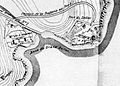 Fort du Dellec map.jpg 683 × 490; 210 KB
-
 Plan du Conquet et des environs vers 1700.jpg 612 × 431; 206 KB
-
 The coast of BRETAGNE from I - Gueltas to Plougoulin NYPL1640590.tiff 7,230 × 5,428; 112.28 MB
-
 The coast of BRETAGNE from Port Douelan to Point Penvis NYPL1640597.tiff 7,230 × 5,428; 112.28 MB
-
 The coast of BRETAGNE from the Penmarks to Port Douelan NYPL1640596.tiff 7,230 × 5,428; 112.28 MB
-
 The coast of BRETAGNE including the bay of BREST and DOVARNENEZ NYPL1640592.tiff 7,230 × 5,428; 112.28 MB
.jpg)


