Category:Satellite pictures of Bretagne
Jump to navigation
Jump to search
Administrative regions and territorial collectivity of Metropolitan France (‡ since start of 2016):
Auvergne-Rhône-Alpes‡ · Bourgogne-Franche-Comté‡ · Brittany · Centre-Val de Loire · Corsica · Grand Est‡ · Hauts-de-France‡ · Île-de-France · Normandy‡ · Nouvelle-Aquitaine‡ · Occitania‡ · Pays de la Loire · Provence-Alpes-Côte d'Azur
Former administrative regions of Metropolitan France (until end of 2015):
Alsace
Overseas departments and regions: Guadeloupe · Martinique · French Guiana · Réunion · Mayotte
Overseas collectivities: Saint Barthélemy · Saint-Martin · Saint Pierre and Miquelon · French Polynesia · Wallis and Futuna · French Southern and Antarctic Lands+
Sui generis territories: New Caledonia · Clipperton Island+
Subcategories
This category has the following 2 subcategories, out of 2 total.
F
Media in category "Satellite pictures of Bretagne"
The following 30 files are in this category, out of 30 total.
-
 Algal bloom 20040615.jpg 2,800 × 2,200; 374 KB
-
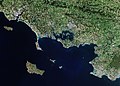
 Baie de Quiberon.png 770 × 713; 1.12 MB
-
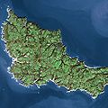 Belle Ile SPOT 1271.jpg 500 × 500; 80 KB
-
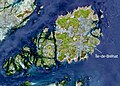 BrehatFrance (cropped).jpg 1,737 × 1,248; 1.32 MB
-
 BrehatFrance.jpg 2,888 × 2,077; 3.59 MB
-
 Bretagne France ASA WSM Orbit 10354 20040222.jpg 1,417 × 1,299; 973 KB
-
 Brittany, France (ASTER).jpg 3,015 × 2,742; 1.04 MB
-
 Channel Islands viewed from ISS in 2012.JPG 2,832 × 4,256; 3.78 MB
-
 Coccoliths in the Celtic Sea-NASA.jpg 1,362 × 1,509; 268 KB
-
 Concarneau SPOT 1147.jpg 500 × 500; 97 KB
-
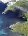
 Envisat view of Bay of Biscay ESA232549.jpg 1,044 × 1,654; 757 KB
-
 Envisat view of Bay of Biscay ESA232549.tiff 1,354 × 2,126; 4.68 MB
-
 Finistère, France ESA21909842.jpeg 15,563 × 15,563; 54.88 MB
-
 Finistère, France ESA21909842.tiff 15,563 × 15,563; 692.99 MB
-
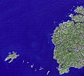
 Groix SPOT 1276.jpg 500 × 500; 67 KB
-
 ISS002-E-7453 - View of France.jpg 3,060 × 2,092; 1.26 MB
-
 ISS002-E-9053 - View of France.jpg 3,060 × 2,092; 1.94 MB
-
 ISS002-E-9054 - View of France.jpg 3,060 × 2,092; 2.28 MB
-
 ISS006-E-49276 - View of France.jpg 3,032 × 2,064; 1.14 MB
-
 ISS006-E-49277 - View of France.jpg 3,032 × 2,064; 1.07 MB
-
 ISS012-E-15934 - View of France.jpg 1,520 × 1,008; 61 KB
-
 ISS066-E-172547 - View of Earth.jpg 5,568 × 3,712; 6.1 MB
-
 Kanal La Manche s popisem.jpg 3,328 × 1,728; 1.3 MB
-
 Morbihan, France ESA23293377.tiff 10,217 × 7,289; 213.09 MB
-
 Morbihan, France.jpg 10,217 × 7,289; 14.55 MB
-
 Phytoplankton blooms in the northern Atlantic Ocean.jpg 4,400 × 2,539; 1.91 MB
-
 Pointe du Raz SPOT 1278.jpg 500 × 500; 53 KB
-
 Quiberon SPOT 1593.jpg 500 × 500; 50 KB
-
 Satellite picture of Brittany - NASA, 2002.jpg 1,386 × 1,049; 415 KB
-
 Satellite picture of the Celtic Sea.jpg 1,258 × 1,618; 640 KB


.jpg)


.jpg)


