Category:Biogeographical maps of South Africa
Appearance
Wikimedia category | |||||
| Upload media | |||||
| Instance of | |||||
|---|---|---|---|---|---|
| Category combines topics | |||||
| |||||
Countries of Africa: Angola · Botswana · Burundi · Cameroon · Democratic Republic of the Congo · Djibouti · Equatorial Guinea · Ethiopia · Kenya · Madagascar · Mozambique · Namibia · Rwanda · Somalia · South Africa · South Sudan · Sudan · Tanzania · Uganda
Subcategories
This category has the following 2 subcategories, out of 2 total.
V
Media in category "Biogeographical maps of South Africa"
The following 33 files are in this category, out of 33 total.
-
Albany Thicket.svg 1,052 × 744; 4.04 MB
-
AT0709 map.png 927 × 844; 29 KB
-
AT0717 map.png 695 × 802; 23 KB
-
AT1003 map.png 1,061 × 844; 15 KB
-
AT1004 map.png 1,063 × 844; 38 KB
-
AT1009 map.png 1,166 × 790; 30 KB
-
AT1012 map.png 1,053 × 812; 29 KB
-
AT1201 map.png 1,084 × 844; 28 KB
-
AT1202 map.png 1,099 × 837; 28 KB
-
AT1203 map.png 1,082 × 834; 31 KB
-
AT1309 map.png 966 × 823; 30 KB
-
AT1314 map.png 996 × 844; 31 KB
-
AT1322 map.png 879 × 811; 33 KB
-
AT1405 map.png 1,049 × 806; 25 KB
-
Azonal Vegetation.svg 1,052 × 744; 5.68 MB
-
Breviceps Fuscus Distribution.png 1,592 × 857; 645 KB
-
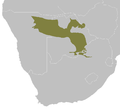
Cape starling range.svg 922 × 536; 18 KB
-
Desert biome.svg 1,052 × 744; 858 KB
-
Ecoregions of SA EEZ.png 3,000 × 2,549; 601 KB
-
Forests.svg 1,052 × 744; 9.61 MB
-
Fynbos legend.svg 1,056 × 1,079; 1.38 MB
-
Fynbos.svg 1,052 × 744; 10.98 MB
-
Grassland legend.svg 1,052 × 744; 983 KB
-
Grassland.svg 1,052 × 744; 14.85 MB
-
Indian Ocean Coastal Belt.svg 1,052 × 744; 3.29 MB
-
LesothosaurusFossilDiscoveriesMap.jpg 942 × 1,200; 367 KB
-
Nama-Karoo.svg 1,052 × 744; 5.36 MB
-
Savanna legend.svg 1,052 × 744; 940 KB
-
Savanna.svg 1,052 × 744; 10.17 MB
-
Sfiliculmis-map.jpg 432 × 384; 82 KB
-
Succulent Karoo legend.svg 1,052 × 744; 859 KB
-
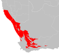
Succulent Karoo.svg 1,052 × 744; 11.09 MB
-
Vegetation types of South Africa.svg 1,052 × 744; 73.9 MB


