Category:Biblical maps
Jump to navigation
Jump to search
Maps from the Bible | |||||
| Upload media | |||||
| Subclass of | |||||
|---|---|---|---|---|---|
| Part of | |||||
| |||||
Subcategories
This category has the following 22 subcategories, out of 22 total.
1
A
C
G
- Generations of Noah (22 F)
H
I
- Maps of the Kingdom of Israel (56 F)
J
- Maps of Jesus (22 F)
M
O
T
- Tanakh maps (1 F)
- Torah maps (6 F)
Media in category "Biblical maps"
The following 160 files are in this category, out of 160 total.
-

-

-

-

-

-
-
 1873 map of Sinai Peninsula during Exodus.jpg 1,766 × 2,118; 977 KB
-
 1873 map of the travels of Apostle Paul.jpg 2,371 × 1,741; 1.04 MB
-
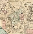 1873 plan of Jerusalem's holy places.jpg 1,647 × 1,689; 907 KB
-
 19 of 'Calvary and the Tomb' (11290074214).jpg 1,260 × 1,151; 271 KB
-
 253 of 'Rambles in Bible Lands' (11228551985).jpg 2,064 × 1,320; 560 KB
-

-
 295 of 'Rambles in Bible Lands' (11229493116).jpg 2,064 × 1,320; 548 KB
-

-

-
 43 of 'Rambles in Bible Lands' (11228644524).jpg 1,320 × 2,073; 562 KB
-
 66 of 'Buried Cities and Bible Countries' (11211391176).jpg 2,176 × 1,421; 784 KB
-
 A dictionary of the Bible.. (1887) (14595257738).jpg 3,328 × 2,116; 1,003 KB
-

-

-

-

-
 A Szentföld Idvezítőnk korában.jpg 1,654 × 2,654; 1.1 MB
-
 Aegyptus Antiqua.jpg 1,300 × 1,121; 1.71 MB
-
 Ajrud.jpg 1,366 × 2,048; 143 KB
-
 Amón 830-es.svg 605 × 706; 63 KB
-
 Antique jew diaspora map fr.svg 855 × 549; 496 KB
-
 Antique jew diaspora map with Acts of the Apostles mention highlight.svg 855 × 549; 500 KB
-
 Aramaic kingdoms and chiefdoms around 10-9th century BC (es).svg 3,126 × 1,978; 386 KB
-
 Aramaic kingdoms and chiefdoms around 10-9th century BC.svg 814 × 515; 163 KB
-

-

-
 C+B-Exodus-Map.PNG 713 × 853; 242 KB
-
 C+B-Galatia-Map.JPG 1,643 × 1,216; 630 KB
-
 C+B-Geography-Map2-IsraeliteWorldviewDuringJudges.PNG 755 × 433; 76 KB
-
 C+B-Geography-Map3-IsraeliteWorldviewIn10thCentury.PNG 756 × 433; 94 KB
-
 C+B-Geography-Map4-IsraeliteWorldviewIn8thCentury.PNG 757 × 441; 226 KB
-
 C+B-Geography-Map5-IsraeliteWorldviewIn5thCentury.PNG 758 × 439; 249 KB
-
 C+B-Goshen-MapOfVicinity.PNG 578 × 370; 53 KB
-
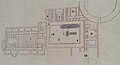
 C+B-Palace-Fig1-PlanOfSolomonsPalace.PNG 530 × 678; 110 KB
-
 C+B-Palace-Fig2-HouseOfForestOfLebanonPlan.PNG 867 × 606; 113 KB
-
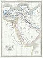
 Ca. 1690 biblical map of the Middle East.jpg 11,219 × 8,658; 20.73 MB
-
 Ca. 1690 Dutch, biblical map of the Middle East.jpg 11,038 × 7,473; 17.07 MB
-
 Cana Where.png 4,549 × 2,049; 26.71 MB
-

-
 Carte du Paradis Terrestre.jpg 2,206 × 2,469; 858 KB
-
 Chaim Solomon Pinia. Panorama des heiligen Landes. 1875.jpg 2,814 × 2,200; 1.33 MB
-

-
 Den Bergh van olniolen - Peeters Jacob - 1686.jpg 1,500 × 685; 527 KB
-
 Dictionnaire de la Bible - F. Vigouroux - Tome I - 40-Afrique des prophetes.jpg 1,765 × 1,100; 477 KB
-
 Edom 830-es.svg 605 × 706; 63 KB
-
 Exodus map Hebrew.jpg 1,200 × 1,256; 426 KB
-
 Exodus Map.jpg 323 × 317; 31 KB
-
 Geographia Sacra.jpg 12,797 × 10,083; 24.34 MB
-
 Georgin François, The 3 Roads to Eternity, 1825 Cornell CUL PJM 1040 01.jpg 5,000 × 3,318; 5.34 MB
-
 Greater Israel map.jpg 1,109 × 656; 157 KB
-
-
-
 Herodian Tetrarchy 2.png 667 × 842; 175 KB
-
 Herods Promontory Palace Map P1100187.JPG 2,767 × 1,501; 664 KB
-
 Historische Karte von Jerusalem MK1888.png 739 × 782; 155 KB
-
 Horvat Teman's couple and 'Yahweh and his Asherah' inscription.jpg 338 × 547; 63 KB
-
 Hæc chorographia præpocapiti 33. libri numer Responsibility, G. Postel, 1555.jpg 5,328 × 4,513; 7.92 MB
-

-
 JBS1956-A 1cover.png 1,270 × 1,869; 34 KB
-
 JBS1956-A 2index.png 1,361 × 1,973; 83 KB
-
 JBS1956-B map01.png 2,061 × 1,427; 3.6 MB
-
 JBS1956-B map02.png 2,057 × 1,434; 4.01 MB
-
 JBS1956-B map03.png 1,435 × 2,059; 3.44 MB
-
 JBS1956-B map04 4a.png 1,457 × 2,083; 3.69 MB
-
 JBS1956-B map05 6.png 1,471 × 2,075; 4.28 MB
-
 JBS1956-B map07.png 2,066 × 1,447; 3.41 MB
-
 JBS1956-B map08.png 2,074 × 1,447; 3.35 MB
-
 JBS1956-B map09.png 2,076 × 1,458; 3.54 MB
-
 JBS1956-B map10.png 2,091 × 1,448; 3.54 MB
-
 JBS1956-B map11.png 1,463 × 2,088; 3.95 MB
-
 JBS1956-B map13 14.png 2,057 × 1,445; 4.69 MB
-
-
 Kingdom of Ammon 830 map-ar.png 720 × 855; 106 KB
-
 Kingdom of Ammon 830 map-pt.svg 720 × 859; 44 KB
-
 Kingdom of Damascus 830 map-pt.svg 720 × 859; 44 KB
-
 Kingdom of Edom 830 map-pt.svg 720 × 859; 44 KB
-
 Kingdom of Moab 830 map-pt.svg 720 × 859; 44 KB
-
 Kingdom of Philistines 830 map-es.svg 768 × 916; 232 KB
-
 Kingdom of Philistines 830 map-pt.svg 720 × 859; 44 KB
-
 Kingdoms around Israel 830 map mk.svg 720 × 859; 177 KB
-
 Kingdoms around Israel 830 map sh.svg 720 × 859; 62 KB
-
 Kingdoms around Israel 830 map sr.svg 720 × 859; 62 KB
-
 Kingdoms around Israel 830 map-de.png 1,004 × 1,198; 318 KB
-
 Kingdoms around Israel 830 map-el.svg 720 × 859; 509 KB
-
 Kingdoms around Israel 830 map-es.svg 768 × 916; 228 KB
-
 Kingdoms around Israel 830 map-nl.svg 720 × 859; 479 KB
-
 Kingdoms around Israel 830 map-pt.svg 720 × 859; 54 KB
-
 Kingdoms around Israel 830 map.svg 720 × 859; 122 KB
-
 Kingdoms of Israel and Judah map 830-pt.svg 720 × 859; 45 KB
-
 Kingdoms of the Levant Map 830.xcf 1,955 × 2,332; 941 KB
-
 Korean Revised Edition Map 1.jpg 5,444 × 3,806; 9.41 MB
-
 Korean Revised Edition Map 2.jpg 3,806 × 5,338; 8.99 MB
-
 Korean Revised Edition Map 3.jpg 3,936 × 5,479; 9.2 MB
-
 Korean Revised Edition Map 5.jpg 3,842 × 5,362; 8.48 MB
-
 Korean Revised Edition Map 6.jpg 5,397 × 3,901; 8.18 MB
-
 Levant 830 map-pt.svg 720 × 859; 44 KB
-
 Levant 830 nl 3-ar.png 720 × 855; 105 KB
-
 Levant 830 nl 3.PNG 771 × 839; 153 KB
-
 Levant 830-HE.svg 545 × 591; 248 KB
-
 Levante 830-es.svg 646 × 753; 262 KB
-
 Location of Bethsaida map.png 1,118 × 729; 92 KB
-

-
 Lower Galilee Cana marks.jpg 2,508 × 1,680; 3.78 MB
-
-
 Map of sacred geography by Abraham Ortelius.jpeg 3,041 × 2,340; 2.17 MB
-
 Map-of-philistine-cities-battles.jpg 1,174 × 1,583; 318 KB
-
 Mapa Asyrii.png 1,987 × 1,365; 611 KB
-
 MapCitiesOfRefuge.svg 406 × 510; 71 KB
-
 Matthew Jesus Resurrection Map.jpg 640 × 480; 69 KB
-
 Millerler Tablosu Yafet'in soyu.jpg 702 × 414; 76 KB
-
 Millerler Tablosu- Yafet'in soyu.jpg 702 × 414; 74 KB
-
 Milletler Tablosu (Genesis 10) Ham'ın soyu.jpg 758 × 517; 65 KB
-
 Milletler Tablosu (Genesis 10) Sam'ın soyu.jpg 758 × 517; 72 KB
-
 Milletler Tablosu (Genesis 10) Yafet'in soyu.jpg 702 × 414; 82 KB
-
 Moab 830-es.svg 605 × 706; 63 KB
-
 Námořní cesta Jaffa - Taršíš, Tarsus.png 370 × 480; 4 KB
-
 Orbis antiquus quem libri sacri nec non ecclesiastici describunt - btv1b550108308.jpg 4,780 × 3,844; 2.92 MB
-

-

-

-

-
 Pavlusun onlara yazdığı cemaatler.jpg 689 × 409; 53 KB
-
 Pavlusun vaizlik turları.jpg 666 × 408; 92 KB
-
 Philistine language.svg 720 × 859; 35 KB
-
 Prophecies of Jonah, Micah and Nahum.jpg 1,811 × 1,252; 3.34 MB
-
 Royaumes autour d'Israel en 830.svg 720 × 859; 99 KB
-
 Schedelsche Weltchronik — Secunda etas mundi — Folio 12v 13r.jpg 1,600 × 2,345; 5.02 MB
-
 Schedelsche Weltchronik — Secunda etas mundi — Folio 12v.jpg 4,844 × 3,468; 11.43 MB
-
-
 Siloam map.jpg 579 × 900; 145 KB
-
 Siloam Map.pdf 2,745 × 4,268; 939 KB
-

-
-

-

-
 The Bible and its story.. (1908) (14740255176).jpg 2,880 × 1,940; 1.1 MB
-

-
 The Dead Sea and Surroundings EL.png 564 × 774; 41 KB
-

-

-

-

-
-

-
-

-
 Tierra Santa.png 1,278 × 1,849; 1.06 MB
-
 İbrahim'in yolculuğu.jpg 599 × 522; 62 KB
-
 אהרן בן חיים. 1836. מפת גבולי ארץ הצבי. התרס.jpg 800 × 600; 742 KB
-
 אהרן בן חיים. 1836. מפת גבולי ארץ הצבי. ורשה 1883.jpg 2,312 × 1,896; 1.72 MB
-
 מואב.png 250 × 542; 26 KB
-
 세상의빛 지도 1.jpg 464 × 691; 139 KB
-
 셩경젼셔 지도 1.jpg 922 × 1,206; 495 KB
-
 셩경젼셔 지도 2.jpg 1,087 × 832; 444 KB


_-_Geographicus_-_Hebreux-maltebrun-1837.jpg)


.jpg)
.jpg)
.jpg)
.jpg)
.jpg)
.jpg)
.jpg)
.jpg)
_(14595257738).jpg)
.png)

_(14595665257).jpg)


.svg)

_(14749893286).jpg)


.jpg)


-Waterhouse-Paul-(d.1924)-Contours-Conrad_Schick(d.1901cem.Mt.Zion)-CCv0-rev9.jpg)
-Waterhouse-Paul-(d.1924)-Contours-Conrad_Schick(d.1901cem.Mt.Zion)-CCv0-v2.9.svg)


.jpg)

.jpg)


_Ham%27%C4%B1n_soyu.jpg)
_Sam%27%C4%B1n_soyu.jpg)
_Yafet%27in_soyu.jpg)


_(14595936850).jpg)
_(14595995527).jpg)
_(14596271007).jpg)
_(14596405910).jpg)
_(14740255176).jpg)

_(14766057595).jpg)
.jpg)
.jpg)
.jpg)
.jpg)

_so_that_all_can_know_the_route_of_the_travels_(of_the_Israelites)_40_years_in_the_desert_(through)_the_width_and_length_of_the_Holy_Land_from_the_Nile_to_the_city_of_Damascus,_WDL2887.png)


.jpg)
.jpg)