Category:Benchmarks in the City of Wakefield
Jump to navigation
Jump to search
Media in category "Benchmarks in the City of Wakefield"
The following 31 files are in this category, out of 31 total.
-
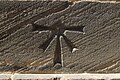 1GL Bolt Bench Mark, St John's Church - geograph.org.uk - 5825863.jpg 1,024 × 683; 335 KB
-
 Bench mark, Kirkgate railway bridge - geograph.org.uk - 5835112.jpg 1,280 × 1,280; 611 KB
-
 Benchmark at corner of Westgate and Bank Street - geograph.org.uk - 3166639.jpg 683 × 1,024; 215 KB
-

-
 Benchmark on Castleford Bridge - geograph.org.uk - 3163602.jpg 2,048 × 1,536; 521 KB
-

-
 Benchmark on County Hall - geograph.org.uk - 3166851.jpg 683 × 1,024; 295 KB
-
 Benchmark on Graziers B^B Hotel - geograph.org.uk - 3167216.jpg 683 × 1,024; 314 KB
-
 Benchmark on school wall, Wentworth Street - geograph.org.uk - 3166885.jpg 683 × 1,024; 238 KB
-
 Benchmark on Sykes Bridge - geograph.org.uk - 3040825.jpg 2,048 × 1,536; 648 KB
-
 Benchmark on the Cathedral - geograph.org.uk - 3166819.jpg 742 × 1,024; 318 KB
-
 Benchmark on wall of Park Hill Walk - geograph.org.uk - 3168845.jpg 683 × 1,024; 261 KB
-
 Benchmark on Waller Bridge, Calder Grove - geograph.org.uk - 3039295.jpg 2,048 × 1,536; 733 KB
-
 Benchmark on ^142-148 Westgate - geograph.org.uk - 3166615.jpg 683 × 1,024; 109 KB
-
 Benchmark on ^18 King Street - geograph.org.uk - 3167041.jpg 683 × 1,024; 304 KB
-
 Benchmark on ^26 King Street - geograph.org.uk - 3166935.jpg 683 × 1,024; 253 KB
-
 Benchmark on ^41 George Street - geograph.org.uk - 3168538.jpg 683 × 1,024; 225 KB
-
 Cut Bench Mark, Kirkgate railway bridge - geograph.org.uk - 5825913.jpg 1,024 × 683; 250 KB
-
 Cut Bench Mark, Margaret Street - geograph.org.uk - 5825852.jpg 1,024 × 683; 287 KB
-
 Cut Bench Mark, St Austin's Church - geograph.org.uk - 5825887.jpg 1,024 × 683; 234 KB
-
 Flush Bracket Bench Mark, Wakefield Cathedral - geograph.org.uk - 5825772.jpg 683 × 1,024; 269 KB
-
 Ordnance Survey Cut Mark - geograph.org.uk - 4007838.jpg 1,920 × 2,560; 3.04 MB
-
 Ordnance Survey Cut Mark - geograph.org.uk - 4120157.jpg 2,560 × 1,536; 1.56 MB
-
 Ordnance Survey Cut Mark - geograph.org.uk - 4120167.jpg 2,560 × 1,536; 2.08 MB
-
 Ordnance Survey Cut Mark - geograph.org.uk - 4120182.jpg 2,560 × 1,536; 2.24 MB
-
 Ordnance Survey Flush Bracket S0528 - geograph.org.uk - 4007882.jpg 1,920 × 2,560; 3.19 MB
-
 Ordnance Survey Flush Bracket S9043 - geograph.org.uk - 2808113.jpg 4,000 × 3,000; 4.1 MB
-
 Ordnance Survey Flush Bracket S9044 - geograph.org.uk - 4035522.jpg 4,000 × 3,000; 2.81 MB
-
 Road sign - geograph.org.uk - 927300.jpg 480 × 640; 119 KB
-
 St Giles church benchmark - geograph.org.uk - 4190541.jpg 1,024 × 768; 241 KB
-
 Unusual road sign - geograph.org.uk - 927291.jpg 480 × 640; 110 KB


