Category:Signs in the City of Wakefield
Jump to navigation
Jump to search
Subcategories
This category has the following 25 subcategories, out of 25 total.
B
C
- Signs in Crigglestone (1 F)
F
H
- Signs in Hemsworth (1 F)
K
- Signs in Knottingley (4 F)
M
N
- Signs in Notton (1 F)
P
S
- Signs in Sharlston (1 F)
W
Media in category "Signs in the City of Wakefield"
The following 21 files are in this category, out of 21 total.
-

-
 Blacker Hall Farm shop. - geograph.org.uk - 518676.jpg 640 × 439; 124 KB
-
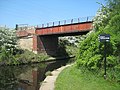 Bridge 4, Harrisons Bridge - geograph.org.uk - 1898523.jpg 640 × 480; 317 KB
-
 Bridge 4, Harrisons Bridge - geograph.org.uk - 1898582.jpg 640 × 480; 329 KB
-

-
 Composed by the City bard^ - geograph.org.uk - 518684.jpg 640 × 531; 95 KB
-
 Ferrybridge Services - geograph.org.uk - 4793118.jpg 640 × 346; 68 KB
-

-
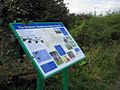
 Fitzwilliam Country Park - geograph.org.uk - 244634.jpg 640 × 480; 105 KB
-
 Kissing gate - geograph.org.uk - 1559360.jpg 640 × 480; 163 KB
-
 Lady Anne Bridge - geograph.org.uk - 1259860.jpg 640 × 480; 98 KB
-
 Lingwell Gate Lane road bridge details - geograph.org.uk - 2440088.jpg 1,024 × 768; 737 KB
-
 New Hall Lane, Midgley, Sitlington CP - geograph.org.uk - 282064.jpg 640 × 456; 75 KB
-
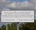
 No tipping - geograph.org.uk - 701327.jpg 640 × 480; 82 KB
-
 Ossett health village - geograph.org.uk - 4945874.jpg 805 × 1,024; 191 KB
-
 Southern Washlands - geograph.org.uk - 1277803.jpg 640 × 480; 391 KB
-
 Southern Washlands - geograph.org.uk - 959153.jpg 640 × 480; 120 KB
-
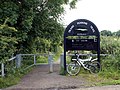
 Trans Pennine Trail North - geograph.org.uk - 491063.jpg 640 × 471; 145 KB
-
 Trans Pennine Trail South - geograph.org.uk - 491068.jpg 640 × 480; 110 KB
-
 Unusual kebab^ - geograph.org.uk - 701331.jpg 518 × 640; 158 KB
-
 Wakefield Wheel (1) - geograph.org.uk - 2559068.jpg 312 × 640; 173 KB


_-_geograph.org.uk_-_2559068.jpg)