Category:Bell gables in West Sussex
Jump to navigation
Jump to search
Ceremonial counties of England: Bedfordshire · Berkshire · Buckinghamshire · Cambridgeshire · Cheshire · Cornwall · Cumbria · Derbyshire · Devon · Dorset · Durham · East Riding of Yorkshire · East Sussex · Essex · Gloucestershire · Greater London · Greater Manchester · Hampshire · Herefordshire · Hertfordshire · Isle of Wight · Kent · Lancashire · Leicestershire · Lincolnshire · Merseyside · Norfolk · North Yorkshire · Northamptonshire · Northumberland · Nottinghamshire · Oxfordshire · Rutland · Shropshire · Somerset · South Yorkshire · Staffordshire · Suffolk · Surrey · Tyne and Wear · Warwickshire · West Midlands · West Sussex · West Yorkshire · Wiltshire · Worcestershire
City-counties: Bristol ·
Former historic counties:
Other former counties:
City-counties: Bristol ·
Former historic counties:
Other former counties:
Media in category "Bell gables in West Sussex"
The following 24 files are in this category, out of 24 total.
-
 ChurchAlbourne.jpg 640 × 480; 89 KB
-
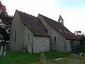
 St Bartholomew's Church - geograph.org.uk - 1299732.jpg 640 × 480; 127 KB
-
 Albourne parish church.JPG 4,608 × 3,456; 5.42 MB
-

-
 St Dunstan's Church (Former), Ashurst Wood.jpg 2,000 × 1,400; 1.2 MB
-
 All Saints Chapel in West Pallant - geograph.org.uk - 1557299.jpg 461 × 640; 57 KB
-
 Former All Saints-in-the-Pallant Church, West Pallant, Chichester (NHLE Code 1181561).JPG 1,944 × 2,592; 1.55 MB
-
 St George's Church, Cleveland Road, Chichester.JPG 2,592 × 1,944; 1.59 MB
-
 Chidham church.JPG 960 × 1,280; 439 KB
-
 St Mary's Church - Chidham - geograph.org.uk - 593763.jpg 640 × 471; 93 KB
-

-
 St Mary's Church, Chithurst - geograph.org.uk - 355206.jpg 640 × 480; 164 KB
-
 St John the Evangelist's Church, Coolhurst.JPG 2,400 × 1,900; 1.3 MB
-
 St John's church, Horsham - geograph.org.uk - 364055.jpg 600 × 413; 69 KB
-
 St Johns Church - geograph.org.uk - 429552.jpg 640 × 480; 71 KB
-
 Holy Trinity Church at Ebernoe - geograph.org.uk - 691407.jpg 640 × 480; 93 KB
-
 St Bartholomew's Church, Egdean (NHLE Code 1226330).JPG 2,400 × 1,800; 1.32 MB
-
 St Bartholomew, Egdean.JPG 2,048 × 1,536; 884 KB
-
 Christ Church, Forestside - geograph.org.uk - 864256.jpg 640 × 480; 114 KB
-
 Church of the Good Shepherd, Franklands Village, Haywards Heath.jpg 2,000 × 1,400; 1.16 MB
-
 Former St Wilfrid's School, Haywards Heath.jpg 1,800 × 1,000; 634 KB
-
 Former St Mary's Church, Whyke Road, Rumboldswhyke (NHLE Code 1354384).JPG 2,592 × 1,944; 1.63 MB
-
 St Giles' church, Merston - geograph.org.uk - 1543854.jpg 640 × 427; 99 KB
-
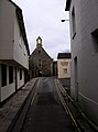 West Pallant - geograph.org.uk - 666668.jpg 473 × 640; 59 KB


,_Ashurst_Wood.jpg)

.JPG)


.JPG)


.JPG)

