Category:Bell gables in Kent
Jump to navigation
Jump to search
Ceremonial counties of England: Bedfordshire · Berkshire · Buckinghamshire · Cambridgeshire · Cheshire · Cornwall · Cumbria · Derbyshire · Devon · Dorset · Durham · East Riding of Yorkshire · East Sussex · Essex · Gloucestershire · Greater London · Greater Manchester · Hampshire · Herefordshire · Hertfordshire · Isle of Wight · Kent · Lancashire · Leicestershire · Lincolnshire · Merseyside · Norfolk · North Yorkshire · Northamptonshire · Northumberland · Nottinghamshire · Oxfordshire · Rutland · Shropshire · Somerset · South Yorkshire · Staffordshire · Suffolk · Surrey · Tyne and Wear · Warwickshire · West Midlands · West Sussex · West Yorkshire · Wiltshire · Worcestershire
City-counties: Bristol ·
Former historic counties:
Other former counties:
City-counties: Bristol ·
Former historic counties:
Other former counties:
Media in category "Bell gables in Kent"
The following 35 files are in this category, out of 35 total.
-
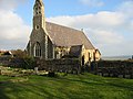
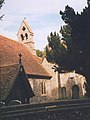 St Peter, Bredhurst - geograph.org.uk - 925733.jpg 480 × 640; 173 KB
-

-
 All Saints church on Military Road - geograph.org.uk - 645349.jpg 640 × 480; 158 KB
-
 St Pancras church - geograph.org.uk - 634027.jpg 477 × 555; 216 KB
-
 St Pancras Church - geograph.org.uk - 740067.jpg 640 × 480; 128 KB
-
 Holy Trinity Church, East Peckham (NHLE Code 1070728).JPG 2,592 × 1,944; 1.67 MB
-
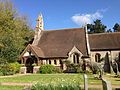
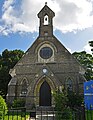
 Chapel of the Holy Innocents, Fairseat - geograph.org.uk - 108402.jpg 640 × 480; 151 KB
-
 St Peter's Church, Spring Hill, Fordcombe.JPG 2,400 × 1,800; 805 KB
-
 St Andrew's Art Centre & Gallery, Bawly Bay, Gravesend.JPG 4,608 × 3,456; 4.27 MB
-
 St. Andrews Mission House, Gravesend - geograph.org.uk - 1386988.jpg 640 × 480; 79 KB
-

-

-
 The church, Groombridge - geograph.org.uk - 1588474.jpg 640 × 435; 89 KB
-
 St John's Church, Groombridge - geograph.org.uk - 656789.jpg 469 × 640; 95 KB
-
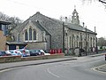
 St Margaret's Church, Halstead.JPG 3,264 × 2,448; 3.69 MB
-
 St John the Evangelist church, Kingsdown - geograph.org.uk - 1097366.jpg 480 × 640; 178 KB
-

-

-
 Kingsdown church on the cliff top - geograph.org.uk - 1097379.jpg 640 × 480; 160 KB
-
 Kingsdown church, Church Cliff - geograph.org.uk - 1097354.jpg 640 × 480; 177 KB
-
 St Catherine's Church, Manston, Kent.jpg 2,848 × 3,683; 3.64 MB
-
 War Memorial and finger post, Manston - geograph.org.uk - 382751.jpg 640 × 480; 67 KB
-
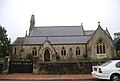
 The Church of St Peter, Monks Horton - geograph.org.uk - 340892.jpg 640 × 480; 141 KB
-
 All Saints Church, Northfleet - geograph.org.uk - 1095994.jpg 640 × 481; 68 KB
-
 St John the Baptist's Church, Sevenoaks.JPG 2,592 × 1,944; 766 KB
-
 Sheerness Catholic Church - geograph.org.uk - 1805780.jpg 3,488 × 2,616; 2.03 MB
-
 Church, Pennington Rd, Southborough - geograph.org.uk - 1064828.jpg 640 × 430; 63 KB
-
 St Thomas's Church, Pennington Road, Southborough.JPG 2,592 × 1,944; 1.58 MB
-
 Chapel of St John the Baptist, Milton Manor Farm, Kent - geograph.org.uk - 1800730.jpg 3,072 × 2,304; 2.92 MB
-
 West Langdon's church - panoramio (1).jpg 1,000 × 750; 295 KB
-
 West Langdon's church - panoramio.jpg 720 × 743; 326 KB
-
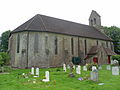
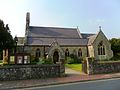
 All Saint's Church, Westbere - geograph.org.uk - 369372.jpg 640 × 480; 87 KB
-
 All Saints Church, Westbere (geograph 1959975).jpg 3,072 × 2,304; 1.42 MB
-
 All Saints, Westbere (geograph 2342325).jpg 1,000 × 687; 175 KB
-


.JPG)


.jpg)


.jpg)
.jpg)
