Category:Belhelvie (civil parish)
Jump to navigation
Jump to search
Scottish parish in Aberdeenshire, Scotland, UK | |||||
| Upload media | |||||
| Instance of | |||||
|---|---|---|---|---|---|
| Part of |
| ||||
| Named after | |||||
| Location |
| ||||
| Population |
| ||||
| Area |
| ||||
 | |||||
Subcategories
This category has the following 5 subcategories, out of 5 total.
P
W
- Whitecairns, Aberdeenshire (14 F)
Media in category "Belhelvie (civil parish)"
The following 200 files are in this category, out of 262 total.
(previous page) (next page)-
 A bend in the B977 - geograph.org.uk - 3994859.jpg 640 × 480; 85 KB
-
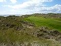 A new golf course in the sand dunes north of Balmedie - geograph.org.uk - 2562858.jpg 3,648 × 2,736; 4.59 MB
-
 A90 near Hatton - geograph.org.uk - 6589739.jpg 800 × 600; 71 KB
-
 Aberdeenshire countryside - geograph.org.uk - 5811063.jpg 6,000 × 4,000; 6.14 MB
-
 Active dune front, Pettens Links - geograph.org.uk - 5642993.jpg 1,024 × 683; 257 KB
-
 Active dunes, Balmedie - geograph.org.uk - 5643579.jpg 1,024 × 683; 219 KB
-
 Al Saeed house, Millden - geograph.org.uk - 6588694.jpg 800 × 600; 109 KB
-
 Alpaca farm - geograph.org.uk - 5104581.jpg 2,626 × 1,970; 3.24 MB
-
 B977 approaching junction - geograph.org.uk - 3994838.jpg 640 × 480; 49 KB
-
 B977 heading south - geograph.org.uk - 3994819.jpg 640 × 480; 55 KB
-
 B977 heading south - geograph.org.uk - 3994849.jpg 640 × 480; 89 KB
-
 B977 leading Belhelvie - geograph.org.uk - 3994826.jpg 640 × 480; 97 KB
-
 B977 near Murton Home Farm - geograph.org.uk - 3994831.jpg 640 × 480; 66 KB
-
 B999 heading north - geograph.org.uk - 3976177.jpg 640 × 480; 86 KB
-
 B999 heading north - geograph.org.uk - 3976189.jpg 640 × 480; 53 KB
-
 B999 heading north - geograph.org.uk - 4098724.jpg 640 × 480; 60 KB
-
 B999 heading north west - geograph.org.uk - 3994843.jpg 640 × 480; 76 KB
-
 Balmedie House - geograph.org.uk - 1269591.jpg 400 × 254; 35 KB
-
 Bare sand, Blairton Links - geograph.org.uk - 5643577.jpg 1,024 × 683; 343 KB
-
 Belhelvie war memorial - geograph.org.uk - 5097226.jpg 1,918 × 2,744; 2.08 MB
-
 Belhelvie war memorial, WWI commemoration - geograph.org.uk - 5097263.jpg 2,571 × 1,930; 2.35 MB
-
 Belhelvie war memorial, WWII commemoration - geograph.org.uk - 5097294.jpg 2,673 × 2,000; 2.97 MB
-
 Bend... - geograph.org.uk - 2853722.jpg 1,600 × 1,064; 488 KB
-
 Blackdog beach - geograph.org.uk - 6546665.jpg 5,686 × 4,000; 5.14 MB
-
 Blackdog Rock - geograph.org.uk - 6547588.jpg 4,785 × 3,520; 3.55 MB
-
 Blairton Links - geograph.org.uk - 5643572.jpg 1,024 × 683; 370 KB
-
 Bruntlandpark Steading - geograph.org.uk - 1627078.jpg 640 × 426; 43 KB
-

-
 Bus stop on Old Road, Balmedie - geograph.org.uk - 6589741.jpg 800 × 600; 113 KB
-
 By the Walled Garden at Balmedie House, Aberdeenshire - geograph.org.uk - 5400075.jpg 3,203 × 2,122; 3.13 MB
-
 Cairn... - geograph.org.uk - 6459608.jpg 5,143 × 3,754; 5.29 MB
-
 Cattle by Ardo - geograph.org.uk - 2583714.jpg 3,456 × 2,304; 1.05 MB
-
 Causeyend - geograph.org.uk - 3993228.jpg 640 × 480; 42 KB
-
 Chalets - geograph.org.uk - 1627236.jpg 640 × 426; 51 KB
-
 Chance Inn Farm - geograph.org.uk - 2896650.jpg 1,600 × 1,064; 322 KB
-
 Climbing the dunes - geograph.org.uk - 925190.jpg 640 × 426; 67 KB
-

-
 Clubhouse, Menie Links - geograph.org.uk - 5642843.jpg 1,024 × 683; 148 KB
-
 Clubhouse, Trump golf course - geograph.org.uk - 6426595.jpg 4,746 × 3,565; 3.61 MB
-
 Clubhouse, Trump golf course - geograph.org.uk - 6426601.jpg 3,930 × 3,215; 2.45 MB
-
 Content Cows - geograph.org.uk - 2973455.jpg 1,600 × 1,064; 286 KB
-
 Cottage - geograph.org.uk - 1496416.jpg 640 × 426; 121 KB
-
 Cottage, Delfrigs - geograph.org.uk - 6588934.jpg 800 × 618; 103 KB
-
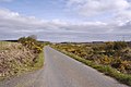
 Country road heading east - geograph.org.uk - 3976169.jpg 640 × 480; 44 KB
-
 Country road heading east - geograph.org.uk - 3976193.jpg 640 × 480; 54 KB
-
 Country road heading east - geograph.org.uk - 3978671.jpg 640 × 480; 77 KB
-

-

-

-
 Country road heading south - geograph.org.uk - 3993235.jpg 640 × 480; 50 KB
-

-
 Country road towards Shiels - geograph.org.uk - 3976188.jpg 640 × 480; 52 KB
-
 Country Scene - geograph.org.uk - 2920459.jpg 1,600 × 1,064; 449 KB
-
 Cows... - geograph.org.uk - 5568833.jpg 3,008 × 2,000; 2.13 MB
-
 Crop field, Goudieburn - geograph.org.uk - 4098721.jpg 640 × 480; 66 KB
-
 Dams of Craigie - geograph.org.uk - 1010238.jpg 640 × 389; 36 KB
-

-
 Derelict cottage near Gateside - geograph.org.uk - 3993206.jpg 640 × 480; 50 KB
-
 Deserted beach at Menie - geograph.org.uk - 6426606.jpg 6,000 × 4,000; 6.7 MB
-
 Donald Trump's golf course being laid - geograph.org.uk - 2562901.jpg 3,648 × 2,736; 4.69 MB
-
-
 Donald Trump's golf course with two kinds of grass - geograph.org.uk - 2562927.jpg 3,648 × 2,736; 4.77 MB
-
 Down to the Sea^ - geograph.org.uk - 1497350.jpg 640 × 426; 83 KB
-
 Driveway to the Trump golf resort - geograph.org.uk - 5095893.jpg 3,008 × 2,000; 2.73 MB
-
 Drums - geograph.org.uk - 5642741.jpg 1,024 × 683; 313 KB
-
 Drums Links - geograph.org.uk - 5642709.jpg 1,024 × 683; 349 KB
-
 Drumside Links - geograph.org.uk - 5643592.jpg 1,024 × 683; 370 KB
-
 Dry stane dyke - geograph.org.uk - 2896310.jpg 1,600 × 1,064; 370 KB
-
 Dune coast south of Balmedie - geograph.org.uk - 6329952.jpg 6,000 × 4,000; 7.46 MB
-
 Dune Coast with Marram Grass - geograph.org.uk - 1496833.jpg 640 × 426; 71 KB
-
 Dune front, Menie - geograph.org.uk - 5642766.jpg 1,024 × 683; 229 KB
-
 Dune stabilisation at Menie May 2010 - geograph.org.uk - 1887199.jpg 1,600 × 1,200; 635 KB
-
 Dunes - geograph.org.uk - 1496402.jpg 640 × 426; 47 KB
-
 Dunes at Menie end of May 2010 - geograph.org.uk - 1887187.jpg 800 × 600; 60 KB
-
 Dunes, Blairton Links - geograph.org.uk - 5643575.jpg 1,024 × 683; 367 KB
-
 Dunes, Drums and Menie - geograph.org.uk - 5642740.jpg 1,024 × 683; 360 KB
-
 Dunes, Eigie Links - geograph.org.uk - 5643600.jpg 1,024 × 683; 264 KB
-
 Dunes, Menie Links - geograph.org.uk - 5642714.jpg 1,024 × 683; 337 KB
-
 Dunes, Menie Links - geograph.org.uk - 5642771.jpg 1,024 × 683; 335 KB
-
 Eigie Burn - geograph.org.uk - 5643587.jpg 1,024 × 683; 134 KB
-
 Eigie Burn meets the sea at Balmedie beach - geograph.org.uk - 6426547.jpg 6,000 × 4,000; 6.12 MB
-
 Entrance to landfill site - geograph.org.uk - 4098739.jpg 640 × 480; 62 KB
-
 Entrance to the Trump golf resort - geograph.org.uk - 5095902.jpg 2,609 × 1,835; 1.61 MB
-
 Eroding dunes, Menie - geograph.org.uk - 5642756.jpg 1,024 × 683; 235 KB
-
 Fairway, Menie - geograph.org.uk - 5643005.jpg 1,024 × 683; 285 KB
-
 Farm in the Snow - geograph.org.uk - 1627480.jpg 640 × 426; 64 KB
-
 Farm track - geograph.org.uk - 1251764.jpg 640 × 426; 68 KB
-
 Farm Track II - geograph.org.uk - 2286124.jpg 1,600 × 1,064; 376 KB
-
 Farmland and woodland - geograph.org.uk - 3994840.jpg 640 × 480; 87 KB
-

-
 Farmland at Dubbystyle - geograph.org.uk - 6213189.jpg 2,592 × 1,944; 1.7 MB
-
 Farmland at Smiddyburn - geograph.org.uk - 6213185.jpg 2,592 × 1,944; 1.82 MB
-
 Farmland near Darrahill - geograph.org.uk - 3993200.jpg 640 × 480; 68 KB
-
 Farmland near Gateside - geograph.org.uk - 6213190.jpg 2,592 × 1,944; 1.9 MB
-
 Farmland near Potterton - geograph.org.uk - 4098737.jpg 640 × 480; 87 KB
-
 Farmland, Denhead of Orrock - geograph.org.uk - 3993233.jpg 640 × 480; 68 KB
-
 Farmland, Mains of Whitecairns - geograph.org.uk - 3976167.jpg 640 × 480; 54 KB
-
 Farmland, Middle Ardo - geograph.org.uk - 3993207.jpg 640 × 480; 116 KB
-
 Farmland, Muirton - geograph.org.uk - 3994834.jpg 640 × 480; 76 KB
-
 Farmland, Westfield - geograph.org.uk - 3993213.jpg 640 × 480; 51 KB
-
 Farmland, Whitecairns - geograph.org.uk - 3976173.jpg 640 × 480; 52 KB
-
 Felled woodland, Red Moss - geograph.org.uk - 3994861.jpg 640 × 480; 68 KB
-
 Felled woodland, Red Moss - geograph.org.uk - 3994863.jpg 640 × 480; 107 KB
-
 Fog and horn - geograph.org.uk - 2730305.jpg 640 × 480; 61 KB
-
 Foredunes, Menie - geograph.org.uk - 5642846.jpg 1,024 × 683; 365 KB
-
 Former United Presbyterian Church, Shiels - geograph.org.uk - 5568864.jpg 2,919 × 1,993; 1.7 MB
-
 Forsyth Hall, Belhelvie - geograph.org.uk - 5097304.jpg 2,489 × 1,960; 2.24 MB
-
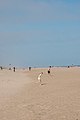
 Fun at the beach - geograph.org.uk - 925177.jpg 640 × 426; 26 KB
-
 Garage, Belhelvie - geograph.org.uk - 3994823.jpg 640 × 480; 64 KB
-
 Gateside - geograph.org.uk - 3993195.jpg 640 × 480; 58 KB
-
 Gorse flower head - geograph.org.uk - 822740.jpg 480 × 640; 194 KB
-
 Grain Field by Potterton - geograph.org.uk - 2574859.jpg 3,456 × 2,304; 900 KB
-
 Grass-covered dunes - geograph.org.uk - 925195.jpg 640 × 426; 62 KB
-
 Grassland near Delfrigs - geograph.org.uk - 6588909.jpg 800 × 600; 71 KB
-
 Gravel Track - geograph.org.uk - 1497343.jpg 640 × 426; 62 KB
-
 Grazing near Kingseat - geograph.org.uk - 3976199.jpg 640 × 480; 59 KB
-
 Grazing of the B977 - geograph.org.uk - 3994856.jpg 640 × 480; 89 KB
-
 Grazing on the edge of Potterton - geograph.org.uk - 4098728.jpg 640 × 480; 92 KB
-
 Grazing, Craigie - geograph.org.uk - 3976180.jpg 640 × 480; 75 KB
-
 Grazing, Easter Craigie - geograph.org.uk - 3976190.jpg 640 × 480; 48 KB
-
 Grazing, Hill of Keir - geograph.org.uk - 3993238.jpg 640 × 480; 62 KB
-
 Grazing, Murton Home Farm - geograph.org.uk - 3994825.jpg 640 × 480; 73 KB
-
 Green Edged Road - geograph.org.uk - 2585954.jpg 3,343 × 2,204; 1.7 MB
-
 Gulls lift from fields at Braehead - geograph.org.uk - 5489850.jpg 1,024 × 682; 155 KB
-
 Heading for Blackdog beach - geograph.org.uk - 6546657.jpg 6,000 × 4,000; 6.2 MB
-
 Hill of Ardo - geograph.org.uk - 1017602.jpg 640 × 410; 47 KB
-
 Hill of Menie - geograph.org.uk - 6588915.jpg 800 × 600; 88 KB
-
 Hillhead of Muirton Farm - geograph.org.uk - 2930176.jpg 1,600 × 1,064; 266 KB
-
 Home Farm Entrance - geograph.org.uk - 2574860.jpg 3,456 × 2,304; 1.9 MB
-
 House, Hill of Menie - geograph.org.uk - 6588921.jpg 800 × 600; 114 KB
-
 Houses at Balmedie - geograph.org.uk - 1300460.jpg 640 × 427; 255 KB
-

-
 Houses on Old Road, Balmedie - geograph.org.uk - 6588705.jpg 800 × 600; 83 KB
-
 Junction - geograph.org.uk - 2853717.jpg 1,600 × 1,064; 336 KB
-
 Kingseat wasteland - geograph.org.uk - 997689.jpg 640 × 438; 61 KB
-
 Kite surfer - geograph.org.uk - 932341.jpg 426 × 640; 25 KB
-
 Kite surfers - geograph.org.uk - 925216.jpg 426 × 640; 27 KB
-
 Light rain on Middle Ardo. - geograph.org.uk - 936976.jpg 640 × 427; 118 KB
-
 Local Heroes - geograph.org.uk - 5104502.jpg 2,097 × 1,574; 1.44 MB
-
 Mains of Whitecairns - geograph.org.uk - 3976166.jpg 640 × 480; 63 KB
-
 Mains of Whitecairns Farm - geograph.org.uk - 2924962.jpg 1,600 × 1,064; 400 KB
-
 Manse Road, Potterton - geograph.org.uk - 1627290.jpg 640 × 426; 95 KB
-
 Meanie Burn meets the sea - geograph.org.uk - 5643042.jpg 1,024 × 683; 242 KB
-
 Menie Burn - geograph.org.uk - 5642975.jpg 1,024 × 683; 294 KB
-
 Menie Burn - geograph.org.uk - 5642998.jpg 1,024 × 683; 332 KB
-
 Menie House (1981) - geograph.org.uk - 870359.jpg 640 × 404; 99 KB
-
 Menie Links - geograph.org.uk - 1599226.jpg 640 × 480; 45 KB
-
 Menie Links Nov 09 - geograph.org.uk - 1599222.jpg 640 × 480; 50 KB
-
 Menie Links, Flotsam - geograph.org.uk - 1539717.jpg 640 × 480; 704 KB
-
 Middlemuir Gateway - geograph.org.uk - 2585933.jpg 3,456 × 2,304; 2.93 MB
-
 Middlemuir Treebelt - geograph.org.uk - 2585918.jpg 3,456 × 2,304; 1.22 MB
-
 Mill of Menie - geograph.org.uk - 1887226.jpg 1,600 × 1,200; 642 KB
-
 Milton of Potterton Farmhouse - geograph.org.uk - 1627297.jpg 640 × 426; 88 KB
-
 Minor road heading south - geograph.org.uk - 3993216.jpg 640 × 480; 66 KB
-
 Minor road heading south - geograph.org.uk - 3993225.jpg 640 × 480; 52 KB
-
 Minor road heading west - geograph.org.uk - 3993201.jpg 640 × 480; 54 KB
-
 Minor road north of Belhelvie - geograph.org.uk - 6213182.jpg 2,592 × 1,944; 1.62 MB
-
 Minor road north of Belhelvie - geograph.org.uk - 6213184.jpg 2,592 × 1,944; 1.62 MB
-
 Minor road, Hill of Menie - geograph.org.uk - 6588919.jpg 800 × 600; 75 KB
-
 Minor road, Millden - geograph.org.uk - 6588695.jpg 800 × 600; 85 KB
-
 Mobile dune, Menie Burn - geograph.org.uk - 5643002.jpg 1,024 × 683; 294 KB
-
 Mobile dunes, Menie Links - geograph.org.uk - 5642734.jpg 1,024 × 683; 360 KB
-
 Mobile sands, Drums Links - geograph.org.uk - 5642706.jpg 1,024 × 683; 213 KB
-
 Murton Home Farm - geograph.org.uk - 3994829.jpg 640 × 480; 49 KB
-
 Newton of Menie Farm - geograph.org.uk - 2896294.jpg 1,600 × 1,064; 348 KB
-

-
 Out in the country - geograph.org.uk - 2973436.jpg 1,600 × 1,064; 354 KB
-
 Park imported to links - geograph.org.uk - 5643008.jpg 1,024 × 683; 277 KB
-
 Path ahead - geograph.org.uk - 5642769.jpg 1,024 × 683; 389 KB
-
 Path from Balmedie Beach - geograph.org.uk - 5643583.jpg 1,024 × 683; 324 KB
-
 Path over the dunes - geograph.org.uk - 6426603.jpg 6,000 × 4,000; 6.89 MB
-
 Petten Farm - geograph.org.uk - 6588897.jpg 640 × 480; 61 KB
-
 Picnic on the beach... - geograph.org.uk - 6546677.jpg 6,000 × 4,000; 5.93 MB
-
 Pillbox at Petten's Links, Aberdeenshire - geograph.org.uk - 6247501.jpg 2,200 × 1,467; 836 KB
-
 Pillbox, Menie Burn - geograph.org.uk - 5643025.jpg 1,024 × 683; 282 KB
-
 Pillboxes, Balmedie beach - geograph.org.uk - 6329981.jpg 6,000 × 4,000; 5.36 MB
-
 Plaque at Trump International Golf Links, Scotland - geograph.org.uk - 6247162.jpg 2,200 × 1,467; 1.67 MB
-
 Potterton Burn outflow, Balmedie - geograph.org.uk - 5643597.jpg 1,024 × 683; 268 KB
-
 Potterton Community Centre - geograph.org.uk - 1627271.jpg 640 × 426; 56 KB
-
 Potterton Home Farm - geograph.org.uk - 5013965.jpg 640 × 427; 421 KB
-
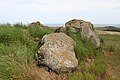
 Potterton Recumbent Stone Circle (1) - geograph.org.uk - 5013933.jpg 640 × 427; 368 KB
-
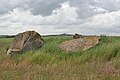 Potterton Recumbent Stone Circle (2) - geograph.org.uk - 5013938.jpg 640 × 427; 373 KB
-
 Potterton Recumbent Stone Circle (3) - geograph.org.uk - 5013942.jpg 640 × 427; 433 KB
-
 Potterton Recumbent Stone Circle (4) - geograph.org.uk - 5013948.jpg 640 × 427; 480 KB
-
 Potterton Recumbent Stone Circle (5) - geograph.org.uk - 5013957.jpg 640 × 427; 408 KB
-
 Potterton Recumbent Stone Circle (6) - geograph.org.uk - 5013961.jpg 640 × 427; 415 KB
-

-
 Race you^ - geograph.org.uk - 925222.jpg 426 × 640; 32 KB
-
 Ready for planting. - geograph.org.uk - 2853713.jpg 1,600 × 1,064; 516 KB
-
 Red for Danger - geograph.org.uk - 1496394.jpg 640 × 426; 66 KB
-
 Red Moss - geograph.org.uk - 2924978.jpg 1,600 × 1,064; 404 KB
-
 Red Moss junction - geograph.org.uk - 1777040.jpg 1,600 × 1,064; 236 KB
-
 Remains of a pillbox, Blackdog beach - geograph.org.uk - 6547583.jpg 6,000 × 4,000; 4.83 MB
-
 Road across Harestone Moss - geograph.org.uk - 5568888.jpg 3,008 × 2,000; 2.52 MB
-
 Road by Chapel Park - geograph.org.uk - 2583770.jpg 2,074 × 2,304; 939 KB
-
 Road from Trump Macleod House Hotel - geograph.org.uk - 6588910.jpg 800 × 600; 57 KB
-

-
 Road Sign - geograph.org.uk - 1775772.jpg 1,600 × 1,064; 384 KB
-
 Road to Middlemuir - geograph.org.uk - 2585911.jpg 3,456 × 2,304; 1.48 MB
-
 Road to nowhere - geograph.org.uk - 2894210.jpg 1,600 × 1,064; 385 KB


_-_geograph.org.uk_-_870359.jpg)


_-_geograph.org.uk_-_5013933.jpg)
_-_geograph.org.uk_-_5013938.jpg)
_-_geograph.org.uk_-_5013942.jpg)
_-_geograph.org.uk_-_5013948.jpg)
_-_geograph.org.uk_-_5013957.jpg)
_-_geograph.org.uk_-_5013961.jpg)


&filefrom=Road+to+Shiels+-+geograph.org.uk+-+2973423.jpg#mw-category-media)