Category:Baycliff
Jump to navigation
Jump to search
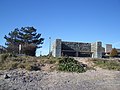
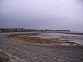
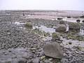
English: Baycliff is a village in the South Lakeland District of Cumbria in England. It is situated south of Ulverston, in the civil parish of Aldingham. At the centre is a village green, and many of its buildings date from the 17th and 18th centuries. There are two public houses, the Farmers Arms and the Fisherman's Arms, situated close to the green. (→Baycliff)
Polski: Baycliff – wieś w Anglii, w Kumbrii, w dystrykcie South Lakeland. Leży 84 km na południe od miasta Carlisle i 355 km na północny zachód od Londynu. (→Baycliff)
village in Cumbria, United Kingdom  | |||||
| Upload media | |||||
| Instance of | |||||
|---|---|---|---|---|---|
| Location | Aldingham, South Lakeland, Cumbria, North West England, England | ||||
 | |||||
Media in category "Baycliff"
The following 26 files are in this category, out of 26 total.
-
 Baycliff - geograph.org.uk - 1983571.jpg 800 × 600; 149 KB
-
 Baycliff - geograph.org.uk - 3026564.jpg 640 × 480; 101 KB
-
 Baycliff - geograph.org.uk - 3026569.jpg 640 × 480; 116 KB
-
 Baycliff - geograph.org.uk - 3026570.jpg 640 × 480; 116 KB
-
 Baycliff - geograph.org.uk - 3026573.jpg 640 × 480; 118 KB
-
 Baycliff - geograph.org.uk - 3026576.jpg 640 × 480; 139 KB
-
 Baycliff - geograph.org.uk - 3026582.jpg 640 × 480; 117 KB
-
 Baycliff Haggs Quarries.JPG 3,072 × 2,304; 2.38 MB
-
 Baycliffe House - panoramio.jpg 3,072 × 1,728; 2.28 MB
-
 Baycliffe House Steps - panoramio.jpg 3,072 × 1,728; 2.57 MB
-
 Farmers Arms, Baycliff - geograph.org.uk - 1983559.jpg 800 × 600; 113 KB
-
 Farmers Arms, Baycliff - geograph.org.uk - 3026559.jpg 640 × 480; 107 KB
-
 Garden Terrace, Baycliff - geograph.org.uk - 3026561.jpg 640 × 480; 142 KB
-
 Houses by the shore below Baycliff - geograph.org.uk - 2487406.jpg 640 × 480; 110 KB
-
 Junction, Baycliff - geograph.org.uk - 3026578.jpg 640 × 480; 108 KB
-
 Sheep to Shore - geograph.org.uk - 141725.jpg 640 × 480; 50 KB
-
 Sheltered Seat - geograph.org.uk - 133496.jpg 640 × 480; 130 KB
-
 The Coast at Baycliff - geograph.org.uk - 1983520.jpg 800 × 600; 161 KB
-
 The shore below Baycliff - geograph.org.uk - 2487411.jpg 640 × 480; 130 KB
-
 Coast at Newbiggin - geograph.org.uk - 141744.jpg 640 × 480; 81 KB
-

-
 Fishermans Arms Hotel, Baycliff - geograph.org.uk - 98166.jpg 640 × 360; 94 KB
-
 Looking towards Moat Scar - geograph.org.uk - 141739.jpg 640 × 480; 71 KB
-
 Morecambe Bay - geograph.org.uk - 19084.jpg 640 × 480; 39 KB
-
 Point of Comfort Scar - geograph.org.uk - 262351.jpg 640 × 480; 129 KB
-
 Slipway At Rampside - geograph.org.uk - 133505.jpg 640 × 480; 106 KB


