Category:Aldingham
Jump to navigation
Jump to search
English: Aldingham is a village and civil parish in the South Lakeland district of Cumbria, England. It is situated on the east coast of the Furness peninsula, facing into Morecambe Bay, and is about eight miles east from Barrow in Furness, and six miles south of Ulverston. According to the 2001 census the parish had a population of 1,187.
village and civil parish in Cumbria, England, UK  | |||||
| Upload media | |||||
| Instance of | |||||
|---|---|---|---|---|---|
| Location | South Lakeland, Cumbria, North West England, England | ||||
| Population |
| ||||
| Area |
| ||||
 | |||||
Subcategories
This category has the following 7 subcategories, out of 7 total.
A
- Aldingham Hall, Cumbria (4 F)
B
- Baycliff (26 F)
C
G
L
N
- Newbiggin, Aldingham (4 F)
R
- Roosebeck (1 F)
Media in category "Aldingham"
The following 200 files are in this category, out of 250 total.
(previous page) (next page)-
 A5087 and sea wall - geograph.org.uk - 6541428.jpg 1,024 × 683; 414 KB
-
 A5087 at Baycliff - geograph.org.uk - 5685663.jpg 640 × 480; 44 KB
-
 A5087 at Colt Park - geograph.org.uk - 5685687.jpg 640 × 480; 69 KB
-
 A5087 at Ladycroft Cottage - geograph.org.uk - 5685679.jpg 640 × 480; 45 KB
-
 A5087 at Sea Wood - geograph.org.uk - 5685660.jpg 640 × 479; 85 KB
-
 A5087 Coast Road at Goadsbarrow - geograph.org.uk - 5685706.jpg 640 × 481; 31 KB
-
 A5087 near Moat Farm - geograph.org.uk - 6541385.jpg 1,024 × 683; 556 KB
-
 A5087 near Seawood Farm - geograph.org.uk - 6541329.jpg 1,024 × 683; 461 KB
-
 A5087 nears Newbiggin - geograph.org.uk - 5685693.jpg 640 × 481; 54 KB
-
 A5087 north of Aldingham - geograph.org.uk - 5685672.jpg 640 × 481; 38 KB
-
 A5087 south of Baycliff - geograph.org.uk - 6541360.jpg 1,024 × 683; 519 KB
-
 Abandoned Trailer near Barren Point Scar - geograph.org.uk - 3323301.jpg 1,524 × 1,012; 1.46 MB
-
 Above the shore - geograph.org.uk - 3367987.jpg 3,456 × 2,304; 2.76 MB
-
 Aldingham - geograph.org.uk - 3026546.jpg 640 × 480; 132 KB
-
 Aldingham Beach, mid February 2015 - geograph.org.uk - 4464525.jpg 640 × 472; 65 KB
-
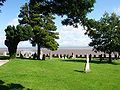 Aldingham Cemetery.jpg 1,280 × 957; 340 KB
-
 Aldingham Church - geograph.org.uk - 6541372.jpg 1,024 × 683; 531 KB
-
 Aldingham Hall - geograph.org.uk - 6541367.jpg 1,024 × 683; 486 KB
-
 Aldingham Hall, Aldingham - geograph.org.uk - 3344543.jpg 640 × 422; 171 KB
-
 Aldingham Motte and environs.jpg 640 × 1,476; 226 KB
-
 Aldingham Nursing and Residential Home - geograph.org.uk - 3716514.jpg 1,512 × 996; 1.2 MB
-
 Aldingham Nursing and Residential Home - geograph.org.uk - 3717882.jpg 1,524 × 1,012; 1.12 MB
-
 Aldingham Parish Hall.JPG 3,072 × 2,304; 2.44 MB
-
 Along Long Lane - geograph.org.uk - 6542303.jpg 1,024 × 683; 545 KB
-
 Approaching Seawood Farm - geograph.org.uk - 6541295.jpg 1,024 × 683; 464 KB
-
 Barley near North Hill - geograph.org.uk - 6544895.jpg 1,024 × 683; 484 KB
-
 Beach at Aldingham - geograph.org.uk - 2816205.jpg 640 × 480; 90 KB
-
 Beach at Aldingham - geograph.org.uk - 2816212.jpg 640 × 480; 119 KB
-
 Beach at Aldingham - geograph.org.uk - 6541376.jpg 1,024 × 683; 519 KB
-
 Beach at Newbiggin - geograph.org.uk - 6541405.jpg 1,024 × 683; 511 KB
-
 Beach near Moat Farm - geograph.org.uk - 6541381.jpg 1,024 × 683; 600 KB
-
 Beach near Newbiggin - geograph.org.uk - 6541395.jpg 1,024 × 683; 467 KB
-
 Beach, Aldingham - geograph.org.uk - 4254652.jpg 640 × 411; 182 KB
-
 Bin along the coast road - geograph.org.uk - 6541450.jpg 1,024 × 683; 529 KB
-
 Bridleway - flooded - geograph.org.uk - 3177338.jpg 1,497 × 966; 1.39 MB
-
 Bridleway - near the highest point - geograph.org.uk - 3176859.jpg 1,520 × 1,005; 1.3 MB
-
 Bridleway - uphill section - geograph.org.uk - 3176437.jpg 1,530 × 1,018; 1.42 MB
-
 Buoy on a sand flat - geograph.org.uk - 3753005.jpg 1,528 × 1,016; 1.29 MB
-
 Buoys on a sand flat - geograph.org.uk - 3752234.jpg 1,524 × 1,008; 1.35 MB
-
 Cattle east of Little Urswick - geograph.org.uk - 2488798.jpg 640 × 480; 81 KB
-
 Channel cutting through the sand - geograph.org.uk - 3876694.jpg 1,524 × 1,012; 1.18 MB
-
 Channel meandering through the sand - geograph.org.uk - 3737272.jpg 1,508 × 984; 1.09 MB
-
 Channel running through the sand - geograph.org.uk - 3869094.jpg 1,520 × 1,000; 1.16 MB
-
 Coast near Leonard Scar - geograph.org.uk - 6541418.jpg 1,024 × 683; 460 KB
-
 Coast Road and sea wall - geograph.org.uk - 6541436.jpg 1,024 × 683; 435 KB
-
 Coast Road at Baycliff - geograph.org.uk - 6541346.jpg 1,024 × 683; 486 KB
-
 Coast Road south of Newbiggin - geograph.org.uk - 6541414.jpg 1,024 × 683; 458 KB
-

-
 Coast south of Newbiggin - geograph.org.uk - 6541412.jpg 1,024 × 683; 505 KB
-
 Country Lane - geograph.org.uk - 1974316.jpg 2,560 × 1,456; 2.54 MB
-
 Country Lane - geograph.org.uk - 1979640.jpg 2,560 × 1,456; 2.71 MB
-
 Country Lane - geograph.org.uk - 1987957.jpg 2,560 × 1,456; 2.58 MB
-
 Deep Meadow Beck, Gleaston - geograph.org.uk - 4518051.jpg 640 × 480; 125 KB
-

-
 Drift Lumber in the intertidal zone - geograph.org.uk - 3721042.jpg 1,520 × 1,008; 1.13 MB
-
 Driftwood in the intertidal zone - geograph.org.uk - 4043957.jpg 1,528 × 1,016; 1.15 MB
-
 Dunes at Aldingham - geograph.org.uk - 6541378.jpg 1,024 × 683; 569 KB
-
 East of the tarn in Leece - geograph.org.uk - 6542488.jpg 1,024 × 683; 494 KB
-
 Electricity Pylon - geograph.org.uk - 3233967.jpg 1,530 × 1,018; 1.06 MB
-
 Entering Baycliff - geograph.org.uk - 6541338.jpg 1,024 × 683; 451 KB
-
 Farmland beside the coast road - geograph.org.uk - 6541364.jpg 1,024 × 572; 478 KB
-
 Farmland north of Baycliffe - geograph.org.uk - 6541335.jpg 1,024 × 683; 437 KB
-
 Field at Four Lane Ends - geograph.org.uk - 6542308.jpg 1,024 × 683; 462 KB
-
 Field near North Hill - geograph.org.uk - 6544886.jpg 1,024 × 683; 531 KB
-
 Field near Sea Wood - geograph.org.uk - 6541291.jpg 1,024 × 683; 457 KB
-
 Field under plastic mulch film - geograph.org.uk - 3955031.jpg 1,530 × 1,018; 1.26 MB
-
 Fields near Goadsbarrow Farm - geograph.org.uk - 6542299.jpg 1,024 × 683; 459 KB
-
 Fields near North Hill - geograph.org.uk - 6544891.jpg 1,024 × 683; 523 KB
-
 Fields north of Leece - geograph.org.uk - 6544884.jpg 1,024 × 683; 494 KB
-
 Fields North of Scales - geograph.org.uk - 1973473.jpg 800 × 600; 150 KB
-
 Fisherman's Arms - geograph.org.uk - 3367838.jpg 3,456 × 2,304; 3.48 MB
-
 Fisherman's Arms - interior - geograph.org.uk - 3367978.jpg 3,456 × 2,304; 3.36 MB
-
 Footpath north of Scales - geograph.org.uk - 2488785.jpg 640 × 480; 129 KB
-
 Fringed foreshore - geograph.org.uk - 3368016.jpg 3,411 × 2,253; 2.49 MB
-
 From Rampside towards Piel - geograph.org.uk - 72130.jpg 640 × 480; 81 KB
-
 Garden mermaid, Hillcrest - geograph.org.uk - 2487444.jpg 480 × 640; 148 KB
-
 Gate on Hard Knotts Lane - geograph.org.uk - 6544885.jpg 1,024 × 683; 477 KB
-
 Gleaston Castle - geograph.org.uk - 5496050.jpg 640 × 480; 70 KB
-
 Gleaston Watermill - geograph.org.uk - 4518044.jpg 640 × 480; 84 KB
-
 Gleaston Watermill - geograph.org.uk - 5496024.jpg 640 × 480; 98 KB
-
 Greylags beside Leece Tarn - geograph.org.uk - 6542319.jpg 1,024 × 683; 507 KB
-
 Greystone Lane - geograph.org.uk - 3445817.jpg 640 × 480; 147 KB
-
 Greystone Lane, Dendron - geograph.org.uk - 3445818.jpg 640 × 480; 151 KB
-
 Greystone Lane, Dendron - geograph.org.uk - 3445819.jpg 640 × 480; 158 KB
-
 Gully in the sand - geograph.org.uk - 3974749.jpg 1,516 × 1,000; 1,020 KB
-
 Hay Bales in a field next to the A5087 - geograph.org.uk - 3693804.jpg 1,528 × 1,016; 1.45 MB
-
 Hay field, Wind Hill - geograph.org.uk - 2487455.jpg 1,024 × 455; 106 KB
-
 Houses near Bracken Hill - geograph.org.uk - 6541388.jpg 1,024 × 683; 533 KB
-
 Houses on the coast road - geograph.org.uk - 6541444.jpg 1,024 × 683; 479 KB
-
 Information board on Aldingham Beach - geograph.org.uk - 4464523.jpg 640 × 480; 64 KB
-
 Inside St Cuthbert, Aldingham (b) - geograph.org.uk - 4468944.jpg 480 × 640; 59 KB
-
 Inside St Cuthbert, Aldingham (c) - geograph.org.uk - 4468946.jpg 640 × 480; 90 KB
-
 Inside St Cuthbert, Aldingham (d) - geograph.org.uk - 4468950.jpg 640 × 480; 40 KB
-
 Inside St Cuthbert, Aldingham (e) - geograph.org.uk - 4468953.jpg 480 × 640; 56 KB
-
 Inside St Cuthbert, Aldingham (f) - geograph.org.uk - 4468954.jpg 480 × 640; 53 KB
-
 Inside St Cuthbert, Aldingham (f) - geograph.org.uk - 4468957.jpg 640 × 480; 56 KB
-
 Inside St Cuthbert, Aldingham (h) - geograph.org.uk - 4468965.jpg 479 × 640; 65 KB
-
 Inside St Cuthbert, Aldingham (i) - geograph.org.uk - 4468966.jpg 640 × 480; 82 KB
-
 Inside St Cuthbert, Aldingham (j) - geograph.org.uk - 4468969.jpg 480 × 640; 76 KB
-
 Inside St Cuthbert, Aldingham (k) - geograph.org.uk - 4468971.jpg 640 × 469; 45 KB
-
 Intertidal zone north of Barren Point Scar - geograph.org.uk - 3251214.jpg 1,530 × 1,018; 1.4 MB
-
 Iron posts sticking out of the sand - geograph.org.uk - 4037067.jpg 1,464 × 968; 1.03 MB
-
 Junction of bridleways north of Scales - geograph.org.uk - 2487824.jpg 640 × 480; 134 KB
-
 Junction of Long Lane with the A5087 - geograph.org.uk - 2816151.jpg 640 × 480; 97 KB
-

-
 Kiln Lane at Four Lane Ends - geograph.org.uk - 6542311.jpg 1,024 × 683; 510 KB
-
 Leece Tarn - geograph.org.uk - 2813916.jpg 640 × 479; 133 KB
-
 Leece Tarn - geograph.org.uk - 4518061.jpg 640 × 480; 88 KB
-
 Leece Tarn - geograph.org.uk - 6542322.jpg 1,024 × 520; 417 KB
-
 Leece Tarn, mid-February 2015 - geograph.org.uk - 4488120.jpg 640 × 480; 40 KB
-
 Lime kilns near Low Town Farm, Scales - geograph.org.uk - 2488770.jpg 640 × 427; 103 KB
-
 Limekiln, Scales.jpg 640 × 480; 156 KB
-
 Long Lane - geograph.org.uk - 2816146.jpg 640 × 480; 100 KB
-

-
 Looking south-west down Church Lane - geograph.org.uk - 4465641.jpg 640 × 480; 122 KB
-
 Mare and foal on Long Lane - geograph.org.uk - 6542305.jpg 1,024 × 683; 486 KB
-
 Maskel Point - geograph.org.uk - 2487417.jpg 640 × 480; 116 KB
-
 Maskel Point - geograph.org.uk - 257672.jpg 640 × 480; 84 KB
-
 Mere Tarn - geograph.org.uk - 3730348.jpg 1,516 × 996; 1.11 MB
-
 Mere Tarn - geograph.org.uk - 4518032.jpg 640 × 480; 67 KB
-
 Metal post on a sand bank - geograph.org.uk - 3734015.jpg 1,524 × 1,008; 1.06 MB
-
 Morecambe Bay at Edge Bank - geograph.org.uk - 1983491.jpg 800 × 600; 167 KB
-
 Moss House - geograph.org.uk - 210578.jpg 640 × 480; 128 KB
-
 Moss Lane - geograph.org.uk - 2813920.jpg 640 × 480; 90 KB
-
 Newbiggin and Roosebeck from the air - geograph.org.uk - 4604077.jpg 480 × 640; 94 KB
-

-
 Outflow near Malt Kiln Road - geograph.org.uk - 6541397.jpg 1,024 × 683; 539 KB
-
 Overgrown footpath north of Scales - geograph.org.uk - 2488777.jpg 640 × 480; 192 KB
-
 Passing Ladycroft Cottage - geograph.org.uk - 6541380.jpg 1,024 × 683; 535 KB
-
 Passing Seawood Farm - geograph.org.uk - 6541328.jpg 1,024 × 683; 448 KB
-
 Pasture above Wind Hill - geograph.org.uk - 2487462.jpg 640 × 480; 78 KB
-
 Pasture North of Scales - geograph.org.uk - 1973461.jpg 800 × 600; 155 KB
-
 Point 92m - geograph.org.uk - 2487432.jpg 640 × 480; 99 KB
-
 Point of Comfort Scar - geograph.org.uk - 3202401.jpg 1,526 × 1,012; 1.25 MB
-
 Precariously balanced Cairn - geograph.org.uk - 4044305.jpg 1,504 × 980; 1.06 MB
-
 Riddings Lane off Coast Road - geograph.org.uk - 2816178.jpg 640 × 480; 106 KB
-
 Risedale, Aldingham - geograph.org.uk - 3026544.jpg 640 × 480; 124 KB
-
 Road junction and memorial - geograph.org.uk - 6544887.jpg 1,024 × 683; 597 KB
-

-
 Road near North Hill - geograph.org.uk - 6544888.jpg 1,024 × 683; 584 KB
-
 Road near the Old School House - geograph.org.uk - 6544923.jpg 1,024 × 683; 562 KB
-
 Roosebeck sands - geograph.org.uk - 1454914.jpg 640 × 474; 41 KB
-
 Rush hour in Aldingham - geograph.org.uk - 4464527.jpg 640 × 480; 99 KB
-
 Rush hour in Dendron (i) - geograph.org.uk - 4488127.jpg 640 × 480; 77 KB
-
 Rush hour in Dendron (ii) - geograph.org.uk - 4488128.jpg 640 × 480; 48 KB
-
 Sand flat in Morecambe Bay - geograph.org.uk - 1973983.jpg 2,560 × 1,456; 2.58 MB
-
 Sand flat in Morecambe Bay - geograph.org.uk - 1986933.jpg 2,560 × 1,456; 2.54 MB
-
 Sand flat in Morecambe Bay - geograph.org.uk - 3193277.jpg 1,526 × 1,012; 1.08 MB
-
 Sand flat in Morecambe Bay - geograph.org.uk - 3201515.jpg 1,512 × 990; 1,014 KB
-
 Sand flat in Morecambe Bay - geograph.org.uk - 3211636.jpg 1,530 × 1,018; 1,004 KB
-
 Sand flat in Morecambe Bay - geograph.org.uk - 3216441.jpg 1,520 × 1,000; 1.01 MB
-
 Sand flat in Morecambe bay - geograph.org.uk - 4045603.jpg 1,520 × 1,008; 1.13 MB
-
 Sand flat in Morecambe bay - geograph.org.uk - 4046645.jpg 1,524 × 1,012; 1.35 MB
-
 Sand Flat in the intertidal zone - geograph.org.uk - 3721785.jpg 1,516 × 996; 1.26 MB
-
 Sand flat in the intertidal zone - geograph.org.uk - 3733068.jpg 1,520 × 1,004; 1.18 MB
-
 Sand flat in the intertidal zone - geograph.org.uk - 3749067.jpg 1,528 × 1,016; 1.04 MB
-
 Sand flat in the intertidal zone - geograph.org.uk - 3755175.jpg 1,512 × 992; 1.12 MB
-
 Sand flat in the intertidal zone - geograph.org.uk - 3871734.jpg 1,520 × 1,008; 1.27 MB
-
 Sand flat in the intertidal zone - geograph.org.uk - 3874859.jpg 1,520 × 1,000; 1.3 MB
-
 Sand flat near Aldingham - geograph.org.uk - 3901115.jpg 1,484 × 972; 1.09 MB
-
 Sandbank in Morecambe Bay - geograph.org.uk - 3868269.jpg 1,516 × 1,000; 1.32 MB
-
 Sands and sea wall - geograph.org.uk - 6541424.jpg 1,024 × 683; 467 KB
-
 Sands near Newbiggin - geograph.org.uk - 6541409.jpg 1,024 × 683; 511 KB
-
 Scarbarrow Hill - geograph.org.uk - 4694623.jpg 2,560 × 1,920; 2.88 MB
-
 Sea wall - Concrete coastal defence - geograph.org.uk - 3198825.jpg 1,494 × 960; 1.09 MB
-
 Sea wall - Concrete coastal defence - geograph.org.uk - 3199977.jpg 1,516 × 997; 1.09 MB
-
 Sea wall - Concrete held by Steel sheet piles - geograph.org.uk - 3198891.jpg 1,490 × 958; 1.21 MB
-
 Sea wall - Steel sheet piles and Concrete - geograph.org.uk - 3198861.jpg 1,512 × 990; 1.36 MB
-
 Sea wall along the Coast Road - geograph.org.uk - 1973864.jpg 2,560 × 1,456; 2.76 MB
-
 Sea Wall and A5087 - geograph.org.uk - 6541433.jpg 1,024 × 683; 450 KB
-
 Sea wall and beach - geograph.org.uk - 6541422.jpg 1,024 × 683; 440 KB
-
 Sea wall and groynes at Roosebeck - geograph.org.uk - 6541439.jpg 1,024 × 683; 444 KB
-
 Sea wall at Roosebeck - geograph.org.uk - 6541442.jpg 1,024 × 683; 398 KB
-
 Sea Wood foreshore - geograph.org.uk - 3367999.jpg 2,304 × 3,456; 2.04 MB
-
 Seawood Farm - geograph.org.uk - 6541297.jpg 1,024 × 683; 452 KB
-
 Seawood Farm - geograph.org.uk - 6541331.jpg 1,024 × 683; 454 KB
-
 Sheep Park above Baycliff - geograph.org.uk - 2487439.jpg 640 × 480; 114 KB
-
 Slipway and revetment near Roosebeck - geograph.org.uk - 4111722.jpg 640 × 427; 281 KB
-
 Slipway to the beach - geograph.org.uk - 6541446.jpg 1,024 × 683; 508 KB
-
 St Cuthbert, Aldingham, altar - geograph.org.uk - 4468985.jpg 640 × 480; 90 KB
-
 St Cuthbert, Aldingham, banner (a) - geograph.org.uk - 4468975.jpg 480 × 640; 62 KB
-
 St Cuthbert, Aldingham, banner (b) - geograph.org.uk - 4468978.jpg 480 × 640; 55 KB
-
 St Cuthbert, Aldingham, banner (c) - geograph.org.uk - 4468983.jpg 480 × 640; 37 KB
-
 St Cuthbert, Aldingham, churchyard (i) - geograph.org.uk - 4465644.jpg 640 × 480; 120 KB
-

-
 St Cuthbert, Aldingham, churchyard (iii) - geograph.org.uk - 4465649.jpg 640 × 480; 116 KB
-

-

-
 St Cuthbert, Aldingham, coat of arms - geograph.org.uk - 4468987.jpg 640 × 480; 81 KB
-
 St Cuthbert, Aldingham, font - geograph.org.uk - 4469001.jpg 640 × 480; 48 KB
-

-
 St Cuthbert, Aldingham, memorial (a) - geograph.org.uk - 4469005.jpg 480 × 640; 69 KB
-
 St Cuthbert, Aldingham, memorial (b) - geograph.org.uk - 4469007.jpg 640 × 462; 66 KB
-
 St Cuthbert, Aldingham, memorial (c) - geograph.org.uk - 4469009.jpg 640 × 485; 70 KB
-
 St Cuthbert, Aldingham, memorial (d) - geograph.org.uk - 4469012.jpg 640 × 458; 37 KB
-
 St Cuthbert, Aldingham, memorial (e) - geograph.org.uk - 4469017.jpg 640 × 480; 39 KB
-
 St Cuthbert, Aldingham, memorial (f) - geograph.org.uk - 4469023.jpg 459 × 640; 48 KB
-
 St Cuthbert, Aldingham, memorial (g) - geograph.org.uk - 4469025.jpg 640 × 419; 49 KB
-
 St Cuthbert, Aldingham, memorial (h) - geograph.org.uk - 4469028.jpg 468 × 640; 44 KB
-
 St Cuthbert, Aldingham, memorial (i) - geograph.org.uk - 4469030.jpg 640 × 480; 54 KB


_-_geograph.org.uk_-_4468944.jpg)
_-_geograph.org.uk_-_4468946.jpg)
_-_geograph.org.uk_-_4468950.jpg)
_-_geograph.org.uk_-_4468953.jpg)
_-_geograph.org.uk_-_4468954.jpg)
_-_geograph.org.uk_-_4468957.jpg)
_-_geograph.org.uk_-_4468965.jpg)
_-_geograph.org.uk_-_4468966.jpg)
_-_geograph.org.uk_-_4468969.jpg)
_-_geograph.org.uk_-_4468971.jpg)


_-_geograph.org.uk_-_4488127.jpg)
_-_geograph.org.uk_-_4488128.jpg)


_-_geograph.org.uk_-_4468975.jpg)
_-_geograph.org.uk_-_4468978.jpg)
_-_geograph.org.uk_-_4468983.jpg)
_-_geograph.org.uk_-_4465644.jpg)
_-_geograph.org.uk_-_4465648.jpg)
_-_geograph.org.uk_-_4465649.jpg)
_-_geograph.org.uk_-_4468936.jpg)
_-_geograph.org.uk_-_4468938.jpg)


_-_geograph.org.uk_-_4469005.jpg)
_-_geograph.org.uk_-_4469007.jpg)
_-_geograph.org.uk_-_4469009.jpg)
_-_geograph.org.uk_-_4469012.jpg)
_-_geograph.org.uk_-_4469017.jpg)
_-_geograph.org.uk_-_4469023.jpg)
_-_geograph.org.uk_-_4469025.jpg)
_-_geograph.org.uk_-_4469028.jpg)
_-_geograph.org.uk_-_4469030.jpg)