Category:Aviation maps of the United States
Jump to navigation
Jump to search
Subcategories
This category has the following 5 subcategories, out of 5 total.
Media in category "Aviation maps of the United States"
The following 78 files are in this category, out of 78 total.
-
 070727 New Washington ADIZ-FRZ.jpg 900 × 692; 220 KB
-

-

-

-

-
 35th Edition - NARA - 140696294.jpg 22,032 × 8,256; 46.19 MB
-
 36th Edition - NARA - 140696292.jpg 22,043 × 8,256; 43.29 MB
-
 37th Edition - NARA - 140696290.jpg 22,049 × 8,256; 45.59 MB
-
 38th Edition - NARA - 140696288.jpg 22,041 × 8,256; 45.66 MB
-
 39th Edition - NARA - 140696286.jpg 22,030 × 8,288; 47.15 MB
-
 40th Edition - NARA - 140696284.jpg 22,036 × 8,320; 48.77 MB
-
 41st Edition - NARA - 140696282.jpg 22,002 × 8,288; 49.25 MB
-
 42nd Edition - NARA - 140696280.jpg 22,053 × 8,352; 47.16 MB
-
 43rd Edition - NARA - 140696278.jpg 22,041 × 8,288; 47.24 MB
-
 44th Edition - NARA - 140696270.jpg 22,037 × 8,320; 46.21 MB
-
 45th Edition - NARA - 140696268.jpg 22,000 × 8,320; 47.03 MB
-
 46th Edition - NARA - 140696266.jpg 22,065 × 8,288; 48.74 MB
-
 47th Edition - NARA - 140696264.jpg 22,059 × 8,288; 48.89 MB
-
 48th Edition - NARA - 140696262.jpg 22,075 × 8,320; 43.78 MB
-
 49th Edition - NARA - 140696260.jpg 22,096 × 8,352; 41.58 MB
-
 50th Edition - NARA - 140696258.jpg 22,099 × 8,320; 45.23 MB
-
 51st Edition - NARA - 140696256.jpg 22,087 × 8,352; 44.09 MB
-
 52nd Edition - NARA - 140696254.jpg 22,063 × 8,352; 45.44 MB
-
 53rd Edition - NARA - 140696298.jpg 22,096 × 8,320; 45.99 MB
-
 54th Edition - NARA - 140696276.jpg 22,122 × 8,352; 48.27 MB
-
 55th Edition - NARA - 140696274.jpg 22,101 × 8,352; 46.6 MB
-
 56th Edition - NARA - 140696272.jpg 22,116 × 8,320; 45.64 MB
-
 Air Routes in Alaska in 1925.jpg 551 × 601; 129 KB
-
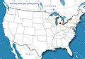
 Air Routes of Quebec, Ontario, and New York in 1925.jpg 601 × 857; 175 KB
-
 Air Routes of the United States in 1925.jpg 1,798 × 1,143; 497 KB
-
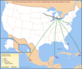
 Air Routes of the West Indies in 1925.jpg 876 × 596; 228 KB
-
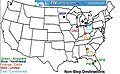
 Airports with Non-Stop Service from KBNA.png 1,142 × 672; 51 KB
-
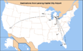
 Airports with non-stop service from Nashville KBNA.png 1,025 × 757; 256 KB
-
 Airways and Landing Fields - NARA - 140696172.jpg 6,560 × 5,421; 2.27 MB
-
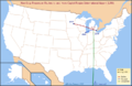
 Alaska ADIZ 2009.jpg 1,086 × 696; 343 KB
-
 Area Forecast Region Map.png 3,162 × 2,098; 2.94 MB
-
 Austin 1945 Edition - NARA - 84786184.jpg 20,075 × 9,376; 41.4 MB
-
 Austin 1946 Edition - NARA - 84786186.jpg 20,079 × 9,344; 32.79 MB
-
 BlackRockGunneryRangeElkoAeroChart1955.png 1,829 × 3,816; 16.77 MB
-
 CIA illegal flights.svg 1,034 × 518; 1.39 MB
-
 Dallas 1941 Edition - NARA - 84786178.jpg 19,462 × 9,664; 31.58 MB
-
 Dallas 1943 Edition - NARA - 84786182.jpg 19,475 × 9,632; 33.76 MB
-
 Dallas 1944 Edition - NARA - 84786176.jpg 19,621 × 9,792; 44.68 MB
-
 Dallas 1945 Edition - NARA - 84786174.jpg 19,664 × 9,472; 24.33 MB
-
 Dallas 1946 Edition - NARA - 84786180.jpg 19,633 × 9,312; 37.62 MB
-
 El Paso 1944 Edition - NARA - 84785552.jpg 19,868 × 9,792; 26.67 MB
-
 El Paso 1945 Edition - NARA - 84785548.jpg 19,900 × 9,408; 26.38 MB
-
 El Paso 1946 Edition - NARA - 84785546.jpg 20,056 × 9,440; 26.74 MB
-
 El Paso 1947 Edition - NARA - 84785550.jpg 20,032 × 9,408; 25.12 MB
-
 ENR L01.svg 1,986 × 5,136; 18.93 MB
-
 ETMS.jpg 300 × 400; 39 KB
-
 Flight restriction.gif 600 × 600; 274 KB
-
 LAN Airline Route Map-2010 Dec.png 759 × 495; 110 KB
-
 LAN Airline Route Map-2010 Jan.png 759 × 495; 102 KB
-
 LAN Airline Route Map-2011 Apr.png 759 × 495; 112 KB
-
 LAN Airline Route Map-2011 Dec.png 770 × 650; 180 KB
-
 LAN Airline Route Map-2013 Feb-updated 2012 Aug.png 770 × 650; 186 KB
-
 LAN Airline Route Map-2013 Feb.png 770 × 650; 182 KB
-
 LAN Airport NOAA Sectional Chart 1935.png 325 × 260; 94 KB
-
 LAN Route Map 085.jpg 1,005 × 703; 91 KB
-
 LAN Route Map 085B 2009-Mar.jpg 1,005 × 703; 81 KB
-
 LAN Route Map 2007-Jan-22.jpg 565 × 357; 59 KB
-
 LAN Route Map 2007-Jan.png 800 × 495; 25 KB
-
 LAN Route Map 2008-May.jpg 600 × 369; 41 KB
-
 Minimum Safe Altitude.gif 260 × 260; 60 KB
-
 Ndbkaln.png 1,536 × 864; 133 KB
-
 Nevada TTR Chart.jpg 4,997 × 3,970; 23.09 MB
-
 Operation Neptune Spear map of locations (2).svg 1,549 × 980; 2.62 MB
-
 Operation Neptune Spear map of locations DE.svg 1,549 × 980; 2.62 MB
-
 Operation Neptune Spear map of locations.svg 1,549 × 980; 2.62 MB
-
 Preston-chart.png 1,072 × 898; 1.77 MB
-
 Proposed Airways Systems of the United States - DPLA - 0ddd7041efce9e89c62baefd3a715f8c.jpg 9,561 × 6,248; 7.62 MB
-
 REA Air Express Map 1943.jpg 2,000 × 1,852; 5.42 MB
-
 Selected-uas-test-site-operators.png 1,200 × 927; 426 KB
-
 Tfrmap.jpeg 680 × 480; 58 KB
-
 UltimateAirDestionations.gif 720 × 360; 16 KB
-

-
 Western Canada, Washington, Montana, and Washington 1925 Air Routes.jpg 596 × 1,410; 211 KB


_Aviation_map_of_United_States,_featuring_landing_fields,_improved,_unimproved,_by_Rand_McNally,_from_the_Digital_Commonwealth_-_commonwealth_3f4639823.jpg)


.svg)


.jpg)
