Category:Armley Road
Jump to navigation
Jump to search
Subcategories
This category has the following 13 subcategories, out of 13 total.
A
- The Albion Inn, Armley (7 F)
- Armley Board School (1 F)
C
- Canal Mills, Leeds (18 F)
- Coal depot, Armley Road, Leeds (10 F)
- Crown House, Leeds (12 F)
D
- Denso Marston, Leeds (58 F)
E
G
- The Golden Lion, Armley (2 F)
N
- Nelson Inn, Armley (2 F)
P
- Premier Farnell, Armley (2 F)
R
- The Rose and Crown, Armley (1 F)
T
- Tower Court, Armley Road (6 F)
- Tradpak, Armley Road (5 F)
Media in category "Armley Road"
The following 81 files are in this category, out of 81 total.
-
 A busy moment at Armley Junction - geograph.org.uk - 6187231.jpg 1,024 × 768; 221 KB
-
 A647 to Leeds - geograph.org.uk - 5721040.jpg 640 × 427; 185 KB
-
 Armley Court, Armley Road, Leeds - geograph.org.uk - 4967061.jpg 1,280 × 720; 423 KB
-

-
 Armley Road (34266254934).jpg 5,992 × 3,137; 5.9 MB
-
 Armley Road (34300388003).jpg 5,592 × 2,929; 5.75 MB
-
 Armley Road (34945447092).jpg 5,992 × 3,129; 6.87 MB
-
 Armley Road (34945692382).jpg 5,992 × 3,130; 6.97 MB
-
 Armley Road (34945697552).jpg 6,000 × 3,137; 6.25 MB
-
 Armley Road (34979425741).jpg 6,000 × 3,136; 6.83 MB
-
 Armley Road (34979724911).jpg 5,992 × 3,130; 6.83 MB
-
 Armley Road (35070252246).jpg 5,779 × 3,023; 5.89 MB
-
 Armley Road (35110031405).jpg 5,992 × 3,136; 6.92 MB
-
 Armley Road (35110056985).jpg 6,000 × 4,000; 9.96 MB
-
 Armley Road (35110071925).jpg 5,992 × 3,137; 6.6 MB
-
 Armley Road - geograph.org.uk - 5721037.jpg 640 × 427; 183 KB
-

-

-

-
 Armley Road - Wellington Road - geograph.org.uk - 1987291.jpg 640 × 480; 67 KB
-
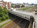 Armley Road bridge over the railway - geograph.org.uk - 6187222.jpg 1,024 × 768; 175 KB
-
 Armley Road in Armley, Leeds - geograph.org.uk - 5973247.jpg 640 × 392; 56 KB
-
 Armley Road parking restrictions - geograph.org.uk - 3754697.jpg 1,024 × 683; 192 KB
-

-
 Armley Road Retail Park in construction - geograph.org.uk - 5151007.jpg 1,024 × 768; 114 KB
-
 Armley Road viewed from Footbridge - geograph.org.uk - 551662.jpg 640 × 436; 38 KB
-
 Armley Road, Armley, Leeds - geograph.org.uk - 4967115.jpg 1,280 × 720; 442 KB
-
 Armley Road, Armley, Leeds - geograph.org.uk - 4967207.jpg 1,280 × 720; 458 KB
-
 Armley Road, Armley, Leeds - geograph.org.uk - 4967208.jpg 1,280 × 720; 413 KB
-
 Armley Road, Armley, Leeds - geograph.org.uk - 4967209.jpg 1,280 × 720; 395 KB
-
 Armley Road, Leeds - geograph.org.uk - 390208.jpg 640 × 480; 55 KB
-
 Armley Road, Leeds - geograph.org.uk - 4959568.jpg 1,280 × 720; 480 KB
-
 Armley Road, Leeds - geograph.org.uk - 4959569.jpg 1,280 × 720; 447 KB
-
 Armley Road, Leeds - geograph.org.uk - 4959572.jpg 1,280 × 720; 469 KB
-
 Armley Road, Leeds - geograph.org.uk - 4959575.jpg 1,280 × 720; 510 KB
-
 Armley Road, Leeds - geograph.org.uk - 4959576.jpg 1,280 × 720; 515 KB
-
 Armley Road, Leeds - geograph.org.uk - 4959583.jpg 1,280 × 853; 559 KB
-
 Armley Road, Leeds - geograph.org.uk - 4959587.jpg 1,280 × 853; 505 KB
-
 Armley road, Leeds - geograph.org.uk - 4963268.jpg 720 × 1,280; 571 KB
-
 Armley Road, Leeds - geograph.org.uk - 4963272.jpg 1,280 × 720; 381 KB
-
 Armley Road, Leeds - geograph.org.uk - 4963276.jpg 1,280 × 720; 584 KB
-
 Armley Road, Leeds - geograph.org.uk - 5052412.jpg 1,280 × 853; 571 KB
-
 Armley Road. Armley - geograph.org.uk - 915101.jpg 640 × 480; 65 KB
-
 ATS, Armley Road - geograph.org.uk - 6187204.jpg 1,024 × 768; 99 KB
-

-
 Benchmark on Armley Road wall - geograph.org.uk - 5292371.jpg 683 × 1,024; 300 KB
-
 Benchmark on Canal Street railway bridge - geograph.org.uk - 3754701.jpg 683 × 1,024; 139 KB
-
 Benchmark on Solk House, Armley Road - geograph.org.uk - 3754698.jpg 683 × 1,024; 316 KB
-
 Benchmark on wall of Armley Road - geograph.org.uk - 3754696.jpg 683 × 1,024; 257 KB
-
 Beside the railway - geograph.org.uk - 5721081.jpg 640 × 427; 176 KB
-
 Blue Moon, Armley Road (geograph 6187202).jpg 1,024 × 768; 135 KB
-
 Bridge over Armley Road - geograph.org.uk - 5721043.jpg 640 × 427; 181 KB
-
 B^M, Armley Road - geograph.org.uk - 5701515.jpg 1,024 × 768; 153 KB
-
-

-
 Crown House, Armley Road, Leeds (6917707561).jpg 2,836 × 3,309; 5.16 MB
-

-

-

-
 Flowerbed at the bottom of Armley Road - geograph.org.uk - 6537318.jpg 1,024 × 768; 287 KB
-

-
 Footpath from Armley Road towards Mistress Lane - geograph.org.uk - 5292376.jpg 1,024 × 683; 188 KB
-

-
 KD Brothers, Armley Road - geograph.org.uk - 6187237.jpg 1,024 × 768; 86 KB
-

-
 Neil Hudgell Law - Armley Road - geograph.org.uk - 2933134.jpg 640 × 480; 64 KB
-
 New cycle superhighway on Armley Road, Leeds - geograph.org.uk - 4920934.jpg 1,024 × 768; 184 KB
-
 Ordnance Survey Cut Mark on wall in Armley Road, Armley - geograph.org.uk - 2765626.jpg 4,000 × 3,000; 3.43 MB
-
 Postbox on Armley Road - geograph.org.uk - 6187199.jpg 1,024 × 768; 210 KB
-
 Postboxes on Armley Road - geograph.org.uk - 6537324.jpg 1,024 × 768; 232 KB
-
 Premier Farnell - geograph.org.uk - 5721041.jpg 640 × 427; 190 KB
-
 Premier Farnell plc - Armley Road - geograph.org.uk - 551645.jpg 640 × 403; 43 KB
-
 Relocated bus stop, Armley Road - geograph.org.uk - 5151018.jpg 1,024 × 768; 110 KB
-
 S lk House, Armley Road - geograph.org.uk - 5078102.jpg 1,024 × 768; 194 KB
-
 Solk House face (6882473895).jpg 2,762 × 3,848; 8.92 MB
-
 Solk House, 66-68 Armley Road, Leeds (6882462449).jpg 1,759 × 1,759; 2.25 MB
-
 Solk House, ^66 Armley Road - geograph.org.uk - 3754699.jpg 1,024 × 683; 201 KB
-
 View up Armley Road - geograph.org.uk - 6187218.jpg 1,024 × 768; 105 KB
-
 Waste ground by Armley Road - geograph.org.uk - 390197.jpg 640 × 480; 67 KB
-
 Wilde Child brewery, Armley Road - geograph.org.uk - 6187253.jpg 1,024 × 768; 98 KB
-
 Crown House - Armley Road - geograph.org.uk - 551655.jpg 640 × 402; 43 KB


.jpg)
.jpg)
.jpg)
.jpg)
.jpg)
.jpg)
.jpg)
.jpg)
.jpg)
.jpg)
.jpg)


.jpg)


.jpg)


.jpg)
.jpg)


