Category:A647 road (England)
Jump to navigation
Jump to search

A road in West Yorkshire, England, UK  | |||||
| Upload media | |||||
| Instance of | |||||
|---|---|---|---|---|---|
| Location | West Yorkshire, Yorkshire and the Humber, England | ||||
| Transport network |
| ||||
| Length |
| ||||
 | |||||
Subcategories
This category has the following 17 subcategories, out of 17 total.
A
B
C
- Croft Street, Bradford (7 F)
F
- Ford Hill, Queensbury (7 F)
G
H
L
Q
- Queensbury Road, Halifax (10 F)
S
- Stanningley Bypass (23 F)
W
Media in category "A647 road (England)"
The following 17 files are in this category, out of 17 total.
-
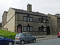 58 and 60, Halifax Road, Catherine Slack.jpg 4,000 × 3,000; 1.01 MB
-
 A647 (37358774896).jpg 6,000 × 4,000; 10.82 MB
-
 A647 Croft Street - geograph.org.uk - 2112902.jpg 2,592 × 1,944; 1.93 MB
-
 A647 Leeds Ring Road - geograph.org.uk - 78630.jpg 640 × 480; 74 KB
-

-
 Halifax Road - Catherine Slack - geograph.org.uk - 532246.jpg 640 × 530; 51 KB
-
 Milestone (2860567696).jpg 1,920 × 2,463; 2.96 MB
-
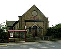
 New Dolphin Inn (2203834585).jpg 2,560 × 1,920; 3.24 MB
-

-
-
 Ruined lodge house (2597863417).jpg 2,560 × 1,920; 4.71 MB
-
 Suit DIY enthusiast (1569865865).jpg 3,505 × 2,177; 2.01 MB
-

-
 Thornbury roundabout - geograph.org.uk - 34727.jpg 640 × 480; 71 KB
-
 Three and three-quarter miles to Halifax (2239059840).jpg 2,560 × 1,920; 2.98 MB
-
 UK road A647.PNG 568 × 184; 7 KB
-
 Upper Shibden Hall Lodge (8402098801).jpg 2,329 × 1,698; 2.51 MB

.jpg)


.jpg)
.jpg)


.jpg)
.jpg)


.jpg)
.jpg)