Category:Animated maps of the Netherlands
Jump to navigation
Jump to search
Media in category "Animated maps of the Netherlands"
The following 13 files are in this category, out of 13 total.
-
Bolnes plattegrond ani.gif 439 × 760; 46 KB
-
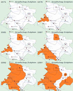
Demonstration gif graafschap zutphen during the 80 years of war.gif 716 × 599; 1.09 MB
-
LocationNetherlands.gif 64 × 64; 41 KB
-
LocationNetherlandsFast.gif 64 × 64; 44 KB
-
LocationNetherlandsLowProfile.gif 64 × 64; 42 KB
-
NetherlandsNavigation.gif 200 × 235; 69 KB
-
NetherlandsNavigationBlueSlow.gif 200 × 235; 67 KB
-
NetherlandsNavigationButton.gif 350 × 404; 120 KB
-
NetherlandsNavigationSlow.gif 200 × 235; 69 KB
-
ProvinceNetherlandsTranparency.GIF 201 × 291; 82 KB
-
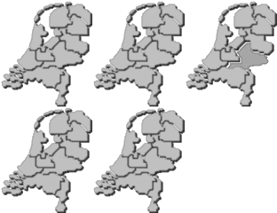
ProvincesOfTheNetherlands.gif 201 × 291; 47 KB
-
Verovering Gallie door de Franken.gif 1,242 × 1,144; 5.92 MB
-
Woutersbergje.gif 800 × 693; 652 KB


