Category:Animated maps of France
Jump to navigation
Jump to search
Media in category "Animated maps of France"
The following 148 files are in this category, out of 148 total.
-
540x394-Carte-10-Aube-A.gif 540 × 394; 298 KB
-
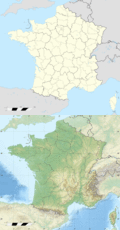
624x600 Animation-Carte-France-Reliefs-et-Admin.gif 624 × 600; 329 KB
-
624x600-Cartes-France.gif 624 × 600; 256 KB
-
300X France Animation 1000.gif 300 × 295; 50 KB
-
Carte (1) - Communauté de communes Isle Manoire en Périgord.gif 485 × 520; 132 KB
-
Carte (2) - Communauté de communes Isle Manoire en Périgord.gif 485 × 509; 95 KB
-
Carte (3) - Communauté de Communes Isle Manoire en Périgord.gif 480 × 516; 145 KB
-
Carte France geo anim.gif 645 × 634; 226 KB
-
Carte-circo.-Garlaban.gif 624 × 499; 190 KB
-
France borders from 1810 to 1871.gif 466 × 430; 143 KB
-
Franks expansion.gif 790 × 505; 64 KB
-
French Empire evolution.gif 1,425 × 625; 146 KB
-
Frontiere francaise 985 1947 small.gif 466 × 430; 1.19 MB
-
Frontiere francaise 985 1947.gif 931 × 859; 2.02 MB
-
Historical map of French autoroutes network - 1 sec.gif 1,195 × 1,179; 4.77 MB
-
Historical map of French autoroutes network - 2 sec.gif 1,195 × 1,179; 4.77 MB
-
Historical map of Paris Metro - 1899-1939.gif 1,663 × 1,465; 5.15 MB
-
Historical map of Paris Metro - 1899-2012 reduced.gif 977 × 897; 9.36 MB
-
Historical map of Paris Metro - 1899-2012.gif 4,282 × 3,933; 50.5 MB
-
Hundred years war.gif 541 × 621; 140 KB
-
Municipales 1983 - 2008 à Paris.gif 1,030 × 740; 194 KB
-
Railway map of France - 01 - animated - fr.gif 1,252 × 2,266; 5.74 MB
-
Railway map of France - 02 - animated - fr.gif 1,252 × 2,794; 6.92 MB
-
Railway map of France - 03 - animated - fr.gif 1,566 × 2,111; 5.49 MB
-
Railway map of France - 04 - animated - fr.gif 1,566 × 2,188; 4.92 MB
-
Railway map of France - 05 - animated - fr.gif 1,566 × 2,266; 4.66 MB
-
Railway map of France - 06 - animated - fr.gif 1,566 × 3,133; 5.63 MB
-
Railway map of France - 07 - animated - fr.gif 1,252 × 2,425; 5.38 MB
-
Railway map of France - 08 - animated - fr.gif 1,252 × 2,150; 5.05 MB
-
Railway map of France - 09 - animated - fr.gif 1,252 × 2,030; 4.03 MB
-
Railway map of France - 10 - animated - fr.gif 1,252 × 2,030; 4.64 MB
-
Railway map of France - 11 - animated - fr.gif 1,566 × 2,030; 5 MB
-
Railway map of France - 12 - animated - fr.gif 1,566 × 2,502; 5.74 MB
-
Railway map of France - 13 - animated - fr.gif 1,566 × 2,463; 6.97 MB
-
Railway map of France - 14 - animated - fr.gif 1,566 × 1,952; 4.98 MB
-
Railway map of France - 15 - animated - fr.gif 1,566 × 2,166; 4.7 MB
-
Railway map of France - 16 - animated - fr.gif 1,252 × 2,227; 4.66 MB
-
Railway map of France - 17 - animated - fr.gif 2,630 × 1,841; 6.94 MB
-
Railway map of France - 18 - animated - fr.gif 1,246 × 2,531; 5.68 MB
-
Railway map of France - 19 - animated - fr.gif 1,566 × 2,111; 4.93 MB
-
Railway map of France - 21 - animated - fr.gif 1,252 × 2,386; 5.68 MB
-
Railway map of France - 22 - animated - fr.gif 1,558 × 2,020; 5.16 MB
-
Railway map of France - 23 - animated - fr.gif 1,252 × 2,227; 4.86 MB
-
Railway map of France - 24 - animated - fr.gif 1,566 × 2,502; 5.76 MB
-
Railway map of France - 25 - animated - fr.gif 1,246 × 2,296; 5.61 MB
-
Railway map of France - 26 - animated - fr.gif 1,252 × 2,463; 5.45 MB
-
Railway map of France - 27 - animated - fr.gif 1,566 × 1,952; 5.11 MB
-
Railway map of France - 28 - animated - fr.gif 1,252 × 2,308; 5.22 MB
-
Railway map of France - 29 - animated - fr.gif 1,246 × 2,335; 5.02 MB
-
Railway map of France - 30 - animated - fr.gif 1,566 × 2,266; 6.01 MB
-
Railway map of France - 31 - animated - fr.gif 1,566 × 2,502; 6.68 MB
-
Railway map of France - 32 - animated - fr.gif 1,566 × 2,111; 5.44 MB
-
Railway map of France - 33 - animated - fr.gif 2,672 × 1,845; 8.97 MB
-
Railway map of France - 34 - animated - fr.gif 1,566 × 2,313; 6.27 MB
-
Railway map of France - 35 - animated - fr.gif 1,246 × 2,335; 5.48 MB
-
Railway map of France - 36 - animated - fr.gif 1,252 × 2,266; 5.02 MB
-
Railway map of France - 37 - animated - fr.gif 1,252 × 2,738; 6.19 MB
-
Railway map of France - 38 - animated - fr.gif 1,558 × 2,531; 6.78 MB
-
Railway map of France - 39 - animated - fr.gif 1,246 × 2,335; 5.56 MB
-
Railway map of France - 40 - animated - fr.gif 1,566 × 2,347; 5.32 MB
-
Railway map of France - 41 - animated - fr.gif 1,566 × 2,188; 5.82 MB
-
Railway map of France - 42 - animated - fr.gif 1,252 × 3,030; 7.13 MB
-
Railway map of France - 43 - animated - fr.gif 1,566 × 2,030; 4.75 MB
-
Railway map of France - 44 - animated - fr.gif 1,566 × 2,188; 6.27 MB
-
Railway map of France - 45 - animated - fr.gif 1,566 × 2,150; 5.77 MB
-
Railway map of France - 46 - animated - fr.gif 1,252 × 2,188; 4.46 MB
-
Railway map of France - 47 - animated - fr.gif 1,252 × 2,150; 4.52 MB
-
Railway map of France - 48 - animated - fr.gif 1,252 × 2,188; 4.33 MB
-
Railway map of France - 49 - animated - fr.gif 1,566 × 2,188; 6.46 MB
-
Railway map of France - 50 - animated - fr.gif 1,252 × 2,502; 5.38 MB
-
Railway map of France - 51 - animated - fr.gif 1,644 × 2,266; 7.08 MB
-
Railway map of France - 52 - animated - fr.gif 1,246 × 2,335; 5.43 MB
-
Railway map of France - 53 - animated - fr.gif 1,246 × 2,061; 4.72 MB
-
Railway map of France - 54-57 - animated - fr.gif 1,802 × 2,502; 9.57 MB
-
Railway map of France - 55 - animated - fr.gif 1,252 × 2,463; 6.27 MB
-
Railway map of France - 56 - animated - fr.gif 1,558 × 2,100; 5.66 MB
-
Railway map of France - 58 - animated - fr.gif 1,252 × 2,266; 5.01 MB
-
Railway map of France - 59 - animated - fr.gif 1,636 × 2,609; 11.02 MB
-
Railway map of France - 60 - animated - fr.gif 1,252 × 1,913; 4.66 MB
-
Railway map of France - 61 - animated - fr.gif 1,566 × 1,952; 4.87 MB
-
Railway map of France - 62 - animated - fr.gif 1,566 × 2,252; 6.24 MB
-
Railway map of France - 63 - animated - fr.gif 1,566 × 2,266; 5.77 MB
-
Railway map of France - 64 - animated - fr.gif 1,725 × 2,150; 5.95 MB
-
Railway map of France - 65 - animated - fr.gif 1,252 × 2,227; 4.8 MB
-
Railway map of France - 66 - animated - fr.gif 1,566 × 1,716; 3.76 MB
-
Railway map of France - 67 - animated - fr.gif 1,252 × 2,266; 5.88 MB
-
Railway map of France - 68 - animated - fr.gif 1,246 × 2,061; 5.36 MB
-
Railway map of France - 69 - animated - fr.gif 1,252 × 2,111; 5.35 MB
-
Railway map of France - 70 - animated - fr.gif 1,252 × 1,991; 4.82 MB
-
Railway map of France - 71 - animated - fr.gif 1,566 × 2,266; 6.1 MB
-
Railway map of France - 72 - animated - fr.gif 1,252 × 2,227; 5.14 MB
-
Railway map of France - 73 - animated - fr.gif 1,566 × 2,308; 5.69 MB
-
Railway map of France - 74 - animated - fr.gif 1,252 × 2,308; 4.94 MB
-
Railway map of France - 75 - animated - fr.gif 1,252 × 2,266; 8.1 MB
-
Railway map of France - 76 - animated - fr.gif 1,566 × 2,502; 6.55 MB
-
Railway map of France - 77 - animated - fr.gif 1,252 × 2,347; 6.22 MB
-
Railway map of France - 78 - animated - fr.gif 1,402 × 3,214; 12.91 MB
-
Railway map of France - 79 - animated - fr.gif 1,246 × 2,374; 5.44 MB
-
Railway map of France - 80 - animated - fr.gif 1,566 × 2,030; 5.61 MB
-
Railway map of France - 81 - animated - fr.gif 1,252 × 2,030; 4.56 MB
-
Railway map of France - 82 - animated - fr.gif 1,252 × 1,952; 4.5 MB
-
Railway map of France - 83 - animated - fr.gif 1,566 × 2,072; 4.86 MB
-
Railway map of France - 84 - animated - fr.gif 1,252 × 1,913; 4.56 MB
-
Railway map of France - 85 - animated - fr.gif 1,566 × 2,030; 5.42 MB
-
Railway map of France - 86 - animated - fr.gif 1,246 × 2,374; 5.39 MB
-
Railway map of France - 87 - animated - fr.gif 1,252 × 2,291; 4.97 MB
-
Railway map of France - 88 - animated - fr.gif 1,566 × 1,913; 5.2 MB
-
Railway map of France - 89 - animated - fr.gif 1,252 × 2,425; 5.3 MB
-
Railway map of France - 90 - animated - fr.gif 1,252 × 2,502; 3.59 MB
-
Railway map of France - 974 - animated - fr.gif 1,559 × 2,528; 1.32 MB
-
Railway map of France - Amiens - animated - fr.gif 1,802 × 1,013; 3.24 MB
-
Railway map of France - Angers - animated - fr.gif 1,620 × 1,980; 11.2 MB
-
Railway map of France - animated - fr - medium.gif 1,169 × 826; 789 KB
-
Railway map of France - animated - fr - small.gif 851 × 601; 768 KB
-
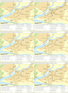
Railway map of France - Avignon - animated - fr.gif 1,566 × 1,416; 7.05 MB
-
Railway map of France - Besançon - animated - fr.gif 1,566 × 1,455; 7.21 MB
-
Railway map of France - Bordeaux - animated - fr.gif 2,067 × 1,501; 20.21 MB
-
Railway map of France - Brest - animated - fr.gif 1,566 × 1,691; 7.65 MB
-
Railway map of France - Caen - animated - fr.gif 1,566 × 1,927; 9.52 MB
-
Railway map of France - Clermont-Ferrand - animated - fr.gif 2,084 × 1,561; 12.44 MB
-
Railway map of France - Dijon - animated - fr.gif 1,802 × 2,008; 11.09 MB
-
Railway map of France - Grenoble - animated - fr.gif 1,996 × 1,740; 19.68 MB
-
Railway map of France - Le Havre - animated - fr.gif 1,686 × 1,772; 9.74 MB
-
Railway map of France - Le Mans - animated - fr.gif 1,802 × 1,691; 10.94 MB
-
Railway map of France - Lille - animated - fr.gif 1,827 × 1,675; 18.82 MB
-
Railway map of France - Limoges - animated - fr.gif 1,566 × 1,811; 5.05 MB
-
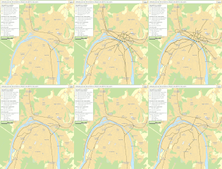
Railway map of France - Lyon - animated - fr.gif 2,016 × 1,415; 26.83 MB
-
Railway map of France - Marseille - animated - fr.gif 1,966 × 1,593; 15.37 MB
-
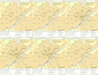
Railway map of France - Metz - animated - fr.gif 1,760 × 1,595; 10.38 MB
-
Railway map of France - Montpellier - animated - fr.gif 1,691 × 1,723; 14.25 MB
-
Railway map of France - Mulhouse - animated - fr.gif 1,566 × 1,850; 10.31 MB
-
Railway map of France - Nancy - animated - fr.gif 1,715 × 1,791; 15.96 MB
-
Railway map of France - Nantes - animated - fr.gif 1,624 × 1,947; 13.63 MB
-
Railway map of France - Nice - animated - fr.gif 1,643 × 1,819; 13.53 MB
-
Railway map of France - Orléans - animated - fr.gif 1,888 × 1,561; 12.9 MB
-
Railway map of France - Paris agglo - animated - fr.gif 1,733 × 1,452; 31.88 MB
-
Railway map of France - Paris intra muros - animated - fr.gif 1,827 × 1,404; 19.21 MB
-
Railway map of France - Reims - animated - fr.gif 1,553 × 1,998; 9.74 MB
-
Railway map of France - Rennes - animated - fr.gif 1,566 × 1,691; 8 MB
-
Railway map of France - Rouen - animated - fr.gif 1,666 × 1,907; 12.67 MB
-
Railway map of France - Saint-Étienne - animated - fr.gif 2,034 × 1,104; 18.89 MB
-
Railway map of France - Strasbourg - animated - fr.gif 1,856 × 1,729; 14.45 MB
-
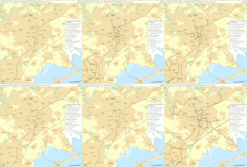
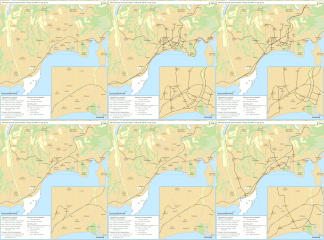
Railway map of France - Toulon - animated - fr.gif 3,150 × 1,888; 9.1 MB
-
Railway map of France - Toulouse - animated - fr.gif 2,150 × 1,561; 18.85 MB
-
Railway map of France - Tours - animated - fr.gif 2,216 × 1,441; 15.28 MB
-
Railway map of France - Valenciennes - animated - fr.gif 1,861 × 1,805; 17.15 MB
-
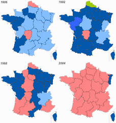
Régionales-historique.gif 515 × 541; 99 KB
-
Verovering Gallie door de Franken.gif 1,242 × 1,144; 5.92 MB


