Category:Angels on maps
Jump to navigation
Jump to search
Subcategories
This category has the following 3 subcategories, out of 3 total.
Media in category "Angels on maps"
The following 47 files are in this category, out of 47 total.
-
 "Fokien Imperii Sinarum provincia undecima." (22066426729).jpg 3,503 × 2,972; 2.05 MB
-
 "Queicheu, Imperii Sinarum provincia decima quarta." (22066336179).jpg 3,545 × 2,992; 2.24 MB
-
 Angel cartouches on a Belgium map by Ortelius.png 422 × 847; 238 KB
-
 1608 cartouche with integrated scales.jpg 2,468 × 3,998; 2.8 MB
-
 Angel cartouche with scales in a Geographia Sacra map by Janssonius.jpg 2,827 × 1,674; 1.18 MB
-
 1660 engraving Scenographia Systematis Copernicani.jpg 783 × 700; 449 KB
-
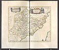 Fokien - Atlas Maior, vol 11, map 23 - Joan Blaeu, 1667 - BL 114.h(star).11.(23).jpg 4,000 × 3,422; 1.99 MB
-
 Qveichev - Atlas Maior, vol 11, map 26 - Joan Blaeu, 1667 - BL 114.h(star).11.(26).jpg 4,000 × 3,440; 2.09 MB
-
 Cartouche in a Piedmont map by Coronelli.jpg 1,304 × 951; 1.19 MB
-

-

-
 1748 map of Rome.jpg 16,826 × 11,648; 56.1 MB
-
 Angel cartouche in a Catalonia map by Fins.jpg 833 × 2,401; 831 KB
-
 Angel cartouche on a Mediterranean map by de Wit.tiff 1,229 × 1,039; 3.65 MB
-
 Angel cartouche on an Africa maps by Sanson.jpg 3,152 × 1,925; 1.72 MB
-
 Angel cartouche on an Americas map by Visscher.jpg 722 × 537; 470 KB
-
 Angel scale cartouche by Wells.jpg 1,836 × 1,673; 495 KB
-
 Angels (Putten) in a 1700s scale cartouche.jpg 3,200 × 1,118; 544 KB
-

-
 Atlas Ortelius KB PPN369376781-026av-026br.jpg 3,000 × 2,194; 4.81 MB
-

-
 Atlas Van der Hagen-KW1049B10 042-UKRAINAE PARS QVA BARCLAVIA PALATINATUS Vulgo dicitur.jpeg 5,500 × 4,312; 3.62 MB
-
 Atlas Van der Hagen-KW1049B12 007-GALLAECIA REGNVM.jpeg 5,500 × 4,241; 3.77 MB
-
 Atlas Van der Hagen-KW1049B13 046-FOKIEN IMPERII SINARVM PROVINCIA VNDECIMA.jpeg 5,500 × 4,638; 4.5 MB
-
 Atlas Van der Hagen-KW1049B13 050-QVEICHEV, IMPERII SINARVM PROVINCIA DECIMAQUATRA.jpeg 5,500 × 4,518; 3.22 MB
-

-
-
 Cartouche in a Poland map by Wit.tif 606 × 692; 1.22 MB
-
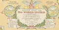 Cartouche on the world peace map by Chase.tif 1,782 × 899; 4.61 MB
-
 Cartouches in a Roman Empire map by Ortelius.jpg 5,288 × 4,136; 6.29 MB
-
 Elaborate cartouche on an Asia map by Homann's heirs.jpg 1,523 × 1,038; 486 KB
-
 Figurative cartouche in a Prussia map by Visscher.jpg 2,981 × 967; 614 KB
-
 Figurative cartouche on a Palatinate map by Funck.jpg 1,722 × 2,142; 1.09 MB
-
 Figurative Cartouche on the 1702 Israel Map by Visscher Stoopendaal.jpg 1,161 × 514; 229 KB
-
 Figurative cartouche on the Holy Land map by Funck.jpg 1,543 × 705; 219 KB
-
-
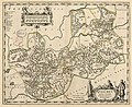
 Galizien und Lodomerien.jpg 3,666 × 3,102; 6.93 MB
-
 Gulf1..JPG 3,072 × 2,304; 3.12 MB
-

-

-
 Novvs atlas Sinensis. LOC 2002625249-5.jpg 7,376 × 6,366; 5.18 MB
-
 Novvs atlas Sinensis. LOC 2002625249-5.tif 7,376 × 6,366; 134.34 MB
-
 Print, map (BM 1937,0802.1.72).jpg 1,041 × 1,455; 369 KB
-
 Psalter World Map, c.1265.jpg 3,791 × 5,496; 19.47 MB
-
-
 Scale cartouche in an Indian Ocean map by Allard.jpg 2,505 × 1,071; 614 KB
-
 Scale cartouche with angels on a Syria map by Janssonius.jpg 3,422 × 1,431; 1.18 MB
.jpg)
.jpg)


.11.(23).jpg)
.11.(26).jpg)

_-_Viro_Perillustri..._-_btv1b8492400j.jpg)
,_NG-501-87.jpg)


.jpg)


.1.(1).jpg)


_;_excud._Ioannes_Blaeu_-_btv1b5963074j.jpg)


.jpg)
.jpg)

.jpg)

_;_Exc._I._Blaeu_-_btv1b5963093w.jpg)


_in_a_1700s_scale_cartouche.jpg)