Category:Altes Wiesenhaus
Jump to navigation
Jump to search
| Object location | | View all coordinates using: OpenStreetMap |
|---|
human settlement in Germany .jpg) | |||||
| Upload media | |||||
| Instance of | |||||
|---|---|---|---|---|---|
| Location | Schönheide, Erzgebirgskreis, Saxony, Germany | ||||
| Elevation above sea level |
| ||||
 | |||||
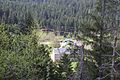
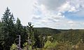
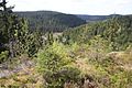
Altes Wiesenhaus (auch Alt-Wiesenhaus genannt) ist ein auf 572 Meter Höhe im Tal der Zwickauer Mulde gelegener Ortsteil Schönheides. Die kleine Siedlung liegt muldeabwärts von Schönheides Ortsteil Wilzschhaus.
Subcategories
This category has only the following subcategory.
H
Media in category "Altes Wiesenhaus"
The following 36 files are in this category, out of 36 total.
-
 Altes Wiesenhaus Ortsteil von Schönheide (20).jpg 12,159 × 5,180; 7.96 MB
-
 Altes Wiesenhaus Ortsteil von Schönheide-im Erzgebirge 1.jpg 5,184 × 3,456; 3.81 MB
-
 Altes Wiesenhaus Ortsteil von Schönheide-im Erzgebirge 10.jpg 5,184 × 3,456; 5.68 MB
-
 Altes Wiesenhaus Ortsteil von Schönheide-im Erzgebirge 11.jpg 3,456 × 5,184; 4.39 MB
-
 Altes Wiesenhaus Ortsteil von Schönheide-im Erzgebirge 12.jpg 5,184 × 3,456; 4.18 MB
-
 Altes Wiesenhaus Ortsteil von Schönheide-im Erzgebirge 13.jpg 5,184 × 3,456; 3.2 MB
-
 Altes Wiesenhaus Ortsteil von Schönheide-im Erzgebirge 14.jpg 5,184 × 3,456; 4.4 MB
-
 Altes Wiesenhaus Ortsteil von Schönheide-im Erzgebirge 15.jpg 5,184 × 3,456; 4.61 MB
-
 Altes Wiesenhaus Ortsteil von Schönheide-im Erzgebirge 16.jpg 5,184 × 3,456; 4.4 MB
-
 Altes Wiesenhaus Ortsteil von Schönheide-im Erzgebirge 17.jpg 6,412 × 1,566; 2.73 MB
-
 Altes Wiesenhaus Ortsteil von Schönheide-im Erzgebirge 18.JPG 2,816 × 1,880; 3.01 MB
-
 Altes Wiesenhaus Ortsteil von Schönheide-im Erzgebirge 19.JPG 2,816 × 1,880; 1.81 MB
-
 Altes Wiesenhaus Ortsteil von Schönheide-im Erzgebirge 2.jpg 3,456 × 5,184; 4.55 MB
-
 Altes Wiesenhaus Ortsteil von Schönheide-im Erzgebirge 3.jpg 5,184 × 3,456; 3.28 MB
-
 Altes Wiesenhaus Ortsteil von Schönheide-im Erzgebirge 4.jpg 5,184 × 3,456; 4.16 MB
-
 Altes Wiesenhaus Ortsteil von Schönheide-im Erzgebirge 5.jpg 5,184 × 3,456; 3.78 MB
-
 Altes Wiesenhaus Ortsteil von Schönheide-im Erzgebirge 6.jpg 5,184 × 3,456; 4.01 MB
-
 Altes Wiesenhaus Ortsteil von Schönheide-im Erzgebirge 7.jpg 3,456 × 5,184; 5.3 MB
-
 Altes Wiesenhaus Ortsteil von Schönheide-im Erzgebirge 8.jpg 5,184 × 3,456; 5.09 MB
-
 Altes Wiesenhaus Ortsteil von Schönheide-im Erzgebirge 9.jpg 5,184 × 3,456; 4.25 MB
-
 Köppelstein über Altes Wiesenhaus Ortsteil von Schönheide (20).jpg 5,184 × 3,456; 10.7 MB
-
 Köppelstein über Altes Wiesenhaus Ortsteil von Schönheide (21).jpg 11,293 × 5,097; 6.48 MB
-
 Köppelstein über Altes Wiesenhaus Ortsteil von Schönheide (22).jpg 5,184 × 3,456; 9.68 MB
-
 Köppelstein über Altes Wiesenhaus Ortsteil von Schönheide (23).jpg 5,184 × 3,456; 9.13 MB
-
 Köppelstein über Altes Wiesenhaus Ortsteil von Schönheide (24).jpg 8,586 × 5,087; 4.39 MB
-
 Köppelstein über Altes Wiesenhaus Ortsteil von Schönheide (25).jpg 5,184 × 3,456; 9.82 MB
-
 Köppelstein über Altes Wiesenhaus Ortsteil von Schönheide (26).jpg 5,184 × 3,456; 11.15 MB
-

-
 M Schönheide im Erzgebirge Ortsteil Altwiesenhaus.JPG 2,816 × 1,880; 2.73 MB
-
 Muldenstraße 14.JPG 2,592 × 1,944; 1.98 MB
-
 Schönheide im Erzgebirge Eisenbahn Chemnitz Adorf 11.JPG 2,816 × 1,880; 3.24 MB
-
 Schönheide im Erzgebirge Eisenbahn Chemnitz Adorf 7.JPG 2,816 × 1,880; 2.42 MB
-
 Schönheide im Erzgebirge Eisenbahn Chemnitz Adorf 8.JPG 2,816 × 1,880; 2.84 MB
-
 Schönheide im Erzgebirge Eisenbahn Chemnitz Adorf 9.JPG 2,816 × 1,880; 2.84 MB
-
 Zwickauer Mulde Altes Wiesenhaus Ortsteil von Schönheide (21).jpg 5,184 × 3,456; 9.93 MB
-
 Zwickauer Mulde Altes Wiesenhaus Ortsteil von Schönheide (22).jpg 5,184 × 3,456; 8.16 MB
.jpg)


.jpg)
.jpg)
.jpg)
.jpg)
.jpg)
.jpg)


.jpg)
.jpg)