Category:Aerial photographs of rivers of the Democratic Republic of the Congo
Jump to navigation
Jump to search
Media in category "Aerial photographs of rivers of the Democratic Republic of the Congo"
The following 18 files are in this category, out of 18 total.
-
-
 Aerial view of the Congo River near Kisangani.jpg 9,000 × 5,544; 17.3 MB
-
 Barrage Tshopo, à Kisangani, RDC.jpg 758 × 641; 134 KB
-
 Crossing over river - North Kivu (21062521965).jpg 5,760 × 3,840; 1.42 MB
-
 Kahuzi-Biega National Park (39423247252).jpg 1,920 × 1,080; 781 KB
-
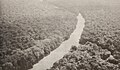
 La rivière Lulilaka, parc national de Salonga, 2005.jpg 500 × 344; 39 KB
-

-
 Photo of the day 11.10.2015 (21868921339).jpg 5,760 × 3,840; 728 KB
-
 Pont thopo.jpg 960 × 695; 536 KB
-
 Pont thopo1.jpg 960 × 720; 540 KB
-
 Pont tshopo.jpg 720 × 511; 204 KB
-
 Pont tshopo2.jpg 960 × 615; 479 KB
-
 River crossing Ituri hills (20439969664).jpg 5,760 × 3,840; 1.58 MB
-
 River crossing South Kivu mountains (20875790279).jpg 5,760 × 3,840; 1.19 MB
-
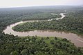 River in rainforest - North Kivu (21062578875).jpg 5,760 × 3,840; 1.41 MB
-
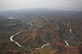
 River in the Great Rift Valley (20875744989).jpg 5,760 × 3,840; 1.16 MB
-
 Stab-DFID09 (8448301660).jpg 1,250 × 833; 1.22 MB
-
.jpg)


.jpg)
.jpg)

.jpg)
.jpg)


.jpg)
.jpg)
.jpg)
.jpg)
.jpg)
