Category:Aerial photographs of Sylt
Jump to navigation
Jump to search
Ameland · Amrum · Baltrum · Borkum · Föhr · Heligoland · Hallig Hooge · Juist · Kachelotplate · Langeneß · Langeoog · Lütje Hörn · Memmert · Minsener Oog · Norderney · Nordstrand · Pellworm · Schiermonnikoog · Spiekeroog · Sylt · Terschelling · Texel · Trischen · Vlieland · Wangerooge ·

Subcategories
This category has the following 2 subcategories, out of 2 total.
A
Media in category "Aerial photographs of Sylt"
The following 153 files are in this category, out of 153 total.
-
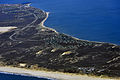
 13-09-29 Hörnum-Odde RalfR-N3S 9146.jpg 4,006 × 2,660; 8.27 MB
-
 13-09-29-nordfriesisches-wattenmeer-RalfR-04.jpg 4,288 × 2,848; 4.08 MB
-
 13-09-29-nordfriesisches-wattenmeer-RalfR-05.jpg 4,145 × 1,798; 3.94 MB
-
 13-09-29-nordfriesisches-wattenmeer-RalfR-23.jpg 4,288 × 2,848; 7.06 MB
-
 13-09-29-nordfriesisches-wattenmeer-RalfR-24.jpg 4,288 × 2,848; 6.28 MB
-
 13-09-29-nordfriesisches-wattenmeer-RalfR-25.jpg 4,288 × 2,848; 5.49 MB
-
 13-09-29-nordfriesisches-wattenmeer-RalfR-27.jpg 4,185 × 1,682; 3.25 MB
-
 13-09-29-nordfriesisches-wattenmeer-RalfR-28.jpg 4,288 × 2,848; 7.76 MB
-
 13-09-29-nordfriesisches-wattenmeer-RalfR-29.jpg 4,288 × 2,279; 6.03 MB
-
 13-09-29-nordfriesisches-wattenmeer-RalfR-37.jpg 4,288 × 2,848; 6.75 MB
-
 Aerial image of the Sylt airport (view from the south).jpg 5,400 × 3,000; 7.88 MB
-
 Aerial image of the Sylt airport.jpg 5,504 × 2,200; 3.93 MB
-
 Aerial photograph 400D 2012 05 05 8237 DxO.jpg 3,888 × 2,592; 1.21 MB
-
 Aerial photograph 400D 2012 05 05 8240 DxO.jpg 3,888 × 2,592; 1.16 MB
-
 Aerial photograph 400D 2012 05 05 8249 DxO.jpg 3,888 × 2,592; 1.39 MB
-
 Aerial photograph 400D 2012 05 05 8251 DxO.jpg 3,888 × 2,592; 1.34 MB
-
 Aerial photograph 400D 2012 05 05 8253 DxO.jpg 3,888 × 2,592; 1.86 MB
-
 Aerial photograph 400D 2012 05 05 8257 DxO.jpg 3,888 × 2,592; 1.19 MB
-
 Aerial photograph 400D 2012 05 05 8258 DxO.jpg 3,888 × 2,592; 1.33 MB
-
 Aerial photograph 400D 2012 05 05 8259 DxO.jpg 3,888 × 2,592; 1.54 MB
-
 Aerial photograph 400D 2012 05 05 8260 DxO.jpg 3,888 × 2,592; 1.54 MB
-
 Aerial photograph 400D 2012 05 05 8261 DxO.jpg 3,888 × 2,592; 1.36 MB
-
 Aerial photograph 400D 2012 05 05 8267 DxO.jpg 3,888 × 2,592; 2.33 MB
-
 Aerial photograph 400D 2013 09 29 9562.JPG 3,888 × 2,592; 3.32 MB
-
 Aerial photograph 8104 DxO.jpg 5,184 × 3,456; 3.48 MB
-
 Aerial photograph 8106 DxO.jpg 5,184 × 3,456; 3.9 MB
-
 Aerial photograph 8109 DxO.jpg 5,184 × 3,456; 3.42 MB
-
 Aerial photograph 8113 DxO.jpg 5,184 × 3,456; 3.61 MB
-
 Aerial photograph 8114 DxO.jpg 5,184 × 3,456; 3.58 MB
-
 Aerial photograph 8115 DxO.jpg 5,184 × 3,456; 3.36 MB
-
 Aerial photograph 8116 DxO.jpg 5,184 × 3,456; 3.3 MB
-
 Aerial photograph 8117 DxO.jpg 5,184 × 3,456; 3.14 MB
-
 Aerial photograph 8119 DxO.jpg 5,184 × 3,456; 3.09 MB
-
 Aerial photograph 8122 DxO.jpg 5,184 × 3,456; 3.66 MB
-
 Aerial photograph 8129 DxO.jpg 5,184 × 3,456; 3.64 MB
-
 Aerial photograph 8130 DxO.jpg 5,184 × 3,456; 3.88 MB
-
 Aerial photograph 8132 DxO.jpg 5,184 × 3,456; 3.8 MB
-
 Aerial photograph 8139 DxO.jpg 5,184 × 3,456; 3.54 MB
-
 Aerial photograph 8140 DxO.jpg 5,184 × 3,456; 3.86 MB
-
 Aerial photograph 8141 DxO.jpg 5,184 × 3,456; 4.21 MB
-
 Aerial photograph 8142 DxO.jpg 5,184 × 3,456; 4.34 MB
-
 Aerial photograph 8143 DxO.jpg 5,184 × 3,456; 4.26 MB
-
 Aerial photograph 8145 DxO.jpg 5,184 × 3,456; 3.83 MB
-
 Aerial photograph 8146 DxO.jpg 5,184 × 3,456; 3.64 MB
-
 Aerial photograph 8147 DxO.jpg 5,184 × 3,456; 4.02 MB
-
 Aerial photograph 8148 DxO.jpg 5,184 × 3,456; 4.18 MB
-
 Aerial photograph 8149 DxO.jpg 5,184 × 3,456; 3.77 MB
-
 Aerial photograph 8153 DxO.jpg 5,184 × 3,456; 3.4 MB
-
 Aerial photograph 8159 DxO.jpg 5,184 × 3,456; 3.17 MB
-
 Aerial photograph 8168 DxO.jpg 5,184 × 3,456; 5.38 MB
-
 Aerial photograph 8172 DxO.jpg 5,184 × 3,456; 5.02 MB
-
 Aerial view Wattenmeer Sylt.jpg 4,786 × 2,689; 13.18 MB
-
 DFJKA ANTONOV AN2 LEAVING SYLT FOR WYK AUF FOHR (4776813044).jpg 4,288 × 3,216; 12.1 MB
-
 DLR Sylt.jpg 2,000 × 2,754; 10.11 MB
-
 Hörnum Odde.jpg 5,224 × 2,935; 9.89 MB
-
 Kliffende, Island Sylt, 1999.jpg 401 × 280; 114 KB
-
 Luftaufnahmen Nordseekueste 2012-05-by-RaBoe-119.jpg 4,288 × 2,848; 12.49 MB
-
 Luftaufnahmen Nordseekueste 2012-05-by-RaBoe-120.jpg 4,288 × 2,848; 13.08 MB
-
 Luftaufnahmen Nordseekueste 2012-05-by-RaBoe-121.jpg 4,288 × 2,848; 12.84 MB
-
 Luftaufnahmen Nordseekueste 2012-05-by-RaBoe-122.jpg 4,288 × 2,848; 13.11 MB
-
 Luftaufnahmen Nordseekueste 2012-05-by-RaBoe-123.jpg 4,288 × 2,848; 13.03 MB
-
 Luftaufnahmen Nordseekueste 2012-05-by-RaBoe-124.jpg 4,288 × 2,848; 13.23 MB
-
 Luftaufnahmen Nordseekueste 2012-05-by-RaBoe-125.jpg 4,288 × 2,848; 12.25 MB
-
 Luftaufnahmen Nordseekueste 2012-05-by-RaBoe-126.jpg 4,288 × 2,848; 13.95 MB
-
 Luftaufnahmen Nordseekueste 2012-05-by-RaBoe-127.jpg 4,288 × 2,848; 13.18 MB
-
 Luftaufnahmen Nordseekueste 2012-05-by-RaBoe-128.jpg 4,288 × 2,848; 13.56 MB
-
 Luftaufnahmen Nordseekueste 2012-05-by-RaBoe-130.jpg 4,288 × 2,848; 13.01 MB
-
 Luftaufnahmen Nordseekueste 2012-05-by-RaBoe-131.jpg 3,938 × 2,613; 9.97 MB
-
 Luftaufnahmen Nordseekueste 2012-05-by-RaBoe-132.jpg 4,288 × 2,848; 12.33 MB
-
 Luftaufnahmen Nordseekueste 2012-05-by-RaBoe-133.jpg 4,288 × 2,848; 13.11 MB
-
 Luftaufnahmen Nordseekueste 2012-05-by-RaBoe-134.jpg 4,288 × 2,848; 11.99 MB
-
 Luftaufnahmen Nordseekueste 2012-05-by-RaBoe-135.jpg 4,288 × 2,848; 11.67 MB
-
 Luftaufnahmen Nordseekueste 2012-05-by-RaBoe-136.jpg 4,288 × 2,848; 12.06 MB
-
 Luftaufnahmen Nordseekueste 2012-05-by-RaBoe-137.jpg 4,288 × 2,848; 11.68 MB
-
 Luftaufnahmen Nordseekueste 2012-05-by-RaBoe-138.jpg 4,288 × 2,848; 16.1 MB
-
 Luftaufnahmen Nordseekueste 2012-05-by-RaBoe-139.jpg 4,288 × 2,848; 16.17 MB
-
 Luftaufnahmen Nordseekueste 2012-05-by-RaBoe-140.jpg 3,813 × 2,531; 8.57 MB
-
 Luftaufnahmen Nordseekueste 2012-05-by-RaBoe-147.jpg 3,709 × 2,462; 7.84 MB
-
 Luftaufnahmen Nordseekueste 2012-05-by-RaBoe-148.jpg 4,288 × 2,036; 8.12 MB
-
 Luftaufnahmen Nordseekueste 2012-05-by-RaBoe-149.jpg 4,288 × 2,551; 10.52 MB
-
 Luftaufnahmen Nordseekueste 2012-05-by-RaBoe-167.jpg 4,288 × 2,848; 13.23 MB
-
 Luftaufnahmen Nordseekueste 2012-05-by-RaBoe-168.jpg 4,288 × 2,848; 12.61 MB
-
 Luftaufnahmen Nordseekueste 2012-05-by-RaBoe-169.jpg 4,032 × 2,292; 10.56 MB
-
 Luftaufnahmen Nordseekueste 2012-05-by-RaBoe-171.jpg 4,288 × 2,848; 13.22 MB
-
 Luftaufnahmen Nordseekueste 2012-05-by-RaBoe-172.jpg 4,065 × 2,282; 10.15 MB
-
 Luftaufnahmen Nordseekueste 2012-05-by-RaBoe-173.jpg 4,288 × 2,848; 11.89 MB
-
 Luftaufnahmen Nordseekueste 2012-05-by-RaBoe-174.jpg 4,288 × 2,848; 13.77 MB
-
 Luftaufnahmen Nordseekueste 2012-05-by-RaBoe-175.jpg 4,288 × 2,848; 15.18 MB
-
 Luftaufnahmen Nordseekueste 2012-05-by-RaBoe-178.jpg 4,288 × 2,848; 17.93 MB
-
 Luftaufnahmen Nordseekueste 2012-05-by-RaBoe-179.jpg 4,288 × 2,848; 19.1 MB
-
 Luftaufnahmen Nordseekueste 2012-05-by-RaBoe-180.jpg 4,148 × 2,000; 8.61 MB
-
 Luftaufnahmen Nordseekueste 2012-05-by-RaBoe-181.jpg 4,288 × 2,667; 11.97 MB
-
 Luftaufnahmen Nordseekueste 2012-05-by-RaBoe-182.jpg 4,288 × 2,848; 12.24 MB
-
 Luftaufnahmen Nordseekueste 2012-05-by-RaBoe-183.jpg 4,288 × 2,551; 11.26 MB
-
 Luftaufnahmen Nordseekueste 2012-05-by-RaBoe-184.jpg 2,848 × 4,288; 11.85 MB
-
 Luftaufnahmen Nordseekueste 2012-05-by-RaBoe-185.jpg 2,346 × 1,943; 4.81 MB
-
 Luftaufnahmen Nordseekueste 2012-05-by-RaBoe-186.jpg 4,288 × 2,848; 11.98 MB
-
 Luftaufnahmen Nordseekueste 2012-05-by-RaBoe-197.jpg 3,709 × 2,359; 8.1 MB
-
 Luftaufnahmen Nordseekueste 2012-05-by-RaBoe-198.jpg 4,288 × 2,848; 10.85 MB
-
 Luftaufnahmen Nordseekueste 2012-05-by-RaBoe-203.jpg 3,679 × 2,441; 9.34 MB
-
 Luftaufnahmen Nordseekueste 2012-05-by-RaBoe-204.jpg 4,288 × 2,848; 14.88 MB
-
 Luftaufnahmen Nordseekueste 2012-05-by-RaBoe-205.jpg 4,288 × 2,848; 15.86 MB
-
 Luftaufnahmen Nordseekueste 2012-05-by-RaBoe-206.jpg 4,288 × 2,848; 16.16 MB
-
 Luftaufnahmen Nordseekueste 2012-05-by-RaBoe-207.jpg 4,288 × 2,848; 14.19 MB
-
 Luftaufnahmen Nordseekueste 2012-05-by-RaBoe-208.jpg 4,073 × 2,002; 8.78 MB
-
 Luftaufnahmen Nordseekueste 2012-05-by-RaBoe-209.jpg 4,288 × 2,848; 12.02 MB
-
 Luftaufnahmen Nordseekueste 2013-09 by-RaBoe 121.jpg 2,500 × 1,659; 2.17 MB
-
 Luftaufnahmen Nordseekueste 2013-09 by-RaBoe 122.jpg 2,500 × 1,659; 2.4 MB
-
 Luftaufnahmen Nordseekueste 2013-09 by-RaBoe 123.jpg 2,500 × 1,659; 2.18 MB
-
 Luftaufnahmen Nordseekueste 2013-09 by-RaBoe 124.jpg 2,500 × 1,660; 2.21 MB
-
 Luftaufnahmen Nordseekueste 2013-09 by-RaBoe 125.jpg 2,500 × 1,660; 2.71 MB
-
 Luftaufnahmen Nordseekueste 2013-09 by-RaBoe 126.jpg 2,500 × 1,660; 2.77 MB
-
 Luftaufnahmen Nordseekueste 2013-09 by-RaBoe 127.jpg 2,500 × 1,660; 2.56 MB
-
 Luftaufnahmen Nordseekueste 2013-09 by-RaBoe 128.jpg 2,500 × 1,660; 3.18 MB
-
 Luftaufnahmen Nordseekueste 2013-09 by-RaBoe 129.jpg 2,500 × 1,660; 3.03 MB
-
 Luftaufnahmen Nordseekueste 2013-09 by-RaBoe 130.jpg 2,500 × 1,660; 3.1 MB
-
 Luftaufnahmen Nordseekueste 2013-09 by-RaBoe 131.jpg 2,500 × 1,660; 2.49 MB
-
 Luftaufnahmen Nordseekueste 2013-09 by-RaBoe 132.jpg 2,500 × 1,660; 2.68 MB
-
 Luftaufnahmen Nordseekueste 2013-09 by-RaBoe 133.jpg 2,500 × 1,660; 2.95 MB
-
 Luftaufnahmen Nordseekueste 2013-09 by-RaBoe 134.jpg 2,500 × 1,660; 2.56 MB
-
 Luftaufnahmen Nordseekueste 2013-09 by-RaBoe 135.jpg 2,500 × 1,660; 2.93 MB
-
 Luftaufnahmen Nordseekueste 2013-09 by-RaBoe 136.jpg 2,500 × 1,660; 2.92 MB
-
 Luftaufnahmen Nordseekueste 2013-09 by-RaBoe 137.jpg 2,500 × 1,660; 2.57 MB
-
 Luftaufnahmen Nordseekueste 2013-09 by-RaBoe 148.jpg 2,500 × 1,660; 2.4 MB
-
 Luftaufnahmen Nordseekueste 2013-09 by-RaBoe 149.jpg 2,500 × 1,660; 2.65 MB
-
 Luftaufnahmen Nordseekueste 2013-09 by-RaBoe 150.jpg 2,500 × 1,659; 2.65 MB
-
 Luftaufnahmen Nordseekueste 2013-09 by-RaBoe 151.jpg 2,500 × 1,660; 2.39 MB
-
 Luftaufnahmen Nordseekueste 2013-09 by-RaBoe 153.jpg 2,500 × 1,660; 2.21 MB
-
 Luftaufnahmen Nordseekueste 2013-09 by-RaBoe 154.jpg 2,500 × 1,660; 2.96 MB
-
 Luftaufnahmen Nordseekueste 2013-09 by-RaBoe 155.jpg 2,500 × 1,660; 2.71 MB
-
 Luftaufnahmen Nordseekueste 2013-09 by-RaBoe 156.jpg 2,500 × 1,659; 2.6 MB
-
 Luftaufnahmen Nordseekueste 2013-09 by-RaBoe 157.jpg 2,500 × 1,659; 2.59 MB
-
 Luftaufnahmen Nordseekueste 2013-09 by-RaBoe 158.jpg 2,500 × 1,659; 2.67 MB
-
 Luftaufnahmen Nordseekueste 2013-09 by-RaBoe 159.jpg 2,500 × 1,659; 2.6 MB
-
 Luftaufnahmen Nordseekueste 2013-09 by-RaBoe 160.jpg 2,500 × 1,660; 2.58 MB
-
 Luftaufnahmen Nordseekueste 2013-09 by-RaBoe 161.jpg 2,500 × 1,659; 2.27 MB
-
 Luftaufnahmen Nordseekueste 2013-09 by-RaBoe 162.jpg 2,500 × 1,659; 2.33 MB
-
 Luftaufnahmen Nordseekueste 2013-09 by-RaBoe 163.jpg 2,500 × 1,660; 2.66 MB
-
 Luftaufnahmen Nordseekueste 2013-09 by-RaBoe 164.jpg 2,500 × 1,660; 2.57 MB
-
 Luftaufnahmen Nordseekueste 2013-09 by-RaBoe 165.jpg 2,500 × 1,660; 2.65 MB
-
 Luftaufnahmen Nordseekueste 2013-09 by-RaBoe 169.jpg 2,500 × 1,660; 3.24 MB
-
 Luftaufnahmen Nordseekueste 2013-09 by-RaBoe 171.jpg 2,500 × 1,660; 3.07 MB
-
 Luftaufnahmen Nordseekueste 2013-09 by-RaBoe 172.jpg 2,500 × 1,660; 2.82 MB
-
 Luftaufnahmen Nordseekueste 2013-09 by-RaBoe 173.jpg 2,500 × 1,659; 2.89 MB
-
 Rantum beach.jpg 5,464 × 3,070; 13.31 MB
-
 Rantum Samoa.jpg 4,734 × 2,660; 7.76 MB
-
 Rantum strand.jpg 4,600 × 2,585; 5.87 MB
-
 Rantum.jpg 4,955 × 2,784; 8.39 MB
-
 Satellitenfoto Sylt mit Erklärungen.jpg 445 × 600; 91 KB
-
 Sylt Nordsee Rotes Kliff Luftbild 2017.jpg 4,000 × 2,667; 13.15 MB
-
 SyltSat.jpg 668 × 900; 40 KB
-
 Söl'.PNG 514 × 900; 676 KB
-
 Wadden Sea and Sylt Island on the radar images by TerraSAR-X.jpg 1,152 × 1,130; 1,007 KB


.jpg)


.jpg)


