Category:Aerial photographs of Sonoma County, California
Jump to navigation
Jump to search
Counties of California: Alameda · Contra Costa · Fresno · Glenn · Inyo · Los Angeles · Madera · Marin · Merced · Mono · Monterey · Napa · Orange · Riverside · Sacramento · San Bernardino · San Diego · San Luis Obispo · San Mateo · Santa Barbara · Santa Clara · Shasta · Siskiyou · Sonoma · Stanislaus · Tuolumne · Ventura · Yolo · – Consolidated city-county: San Francisco
Español: Fotografías aéreas del Condado de Sonoma, California
Subcategories
This category has only the following subcategory.
A
Media in category "Aerial photographs of Sonoma County, California"
The following 10 files are in this category, out of 10 total.
-
 Aerial Survey SP-EC 1-31-13 125.jpg 4,288 × 2,848; 8.45 MB
-
 Aerial view of Italian Swiss Colony winery, circa 1940 (6359778219).jpg 2,159 × 1,355; 454 KB
-
 Bodega Marine Lab 3543.jpg 2,048 × 1,047; 1.41 MB
-
 Charles M. Schulz – Sonoma County Airport-CA-11 July 1993-USGS.jpg 614 × 576; 119 KB
-
 Guerneville California flooding.jpg 1,500 × 1,001; 656 KB
-
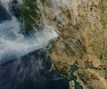 Kincade Fire tmo 2019297 MODIS.jpg 1,944 × 1,620; 1.29 MB
-
 Kincade Fire, Sonoma County, California, USA - October 25th, 2019 (48963250268).jpg 6,868 × 4,546; 23.37 MB
-
 Sonoma County Airport - Topo.jpg 768 × 768; 187 KB
-
 Sonoma Valley (20184477520).jpg 1,200 × 800; 681 KB
-
 Sonoma Valley.jpg 4,000 × 2,250; 4.63 MB

.jpg)


.jpg)

.jpg)
