Category:Aerial photographs of San Mateo County, California
Jump to navigation
Jump to search
Subcategories
This category has the following 5 subcategories, out of 5 total.
A
M
S
Media in category "Aerial photographs of San Mateo County, California"
The following 37 files are in this category, out of 37 total.
-
 Aerial photo of Pacifica and east side of San Mateo County beyond the mountains.jpg 4,608 × 3,456; 10.06 MB
-
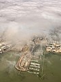 Aerial view of a seaport (San Francisco) July 2022.jpg 3,024 × 4,032; 2.28 MB
-
 Aerial view of Belmont, September 2019.JPG 5,184 × 3,888; 4.42 MB
-
 Aerial view of Guadalope Quarry in Brisbane, California.jpg 3,779 × 2,524; 3.84 MB
-
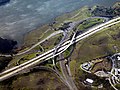 Aerial view of I-280 and SR 92 interchange, December 2021.JPG 5,184 × 3,888; 11.88 MB
-
 Aerial view of Kinder Morgan Brisbane Terminal.jpg 5,018 × 1,581; 2.84 MB
-
 Aerial view of Millbrae station, December 2021.JPG 5,184 × 3,888; 10.4 MB
-
 Aerial view of Oyster Point, September 2019.JPG 5,184 × 3,888; 4.46 MB
-
 Aerial view of Pacific Shores, September 2019.JPG 5,184 × 3,888; 4.04 MB
-
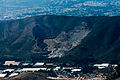
 Aerial view of San Bruno Mountain.jpg 7,360 × 3,775; 9.6 MB
-
 Aerial view of San Carlos, September 2019.JPG 5,126 × 3,233; 3.4 MB
-
 Aerial View of San Francisco International Airport IMG 3670.jpg 2,925 × 2,734; 1.2 MB
-
 Aerial view of US 101 - I-380 interchange, September 2022.JPG 5,184 × 3,888; 13.46 MB
-
 Aerial view of Westlake Shopping Center, San Francisco.jpg 5,257 × 2,474; 4.52 MB
-
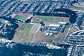 Aerial view of Westmoor High School and football stadium in Daly City (July 2013).jpg 3,853 × 2,572; 4.43 MB
-
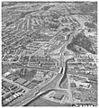
 Bayshore Highway at Sierra Point 1929.jpg 640 × 480; 35 KB
-
 Belmont, California aerial view, February 2018.JPG 5,184 × 3,888; 4.08 MB
-
 CA-84 Woodside April 2023 001.jpg 5,464 × 3,640; 14.13 MB
-
 CA-84 Woodside April 2023 002.jpg 5,464 × 3,640; 11.52 MB
-
 CA-84 Woodside April 2023 003.jpg 5,464 × 3,640; 11.24 MB
-
 CA-84 Woodside April 2023 HDR.jpg 5,464 × 3,640; 8.44 MB
-
 CHPW - 19th Ave Fwy (May-Jun '64, pg 40).jpg 732 × 796; 184 KB
-
 Coyote Point Marina - San Mateo (49811517707).jpg 3,600 × 2,400; 4.64 MB
-
 Crystal Springs Reservoir aerial view, February 2018.JPG 5,184 × 3,888; 3.79 MB
-
 Golden Gate National Cemetery from the air July 2014.jpg 6,016 × 4,016; 7.72 MB
-
 Mountains and canyons in Colorado.jpg 3,456 × 2,304; 997 KB
-
 Oyster Point and San Bruno Mountain, December 2018.JPG 4,567 × 2,963; 2.29 MB
-
 Ravenswood Slough - Menlo Park - Facebook Campus (49811217511).jpg 3,600 × 2,400; 3.64 MB
-
 San Bruno Mountain aerial.jpg 1,477 × 1,139; 507 KB
-
 San Bruno station aerial view, August 2018.JPG 5,184 × 3,461; 3.6 MB
-
 San Francisco, USA (16575857299).jpg 4,608 × 3,456; 10.2 MB
-
 SF-Bay-southern-aerial-2587.jpg 2,048 × 1,536; 365 KB
-
 SF-Bay-southern-aerial-2588.jpg 2,048 × 1,536; 1.12 MB
-
 Sierra Point aerial view, February 2018.JPG 3,951 × 2,973; 2.06 MB
-
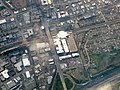
 Ssfindustrialcitysign.jpg 2,048 × 1,536; 1.07 MB
-
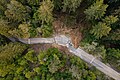
 Trail on the Hills Near the Bay Area (49811217186).jpg 2,400 × 3,600; 3.95 MB
-
 Yet further south, San Mateo Co. (4405187002).jpg 1,280 × 1,024; 118 KB

_July_2022.jpg)


.jpg)


.jpg)
.jpg)


.jpg)


.jpg)


.jpg)
.jpg)