
Category:Aerial photographs of Osnabrück

Deutsch: Luftbilder aus Osnabrück, Niedersachsen
Media in category "Aerial photographs of Osnabrück"
The following 13 files are in this category, out of 13 total.
-
 Aerial image of the Osnabrück-Atterheide airfield.jpg 4,500 × 3,500; 5.1 MB
-
 Atem meta.jpg 3,008 × 2,000; 1.47 MB
-
 Drohnenaufnahme des Nettebads der Stadtwerke Osnabrück.jpg 5,464 × 3,640; 5.89 MB
-
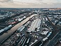
 Drohnenaufnahme des Osnabrücker Hafens.jpg 5,280 × 3,956; 12.63 MB
-
 Felix Schoeller Osnabrück aerial.jpg 3,744 × 5,616; 2.18 MB
-
 Firmengelände-am-brinkhofweg.jpg 434 × 243; 222 KB
-
 Hellmann Luftbild Osnabrück 2023-11-01.jpg 3,992 × 2,992; 6.45 MB
-
 ISS057-E-51294 - View of Germany.jpg 5,568 × 3,712; 3.19 MB
-
 ISS057-E-51296 - View of Germany.jpg 5,568 × 3,712; 3.21 MB
-
 Osnabrueck.JPG 2,592 × 1,944; 1.9 MB
-
 Osnabrück aerial.jpg 2,288 × 1,514; 770 KB
-
 Piesberg.JPG 2,592 × 1,944; 1.57 MB
-
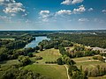 Rubbenbruchsee im Sommer.jpg 3,992 × 2,992; 848 KB


