Category:Aerial photographs of Landkreis Meißen
Jump to navigation
Jump to search
Districts of Saxony:
Subcategories
This category has the following 2 subcategories, out of 2 total.
A
- Aerial photographs of Meißen (15 F)
Media in category "Aerial photographs of Landkreis Meißen"
The following 128 files are in this category, out of 128 total.
-
 01842-Sörnewitz-1901-Blick auf Sörnewitz-Brück & Sohn Kunstverlag.jpg 1,533 × 1,000; 585 KB
-

-

-
 31083-Stauchitz-1992-Luftbild-Brück & Sohn Kunstverlag.jpg 3,504 × 2,492; 4.66 MB
-
 31419-Moritzburg-1994-Luftaufnahme-Brück & Sohn Kunstverlag.jpg 3,520 × 2,500; 4.95 MB
-
 32140-Meißen-1998-Blick vom Bischofsturm-Brück & Sohn Kunstverlag.jpg 3,496 × 2,500; 4.16 MB
-
 32673-Meißen-2002-Albrechtsburg-Dom von oben - Vollbild-Brück & Sohn Kunstverlag.jpg 3,512 × 2,492; 4.12 MB
-
 33317-Meißen-2008-Kalenderkarte 2009-Brück & Sohn Kunstverlag.jpg 3,512 × 2,484; 3.33 MB
-
 Aerial image of Schloss Nossen (view from the south).jpg 4,600 × 2,600; 5.62 MB
-
 Aerial image of the Großenhain airfield.jpg 5,300 × 3,200; 5.86 MB
-
 Aerial image of the Riesa-Canitz gliding site.jpg 5,200 × 3,200; 5.85 MB
-
 Aerial image of the Riesa-Göhlis airfield.jpg 4,200 × 2,900; 4.02 MB
-
 Althirschstein 001.jpg 6,016 × 3,384; 8.63 MB
-
 Barockschloss Seußlitz 003.jpg 6,016 × 3,384; 9.68 MB
-
 Barockschloss Seußlitz 009, Heinrichsburg.jpg 6,016 × 3,384; 9.54 MB
-
 Barockschloss Seußlitz 013.jpg 6,016 × 3,384; 9.73 MB
-
 Barockschloss Seußlitz 015.jpg 6,016 × 3,384; 9.87 MB
-
 Boritz 001.jpg 6,016 × 3,384; 8.97 MB
-
 Bosel & Sörnewitz 01.jpg 4,032 × 2,268; 1.85 MB
-
 Diera 001.jpg 6,016 × 3,384; 8.84 MB
-
 Fährstelle Gauernitz.jpg 4,032 × 2,268; 1.62 MB
-
 Luftbild 181 Großdobritz.jpg 3,456 × 2,592; 4.17 MB
-
 Göhrischgut 005.jpg 6,016 × 3,384; 9.31 MB
-
 Göhrischgut 028b, Presse, Gärtnerei Ihm.jpg 4,512 × 2,538; 5.59 MB
-
 Kiessandtagebau Laußnitz I.jpg 4,032 × 1,757; 1.08 MB
-
 Lampertswalde Aerial Panorama.jpg 7,781 × 1,843; 9.88 MB
-
 Leutewitz 001.jpg 6,016 × 3,384; 8.48 MB
-
 Luftbild 144 Radebeul-Oberlößnitz.jpg 2,592 × 3,456; 5.86 MB
-
 Luftbild 149 Reichenberg 1.jpg 2,592 × 3,456; 4.95 MB
-
 Luftbild 150 Radebeul-Wahnsdorf.jpg 3,456 × 2,592; 5.04 MB
-
 Luftbild 157 Radebeul-West.jpg 3,456 × 2,592; 5.89 MB
-
 Luftbild 159 Radebeul-Wahnsdorf 2.jpg 3,456 × 2,592; 4.99 MB
-
 Luftbild 160 Reichenberg 2.jpg 3,456 × 2,592; 4.42 MB
-
 Luftbild 162 Radebeul-Wahnsdorf 3.jpg 2,592 × 3,456; 5.07 MB
-
 Luftbild 173 Frauenteich.jpg 3,456 × 2,592; 4.09 MB
-
 Luftbild 174 Bärwalde.jpg 3,456 × 2,592; 4.4 MB
-
 Luftbild 176 Schönberghäuser.jpg 2,592 × 3,456; 4.9 MB
-
 Luftbild 178 Naunhof.jpg 3,456 × 2,592; 4.25 MB
-
 Luftbild 186 Gröbern.jpg 3,456 × 2,592; 4.58 MB
-
 Luftbild 187 Ockrilla.jpg 3,456 × 2,592; 4.06 MB
-
 Luftbild 190 Bohnitzsch.jpg 3,456 × 2,592; 4.86 MB
-
 Luftbild 191 Proschwitz Winkwitz.jpg 3,456 × 2,592; 7.19 MB
-
 Luftbild 195 Zscheila.jpg 3,456 × 2,592; 7.26 MB
-
 Luftbild 196 Niederfähre.jpg 2,592 × 3,456; 4.25 MB
-
 Luftbild 197 Altstadt 1.jpg 3,456 × 2,592; 5.22 MB
-
 Luftbild 198 Vorbrücke Fischergasse.jpg 2,592 × 3,456; 4.99 MB
-
 Luftbild 199 Altstadt 2.jpg 3,456 × 2,592; 5.25 MB
-
 Luftbild 200 Triebischtal.jpg 3,456 × 2,592; 5.52 MB
-
 Luftbild 202 Altstadt 3.jpg 2,592 × 3,456; 1.37 MB
-
 Luftbild 210 Garsebach.jpg 3,456 × 2,592; 4.77 MB
-
 Luftbild 211 Robschütz.jpg 3,456 × 2,592; 4.69 MB
-
 Luftbild 212 Roitzschen.jpg 3,456 × 2,592; 4.42 MB
-
 Luftbild 213 Miltitz 1.jpg 3,456 × 2,592; 4.07 MB
-
 Luftbild 215 Sönitz.jpg 2,592 × 3,456; 4.75 MB
-
 Luftbild 216 Piskowitz.jpg 3,456 × 2,592; 4.77 MB
-
 Luftbild 217 Weitzschen.jpg 3,456 × 2,592; 4.46 MB
-
 Luftbild 219 Miltitz 2.jpg 2,592 × 3,456; 4.63 MB
-
 Luftbild 221 Munzig.jpg 3,456 × 2,592; 4.93 MB
-
 Luftbild 224 Groitzsch Perne.jpg 3,456 × 2,592; 4.36 MB
-
 Luftbild 228 Tanneberger Loch 1.jpg 2,592 × 3,456; 5.25 MB
-
 Luftbild 230 Tanneberger Loch 2 Tanneberg.jpg 3,456 × 2,592; 4.81 MB
-
 Luftbild 231 Tanneberger Loch 3 Triebischtalbrücke.jpg 3,456 × 2,592; 4.9 MB
-
 Luftbild 232 Tanneberg.jpg 3,456 × 2,592; 4.77 MB
-
 Luftbild 237 Dreieck Nossen.jpg 3,456 × 2,592; 4.2 MB
-
 Luftbild 238 Deutschenbora.jpg 3,456 × 2,592; 4.11 MB
-
 Luftbild 240 Tanneberger Loch 4.jpg 2,592 × 3,456; 4.71 MB
-
 Luftbild Bockwen.jpg 4,032 × 2,268; 1.41 MB
-
 Luftbild Bosel 01.jpg 4,032 × 2,268; 3.44 MB
-
 Luftbild Bosel 02.jpg 4,032 × 2,268; 3.51 MB
-
 Luftbild Coswig.jpg 4,032 × 2,268; 3.09 MB
-
 Luftbild Dobra 01.jpg 4,032 × 2,268; 2.17 MB
-
 Luftbild Dobra 02.jpg 4,032 × 2,268; 1.94 MB
-

-
 Luftbild Fasanenschlösschen 01.jpg 4,032 × 2,268; 2.52 MB
-
 Luftbild Fasanenschlösschen 02.jpg 4,032 × 2,268; 1.67 MB
-
 Luftbild Fasanenschlösschen 03.jpg 4,032 × 2,268; 1.61 MB
-
 Luftbild Niederlößnitz 01.jpg 4,032 × 2,268; 3.69 MB
-
 Luftbild Niederlößnitz 02.jpg 4,032 × 2,268; 2.56 MB
-
 Luftbild Niederlößnitz 03.jpg 4,032 × 2,268; 2.57 MB
-
 Luftbild Niederlößnitz 04.jpg 4,032 × 2,268; 2.78 MB
-
 Luftbild Niederlößnitz 05.jpg 4,032 × 2,268; 2.88 MB
-
 Luftbild Niederlößnitz 06.jpg 4,032 × 2,268; 3.13 MB
-
 Luftbild Niederlößnitz 07.jpg 4,032 × 1,992; 2.22 MB
-
 Luftbild Oberspaar 01.jpg 4,032 × 2,268; 2.66 MB
-
 Luftbild Oberspaar 02.jpg 4,032 × 2,268; 3 MB
-
 Luftbild Radeburg 01.jpg 2,268 × 4,032; 2.97 MB
-
 Luftbild Radeburg 02.jpg 2,268 × 4,032; 2.76 MB
-
 Luftbild Seußlitz - Richtung Goldkuppe Luftbild Jagiella.jpg 600 × 429; 89 KB
-
 Luftbild Sternwarte Riesa.jpg 800 × 712; 113 KB
-
 Luftbild Weinböhla.jpg 4,032 × 2,268; 3.12 MB
-
 Mautitz 001.jpg 6,016 × 3,384; 8.22 MB
-
 Merschwitz (Nünchritz) 001.jpg 6,016 × 3,384; 8.74 MB
-
 Niederlommatzsch 004.jpg 6,016 × 3,384; 9.1 MB
-
 Niedermuschütz 001.jpg 6,016 × 3,384; 8.63 MB
-
 Nieschütz 002.jpg 6,016 × 3,384; 9.02 MB
-
 Nieschütz-Göhrischgut.jpg 2,060 × 1,520; 497 KB
-
 Nünchritz 001.jpg 6,016 × 3,384; 8.47 MB
-
 Riesa 002.jpg 6,016 × 3,384; 9.81 MB
-
 Riesa 005, Trinitatiskirche.jpg 6,016 × 3,384; 9.37 MB
-
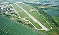
 Riesa 006, Flugplatz.jpg 6,016 × 3,384; 7.61 MB
-
 Rottewitz, Rittergut Rottewitz 001.jpg 6,016 × 3,384; 9.77 MB
-
 Rottewitz, Rittergut Rottewitz 003.jpg 6,016 × 3,384; 8.75 MB
-
 Schloss Hirschstein 005 (cropped).jpg 4,024 × 2,963; 5.18 MB
-
 Schloss Hirschstein 005.jpg 6,016 × 3,384; 8.81 MB
-
 Schloss Hirschstein 023.jpg 6,016 × 3,384; 9.13 MB
-
 Schloss Proschwitz 006b.jpg 4,104 × 2,308; 5.66 MB
-
 Schloss Schieritz 003.jpg 6,016 × 3,384; 9.8 MB
-
 Schloss Schieritz 007.jpg 6,016 × 3,384; 9.89 MB
-
 Schönfeld Aerial Pan.jpg 9,678 × 3,855; 9.73 MB
-
 Schönfeld Aerial.jpg 3,932 × 2,116; 2.69 MB
-
 Soernewitz-von-Bosel-050716.jpg 1,600 × 1,200; 607 KB
-
 Speicher Radeburg II - 01.jpg 4,032 × 2,268; 1.53 MB
-
 Speicher Radeburg II - 02.jpg 3,965 × 2,029; 1.18 MB
-
 Speicher Radeburg II - 03.jpg 3,969 × 1,990; 1.48 MB
-
 Sternwarte rdbl.jpg 2,275 × 1,581; 478 KB
-
 Techertschlucht Rödern DJI 0485.JPG 4,000 × 2,250; 3.84 MB
-
 Techertschlucht Rödern DJI 0486.JPG 4,000 × 2,250; 4.15 MB
-
 Techertschlucht Rödern DJI 0488.JPG 4,000 × 2,250; 3.87 MB
-
 WRM Seusslitz with sorbischer Schanze - Seußlitz mit Goldkuppe.jpg 425 × 425; 99 KB
-
 Zabeltitz Luftbild.jpg 1,600 × 900; 220 KB
-
 Zadel 001.jpg 6,016 × 3,384; 9.42 MB
-
 Zehren 001.jpg 6,016 × 3,384; 9.44 MB
-
 Zehren 005, Bergstraße, Alte Schule.jpg 6,016 × 3,384; 9.33 MB
-
 Zehren 011.jpg 6,016 × 3,384; 9.37 MB
-
 Zehren 012 St. Michaeliskirche.jpg 6,016 × 3,384; 9.52 MB
-
 Zeithain Promnitz Aerial Pan alt.jpg 4,795 × 3,280; 11.38 MB
-
 Zeithain Promnitz Aerial Pan.jpg 6,375 × 3,992; 15.7 MB
-
 Zeithain Promnitz Aerial.jpg 3,937 × 2,160; 7.12 MB


.jpg)


_001.jpg)


.jpg)


